Fassifern, Queensland

Last updated

Fassifern
Queensland
Pastures at Fassifern.jpg
Pastures at Fassifern.
Australia Queensland location map.svg
Red pog.svg
Fassifern
Coordinates 27°57′22″S152°35′17″E / 27.9561°S 152.5880°E / -27.9561; 152.5880 (Fassifern (centre of locality))
Population18 (2021 census) [1]
 • Density9.0/km2 (23.3/sq mi)
Postcode(s) 4309
Area2.0 km2 (0.8 sq mi)
Time zone AEST (UTC+10:00)
Location
LGA(s) Scenic Rim Region
State electorate(s) Scenic Rim
Federal division(s) Wright
Suburbs around Fassifern:
Kalbar Kalbar Kalbar
Frazerview Fassifern Fassifern Valley
Aratula Morwincha Morwincha

Fassifern is a rural locality in the Scenic Rim Region, Queensland, Australia. [2] In the 2021 census, Fassifern had a population of 18 people. [1]

Contents

Geography

Reynolds Creek forms the eastern boundary, while Warrill Creek forms most of the western. Washpool Gully flows through from south-west to north-west, where it joins Warrill Creek. [3]

The Cunningham Highway runs through from north-west to south-west, and Boonah-Fassifern Road (State Route 90) runs east from the highway, forming most of the southern boundary. [4]

The land use is a mix of grazing on native vegetation and crop growing. [4]

History

The name Fassifern comes from a pastoral run name, used in 1846 by pastoralists John Cameron and Macquarie McDonald, possibly named for a place in Scotland called Fassifern. [2]

Fassifern Provisional School opened circa 1879 and closed circa 1887. [5]

Demographics

In the 2016 census, Fassifern had a population of 21 people. The locality contained 12 households, in which 68.4% of the population were males and 31.6% of the population were females with a median age of 50, 12 years above the national average. The average weekly household income was $575, $863 below the national average. [6]

In the 2021 census, Fassifern had a population of 18 people. [1]

Education

There are no schools in Fassifern. The nearest government primary schools are Kalbar State School in neighbouring Kalbar to the north-east and Aratula State School in neighbouring Aratula to the south-west. The nearest government secondary school is Boonah State High School in Boonah to the south-east. [4]

Related Research Articles

<span class="mw-page-title-main">Aratula</span> Town in Queensland, Australia

Aratula is a rural town and locality in the Scenic Rim Region, Queensland, Australia. In the 2016 census, the locality of Aratula had a population of 532 people.

<span class="mw-page-title-main">Kalbar, Queensland</span> Town in Queensland, Australia

Kalbar is a rural town and locality in the Scenic Rim Region, Queensland, Australia. In the 2016 census, the locality of Kalbar had a population of 1,093 people.

<span class="mw-page-title-main">Rosevale, Queensland</span> Town in Queensland, Australia

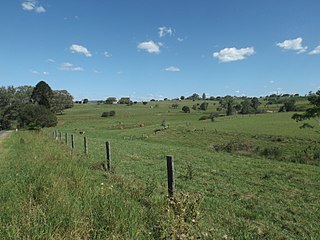
Rosevale is a rural locality in the Scenic Rim Region, Queensland, Australia. In the 2016 census, Rosevale had a population of 208 people.

<span class="mw-page-title-main">Munbilla, Queensland</span> Town in Queensland, Australia

Munbilla is a rural town and locality in the Scenic Rim Region, Queensland, Australia. In the 2016 census, the locality of Munbilla had a population of 100 people.

<span class="mw-page-title-main">Templin, Queensland</span> Suburb of Scenic Rim Region, Queensland, Australia

Templin is a rural locality in the Scenic Rim Region, Queensland, Australia. In the 2016 census, Templin had a population of 86 people.

<span class="mw-page-title-main">Coleyville, Queensland</span> Suburb of Scenic Rim Region, Queensland, Australia

Coleyville is a rural locality in the Scenic Rim Region, Queensland, Australia. In the 2021 census, Coleyville had a population of 192 people.

<span class="mw-page-title-main">Silverdale, Queensland</span> Suburb of Scenic Rim Region, Queensland, Australia

Silverdale is a rural locality in the Scenic Rim Region, Queensland, Australia. In the 2021 census, Silverdale had a population of 112 people.

<span class="mw-page-title-main">Frazerview, Queensland</span> Suburb of Scenic Rim Region, Queensland, Australia

Frazerview is a rural locality in the Scenic Rim Region, Queensland, Australia. In the 2021 census, Frazerview had a population of 36 people.

<span class="mw-page-title-main">Teviotville, Queensland</span> Town in Queensland, Australia

Teviotville is a rural locality in the Scenic Rim Region, Queensland, Australia. In the 2021 census, Teviotville had a population of 114 people.

<span class="mw-page-title-main">Charlwood, Queensland</span> Suburb of Scenic Rim Region, Queensland, Australia

Charlwood is a rural locality in the Scenic Rim Region, Queensland, Australia. In the 2021 census, Charlwood had a population of 146 people.

<span class="mw-page-title-main">Fassifern Valley, Queensland</span> Suburb of Scenic Rim Region, Queensland, Australia

Fassifern Valley is a rural locality in the Scenic Rim Region, Queensland, Australia. In the 2021 census, Fassifern Valley had a population of 112 people.

<span class="mw-page-title-main">Moogerah, Queensland</span> Suburb of Scenic Rim Region, Queensland, Australia

Moogerah is a rural locality in the Scenic Rim Region, Queensland, Australia. In the 2016 census, Moogerah had a population of 234 people.

<span class="mw-page-title-main">Mount Edwards, Queensland</span> Suburb of Scenic Rim Region, Queensland, Australia

Mount Edwards is a rural locality in the Scenic Rim Region, Queensland, Australia. In the 2016 census, Mount Edwards had a population of 63 people.

Obum Obum is a rural locality in the Scenic Rim Region, Queensland, Australia. In the 2021 census, Obum Obum had a population of 129 people.

Kulgun is a locality in the Scenic Rim Region, Queensland, Australia. In the 2021 census, Kulgun had a population of 104 people.

<span class="mw-page-title-main">Moorang, Queensland</span> Suburb of Scenic Rim Region, Queensland, Australia

Moorang is a rural locality in the Scenic Rim Region, Queensland, Australia. In the 2016 census, Moorang had a population of 46 people.

Kents Pocket is a rural locality in the Scenic Rim Region, Queensland, Australia. In the 2021 census, Kents Pocket had a population of 21 people.

Morwincha is a rural locality in the Scenic Rim Region, Queensland, Australia. In the 2016 census, Morwincha had a population of 30 people.

Radford is a rural locality in the Scenic Rim Region, Queensland, Australia. In the 2016 census, Radford had a population of 41 people.

Wallaces Creek is a rural locality in the Scenic Rim Region, Queensland, Australia. In the 2016 census, Wallaces Creek had a population of 58 people.

References

  1. 1 2 3 Australian Bureau of Statistics (28 June 2022). "Fassifern (SAL)". 2021 Census QuickStats. Retrieved 28 February 2023. OOjs UI icon edit-ltr-progressive.svg
  2. 1 2 "Fassifern – locality in Scenic Rim Region (entry 45137)". Queensland Place Names. Queensland Government . Retrieved 20 July 2021.
  3. Google (18 January 2022). "Fassifern, Queensland" (Map). Google Maps . Google. Retrieved 18 January 2022.
  4. 1 2 3 "Queensland Globe". State of Queensland . Retrieved 8 September 2023.
  5. Queensland Family History Society (2010), Queensland schools past and present (Version 1.01 ed.), Queensland Family History Society, ISBN   978-1-921171-26-0
  6. Australian Bureau of Statistics (27 June 2017). "Fassifern (SSC)". 2016 Census QuickStats. Retrieved 20 October 2018. OOjs UI icon edit-ltr-progressive.svg

Further reading