Birnam, Queensland (Scenic Rim Region)

Last updated

Birnam
Logan City,  Queensland
Paddocks at Birnam.jpg
Paddocks along Beaudesert Beenleigh Road, 2014
Australia Queensland location map.svg
Red pog.svg
Birnam
Coordinates 27°56′55″S153°03′42″E / 27.9486°S 153.0616°E / -27.9486; 153.0616 (Birnam (centre of locality)) Coordinates: 27°56′55″S153°03′42″E / 27.9486°S 153.0616°E / -27.9486; 153.0616 (Birnam (centre of locality))
Population106 (2016 census) [1]
 • Density5.07/km2 (13.14/sq mi)
Postcode(s) 4285
Area20.9 km2 (8.1 sq mi)
Time zone AEST (UTC+10:00)
Location
LGA(s) Scenic Rim Region
State electorate(s) Scenic Rim
Federal division(s) Wright
Suburbs around Birnam:
Veresdale Scrub
Veresdale
Mundoolun Boyland
Veresdale Birnam Tabragalba
Beaudesert Tabragalba Tabragalba

Birnam is a rural locality in the Scenic Rim Region, Queensland, Australia. [2] In the 2016 census, Birnam had a population of 106 people. [1]

Contents

Geography

The eastern border of Birnam is marked by the Albert River. The locality is relatively undeveloped, with a few farms in the east. In the north west the slopes of Mount Dunsinane rise to around 300 m.

The Beaudesert–Beenleigh Road runs through from south to north-east. [3]

History

Birnam State School opened on 17 October 1929 and closed on 1937. [4]

In the 2016 census, Birnam had a population of 106 people. [1] The locality contained 44 households, in which 51.9% of the population were males and 48.1% of the population were females with a median age of 45, 7 years above the national average. The average weekly household income was $1,889, $461 above the national average. [1]

Education

There are no schools in Birnam. The nearest government primary schools are Beaudesert State School in neighbouring Beaudesert to the south-west and Veresdale Scrub State School in neighbouring Veresdale Scrub to the north-west. The nearest government secondary school is Beaudesert State High School in Beaudesert. [5]

Related Research Articles

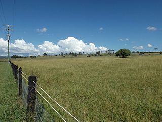
Witheren is a rural locality in the Scenic Rim Region, Queensland, Australia. In the 2016 census Witheren had a population of 496 people.

Veresdale Scrub is a locality split between the Scenic Rim Region and the City of Logan, both in Queensland, Australia. In the 2016 census, Veresdale Scrub had a population of 481 people.

Allenview, Queensland Suburb of Scenic Rim Region, Queensland, Australia

Allenview is a rural locality in the Scenic Rim Region, Queensland, Australia. In the 2016 census, Allenview had a population of 184 people.

Hillview, Queensland Town in Queensland, Australia

Hillview is a rural town and locality in the Scenic Rim Region, Queensland, Australia. In the 2016 census, the locality of Hillview had a population of 74 people.

Christmas Creek, Queensland Suburb of Scenic Rim Region, Queensland, Australia

Christmas Creek is a rural locality in the Scenic Rim Region, Queensland, Australia. In the 2016 census, Christmas Creek had a population of 53 people.

Laravale, Queensland Town in Queensland, Australia

Laravale is a rural locality in the Scenic Rim Region, Queensland, Australia. In the 2016 census, Laravale had a population of 189 people.

Josephville, Queensland Town in Queensland, Australia

Josephville is a rural locality in the Scenic Rim Region, Queensland, Australia. In the 2016 census, Josephville had a population of 166 people.

Mount Gipps, Queensland Suburb of Scenic Rim Region, Queensland, Australia

Mount Gipps is a rural locality in the Scenic Rim Region, Queensland, Australia. In the 2016 census, Mount Gipps had a population of 7 people.

Innisplain, Queensland Suburb of Scenic Rim Region, Queensland, Australia

Innisplain is a rural locality in the Scenic Rim Region, Queensland, Australia. In the 2016 census, Innisplain had a population of 85 people.

Oaky Creek, Queensland Suburb of Scenic Rim Region, Queensland, Australia

Oaky Creek is a rural locality in the Scenic Rim Region, Queensland, Australia. In the 2016 census Oaky Creek had a population of 83 people.

Lamington, Queensland Suburb of Scenic Rim Region, Queensland, Australia

Lamington is a rural locality in the Scenic Rim Region, Queensland, Australia. In the 2016 census, Lamington had a population of 86 people.

Gleneagle, Queensland Suburb of Scenic Rim Region, Queensland, Australia

Gleneagle is a rural locality in the Scenic Rim Region, Queensland, Australia. In the 2016 census, Gleneagle had a population of 1,877 people.

Coulson, Queensland Suburb of Scenic Rim Region, Queensland, Australia

Coulson is a rural locality in the Scenic Rim Region, Queensland, Australia. In the 2016 census, Coulson had a population of 195 people.

Cannon Creek is a rural locality in the Scenic Rim Region, Queensland, Australia. In the 2016 census, Cannon Creek had a population of 78 people.

Chinghee Creek is a rural locality in the Scenic Rim Region, Queensland, Australia. In the 2016 census, Chinghee Creek had a population of 30 people.

Fassifern, Queensland Suburb of Scenic Rim Region, Queensland, Australia

Fassifern is a rural locality in the Scenic Rim Region, Queensland, Australia. In the 2016 census, Fassifern had a population of 21 people.

Flying Fox, Queensland Suburb of Scenic Rim Region, Queensland, Australia

Flying Fox is a rural locality in the Scenic Rim Region, Queensland, Australia. In the 2016 census, Flying Fox had a population of 65 people.

Cainbable, Queensland Suburb of Scenic Rim Region, Queensland, Australia

Cainbable is a rural locality in the Scenic Rim Region, Queensland, Australia. In the 2016 census Cainbable had a population of 74 people.

Kents Pocket is a rural locality in the Scenic Rim Region, Queensland, Australia. In the 2016 census, Kents Pocket had a population of 24 people.

Wallaces Creek is a rural locality in the Scenic Rim Region, Queensland, Australia. In the 2016 census, Wallaces Creek had a population of 58 people.

References

  1. 1 2 3 4 Australian Bureau of Statistics (27 June 2017). "Birnam (SSC)". 2016 Census QuickStats. Retrieved 20 October 2018. OOjs UI icon edit-ltr-progressive.svg
  2. "Birnam – locality in Scenic Rim Region (entry 45114)". Queensland Place Names. Queensland Government . Retrieved 29 December 2020.
  3. Birnam, Queensland (Map). OpenStreetMap. Archived from the original on 21 February 2022. Retrieved 21 February 2022.
  4. Queensland Family History Society (2010), Queensland schools past and present (Version 1.01 ed.), Queensland Family History Society, ISBN   978-1-921171-26-0
  5. "Queensland Globe". State of Queensland . Retrieved 4 April 2021.