Bromelton, Queensland

Last updated

Bromelton
Queensland
Paddocks along Beaudesert Boonah Road at Bromelton, Queensland.jpg
Paddocks, 2016
Australia Queensland location map.svg
Red pog.svg
Bromelton
Coordinates 27°59′12″S152°53′01″E / 27.9866°S 152.8836°E / -27.9866; 152.8836 Coordinates: 27°59′12″S152°53′01″E / 27.9866°S 152.8836°E / -27.9866; 152.8836
Population155 (2016 census) [1]
 • Density1.363/km2 (3.531/sq mi)
Postcode(s) 4285
Area113.7 km2 (43.9 sq mi)
Time zone AEST (UTC+10:00)
Location
LGA(s) Scenic Rim Region
State electorate(s) Scenic Rim
Federal division(s) Wright
Localities around Bromelton:
Wyaralong Allenview Gleneagle
Coulson Bromelton Beaudesert
Allandale Kooralbyn Josephville

Bromelton is a rural locality in the Scenic Rim Region, Queensland, Australia. [2] In the 2016 census, Bromelton had a population of 155 people. [1]

Contents

Geography

The Beaudesert–Boonah Road (State Route 90) runs through from east to north. [3]

History

Moloney family, ~1897 StateLibQld 1 99928 Moloney family outside their home at Bromelton, ca. 1897.jpg
Moloney family, ~1897

Bromelton Post Office opened on 1 July 1927 (a receiving office had been open by 1883) and closed in 1938. [4] In 1842, Hugh Henry Robertson settled a run at Bromelton, becoming the first European to reside in the Logan River valley. [5]

Bromelton Provisional School opened on 25 October 1880. On 1 January 1909 it became Bromelton State School. It closed on 1953. [6]

Allen's Creek Provisional School opened on 4 October 1927 and closed on 18 September 1929. It was a railway camp school and provided schooling for children of workers building the Sydney–Brisbane rail corridor. [7] Allan's Creek (as it is currently spelled) crosses the railway line at the intersection of three present-day localities: Allenview, Bromelton and Gleneagle. [8]

Bromelton railway station was served by a northbound XPT service to Roma Street and a southbound service to Sydney until it closed in 1994. [9]

Bromelton State Development Area (SDA) was declared in 2008, covering 15,000 hectares of land approximately 6 kilometres (3.7 mi) west of Beaudesert. About 1,800 hectares (4,400 acres) was earmarked for industrial development of regional, state and national significance, maximising the use of the area's existing standard gauge railway line which connects Bromelton to the Port of Brisbane, to other parts of Queensland, and to other states of Australia. Mirvac has commenced work on a site bordered by Sandy Creek Road and Beaudesert Boonah Road. The Bromelton SDA applications are reviewed by the Co-ordinator General for approval. The Scenic Rim Regional Council is responsible for operational works, clearing of vegetation, plumbing and Reconfiguration of Lots (ROLs) applications after the MCUs[ clarification needed ] have been approved by the Queensland Government. [10]

In 2016, SCT Logistics commenced building a transport hub adjacent to the Sydney-Brisbane railway line. [11] [12] [13] It opened in January 2017. [14]

In the 2016 census, Bromelton had a population of 155 people. [1] The locality contains 58 households, in which 51.6% of the population are males and 48.4% of the population are females with a median age of 40, 2 years above the national average. The average weekly household income is $1,771, $333 below the national average. 4.0% of Bromelton's population is either of Aborigional or Torres Strait Islander descent. 66.4% of the population aged 15 or over is either registered or de facto married, while 33.6% of the population is not married. 28.8% of the population is currently attending some form of a compulsory education. The most common nominated ancestries were Australian (48.2%), English (25.6%) and Irish (13.1%), while the most common country of birth was Australia (90.3%), and the most commonly spoken language at home was English (94.7%). The most common nominated religions were Catholin (37.4%), Anglican (23.9%) and No Religion (16.6%). The most common occupation was a manager (21.8%) and the majority/plurality of residents worked 40 or more hours per week (39.7%). [1]

Transport

The town has a crossing loop on the Sydney to Brisbane standard gauge line. [8]

SCT Logistics operates a rail-road transport hub at 2603 Beaudesert Boonah Road ( 27°57′51″S152°55′19″E / 27.9642°S 152.9219°E / -27.9642; 152.9219 (SCT Transport Hub) ). [15]

The Australian Rail Track Corporation has also purchased land in Bromleton. [16]

Notable people

See also

Related Research Articles

Rathdowney, Queensland Town in Queensland, Australia

Rathdowney is a rural town and locality in the Scenic Rim Region, Queensland, Australia. In the 2016 census, Rathdowney had a population of 308 people.

Beaudesert, Queensland Town in Queensland, Australia

Beaudesert is a rural town and locality in the Scenic Rim Region, Queensland, Australia. In the 2016 census, Beaudesert had a population of 6,395 people.

Logan River River in Queensland, Australia

The Logan River is a perennial river located in the Scenic Rim, Logan and Gold Coast local government areas of the South East region of Queensland, Australia. The 184-kilometre (114 mi)-long river is one of the dominant waterways in South East Queensland that drains the southern ranges of the Scenic Rim and empties into Moreton Bay after navigating the City of Logan, a major suburban centre located south of Brisbane. The catchment is dominated by urban and agricultural land use. Near the river mouth are mangrove forests and a number of aquaculture farms.

Nindooinbah, Queensland Suburb of Scenic Rim Region, Queensland, Australia

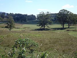
Nindooinbah is a rural locality in the Scenic Rim Region, Queensland, Australia. In the 2016 census Nindooinbah had a population of 80 people.

Barney View, Queensland Suburb of Scenic Rim Region, Queensland, Australia

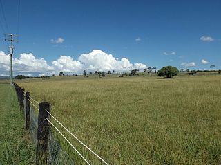
Barney View is a rural locality in the Scenic Rim Region, Queensland, Australia. In the 2016 census, Barney View had a population of 64 people.

Tamborine, Queensland Suburb of Logan City, Queensland, Australia

Tamborine is a rural town in the Scenic Rim Region and a locality split between the Scenic Rim Region and the City of Logan in Queensland, Australia. In the 2016 census, the locality of Tamborine had a population of 3,950 people.

Allenview, Queensland Suburb of Scenic Rim Region, Queensland, Australia

Allenview is a rural locality in the Scenic Rim Region, Queensland, Australia. In the 2016 census, Allenview had a population of 184 people.

Josephville, Queensland Town in Queensland, Australia

Josephville is a rural locality in the Scenic Rim Region, Queensland, Australia. In the 2016 census, Josephville had a population of 166 people.

Palen Creek, Queensland Suburb of Scenic Rim Region, Queensland, Australia

Palen Creek is a rural locality in the Scenic Rim Region, Queensland, Australia. It borders New South Wales. In the 2016 census, Palen Creek had a population of 280 people.

Wyaralong, Queensland Suburb of Scenic Rim Region, Queensland, Australia

Wyaralong is a rural locality in the Scenic Rim Region, Queensland, Australia. In the 2016 census, Wyaralong had a population of 20 people.

Innisplain, Queensland Suburb of Scenic Rim Region, Queensland, Australia

Innisplain is a rural locality in the Scenic Rim Region, Queensland, Australia. In the 2016 census, Innisplain had a population of 85 people.

Running Creek, Queensland Suburb of Scenic Rim Region, Queensland, Australia

Running Creek is a rural locality in the Scenic Rim Region, Queensland, Australia. In the 2016 census, Running Creek had a population of 147 people. It borders New South Wales.

Gleneagle, Queensland Suburb of Scenic Rim Region, Queensland, Australia

Gleneagle is a rural locality in the Scenic Rim Region, Queensland, Australia. In the 2016 census, Gleneagle had a population of 1,877 people.

Coulson, Queensland Suburb of Scenic Rim Region, Queensland, Australia

Coulson is a rural locality in the Scenic Rim Region, Queensland, Australia. In the 2016 census, Coulson had a population of 195 people.

Cannon Creek is a rural locality in the Scenic Rim Region, Queensland, Australia. In the 2016 census, Cannon Creek had a population of 78 people.

Obum Obum is a rural locality in the Scenic Rim Region, Queensland, Australia. In the 2016 census, Obum Obum had a population of 131 people.

Bunburra is a rural locality in the Scenic Rim Region, Queensland, Australia. In the 2016 census, Bunburra had a population of 90 people.

Morwincha is a rural locality in the Scenic Rim Region, Queensland, Australia. In the 2016 census, Morwincha had a population of 30 people.

Ipswich–Boonah–Rathdowney Road is a continuous 87.8 kilometres (54.6 mi) road route in the Ipswich and Scenic Rim regions of Queensland, Australia. It has two official names, Ipswich–Boonah Road and Boonah–Rathdowney Road. The entire route is signed as State Route 93, and much of it is also part of Tourist Drive 16.

Beaudesert–Boonah–Fassifern Road is a non-continuous 49.9 kilometres (31.0 mi) road route in the Scenic Rim region of Queensland, Australia. It has two official names, Beaudesert–Boonah Road and Boonah–Fassifern Road. The route is signed as State Route 90. These roads are joined by a 6.8 kilometres (4.2 mi) section of Ipswich-Boonah Road. Beaudesert–Boonah Road is a state-controlled regional road, and Boonah–Fassifern Road is also a state-controlled regional road. As part of State Route 90 it provides an alternate route between the Cunningham Highway and the Gold Coast.

References

  1. 1 2 3 4 Australian Bureau of Statistics (27 June 2017). "Bromelton (SSC)". 2016 Census QuickStats. Retrieved 20 October 2018. OOjs UI icon edit-ltr-progressive.svg
  2. "Bromelton – locality in Scenic Rim Region (entry 49611)". Queensland Place Names. Queensland Government . Retrieved 17 November 2019.
  3. Google (18 January 2022). "Bromelton, Queensland" (Map). Google Maps . Google. Retrieved 18 January 2022.
  4. Premier Postal History. "Post Office List". Premier Postal Auctions. Archived from the original on 15 May 2014. Retrieved 10 May 2014.
  5. Starr, Joan. Logan, the man, the river and the city. Tenterfield, New South Wales: Southern Cross PR and Press Services. p. 7. ISBN   0958802114.
  6. Queensland Family History Society (2010), Queensland schools past and present (Version 1.01 ed.), Queensland Family History Society, ISBN   978-1-921171-26-0
  7. Queensland Family History Society (2010), Queensland schools past and present (Version 1.01 ed.), Queensland Family History Society, ISBN   978-1-921171-26-0
  8. 1 2 "Queensland Globe". State of Queensland . Retrieved 23 August 2020.
  9. "Bromelton Closure" Railway Digest April 1995 page 8
  10. "Bromelton State Development Area". State Development, Infrastructure, Local Government and Planning. Queensland Government. Archived from the original on 16 January 2021. Retrieved 22 May 2021.
  11. ASCT Logistics to build $30m freight terminal at Bromleton Archived 20 December 2016 at the Wayback Machine Beaudesert Times 7 December 2015
  12. SCT to build Queensland Terminal Archived 20 December 2016 at the Wayback Machine Diesel News 10 December 2015
  13. $30m freight terminal on track Archived 19 May 2016 at the Wayback Machine Queensland Times 13 May 2016
  14. "SCT Bromelton – Rail Industry Event". SCT Logistics. 22 July 2019. Archived from the original on 23 August 2020. Retrieved 23 August 2020.
  15. "Locations". SCT Logistics. Archived from the original on 23 August 2020. Retrieved 23 August 2020.
  16. First SCT train to Bromleton in January, ARTC buys land Archived 23 August 2020 at the Wayback Machine Rail Express 29 November 2016

Further reading

Commons-logo.svg Media related to Bromelton, Queensland at Wikimedia Commons