Coochin, Queensland

Last updated

Map all coordinates using: OpenStreetMap  
Download coordinates as: KML
Coochin
Queensland
Coochin Coochin homestead and surrounding landscape, 2013.jpg
Coochin Coochin homestead at Coochin, 2013
Australia Queensland location map.svg
Red pog.svg
Coochin
Coordinates 28°07′18″S152°38′50″E / 28.1216°S 152.6472°E / -28.1216; 152.6472 (Coochin (centre of locality)) Coordinates: 28°07′18″S152°38′50″E / 28.1216°S 152.6472°E / -28.1216; 152.6472 (Coochin (centre of locality))
Population96 (2016 census) [1]
 • Density2.167/km2 (5.61/sq mi)
Postcode(s) 4310
Area44.3 km2 (17.1 sq mi)
Time zone AEST (UTC+10:00)
Location
LGA(s) Scenic Rim Region
State electorate(s) Scenic Rim
Federal division(s) Wright
Suburbs around Coochin:
Mount Alford Wallaces Creek Bunburra
Mount Alford Coochin Cannon Creek
Croftby Maroon Maroon

Coochin is a rural locality in the Scenic Rim Region, Queensland, Australia. [2] In the 2016 census Coochin had a population of 96 people. [1]

Contents

History

In 1877, 8,500 acres (3,400 ha) were resumed from the Coochin Coochin pastoral run and offered for selection on 19 April 1877. [3]

In the 2016 census Coochin had a population of 96 people. [1]

Heritage listings

Coochin has a number of heritage listings, including:

Demographics

Coochin had a population of 96 at the 2016 census. The locality contained 54 households, in which 50.5% of the population were males and 49.5% were females, with a median age of 51, 13 years above the national average. The average weekly household income was $1,021, $417 below the national average. [1]

Education

There are no schools in Coochin. The nearest government primary schools are Mount Alford State School in neighbouring Mount Alford to the north-west and Maroon State School in neighbouring Maroon to the south-east. The nearest government secondary school is Boonah State High School to the north-east. [5]

Related Research Articles

Boonah, Queensland Town in Queensland, Australia

Boonah is a rural town and locality in the Scenic Rim Region, Queensland, Australia. In the 2016 census the locality of Boonah had a population of 2,484 people.

Kalbar, Queensland Town in Queensland, Australia

Kalbar is a rural town and locality in the Scenic Rim Region, Queensland, Australia. In the 2016 census, Kalbar had a population of 1,093 people.

Maroon, Queensland Town in Queensland, Australia

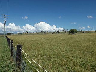
Maroon is a rural locality in the Scenic Rim Region, Queensland, Australia. In the 2016 census, Maroon had a population of 149 people.

Nindooinbah, Queensland Suburb of Scenic Rim Region, Queensland, Australia

Nindooinbah is a rural locality in the Scenic Rim Region, Queensland, Australia. In the 2016 census Nindooinbah had a population of 80 people.

Barney View, Queensland Suburb of Scenic Rim Region, Queensland, Australia

Barney View is a rural locality in the Scenic Rim Region, Queensland, Australia. In the 2016 census, Barney View had a population of 64 people.

Allenview, Queensland Suburb of Scenic Rim Region, Queensland, Australia

Allenview is a rural locality in the Scenic Rim Region, Queensland, Australia. In the 2016 census, Allenview had a population of 184 people.

Birnam, Queensland (Scenic Rim Region) Suburb of Logan City, Queensland, Australia

Birnam is a rural locality in the Scenic Rim Region, Queensland, Australia. In the 2016 census Birnam had a population of 106 people.

Mount Alford, Queensland Town in Queensland, Australia

Mount Alford is a rural town and locality in the Scenic Rim Region, Queensland, Australia. In the 2016 census the locality of Mount Alford had a population of 268 people.

Christmas Creek, Queensland Suburb of Scenic Rim Region, Queensland, Australia

Christmas Creek is a rural locality in the Scenic Rim Region, Queensland, Australia. In the 2016 census Christmas Creek had a population of 53 people.

Palen Creek, Queensland Suburb of Scenic Rim Region, Queensland, Australia

Palen Creek is a rural locality in the Scenic Rim Region, Queensland, Australia. It borders New South Wales. In the 2016 census, Palen Creek had a population of 280 people.

Innisplain, Queensland Suburb of Scenic Rim Region, Queensland, Australia

Innisplain is a rural locality in the Scenic Rim Region, Queensland, Australia. In the 2016 census, Innisplain and surrounding localities had a population of 85 people.

Lamington, Queensland Suburb of Scenic Rim Region, Queensland, Australia

Lamington is a rural locality in the Scenic Rim Region, Queensland, Australia. In the 2016 census Lamington had a population of 86 people.

Gleneagle, Queensland Suburb of Scenic Rim Region, Queensland, Australia

Gleneagle is a rural locality in the Scenic Rim Region, Queensland, Australia. In the 2016 census, Gleneagle had a population of 1877 people.

Bunjurgen, Queensland Suburb of Scenic Rim Region, Queensland, Australia

Bunjurgen is a rural locality in the Scenic Rim Region, Queensland, Australia. In the 2016 census Bunjurgen had a population of 116 people.

Cannon Creek, Queensland (Scenic Rim Region) Suburb of Scenic Rim Region, Queensland, Australia

Cannon Creek is a rural locality in the Scenic Rim Region, Queensland, Australia. In the 2016 census, Cannon Creek had a population of 78 people.

Carneys Creek, Queensland Suburb of Scenic Rim Region, Queensland, Australia

Carneys Creek is a rural locality in the Scenic Rim Region, Queensland, Australia. In the 2016 census Carneys Creek had a population of 51 people. It borders New South Wales.

Chinghee Creek, Queensland Suburb of Scenic Rim Region, Queensland, Australia

Chinghee Creek is a rural locality in the Scenic Rim Region, Queensland, Australia. In the 2016 census Chinghee Creek had a population of 30 people.

Croftby, Queensland Suburb of Scenic Rim Region, Queensland, Australia

Croftby is a rural locality in the Scenic Rim Region, Queensland, Australia. In the 2016 census, Croftby had a population of 133 people. The town of Teviot is within the locality.

Bunburra, Queensland Suburb of Scenic Rim Region, Queensland, Australia

Bunburra is a rural locality in the Scenic Rim Region, Queensland, Australia. In the 2016 census Bunburra had a population of 90 people.

Burnett Creek, Queensland Suburb of Scenic Rim Region, Queensland, Australia

Burnett Creek is a rural locality in the Scenic Rim Region, Queensland, Australia. In the 2016 census Burnett Creek had a population of 11 people. It borders New South Wales to the south.

References

  1. 1 2 3 4 Australian Bureau of Statistics (27 June 2017). "Coochin (SSC)". 2016 Census QuickStats. Retrieved 20 October 2018. OOjs UI icon edit-ltr-progressive.svg
  2. "Coochin – locality in Scenic Rim Region (entry 49240)". Queensland Place Names. Queensland Government . Retrieved 20 July 2021.
  3. "Proclamations under the New Land Acts". The Brisbane Courier . Queensland, Australia. 2 March 1877. p. 3. Archived from the original on 27 August 2020. Retrieved 19 February 2020 via Trove.
  4. "Coochin Coochin Homestead (entry 600034)". Queensland Heritage Register . Queensland Heritage Council. Retrieved 1 August 2014.
  5. "Queensland Globe". State of Queensland . Retrieved 10 December 2021.