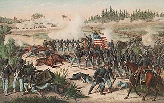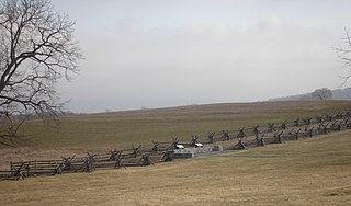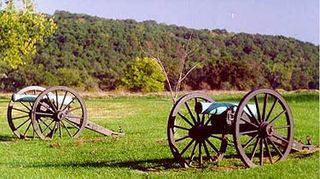
The Battle of Olustee or Battle of Ocean Pond was fought in Baker County, Florida on February 20, 1864, during the American Civil War. It was the largest battle fought in Florida during the war.

Kennesaw Battlefield Park preserves a Civil War battleground of the Atlanta Campaign, and also contains Kennesaw Mountain. It is located at 900 Kennesaw Mountain Drive, between Marietta and Kennesaw, Georgia. The name "Kennesaw" derives from the Cherokee Indian "Gah-nee-sah" meaning "cemetery" or burial ground. The area was designated as a U.S. historic district on October 15, 1966.
Monocacy National Battlefield is a unit of the National Park Service, the site of the Battle of Monocacy in the American Civil War fought on July 9, 1864. The battlefield straddles the Monocacy River southeast of the city of Frederick, Maryland. The battle, labeled "The Battle That Saved Washington," was one of the last the Confederates would carry out in Union territory. The two opposing leaders were General Jubal Early, fighting for the South, and General Lew Wallace, fighting for the North.

Shiloh National Military Park preserves the American Civil War Shiloh and Corinth battlefields. The main section of the park is in the unincorporated town of Shiloh, about nine miles (14 km) south of Savannah, Tennessee, with an additional area located in the city of Corinth, Mississippi, 23 miles (37 km) southwest of Shiloh. The Battle of Shiloh began a six-month struggle for the key railroad junction at Corinth. Afterward, Union forces marched from Pittsburg Landing to take Corinth in a May siege, then withstood an October Confederate counter-attack.

Poison Springs Battleground State Park is an Arkansas state park located southeast of Bluff City. It commemorates the Battle of Poison Spring in the American Civil War, which was part of the 1864 Camden Expedition, an element of a Union Army initiative to gain control of Shreveport, Louisiana and get a foothold in Texas.
The Battle of Averasborough or the Battle of Averasboro, fought March 16, 1865, in Harnett and Cumberland counties, North Carolina, as part of the Carolinas Campaign of the American Civil War, was a prelude to the climactic Battle of Bentonville, which began three days later.

The Battle of Champion Hill of May 16, 1863, was the pivotal battle in the Vicksburg Campaign of the American Civil War (1861–1865). Union Army commander Major General Ulysses S. Grant and the Army of the Tennessee pursued the retreating Confederate States Army under Lieutenant General John C. Pemberton and defeated it twenty miles to the east of Vicksburg, Mississippi, leading inevitably to the Siege of Vicksburg and surrender. The battle is also known as Baker's Creek.

Antietam National Battlefield is a National Park Service-protected area along Antietam Creek in Sharpsburg, Washington County, northwestern Maryland. It commemorates the American Civil War Battle of Antietam that occurred on September 17, 1862.

Wilson's Creek National Battlefield, located near Republic, Missouri, preserves the site of the Battle of Wilson's Creek. Fought on August 10, 1861, the battle was the first major American Civil War engagement west of the Mississippi River. In the battle, a Confederate army commanded by Benjamin McCulloch and Sterling Price defeated a smaller Union army commanded by Nathaniel Lyon. However, the Confederates were unable to hold much of Missouri, and a Confederate defeat at the Battle of Pea Ridge effectively solidified Union control of the state. Major features include a five-mile automobile tour loop, the restored 1852 Ray House, and "Bloody Hill", the site of the final stage of the battle. The site is located near Republic in southwestern Missouri just southwest of the city of Springfield. It has been a unit of the National Park Service since 1960, and was listed on the National Register of Historic Places in 1966.

Petersburg National Battlefield is a National Park Service unit preserving sites related to the American Civil War Siege of Petersburg (1864–65). The battlefield is near the city of Petersburg, Virginia, and includes outlying components in Hopewell, Prince George County, and Dinwiddie County. Over 140,000 people visit the park annually.

The Richmond National Battlefield Park commemorates 13 American Civil War sites around Richmond, Virginia, which served as the capital of the Confederate States of America for most of the war. The park connects certain features within the city with defensive fortifications and battle sites around it.
The Battle of Wyse Fork, also known as the Battle of Kinston, was fought in the Carolinas Campaign of the American Civil War, resulting in a Union Army victory.

Perryville Battlefield State Historic Site is a 745-acre (3.01 km2) park near Perryville, Kentucky. The park continues to expand with purchases of parcels by the Office of Kentucky Nature Preserves' Kentucky Heritage Land Conservation Fund and the American Battlefield Trust. An interpretive museum is located near the site where many Confederate soldiers killed in the Battle of Perryville were buried. Monuments, interpretive signage, and cannons also mark notable events during the battle. The site became part of the Kentucky State Park System in 1936.
The Port Gibson Battlefield is the site near Port Gibson, Mississippi where the 1863 Battle of Port Gibson was fought during the American Civil War. The battlefield covers about 3,400 acres (1,400 ha) of land west of the city, astride Rodney Road, where Union Army forces were establishing a beachhead after crossing the Mississippi River in a bid to take the Confederate fortress of Vicksburg. The Union victory secured that beachhead and paved the way for the eventual fall of Vicksburg. A 2,080-acre (840 ha) area surrounding part of the site was listed on the National Register of Historic Places in 1972, and a larger area was designated a National Historic Landmark in 2005. In 2009, the battlefield was designated by the Civil War Preservation Trust as one of its Top 10 most endangered Civil War battlefields. In 2011, the Civil War Preservation Trust was renamed the Civil War Trust, which in 2018 became a division of the American Battlefield Trust. The Trust and its partners have acquired and preserved 644 acres (2.61 km2) of the Port Gibson battlefield.

Sayler's Creek Battlefield, near Farmville, Virginia, was the site of the Battle of Sayler's Creek of the American Civil War. Confederate general Robert E. Lee's army was retreating from the Richmond to the Petersburg line. Here, on April 6, 1865, Union general Philip Sheridan cut off and beat back about a quarter of Lee's depleted army. Eight Confederate generals surrendered, and 7,700 men were lost. Confederate Major General George Washington Custis Lee, eldest son of Robert E. Lee, was forcibly captured on the battlefield by Private David Dunnels White of the 37th Massachusetts Regiment. The battle was the last major engagement of the war in Virginia; Lee's surrender at Appomattox occurred three days later. A portion of the landmarked battlefield area is included in Sailor's Creek Battlefield Historical State Park. The Civil War Trust and its partners have acquired and preserved 885 acres (3.58 km2) of the battlefield in five transactions since 1996.

Staunton River Battlefield State Park is a state park located in Virginia. The park straddles the Staunton River in Halifax and Charlotte counties. The Roanoke visitor center in Randolph, Virginia is a railroad depot which now holds exhibits on Native Americans and railroad history. The Clover visitor center has exhibits on the American Civil War and the battle which took place on this site. It also includes information about the production of electric energy. The park also includes the Mulberry Hill plantation, given to the state in 1999.
The Port Hudson State Historic Site is located on the Mississippi River north of Baton Rouge in East Feliciana Parish, Louisiana, just outside the limits of Port Hudson and in the vicinity of Jackson. The site preserves a portion of the fortifications and battle area of the longest siege in American history, during the American Civil War from May 23 through July 9, 1863. The state of Louisiana maintains the site, which includes a museum about the siege, artillery displays, redoubts, and interpretive plaques. Historical reenactments are held each year. It was designated a National Historic Landmark in 1974, significant as the first place where African-American military units fought for the Union Army under African-American field leadership.

The Battle of Bentonville was fought in Johnston County, North Carolina, near the village of Bentonville, as part of the Western Theater of the American Civil War. It was the last battle between the western field armies of William T. Sherman and Joseph E. Johnston.
The Civil War Trust's Civil War Discovery Trail is a heritage tourism program that links more than 600 U.S. Civil War sites in more than 30 states. The program is one of the White House Millennium Council's sixteen flagship National Millennium Trails. Sites on the trail include battlefields, museums, historic sites, forts and cemeteries.

Harper House is a historic home located near Four Oaks, North Carolina, Johnston County, North Carolina. It was built about 1855, and is a two-story, three-bay, vernacular Greek Revival style frame dwelling. It sits on the original brick pier foundation and has a hipped roof and interior end chimneys. The front facade features a two-story pedimented portico. The house served as a Union field hospital during the Battle of Bentonville and is located adjacent to the Bentonville Battlefield state historic site visitors center, which offers tours of its interior. It was bought by the state in 1957. Before the state's acquisition of the property, it was privately owned by the Dunn family, and before them the Thorntons. It served as a home for 6 of the Harper children, and two of the Harpers grandchildren during the battle.


