Reed Gold Mine

Last updated

Reed Gold Mine
ReedGoldMine.jpg
USA North Carolina location map.svg
Red pog.svg
Usa edcp location map.svg
Red pog.svg
Nearest city Concord, North Carolina
Built1799
NRHP reference No. 66000587 [1]
Added to NRHPOctober 15, 1966

The Reed Gold Mine is located in Midland, Cabarrus County, North Carolina, and is the site of the first documented commercial gold find in the United States. [2] It has been designated a National Historic Landmark because of its importance and listed on the National Register of Historic Places

Contents

History

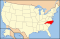
In 1799, Conrad Reed, the son of farmer and former Hessian soldier John Reed (né Johannes Reidt) born June 6, 1757, found a 17-pound yellow "rock" in Little Meadow Creek on the family farm in Cabarrus County, North Carolina. [3] :11 For three years, the rock served as a bulky doorstop. In 1802, a jeweler from Fayetteville identified the rock as a large gold nugget. He told John Reed to name his price. Reed, not understanding the true value of gold, asked for what he thought was the hefty price of $3.50, or a week's worth of wages. The large nugget's true value was around $3,600.

About 1803, John Reed organized a small gold mining operation. Soon afterward a slave named Peter found a 28-pound nugget. [2] Reed continued with placer mining for a number of years. In 1831 he began underground mining. John Reed died at age 88 on May 28, 1845, rich from the gold found on his property.

Some years later, the American Civil War decreased mining activity because of labor and resources being pulled into the war. The last large nugget uncovered by placer mining was discovered in 1896. The last underground mining took place at the Reed Mine in 1912. To handle the large amount of gold found in the region and state from the 19th into the early 20th century, the Charlotte Mint was built in nearby Charlotte, North Carolina. [2] [4]

Today, the Reed Mine is a state historic site that belongs to the North Carolina Department of Natural and Cultural Resources and open to the public. Visitors can tour a museum with extensive displays about North Carolina gold mining. In addition, they can explore several hundred feet of restored gold mine tunnels.

About John Reed

Panning for gold at the mine GoldPanning.jpg
Panning for gold at the mine

Johannes Reith, a Hessian soldier from Raboldshausen, Germany, served during the American Revolution in Company C (Col. Friedrich von Porbeck) of the Garrison Regiment von Wissenbach. On June 21, 1782 he deserted his post outside Savannah, Georgia and took his arms and equipment. He left the British army and came to settle in the lower part of North Carolina.

He went to 'upper' Mecklenburg County, North Carolina, later Cabarrus County, where he settled in the ethnic German community. He Anglicized his name to John Reed. Later he married Sarah Kiser, daughter of Peter Kiser and Fanny Garmon.

See also

Related Research Articles

<span class="mw-page-title-main">Cabarrus County, North Carolina</span> County in North Carolina, United States

Cabarrus County is a county located in the south-central part of the U.S. state of North Carolina. As of the 2020 census, the population was 225,804, making it the 9th-most populous county in North Carolina. The county seat is Concord, which was incorporated in 1803. Cabarrus County is included in the Charlotte-Concord-Gastonia, NC-SC Metropolitan Statistical Area.

<span class="mw-page-title-main">Gold rush</span> Gold discovery triggering an onrush of miners seeking fortune

A gold rush or gold fever is a discovery of gold—sometimes accompanied by other precious metals and rare-earth minerals—that brings an onrush of miners seeking their fortune. Major gold rushes took place in the 19th century in Australia, Greece, New Zealand, Brazil, Chile, South Africa, the United States, and Canada while smaller gold rushes took place elsewhere.

Midland is a town in southern Cabarrus County in the U.S. state of North Carolina. Located in the Charlotte region of North Carolina, Midland is a 30-minute commute to uptown Charlotte. The name of the town is derived from its location approximately halfway between Charlotte and Oakboro on the railroad line. The population was 3,073 at the 2010 census.

<span class="mw-page-title-main">Gold Country</span> Historic gold-mining region in Northern California

The Gold Country is a historic region in the northern portion of the U.S. state of California, that is primarily on the western slope of the Sierra Nevada. It is famed for the mineral deposits and gold mines that attracted waves of immigrants, known as the 49ers, during the 1849 California Gold Rush.

<span class="mw-page-title-main">Malakoff Diggins State Historic Park</span> State Historic Park

Malakoff Diggins State Historic Park is a state park unit preserving Malakoff Diggins, the largest hydraulic mining site in California, United States. The mine was one of several hydraulic mining sites at the center of the 1882 landmark case Woodruff v. North Bloomfield Mining and Gravel Company. The mine pit and several Gold Rush-era buildings are listed on the National Register of Historic Places as the Malakoff Diggins-North Bloomfield Historic District. The "canyon" is 7,000 feet (2,100 m) long, as much as 3,000 feet (910 m) wide, and nearly 600 feet (180 m) deep in places. Visitors can see huge cliffs carved by mighty streams of water, results of the mining technique of washing away entire mountains of gravel to wash out the gold. The park is 26 miles (42 km) north-east of Nevada City, California, in the Gold Rush country. The 3,143-acre (1,272 ha) park was established in 1965.

<span class="mw-page-title-main">Calhoun Mine</span> United States historic place

The Calhoun Mine is perhaps the oldest and best-known mine in Lumpkin County, Georgia. When gold was discovered in Lumpkin County in 1828, which led to the Georgia Gold Rush in 1829, it was discovered on 239 acres (0.97 km2) owned by Robert Obar. After at least two intermediary sales, the land was purchased by Senator John C. Calhoun of South Carolina, who was also the 7th Vice President of the United States. Calhoun started a mining company to mine the land and later allowed his son-in-law Thomas Green Clemson, the founder of Clemson University, to manage it. The ore deposit was a very rich deposit and, according to an 1856 letter from Clemson to his brother-in-law, was still producing significant quantities of gold nearly 30 years after its initial discovery on the land. This mine - along with the Consolidated Mine and the Loud Mine - were some of the most productive mines in the Georgia Gold Belt.

<span class="mw-page-title-main">Uwharrie Mountains</span> Mountain range in North Carolina, United States

The Uwharrie Mountains are a mountain range in North Carolina spanning the counties of Randolph, Montgomery, Stanly, and Davidson. The range's foothills stretch into Cabarrus, Anson, Union, and Richmond counties.

<span class="mw-page-title-main">California State Route 49</span> Highway in California

State Route 49 is a north–south state highway in the U.S. state of California that passes through many historic mining communities of the 1849 California gold rush and it is known as the Golden Chain Highway. The highway's creation was lobbied by the Mother Lode Highway Association, a group of locals and historians seeking a single highway to connect many relevant locations along the Gold Rush to honor the 49ers. One of the bridges along SR 49 is named for the leader of the association, Archie Stevenot.

<span class="mw-page-title-main">Empire Mine State Historic Park</span> State-protected site in California

Empire Mine State Historic Park is a state-protected mine and park in the Sierra Nevada mountains in Grass Valley, California, U.S. The Empire Mine is on the National Register of Historic Places, a federal Historic District, and a California Historical Landmark. Since 1975 California State Parks has administered and maintained the mine as a historic site. The Empire Mine is "one of the oldest, largest, deepest, longest and richest gold mines in California". Between 1850 and its closure in 1956, the Empire Mine produced 5.8 million ounces of gold, extracted from 367 miles (591 km) of underground passages.

<span class="mw-page-title-main">Georgia Gold Rush</span>

The Georgia Gold Rush was the second significant gold rush in the United States and the first in Georgia, and overshadowed the previous rush in North Carolina. It started in 1829 in present-day Lumpkin County near the county seat, Dahlonega, and soon spread through the North Georgia mountains, following the Georgia Gold Belt. By the early 1840s, gold became difficult to find. Many Georgia miners moved west when gold was found in the Sierra Nevada in 1848, starting the California Gold Rush. Since the 16th century, American Indians in Georgia told European explorers that the small amounts of gold which they possessed came from mountains of the interior. Some poorly documented accounts exist of Spanish or French mining gold in North Georgia between 1560 and 1690, but they are based on supposition and on rumors passed on by Indians. In summing up known sources, W.S. Yeates observed: "Many of these accounts and traditions seem to be quite plausible. Nevertheless, it is hardly probable that the Spaniards would have abandoned mines which were afterwards found to be quite profitable, as those in North Georgia."

Gold Hill is an unincorporated community and census-designated place (CDP) in southeastern Rowan County, North Carolina, United States near the Cabarrus County line. It was first listed as a CDP in the 2020 census with a population of 372. It is situated near the Yadkin River and is served by U.S. Highway 52 and Old Beatty Ford Road.

<span class="mw-page-title-main">Cane Creek Mountains</span> Mountain in North Carolina, USA

Cane Creek Mountains is a small mountain range that lies south of Burlington, North Carolina. The range covers an area including Alamance County, Guilford County, Randolph County, and Chatham County in North Carolina.

<span class="mw-page-title-main">Central City/Black Hawk Historic District</span> Historic district in Colorado, United States

The Central City/Black Hawk Historic District is a National Historic Landmark District that encompasses the developed areas of Central City and Black Hawk, Colorado, United States. They are adjacent former gold mining camps in the Front Range of the Rocky Mountains in Gilpin County, Colorado. For a time, the area was known as the Richest Square Mile on Earth, and was the largest urban area of the Colorado Territory in the 1870s.

<span class="mw-page-title-main">Gold mining in the United States</span>

In the United States, gold mining has taken place continually since the discovery of gold at the Reed farm in North Carolina in 1799. The first documented occurrence of gold was in Virginia in 1782. Some minor gold production took place in North Carolina as early as 1793, but created no excitement. The discovery on the Reed farm in 1799 which was identified as gold in 1802 and subsequently mined marked the first commercial production.

<span class="mw-page-title-main">Carolina gold rush</span>

The Carolina gold rush, the first gold rush in the United States, followed the discovery of a large gold nugget in North Carolina in 1799, by a 12-year-old boy named Conrad Reed. He spotted the nugget while playing in Meadow Creek on his family's farm in Cabarrus County, North Carolina. Conrad took the 17-pound (7.7 kg) gold nugget home to show his father. However, gold was not commonly seen in their community and the value of the nugget was not understood. The nugget was used as a door stop in the family's home for several years. In 1802, Conrad's father, John Reed, showed the rock to a jeweler, who recognized it as gold and offered to buy it. Reed, still unaware of the real value of his "doorstop," sold it to the jeweler for US$3.50. The large nugget's true value was around $3,600.

<span class="mw-page-title-main">National Register of Historic Places listings in Cabarrus County, North Carolina</span>

This list includes properties and districts listed on the National Register of Historic Places in Cabarrus County, North Carolina. Click the "Map of all coordinates" link to the right to view an online map of all properties and districts with latitude and longitude coordinates in the table below.

Red Dog was a California gold rush mining town located in the Gold Country in south-central Nevada County, California, United States, 6 mi (9.7 km) northeast of Chicago Park. Red Dog Hill, a mine and campsite, was founded by three men all under the age of 22, and was named by their youngest, a 15-year-old prospector. As mining operations grew, the campsite became a settlement, and then a town with a population of 2,000 residents, before it was eventually abandoned. Still considered important today, Red Dog Townsite is listed on the National Register of Historic Places.

Mining in the United States has been active since the beginning of colonial times, but became a major industry in the 19th century with a number of new mineral discoveries causing a series of mining rushes. In 2015, the value of coal, metals, and industrial minerals mined in the United States was US$109.6 billion. 158,000 workers were directly employed by the mining industry.

<span class="mw-page-title-main">Anvil Creek (Alaska)</span> River in Alaska, United States

Anvil Creek is a stream in Alaska. Part of it is in the Nome mining district near Nome, Alaska and became a center of gold rush attention after three Swedes found gold along it. The resulting influx of prospectors brought thousands of people to Nome in the spring of 1899.

<span class="mw-page-title-main">Silver Hill Mine</span> Mine in North Carolina

The Silver Hill Mine was the first silver mine in the United States, later used primarily as a source of lead and zinc. Discovered during the Carolina gold rush at a Davidson County, North Carolina location later named Silver Hill, operations began at the site in 1839 under the Washington Mining Company. Increasing difficulties extracting the silver from ore heavy in lead and zinc led to the introduction of various new metallurgical processes and equipment. These were unable to fully stem losses of silver in refinement, and an increasingly convoluted production chain led to closure of the mine in 1852.

References

  1. "National Register Information System". National Register of Historic Places . National Park Service. November 2, 2013.
  2. 1 2 3 "Reed Gold Mine". North Carolina Historic Sites. Retrieved December 19, 2006.
  3. Williams, David, 1993, The Georgia Gold Rush: Twenty-Niners, Cherokees, and Gold Fever, Columbia: University of South Carolina Press, ISBN   1570030529
  4. "Antebellum Gold Mining (1820-1860)". North Carolina History Project. Retrieved December 19, 2006.

35°17′08″N80°28′12″W / 35.28542°N 80.46996°W / 35.28542; -80.46996