Berbice Bridge

Last updated
Berbice Bridge
Pilings for the Berbice River bridge.jpg
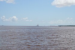
The Berbice Bridge under construction in 2007
Coordinates 6°16′52″N57°31′44″W / 6.281°N 57.529°W / 6.281; -57.529 Coordinates: 6°16′52″N57°31′44″W / 6.281°N 57.529°W / 6.281; -57.529
Carries2-lane wide highway
CrossesBerbice River
LocaleNorth east Berbice
Characteristics
Total length1,571 m
History
Opened23 December 2008
Statistics
Tollyes
Location
Berbice Bridge

The Berbice Bridge is a pontoon bridge over the Berbice River near New Amsterdam in Guyana. The bridge is tolled and was opened on 23 December 2008. [1]

Contents

With the completion of the Berbice Bridge, and the earlier completion of the Coppename Bridge in Suriname in 1999, the Courantyne River is the only river between the Guyanese capital of Georgetown and the Surinamese capital of Paramaribo still left without a bridge. This is due to change in the near future, with plans for a bridge on the Courantyne near South Drain. [2] The bridge doesn't have a pedestrian crossing.

It is owned by Berbice Bridge Company Incorporated and tolls are set by a Concession Agreement between the government and the company. [3] In 2018, the government took over ownership of the bridge as a reaction to the 360% increase in toll, [4] citing Sections 4 (1) and 11 of the Berbice River Bridge Act in the interest of public safety. [5]

See also

Related Research Articles

The transport sector comprises the physical infrastructure, docks and vehicle, terminals, fleets, ancillary equipment and service delivery of all the various modes of transport operating in Guyana. The transport services, transport agencies providing these services, the organizations and people who plan, build, maintain, and operate the system, and the policies that mold its development.

Dutch colonisation of the Guianas

Dutch colonisation of the Guianas—the coastal region between the Orinoco and Amazon rivers in South America—began in the late 16th century. The Dutch originally claimed all of Guiana but—following attempts to sell it first to Bavaria and then to Hanau and the loss of sections to Portugal, Britain, and France—the section actually settled and controlled by the Netherlands became known as Dutch Guiana.

New Amsterdam, Guyana Town and regional capital in East Berbice-Corentyne, Guyana

New Amsterdam is the regional capital of East Berbice-Corentyne, Guyana and one of the country's largest towns. It is 100 kilometres (62 mi) from the capital, Georgetown and located on the eastern bank of the Berbice River, 6 km (4 mi) upriver from its mouth at the Atlantic Ocean, and immediately south of the Canje River. New Amsterdam's population is 17,329 inhabitants as of 2012.

Coffy (person)

Cuffy, also spelled as Kofi or Koffi, was an Akan man who was captured in his native West Africa and stolen for slavery to work on the plantations of the Dutch colony of Berbice in present-day Guyana. He became famous because in 1763 he led a revolt of more than 2,500 slaves against the colony regime. Today, he is a national hero in Guyana.

Berbice River

The Berbice River, located in eastern Guyana, is one of the country's major rivers. It rises in the highlands of the Rupununi region and flows northward for 595 kilometres (370 mi) through dense forests to the coastal plain. The river's tidal limit is between 160 and 320 km (99–199 mi) from the sea.

Courantyne River

The Courantyne/Corentyne/Corantijn River is a river in northern South America in Suriname. It is the longest river in the country and creates the border between Suriname and the East Berbice-Corentyne region of Guyana.

Ituni Town in the interior of Guyana

Ituni is a village in the interior of Guyana, at an altitude of 100 metres (331 feet). The area grew as a result of bauxite mining in the area.

Baracara village in East Berbice-Corentyne, Guyana

Baracara was founded as a maroon community in the East Berbice-Corentyne Region of Guyana, located on the Canje River. The community has also been called New Ground Village or Wel te Vreeden. Baracara is 20 miles west of Corriverton and just north of the Torani Canal's connection to the Canje River.

Abary River

The Abary River is a small river in northern Guyana that drains into the Atlantic Ocean.

Demerara Harbour Bridge

The Demerara Harbour Bridge is a 6,074-foot (1,851 m) long floating toll bridge. It was commissioned on 2 July 1978. The bridge crosses the Demerara River 4 miles (6.4 km) south of the Guyanese capital Georgetown, from Peter's Hall, Demerara-Mahaica, East Bank Demerara to Schoon Ord, Essequibo Islands-West Demerara, West Bank Demerara. There is a pedestrian footwalk. A raised section lets small vessels pass under. A retractor span lets large vessels pass.

The Railways of Guyana comprised two public railways, the Demerara-Berbice Railway and the Demerara-Essequibo railway. There are also several industrial railways mainly for the bauxite industry. The Demerara-Berbice Railway is the oldest in South America. None of the railways are in operation in the 21st century.

Berbice slave uprising

The Berbice slave uprising was a slave revolt in Guyana that began on 23 February 1763 and lasted to December, with leaders including Coffy. It is seen as a major event in Guyana's anti-colonial struggles, and when Guyana became a republic in 1970 the state declared 23 February as a day to commemorate the start of the Berbice slave revolt.

Moleson Creek Place in East Berbice-Corentyne, Guyana

Moleson Creek is a community on the Corentyne River in the East Berbice-Corentyne region of Guyana, and home to the Guyana-Suriname ferry stelling. It is north of Orealla Mission, 10 km (6.2 mi) south of Corriverton, and approximately 90 km (56 mi) from New Amsterdam.

South Drain, Suriname Place in Nickerie District, Suriname

South Drain, also Zuiddrain, is a town in western Suriname. Since the pavement of 32 kilometres (20 mi) road section to Nieuw Nickerie, it is the final destination of the northern East-West Link. The European Union funded the reconstruction, which started in 2007, with 13.2 million euro. The section was opened on 30 April 2010. There is a jeep trail between South Drain and Apoera, connecting the Northern East-West Link with the Southern East-West Link. Contrary to earlier plans, the pavement of this road is not imminent.

Borders of Suriname

The borders of Suriname consist of land borders with three countries: Guyana, Brazil, and France. The borders with Guyana and France are in dispute, but the border with Brazil has been uncontroversial since 1906.

Tigri Area Disputed area between Guyana and Suriname

The Tigri Area is a wooded area that has been disputed since around 1840 by Suriname and Guyana. It involves the area between the Upper Corentyne River, the Coeroeni River and the Kutari River. This triangular area is in Guyana known as the New River Triangle. In 1969 the conflict ran high on and since then the Tigri Area is controlled by Guyana and claimed by Suriname. In 1971 both governments in Trinidad agreed that they continue talks over the border issue and withdraw their military forces from the disputed Triangle. Guyana has never held upon this agreement.

Guyana–Suriname relations Diplomatic relations between the Republic of Guyana and the Republic of Suriname

Guyana – Suriname relations refer to the bilateral relations between Guyana and Suriname. Suriname has an embassy in Georgetown. Guyana has an embassy in Paramaribo. The Courantyne River makes up most of the border between the two countries.

Mining is a significant contributor to the economy of Guyana, owing to sizable reserves of bauxite, gold, and diamonds. Much of these resources are found in Guyana's Hilly Sand and Clay belt, a region that makes up 20% of the country.

COVID-19 pandemic in Guyana Ongoing COVID-19 viral pandemic in Guyana

The COVID-19 pandemic in Guyana is part of the worldwide pandemic of coronavirus disease 2019 caused by severe acute respiratory syndrome coronavirus 2. The virus was confirmed to have reached Guyana on 11 March 2020. The first case was a woman who travelled from New York, a 52-year-old woman suffering from underlying health conditions, including diabetes and hypertension. The woman died at the Georgetown Public Hospital.

References

  1. Stabroek News - Berbice bridge opened, 24 December 2008
  2. Dagblad Suriname - OW-minister en Ballast Nedam bekijken locatie Corantijnbrug, 27 January 2018 (in Dutch)
  3. "Patterson declines to meet Berbice Bridge company to discuss possible sale". Stabroek News. 2019-08-31. Retrieved 2021-02-09.
  4. "Gov't takes control of Berbice Bridge". Stabroek News. 2018-11-05. Retrieved 2021-02-09.
  5. "Berbicians welcome gov't takeover of Berbice bridge". Stabroek News. 2018-11-06. Retrieved 2021-02-09.