Bjorne Peninsula

Last updated

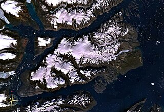
The Bjorne Peninsula is located on the western coast of Ellesmere Island, a part of the Qikiqtaaluk Region of the Canadian territory of Nunavut. It protrudes northwest into Norwegian Bay from the island's mainland. Goose Point, a narrow isthmus, is the furthest northwest landform. [1] Other areas of the peninsula include Schei Point (north), Little Bear Cape (west), and Great Bear Cape (southwest). [2] The peninsula's midsection is approximately 144 m (472 ft) above sea level. [3]

Ellesmere Island part of the Qikiqtaaluk Region of the Canadian territory of Nunavut

Ellesmere Island is part of the Qikiqtaaluk Region in the Canadian territory of Nunavut. Lying within the Canadian Arctic Archipelago, it is considered part of the Queen Elizabeth Islands, with Cape Columbia being the most northerly point of land in Canada. It comprises an area of 196,235 km2 (75,767 sq mi) and the total length of the island is 830 kilometres (520 mi), making it the world's tenth largest island and Canada's third largest island. The Arctic Cordillera mountain system covers much of Ellesmere Island, making it the most mountainous in the Canadian Arctic Archipelago. The Arctic willow is the only woody species to grow on Ellesmere Island.

Qikiqtaaluk Region Region of Nunavut, Canada

The Qikiqtaaluk Region, Qikiqtani Region or Baffin Region is the easternmost administrative region of Nunavut, Canada. Qikiqtaaluk is the traditional Inuktitut name for Baffin Island. Although the Qikiqtaaluk Region is the most commonly used name in official contexts, several notable public organisations, including Statistics Canada prefer the older term Baffin Region.

Canada Country in North America

Canada is a country in the northern part of North America. Its ten provinces and three territories extend from the Atlantic to the Pacific and northward into the Arctic Ocean, covering 9.98 million square kilometres, making it the world's second-largest country by total area. Canada's southern border with the United States is the world's longest bi-national land border. Its capital is Ottawa, and its three largest metropolitan areas are Toronto, Montreal, and Vancouver. As a whole, Canada is sparsely populated, the majority of its land area being dominated by forest and tundra. Consequently, its population is highly urbanized, with over 80 percent of its inhabitants concentrated in large and medium-sized cities, many near the southern border. Canada's climate varies widely across its vast area, ranging from arctic weather in the north, to hot summers in the southern regions, with four distinct seasons.

Muskox frequent the peninsula. [1]

Nearby, Graham Island is found to the west and Axel Heiberg Island is to the northwest. Hoved Island lies between the peninsula and Ellesmere Island's mainland.

Graham Island island in Canada

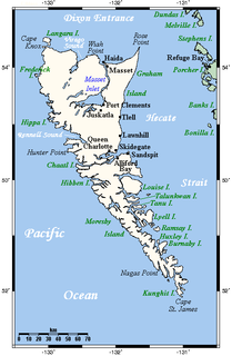
Graham Island is the largest island in the Haida Gwaii archipelago, lying off the coast of British Columbia, Canada. It is separated only by a narrow channel from the other principal island of the group, Moresby Island. It has a population of 4,475, an area of 6,361 km2 (2,456 sq mi), and is the 101st largest island in the world and Canada's 22nd largest island.

Axel Heiberg Island island in the Qikiqtaaluk Region, Nunavut, Canada

Axel Heiberg Island is an island in the Qikiqtaaluk Region, Nunavut, Canada. Located in the Arctic Ocean, it is the 32nd largest island in the world and Canada's seventh largest island. According to Statistics Canada, it has an area of 43,178 km2 (16,671 sq mi). It is named after Axel Heiberg.

Hoved Island is part of the Qikiqtaaluk Region of the Canadian territory of Nunavut. The island is located between the Svendsen and Bjorne peninsulas, and within the Baumann Fiord of Ellesmere Island, considered part of the Queen Elizabeth Islands, in the Canadian Arctic Archipelago. It comprises an area of 158 km2 (61 sq mi).

Related Research Articles

Geography of Canada geographic features of Canada

The geography of Canada describes the geographic features of Canada, the world's second largest country in total area.

Geography of Italy

Italy is located in southern Europe and comprises the long, boot-shaped Italian Peninsula, the southern side of Alps, the large plain of the Po Valley and some islands including Sicily and Sardinia. Corsica, although belonging to the Italian geographical region, has been a part of France since 1769. Italy is part of the Northern Hemisphere.

Victoria Island (Canada) island in arctic Canada

Victoria Island is a large island in the Canadian Arctic Archipelago that straddles the boundary between Nunavut and the Northwest Territories of Canada. It is the eighth largest island in the world, and at 217,291 km2 (83,897 sq mi) in area, it is Canada's second largest island. It is nearly double the size of Newfoundland (111,390 km2 [43,008 sq mi]), and is slightly larger than the island of Great Britain (209,331 km2 [80,823 sq mi]) but smaller than Honshu (225,800 km2 [87,182 sq mi]). It contains the world's largest island within an island within an island. The western third of the island belongs to the Inuvik Region in the Northwest Territories; the remainder is part of Nunavut's Kitikmeot Region.

Gulf of Saint Lawrence The outlet of the North American Great Lakes via the Saint Lawrence River into the Atlantic Ocean

The Gulf of Saint Lawrence is the outlet of the North American Great Lakes via the Saint Lawrence River into the Atlantic Ocean. The gulf is a semienclosed sea, covering an area of about 226,000 square kilometres (87,000 sq mi) and containing about 34,500 cubic kilometres (8,300 cu mi) of water, which results in an average depth of 152 metres (499 ft).

Arctic Archipelago Canadian archipelago

The Arctic Archipelago, also known as the Canadian Arctic Archipelago, is a group of islands north of the Canadian mainland.

Cap-Vert peninsula in Senegal

Cap-Vert or the Cape Verde Peninsula is a peninsula in Senegal, and the westernmost point of the continent of Africa and of the Old World mainland. Portuguese explorers called it Cabo Verde or "Green Cape", but it is not to be confused with the Cape Verde islands, which are some 560 kilometres (350 mi) further west. Dakar, the capital of Senegal, is located near the southern tip.

Baffin Bay A marginal sea between Greenland and Baffin Island, Canada

Baffin Bay, located between Baffin Island and the west coast of Greenland, is a marginal sea of the North Atlantic Ocean. It is connected to the Atlantic via Davis Strait and the Labrador Sea. The narrower Nares Strait connects Baffin Bay with the Arctic Ocean. The bay is not navigable most of the year because of the ice cover and high density of floating ice and icebergs in the open areas. However, a polynya of about 80,000 km2 (31,000 sq mi), known as the North Water, opens in summer on the north near Smith Sound. Most of the aquatic life of the bay is concentrated near that region.

Extreme points of Eurasia Wikimedia list article

This is a list of the extreme points of Eurasia, the points that are farther north, south, east or west than any other location on the continent. Some of these locations are open to debate, owing to the diverse definitions of Europe and Asia.

Milne Land island in Greenland

Milne Land or Milneland is a large island in eastern Greenland. It is the third largest island of Greenland, after the main island of Greenland and Disko Island. It is named after British admiral David Milne.

The Svendsen Peninsula is located on the southwestern coast of Ellesmere Island, a part of the Qikiqtaaluk Region of the Canadian territory of Nunavut. Much of it is shielded from Norwegian Bay by the Raanes Peninsula (northwest) and Bjorne Peninsula (southwest). The Svendsen Peninsula is notable for its many fiords, including Trold, Baumann, and Vendom. Gryte Bay is in the west. Hoved Island lies offshore.

The Cook Peninsula is located on the eastern coast of Ellesmere Island, a part of the Qikiqtaaluk Region of the Canadian territory of Nunavut. North of Princess Marie Bay, it stretches eastward into Nares Strait. The peninsula is approximately 64 square kilometres (25 sq mi) in size, and has two lowland areas frequented by muskox.

Inussulik Bay is a bay in the Upernavik Archipelago in the Qaasuitsup municipality in northwestern Greenland.

Cape Parry is a headland in Canada's Northwest Territories. Located at the northern tip of the Parry Peninsula, it projects into Amundsen Gulf. The nearest settlement is Paulatuk, 100 km (62 mi) to the south, and Fiji Island is located 9 km (5.6 mi) to the west. Cape Parry was formerly accessible through Cape Parry Airport that was located at the Distant Early Warning Line. The airport was listed as abandoned after the closure of the DEW line site.

Borders of the oceans The limits of the Earths oceanic waters

The borders of the oceans are the limits of the Earth's oceanic waters. The definition and number of oceans can vary depending on the adopted criteria.

Remote Peninsula

The Remote Peninsula is a peninsula located on the eastern coast of Baffin Island. It is part of the Qikiqtaaluk Region of the Canadian territory of Nunavut. The Inuit settlement of Pond Inlet is 295 km (183 mi) to the northwest and Clyde River is 90 km (56 mi) to the southeast.

References

  1. 1 2 Barr, William (2004). Red Serge and Polar Bear Pants: The Biography of Harry Stallworthy, RCMP. University of Alberta. p. 160. ISBN   0-88864-433-7.
  2. "Bjorne Peninsula". nrcan.gc.ca. Archived from the original on 2008-10-04. Retrieved 2008-10-17.
  3. "Bjorne Peninsula ca. 144 m". geonames.org. Retrieved 2008-10-17.

Coordinates: 77°37′N086°59′W / 77.617°N 86.983°W / 77.617; -86.983 (Bjorne Peninsula)

Geographic coordinate system Coordinate system

A geographic coordinate system is a coordinate system that enables every location on Earth to be specified by a set of numbers, letters or symbols. The coordinates are often chosen such that one of the numbers represents a vertical position and two or three of the numbers represent a horizontal position; alternatively, a geographic position may be expressed in a combined three-dimensional Cartesian vector. A common choice of coordinates is latitude, longitude and elevation. To specify a location on a plane requires a map projection.