Related Research Articles

The Gulf of St. Lawrence fringes the shores of the provinces of Quebec, New Brunswick, Nova Scotia, Prince Edward Island, Newfoundland and Labrador, in Canada, plus the islands Saint-Pierre and Miquelon, possessions of France, in North America.

The Arctic Archipelago, also known as the Canadian Arctic Archipelago, is an archipelago lying to the north of the Canadian continental mainland, excluding Greenland and Iceland.

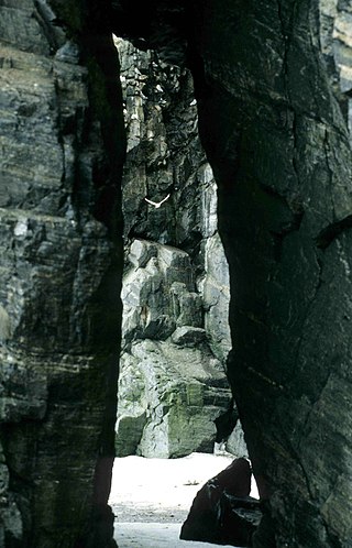
The piping plover is a small sand-colored, sparrow-sized shorebird that nests and feeds along coastal sand and gravel beaches in North America. The adult has yellow-orange-red legs, a black band across the forehead from eye to eye, and a black stripe running along the breast line. This chest band is usually thicker in males during the breeding season, and it is the only reliable way to tell the sexes apart. The bird is difficult to see when it is standing still, as it blends well with open, sandy beach habitats. It typically runs in short, quick spurts and then stops.

Baffin Bay, located between Baffin Island and the west coast of Greenland, is defined by the International Hydrographic Organization as a marginal sea of the Arctic Ocean. It is sometimes considered a sea of the North Atlantic Ocean. It is connected to the Atlantic via Davis Strait and the Labrador Sea. The narrower Nares Strait connects Baffin Bay with the Arctic Ocean. The bay is not navigable most of the year because of the ice cover and high density of floating ice and icebergs in the open areas. However, a polynya of about 80,000 km2 (31,000 sq mi), known as the North Water, opens in summer on the north near Smith Sound. Most of the aquatic life of the bay is concentrated near that region.

Akimiski Island is the largest island in James Bay, Canada, which is part of the Qikiqtaaluk Region of the territory of Nunavut. It has an area of 3,001 km2 (1,159 sq mi), making it the 163rd largest island in the world, and Canada's 29th largest island. Akimiski Island is 19 km (12 mi) from the province of Ontario. From the western side of the island, the Ontario coastline is visible.

Devon Island is an island in Canada and the largest uninhabited island in the world. It is located in Baffin Bay, Qikiqtaaluk Region, Nunavut, Canada. It is one of the largest members of the Arctic Archipelago, the second-largest of the Queen Elizabeth Islands, Canada's sixth-largest island, and the 27th-largest island in the world. It has an area of 55,247 km2 (21,331 sq mi). The bedrock is Precambrian gneiss and Paleozoic siltstones and shales. The highest point is the Devon Ice Cap at 1,920 m (6,300 ft) which is part of the Arctic Cordillera. Devon Island contains several small mountain ranges, such as the Treuter Mountains, Haddington Range and the Cunningham Mountains. The notable similarity of its surface to that of Mars has attracted interest from scientists.

Barrow Strait is a shipping waterway in Northern Canada's territory of Nunavut. Forming part of the Parry Channel, the strait separates several large islands including Cornwallis Island and Devon Island to the north, from Prince of Wales Island, Somerset Island, and Prince Leopold Island to the south.
Berlinguet Inlet is a body of water adjoining Baffin Island within the Qikiqtaaluk Region of Nunavut, Canada. It runs west–east at Admiralty Inlet's southern end, separated from Bernier Bay to the west, which opens into the Gulf of Boothia, by a 1.5 km (0.93 mi) isthmus. Baffin Island's Brodeur Peninsula is to the north; Borden Peninsula is to the northeast.
Scott Inlet is a body of water in the Qikiqtaaluk Region of Nunavut, Canada. It is an arm of Baffin Bay. Scott Island lies in its middle. At its south end, it splits into Clark and Gibbs Fiords. The Inuit community of Clyde River is approximately 120 km (75 mi) to the southeast.
Cape Hoppner is a land point on Melville Island, Northwest Territories, Canada. It juts into the southern section of Liddon Gulf across from Barry Bay.
Niaqunnguut (Inuktitut syllabics: ᓂᐊᖁᙴᑦ formerly Cape Graham Moore, after Vice-Admiral Sir Graham Moore, is an uninhabited headland on Bylot Island in the Qikiqtaaluk Region of Nunavut, Canada. It is located at the island's southeastern tip protruding into Lancaster Sound. The community of Pond Inlet is 70 km to the southwest.

Cape Hay is an uninhabited headland on Bylot Island in the Qikiqtaaluk Region of Nunavut, Canada. It is located at the island's northwestern tip, protruding into Lancaster Sound. The Wollaston Islands are offshore.
Cape Vera is an uninhabited headland on Devon Island, in the Qikiqtaaluk Region of Nunavut, Canada. Protruding off the island's northwestern Colin Archer Peninsula, it faces Jones Sound. Often, a polynya forms in the Cardigan Strait, a waterway that separates the cape from North Kent Island.
Cape Pembroke is an uninhabited headland at the northeastern tip of Coats Island in northern Hudson Bay within the Kivalliq Region of Nunavut, Canada.
Reid Bay is an Arctic waterway in the Qikiqtaaluk Region, Nunavut, Canada. It is located in Davis Strait off Baffin Island's Cumberland Sound.
Radstock Bay is a waterway located in the Qikiqtaaluk Region, Nunavut, Canada. It lies off the southern coast of Devon Island in the eastern high Arctic. Like Maxwell Bay to the east, it is an arm of Lancaster Sound and Barrow Strait.
Daniel Island is one of the many uninhabited Canadian Arctic islands in the Qikiqtaaluk Region, Nunavut. It is a Baffin Island offshore island located in Frobisher Bay, southeast of Iqaluit. Other islands in the immediate vicinity include Eden Island, Fletcher Island, Nest Island, Redan Island and Scalene Island.
The Southwest Bylot plain is an uninhabited plain in Qikiqtaaluk, Nunavut, Canada. It is located in southwestern Bylot Island directly north of Eclipse Sound. Pond Inlet is the closest community. Southwest Bylot is notable for housing the largest known breeding colony of the greater snow goose.

Cape Parry is a headland in Canada's Northwest Territories. Located at the northern tip of the Parry Peninsula, it projects into Amundsen Gulf. The nearest settlement is Paulatuk, 100 km (62 mi) to the south, and Fiji Island is located 9 km (5.6 mi) to the west. Cape Parry was formerly accessible through Cape Parry Airport that was located at the Distant Early Warning Line. The airport was listed as abandoned after the closure of the DEW line site.
References
- ↑ "Cape Liddon". bsc-eoc.org. Archived from the original on 2011-06-12. Retrieved 2009-04-23.
- Cape Liddon at the Atlas of Canada
74°37′59″N091°04′59″W / 74.63306°N 91.08306°W
| | This Qikiqtaaluk Region, Nunavut location article is a stub. You can help Wikipedia by expanding it. |