Bland County, Virginia

Last updated

Bland County
Bland County Courthouse.jpg
Bland County Courthouse
Flag of Bland County, Virginia.png
Blandcountyseal.png
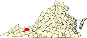
Map of Virginia highlighting Bland County.svg
Location within the U.S. state of Virginia
Virginia in United States.svg
Virginia's location within the U.S.
Coordinates: 37°08′N81°08′W / 37.13°N 81.13°W / 37.13; -81.13
CountryFlag of the United States.svg United States
StateFlag of Virginia.svg  Virginia
Founded1861
Named for Richard Bland
Seat Bland
Largest communityBland
Area
  Total359 sq mi (930 km2)
  Land358 sq mi (930 km2)
  Water1 sq mi (3 km2)  0.3%
Population
 (2020)
  Total6,270
  Density17/sq mi (6.7/km2)
Time zone UTC−5 (Eastern)
  Summer (DST) UTC−4 (EDT)
Congressional district 9th
Website www.blandcountyva.gov

Bland County is a county located in the southwestern portion of the Commonwealth of Virginia. The county seat is the unincorporated area of Bland. [1] At the 2020 census, the population was 6,270.

Contents

Bland County was created in 1861 from parts of Wythe, Tazewell, and Giles counties in Virginia. The new county was named in honor of Richard Bland, a Virginia statesman who served in the House of Burgesses and the Continental Congress.

As of the 2020 census, the county population was 6,270, making it the 4th least populated county in Virginia. [2] Bland County is also one of the few counties in the United States that do not contain any incorporated municipalities.[ citation needed ]

History

Richard Bland, for whom the county was named Richard Bland.jpg
Richard Bland, for whom the county was named

The push to create Bland County resulted from popular dissatisfaction with the distances required to travel to the various county seats in the area. The distances and the difficult mountain trails created a significant hardship for those needing to conduct legal affairs. In addition, the growing population resented paying taxes for benefits outside of the local area. This pressure eventually persuaded the Virginia General Assembly to take action to form a new county in the southwestern portion of the state. [3]

Bland County was officially formed on March 30, 1861, from parts of Wythe, Tazewell, and Giles counties. Additional land from Giles County was added later. The county was named after Richard Bland, a Virginia statesman and political figure who helped lead the struggle for freedom and independence from England. [4]

Geography

According to the U.S. Census Bureau, the county has a total area of 358.7 square miles (929.0 km2), of which 357.7 square miles (926.4 km2) is land and 1.0 square mile (2.6 km2) (0.3%) is water. [5]

Bland County lies within the Appalachian Regional Commission's definition of the Appalachian region. The county is mountainous with small river valleys running through the county. The county lies entirely within the Ridge and Valley physiographic province.

The North Fork of the Holston River has its head waters in Bland County.

Adjacent counties

National protected area

Major highways

Demographics

Historical population
CensusPop.Note
1870 4,000
1880 5,00425.1%
1890 5,1292.5%
1900 5,4977.2%
1910 5,154−6.2%
1920 5,5938.5%
1930 6,0317.8%
1940 6,73111.6%
1950 6,436−4.4%
1960 5,982−7.1%
1970 5,423−9.3%
1980 6,34917.1%
1990 6,5142.6%
2000 6,8715.5%
2010 6,824−0.7%
2020 6,270−8.1%
2022 (est.)6,148 [6] −1.9%
U.S. Decennial Census [7]
1790–1960 [8] 1900–1990 [9]
1990–2000 [10] 2010 [11] 2020 [12]

2020 census

Bland County, Virginia – Racial and ethnic composition
Note: the US Census treats Hispanic/Latino as an ethnic category. This table excludes Latinos from the racial categories and assigns them to a separate category. Hispanics/Latinos may be of any race.
Race / Ethnicity (NH = Non-Hispanic)Pop 2010 [11] Pop 2020 [12] % 2010% 2020
White alone (NH)6,4945,85795.16%93.41%
Black or African American alone (NH)2281673.34%2.66%
Native American or Alaska Native alone (NH)100.01%0.00%
Asian alone (NH)1840.26%0.06%
Pacific Islander alone (NH)100.01%0.00%
Some Other Race alone (NH)050.00%0.08%
Mixed Race or Multi-Racial (NH)431770.63%2.82%
Hispanic or Latino (any race)39600.57%0.96%
Total6,8246,270100.00%100.00%

2000 Census

As of the census [13] of 2000, there were 6,871 people, 2,568 households, and 1,908 families residing in the county. The population density was 19 people per square mile (7.3 people/km2). There were 3,161 housing units at an average density of 9 units per square mile (3.5 units/km2). The racial makeup of the county was 94.82% White, 4.19% Black or African American, 0.09% Native American, 0.12% Asian, 0.01% Pacific Islander, 0.09% from other races, and 0.68% from two or more races. 0.47% of the population were Hispanic or Latino of any race. 37.4% were of American, 11.8% German, 11.5% English and 10.9% Irish ancestry according to Census 2000.

There were 2,568 households, out of which 28.30% had children under the age of 18 living with them, 62.40% were married couples living together, 8.70% had a female householder with no husband present, and 25.70% were non-families. 23.30% of all households were made up of individuals, and 10.30% had someone living alone who was 65 years of age or older. The average household size was 2.43 and the average family size was 2.85.

The population distribution of Bland County is: 19.40% under the age of 18, 7.60% from 18 to 24, 30.60% from 25 to 44, 27.90% from 45 to 64, and 14.50% who were 65 years of age or older. The median age was 40 years. For every 100 females there were 119.90 males. For every 100 females aged 18 and over, there were 121.90 males.

The median income for a household in the county was $30,397, and the median income for a family was $35,765. Males had a median income of $30,801 versus $23,380 for females. The per capita income for the county was $17,744. 12.40% of the population and 9.10% of families were below the poverty line. Out of the total people living in poverty, 14.20% are under the age of 18 and 22.60% are 65 or older.

Government

Board of Supervisors

2022-2024

Constitutional officers

Bland County is represented by Republican Travis Hackworth in the Virginia Senate, Republican James W. "Will" Morefield in the Virginia House of Delegates, and Republican H. Morgan Griffith in the U.S. House of Representatives.

United States presidential election results for Bland County, Virginia [14]
Year Republican Democratic Third party
No.%No.%No.%
2020 2,90383.44%53215.29%441.26%
2016 2,57381.97%45314.43%1133.60%
2012 2,14472.73%73524.93%692.34%
2008 2,03168.64%86429.20%642.16%
2004 1,96268.48%84629.53%571.99%
2000 1,75965.44%85131.66%782.90%
1996 1,16746.00%93937.01%43116.99%
1992 1,36848.31%1,00135.35%46316.35%
1988 1,55661.12%93736.80%532.08%
1984 1,81267.29%86732.19%140.52%
1980 1,27854.50%1,00242.73%652.77%
1976 1,04751.91%96147.65%90.45%
1972 1,35270.64%52727.53%351.83%
1968 93850.38%56030.08%36419.55%
1964 71745.67%85154.20%20.13%
1960 84850.75%82249.19%10.06%
1956 1,11357.16%81341.76%211.08%
1952 1,00057.21%74342.51%50.29%
1948 82250.49%73845.33%684.18%
1944 74449.40%76250.60%00.00%
1940 69347.83%75351.97%30.21%
1936 64245.05%77854.60%50.35%
1932 55641.00%78357.74%171.25%
1928 82658.96%57541.04%00.00%
1924 60949.96%60449.55%60.49%
1920 47854.26%40345.74%00.00%
1916 42053.85%35645.64%40.51%
1912 20633.50%28946.99%12019.51%

The county is a historically Republican county. The only Democrats who have carried it since 1910 have been Woodrow Wilson in 1912 when the Republican Party was split between William Howard Taft and Theodore Roosevelt, Franklin D. Roosevelt in each of his four elections, and Lyndon B. Johnson in 1964, all national Democratic Party landslides.

Communities

Census-designated places

Additional community

See also

Related Research Articles

<span class="mw-page-title-main">Montgomery County, Virginia</span> County in Virginia, United States

Montgomery County is a county located in the Valley and Ridge area of the U.S. state of Virginia. As population in the area increased, Montgomery County was formed in 1777 from Fincastle County, which in turn had been taken from Botetourt County. As of the 2020 census, the population was 99,721. Its county seat is Christiansburg, and Blacksburg is the largest town. Montgomery County is part of the Blacksburg-Christiansburg metropolitan area. It is dominated economically by the presence of Virginia Tech, Virginia's third largest public university, which is the county's largest employer.

<span class="mw-page-title-main">Mercer County, West Virginia</span> County in West Virginia, United States

Mercer County is a county in Southern West Virginia on the southeastern border of the U.S. state of West Virginia. At the 2020 census, the population was 59,664. Its county seat is Princeton. The county was originally established in the State of Virginia by act of its General Assembly on March 17, 1837, using lands taken from Giles and Tazewell counties.
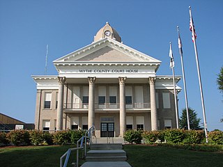
<span class="mw-page-title-main">Wythe County, Virginia</span> County in Virginia, United States

Wythe County is a county located in the southwestern part of the U.S. state of Virginia. As of the 2020 census, the population was 28,290. Its county seat is Wytheville.

<span class="mw-page-title-main">Washington County, Virginia</span> County in Virginia, United States

Washington County is a county located in the Commonwealth of Virginia. As of the 2020 census, the population was 53,935. Its county seat is Abingdon.

<span class="mw-page-title-main">Smyth County, Virginia</span> County in Virginia, United States

Smyth County is a county located in the U.S. state of Virginia. As of the 2020 census, the population was 29,800. Its county seat is Marion.

<span class="mw-page-title-main">Russell County, Virginia</span> County in Virginia, United States

Russell County is a county located in the Commonwealth of Virginia. As of the 2020 census, the population was 25,781. Its county seat is Lebanon.

<span class="mw-page-title-main">Pulaski County, Virginia</span> County in Virginia, United States

Pulaski County is a county located in the southwestern part of the U.S. state of Virginia. As of the 2020 census, the population was 33,800. Its county seat is Pulaski. Pulaski County is part of the Blacksburg–Christiansburg, VA Metropolitan Statistical Area.

<span class="mw-page-title-main">Lancaster County, Virginia</span> County in Virginia, United States

Lancaster County is a county located on the Northern Neck in the Commonwealth of Virginia. As of the 2020 census, the population sits at 10,919. Its county seat is Lancaster.

<span class="mw-page-title-main">Giles County, Virginia</span> County in Virginia, United States

Giles County is a county located in the U.S. state of Virginia on the West Virginia state line. As of the 2020 census, the population was 16,787. Its county seat is Pearisburg.

<span class="mw-page-title-main">Essex County, Virginia</span> County in Virginia, United States

Essex County is a county located in the Middle Peninsula in the U.S. state of Virginia; the peninsula is bordered by the Rappahannock River on the north and King and Queen County on the south. As of the 2020 census, the population was 10,599. Its county seat is Tappahannock.
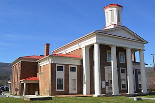
<span class="mw-page-title-main">Craig County, Virginia</span> County in Virginia, United States

Craig County is a county located in the Commonwealth of Virginia. As of the 2020 census, the population was 4,892. Its county seat is New Castle.

<span class="mw-page-title-main">Buchanan County, Virginia</span> County in Virginia, United States

Buchanan County is a United States county in far western Virginia, the only county in the state to border both West Virginia and Kentucky. The county is part of the Southwest Virginia region and lies in the rugged Appalachian Plateau portion of the Appalachian Mountains. Its county seat is Grundy.

<span class="mw-page-title-main">Hancock County, Tennessee</span> County in Tennessee, United States

Hancock County is a county located in the northeastern part of the U.S. state of Tennessee. As of the 2020 census, the population was 6,662, making it the fourth-least populous county in Tennessee. Its county seat is Sneedville.

<span class="mw-page-title-main">Wyomissing Hills, Pennsylvania</span> Former borough in Pennsylvania, United States

Wyomissing Hills was a borough in Berks County, Pennsylvania that merged into Wyomissing in January, 2002. The population was 2,568 at the 2000 census.
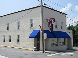
<span class="mw-page-title-main">New Tazewell, Tennessee</span> City in Tennessee, United States

New Tazewell is a city in Claiborne County, Tennessee, United States. The population was 3,037 at the 2010 census.The population was 2,769 at the 2020 census.
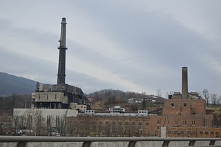
<span class="mw-page-title-main">Glen Lyn, Virginia</span> Town in Virginia, United States

Glen Lyn is a town in Giles County, Virginia, United States, at the confluence of the East and New rivers. The population was 115 at the 2010 census, down from 151 at the 2000 census. It is part of the Blacksburg–Christiansburg Metropolitan Statistical Area.

<span class="mw-page-title-main">Dublin, Virginia</span> Town in Virginia, United States

Dublin is a town in Pulaski County, Virginia, United States. The population was 2,610 as of the 2020 census. It is part of the Blacksburg–Christiansburg Metropolitan Statistical Area.

<span class="mw-page-title-main">Tazewell, Virginia</span> Town in Virginia, United States

Tazewell is a town in Tazewell County, Virginia, United States. The population was 4,627 at the 2010 census. It is part of the Bluefield, WV-VA micropolitan area, which has a population of 107,578. It is the county seat of Tazewell County.

<span class="mw-page-title-main">Tazewell County, Virginia</span> County in Virginia, United States

Tazewell County is a county located in the southwestern portion of the U.S. state of Virginia. As of the 2020 census, the population was 40,429. Its county seat is Tazewell.

<span class="mw-page-title-main">Carroll County, Virginia</span> County in Virginia, United States

Carroll County is a United States county located in the southwestern part of the Commonwealth of Virginia. Roughly one fifth of the county lies in the Virginia Piedmont region, while the rest is part of the Appalachian Mountains. The county seat and largest town is Hillsville.

References

  1. "Find a County". National Association of Counties. Archived from the original on May 31, 2011. Retrieved June 7, 2011.
  2. "Bland County, Virginia". United States Census Bureau . Retrieved January 30, 2022.
  3. "A Brief History of Bland County". Bland County Historical Society. Retrieved August 21, 2014.
  4. Salmon, Emily; Edward D.C. Campbell, Jr., eds. (1994). The Hornbook of Virginia History: a ready-reference guide to the Old Dominion's people, places, and past (4th ed.). Richmond: Library of Virginia. ISBN   0884901777.
  5. "US Gazetteer files: 2010, 2000, and 1990". United States Census Bureau. February 12, 2011. Retrieved April 23, 2011.
  6. "QuickFacts". United States Census Bureau. Retrieved March 2, 2024.
  7. "Census of Population and Housing from 1790-2000". US Census Bureau . Retrieved January 24, 2022.
  8. "Historical Census Browser". University of Virginia Library. Retrieved January 1, 2014.
  9. "Population of Counties by Decennial Census: 1900 to 1990". United States Census Bureau. Retrieved January 1, 2014.
  10. "Census 2000 PHC-T-4. Ranking Tables for Counties: 1990 and 2000" (PDF). United States Census Bureau. Archived (PDF) from the original on October 9, 2022. Retrieved January 1, 2014.
  11. 1 2 "P2 Hispanic or Latino, and Not Hispanic or Latino by Race – 2010: DEC Redistricting Data (PL 94-171) - Bland County, Virginia". United States Census Bureau .
  12. 1 2 "P2 Hispanic or Latino, and Not Hispanic or Latino by Race – 2020: DEC Redistricting Data (PL 94-171) - Bland County, Virginia". United States Census Bureau .
  13. "U.S. Census website". United States Census Bureau . Retrieved May 14, 2011.
  14. Leip, David. "Dave Leip's Atlas of U.S. Presidential Elections". uselectionatlas.org. Retrieved December 9, 2020.

37°08′N81°08′W / 37.13°N 81.13°W / 37.13; -81.13