Bluewater Lake State Park

Last updated
Bluewater Lake State Park
USA New Mexico location map.svg
Red pog.svg
Location of Bluewater Lake State Park in New Mexico
Location Cibola, New Mexico, United States
Coordinates 35°17′40″N108°6′35″W / 35.29444°N 108.10972°W / 35.29444; -108.10972 Coordinates: 35°17′40″N108°6′35″W / 35.29444°N 108.10972°W / 35.29444; -108.10972
Area3,000 acres (12 km2)
Elevation7,400 ft (2,300 m)
Established1937 [1]
Governing bodyNew Mexico State Parks Division

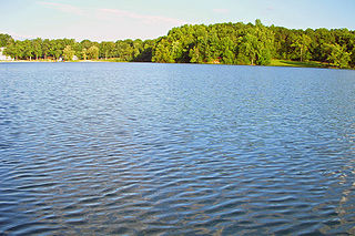
Bluewater Lake State Park is a state park of New Mexico, United States, located in the Zuni Mountains 30 miles (48 km) west of Grants. [2] The park itself encompasses approximately 3,000 acres (12 km2), and the lake has a surface area of approximately 1,200 acres (4.9 km2).

State park protected area managed at the federated state level

State parks are parks or other protected areas managed at the sub-national level within those nations which use "state" as a political subdivision. State parks are typically established by a state to preserve a location on account of its natural beauty, historic interest, or recreational potential. There are state parks under the administration of the government of each U.S. state, some of the Mexican states, and in Brazil. The term is also used in the Australian state of Victoria. The equivalent term used in Canada, Argentina, South Africa and Belgium, is provincial park. Similar systems of local government maintained parks exist in other countries, but the terminology varies.

New Mexico State of the United States of America

New Mexico is a state in the Southwestern region of the United States of America; its capital and cultural center is Santa Fe, which was founded in 1610 as capital of Nuevo México, while its largest city is Albuquerque with its accompanying metropolitan area. It is one of the Mountain States and shares the Four Corners region with Utah, Colorado, and Arizona; its other neighboring states are Oklahoma to the northeast, Texas to the east-southeast, and the Mexican states of Chihuahua to the south and Sonora to the southwest. With a population around two million, New Mexico is the 36th state by population. With a total area of 121,590 sq mi (314,900 km2), it is the fifth-largest and sixth-least densely populated of the 50 states. Due to their geographic locations, northern and eastern New Mexico exhibit a colder, alpine climate, while western and southern New Mexico exhibit a warmer, arid climate.

Zuni Mountains

The Zuni Mountains are a mountain range located mainly in Cibola County of northwestern New Mexico, with a small portion extending into McKinley County. The range is located largely in the Cibola National Forest, lying south of Interstate 40 from southeast of Gallup to southwest of Grants. The range is about sixty miles long and forty miles wide. The highest point is Mount Sedgwick, 9,256 feet ; elevations in the range go down to 6,400 feet.

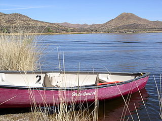
The park is popular for fishing and bird watching, with 68 different species of birds either calling the park home, or passing through the park on their annual migrations. The lake is stocked with rainbow trout, cutthroat trout, and catfish. Its high altitude (7,400 ft) and location in northern New Mexico cause the lake to freeze over in the winter, allowing ice fishing to take place.

Rainbow trout species of trout

The rainbow trout is a trout and species of salmonid native to cold-water tributaries of the Pacific Ocean in Asia and North America. The steelhead is an anadromous (sea-run) form of the coastal rainbow trout(O. m. irideus) or Columbia River redband trout (O. m. gairdneri) that usually returns to fresh water to spawn after living two to three years in the ocean. Freshwater forms that have been introduced into the Great Lakes and migrate into tributaries to spawn are also called steelhead.

Cutthroat trout species of fish

The cutthroat trout(Oncorhynchus clarkii) is a fish species of the family Salmonidae native to cold-water tributaries of the Pacific Ocean, Rocky Mountains, and Great Basin in North America. As a member of the genus Oncorhynchus, it is one of the Pacific trout, a group that includes the widely distributed rainbow trout. Cutthroat trout are popular gamefish, especially among anglers who enjoy fly fishing. The common name "cutthroat" refers to the distinctive red coloration on the underside of the lower jaw. The specific name clarkii was given to honor explorer William Clark, coleader of the Lewis and Clark Expedition.

Catfish order of fishes

Catfish are a diverse group of ray-finned fish. Named for their prominent barbels, which resemble a cat's whiskers, catfish range in size and behavior from the three largest species alive, the Mekong giant catfish from Southeast Asia, the wels catfish of Eurasia and the piraíba of South America, to detritivores, and even to a tiny parasitic species commonly called the candiru, Vandellia cirrhosa. There are armour-plated types and there are also naked types, neither having scales. Despite their name, not all catfish have prominent barbels. Members of the Siluriformes order are defined by features of the skull and swimbladder. Catfish are of considerable commercial importance; many of the larger species are farmed or fished for food. Many of the smaller species, particularly the genus Corydoras, are important in the aquarium hobby. Many catfish are nocturnal, but others are crepuscular or diurnal.
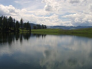
Related Research Articles

Henrys Lake lake of the United States of America

Henrys Lake is a small, shallow alpine lake, approximately 8 square miles (21 km2) in area, at 4 miles (6.4 km) in length and 2 miles (3.2 km) in width. It is located at 6,472 ft (1,973 m) above sea level in the mountains of southeastern Idaho in the United States. It is on the southwest side of the Henrys Lake Mountains of northern Fremont County, approximately 2 miles south of the continental divide along the Montana state line, just west of Targhee Pass and north of Sawtell Peak. The lake provides the headwaters of the Henrys Fork, a tributary of the Snake River. The lake lies less than 10 miles (16 km) across the continental divide from the headwaters of the Missouri River in southwestern Montana. It is 16 miles due west of the western boundary of Yellowstone National Park. The lake is located in Caribou-Targhee National Forest.

Deep Creek Lake reservoir in Garrett County, MD

Deep Creek Lake is the largest inland body of water in the U.S. state of Maryland. It covers approximately 3,900 acres (16 km2) and has 69 miles (111 km) of shoreline. Like all lakes in Maryland, it is man-made by the state. The lake is home to a wide variety of freshwater fish and aquatic birds. The Wisp ski resort is located nearby.

Catharine Creek

Catharine Creek is a roughly 15-mile-long (24 km) stream that flows through Chemung and Schuyler counties in New York. The creek, named after Catharine Montour, is a major tributary to Seneca Lake.

Oquaga Creek State Park

Oquaga Creek State Park is a 1,385-acre (5.60 km2) state park in Broome, Delaware, and Chenango counties, New York. The park is partially in the Town of Masonville and partly in the Town of Sanford. Broome County Road 241 passes through the park.

Lake McDonald Lake in Flathead County, Montana

Lake McDonald is the largest lake in Glacier National Park. It is located at 48°35′N113°55′W in Flathead County in the U.S. state of Montana. Lake McDonald is approximately 10 miles (16 km) long, and over a mile (1.6 km) wide and 472 feet deep, filling a valley formed by a combination of erosion and glacial activity. Lake McDonald lies at an elevation of 3,153 feet (961 m) and is on the west side of the Continental Divide. The Going-to-the-Sun Road parallels the lake along its southern shoreline. The surface area of the lake is 6,823 acres (27.6 km2).

Lynx Lake (Arizona) lake of the United States of America

Lynx Lake, Arizona, is a 55-acre (220,000 m2) reservoir located within Prescott National Forest, approximately 5 miles (8.0 km) east of Prescott, Arizona, in the Bradshaw Mountains. The lake is located at 5,530 feet (1,690 m) elevation and is stocked for fishing. It is one of the most popular recreation areas in central Arizona. Mild weather, the cool ponderosa pine forest, trout fishing, boating, mountain hiking, horseback riding, archaeological sites, and bird watching attract visitors from throughout Arizona. The lake was formed in 1952, when a dam was put in Lynx Creek, 6 miles (9.7 km) below Walker, Arizona.

Patagonia Lake State Park

Patagonia Lake State Park is a state park of Arizona, USA, containing Patagonia Lake. The 2.5-mile-long (4.0 km), 250-acre (100 ha) lake located near Patagonia, Arizona, is a popular southern Arizona site for fishing, camping, boat rental, picnicking, hiking, and birding. Located inside the park is the recently established Sonoita Creek State Natural Area, Arizona's first major state natural area. Created by the damming of Sonoita Creek, the lake is habitat for reproducing largemouth bass, black crappie, bluegill, green sunfish, flathead catfish, threadfin shad, redear sunfish, channel catfish, and American bullfrogs. Rainbow trout are stocked every three weeks from October to March. Sonoita Creek contains black bullhead, red shiner, mosquitofish, crayfish, American bullfrogs, largemouth bass, Gila topminnows, speckled dace, longfin dace, Sonora suckers, and desert suckers. Special events include an annual mariachi festival in March and bird tours and interpretive programs on request.

Chapman State Park

Chapman State Park is a 805-acre (326 ha) Pennsylvania state park in Pleasant Township, Warren County, Pennsylvania near Clarendon, in the United States. The man-made Chapman Lake covers 68 acres (28 ha) of the park. Chapman State Park is named in honor of Dr. Leroy E. Chapman. Dr. Chapman was a state senator from 1929 until 1963. He was part of several civic groups that pushed for the creation of a state park in Warren County. Chapman State Park, opened in 1951, is adjacent to Allegheny National Forest and State Game Land 29 just off U.S. Route 6.

Heron Lake (New Mexico)

Heron Lake is a reservoir in Rio Arriba County, in northern New Mexico in the southwestern United States. The lake is part of the San Juan-Chama Project, which transfers water from the upper reaches of the San Juan River through the 12.8-mile (20.6 km) Azotea Tunnel, into Willow Creek and the Rio Chama.

Chandler State Wayside

Chandler State Wayside is a state park in south-central Oregon in the United States. It is named in honor of Solomon and Hattie Chandler, who donated the land for the park. The park covers 85 acres (34 ha) of pine forest along a creek. The park provides restrooms and other basic facilities to accommodate the traveling public. Chandler State Wayside is administered by the Oregon Parks and Recreation Department.

Wood River (Oregon) river in the United States of America

The Wood River is a short river in the southern region of the U.S. state of Oregon, and part of the Klamath Basin drainage. It flows 18 miles (29 km) through the Fremont-Winema National Forests, Bureau of Land Management land, and private property in southern Oregon. Its watershed consists of 220 square miles (570 km2) of conifer forest, rural pasture land, and marsh. The river provides habitat for many species of wildlife including an adfluvial (migratory) and resident populations of native Great Basin redband trout.

Sugarite Canyon State Park

Sugarite Canyon State Park is a state park of New Mexico, United States, featuring a historic early-20th century coal-mining camp and natural scenery at the border of the Rocky Mountains and the Great Plains. The park is located on the Colorado–New Mexico state line 6 miles (9.7 km) northeast of Raton, New Mexico.

Laguna Niguel Lake

Laguna Niguel Lake, formerly known as Sulphur Creek Reservoir, is an artificial 44-acre (180,000 m2) fishing and recreational lake in Laguna Niguel, California. It is created by the Sulphur Creek Dam, which was completed in 1966. It is located at 33°32′59″N117°42′22″W and is 190 feet (58 m) above sea level. It is fed from two sources, one of which is Sulphur Creek itself and the other, a storm drain. It is accessed from La Paz Road, which runs along its east shore. Surrounding the reservoir is the Laguna Niguel Regional Park. In addition, within the lake on the large island is a protected bird sanctuary.

Eagle Nest Lake State Park state park in New Mexico, United States

Eagle Nest Lake State Park is a state park in New Mexico, United States. The park is located outside Eagle Nest, approximately 30 miles (48 km) east of Taos. It was established on July 3, 2004. Its main attraction is a 2,400-acre (9.7 km2) lake which is popular for fishing and boating in the summer, and ice fishing and snowmobiling in the winter. The lake itself is a man-made reservoir created when the Cimarron River was impounded by the Eagle Nest Dam in 1918. The lake is home to several species of fish, including rainbow trout, brown trout, cutthroat trout, kokanee salmon, smallmouth bass, yellow perch, common carp, white sucker, channel catfish, sunfish, and northern pike, which were accidentally introduced into Eagle Nest Lake . Eagle Nest Lake is at an elevation of 8,300 feet (2,500 m), making it an alpine lake, and it is situated in a glacial valley on the slopes of Wheeler Peak, New Mexico's highest mountain. The surrounding mountains are rich in wildlife such as elk, deer, turkeys and bears.

Cimarron Canyon State Park state park in New Mexico, United States

Cimarron Canyon State Park is a state park of New Mexico, United States, located 3 miles (4.8 km) east of Eagle Nest in the Colin Neblett Wildlife Area. The park extends for 8 miles (13 km) along the Cimarron Canyon between Tolby Creek and Ute Park. The Palisades Sill forms spectacular cliffs above the Cimarron River here.

Sylvan Lake (New York) lake

Sylvan Lake is located next to the community by that name in the Town of Beekman, New York, United States. It is the deepest and second-largest lake in Dutchess County.

Morphy Lake State Park

Morphy Lake State Park is a state park of New Mexico, United States, located 7 miles (11 km) southwest of Mora in the Sangre de Cristo Mountains. The park is one of New Mexico's smaller state parks, at only 30 acres (120,000 m2), and the lake has a surface area of approximately 15 acres (61,000 m2).

Trout Lake (Wyoming) Lake in Park County, Wyoming, USA

Trout Lake, formerly known as Fish Lake and Soda Butte Lake, is a 12 acres (0.049 km2) popular backcountry lake for hikers and anglers in Yellowstone National Park. The lake is located approximately .33 miles (0.53 km) north of the Northeast Entrance Road near the confluence of Pebble Creek and Soda Butte Creek. The lake sits in a depression on a high bench above the Soda Butte Creek Canyon. A steep trail through a Douglas fir forest leads to the lake. The trailhead is located at: 44°53′57″N110°7′21″W.

Elliott Corbett Memorial State Recreation Site

Elliott Corbett Memorial State Recreation Site is a state park along the south shore of Blue Lake Crater in Jefferson County, Oregon, United States. The park is named in honor of Elliott R. Corbett II, who was killed while serving in the United States Army during World War II. It includes 63 acres (25 ha) of wilderness land with very few park facilities. Corbett State Park is administered by the Oregon Parks and Recreation Department.

Bluewater Acres, New Mexico Census-designated place in New Mexico, United States

Bluewater Acres is a census-designated place (CDP) in Cibola County, New Mexico, United States. The population was 206 at the 2010 census.

References

  1. "Bluewater Lake State Park Management and Development Plan 2000-2004" (PDF). Retrieved January 6, 2011.
  2. New Mexico State Parks Division. "Bluewater Lake State Park". New Mexico Energy, Minerals and Natural Resources Department.

Commons-logo.svg Media related to Bluewater Lake State Park at Wikimedia Commons