Pecos National Historical Park

Last updated

Pecos National Historical Park
Pecos-pueblo-mission-church.jpg
Pecos Pueblo Mission Church
USA New Mexico relief location map.svg
Red pog.svg
Usa edcp relief location map.png
Red pog.svg
Location NM 63 SW of jct. with NM 50, Pecos, New Mexico
Coordinates 35°33′00″N105°41′4″W / 35.55000°N 105.68444°W / 35.55000; -105.68444
Area6,671.4 acres (2,699.8 ha)
BuiltStart date ~A.D. 1300
Architectural styleStone Masonry w/adobe mortar
Visitation43,873 (2011) [1]
Website Pecos National Historical Park
NRHP reference No. 66000485 [2]  (original)
91000822 [2]  (increase)
NMSRCP No. 74
Significant dates
Added to NRHPOctober 15, 1966
Boundary increaseJuly 2, 1991
Designated NHLOctober 9, 1960
Designated NMONJune 28, 1965
Designated NHPJuly 2, 1991
Designated NMSRCPMay 21, 1971
Ruins of the Pecos Pueblo at the Pecos National Historic Site Pecos National Historic Site - Ruins of Pecos Pueblo.jpg
Ruins of the Pecos Pueblo at the Pecos National Historic Site
Pecos Glazeware bowl from the early Spanish era, displayed in the Park museum. Pecos Glazeware bowl.jpg
Pecos Glazeware bowl from the early Spanish era, displayed in the Park museum.
Ruins of a ceremonial kiva at Cicuye (Pecos Pueblo) Ceremonial Kiva Remains at Pecos Pueblo (known historically as Cicuye).jpg
Ruins of a ceremonial kiva at Cicuye (Pecos Pueblo)

Pecos National Historical Park is a United States National Historical Park in San Miguel County, New Mexico. The park, operated by the National Park Service, encompasses thousands of acres of landscape infused with historical elements from prehistoric archaeological ruins to 19th-century ranches, to a battlefield of the American Civil War. Its largest single feature is Pecos Pueblo also known as Cicuye Pueblo, a Native American community abandoned in historic times. First a state monument in 1935, it was made Pecos National Monument in 1965, and greatly enlarged and renamed in 1990. Two sites within the park, the pueblo and the Glorieta Pass Battlefield, are National Historic Landmarks.

Contents

Features

Pecos National Historical Park's main unit is located in western San Miguel County, [3] about 17 miles (27 km) east of Santa Fe and just south of Pecos.

Pecos Pueblo

The main unit of the park preserves the ruins of Pecos Pueblo, known historically as Cicuye (sometimes spelled Ciquique), the "village of 500 warriors". [4] [5] The first Pecos pueblo was one of two dozen rock-and-mud villages built in the valley around AD 1100 in the prehistoric Pueblo II Era. Within 350 years the Pueblo IV Era Pecos village had grown to house more than 2,000 people in its five-storied complex. [6] [5]

The people who lived at Cicuye/Pecos Pueblo spoke the Towa language. [7] The Pecos people enjoyed a rich culture with inventive architecture and beautiful crafts. They also possessed an elaborate religious life, evidenced by the remains of over 20 ceremonial subterranean kivas. Some of the kivas have diameters as large as 40 feet and are 10 feet deep, [5] accessed by wooden ladders. Farming was a main part of their diet and staple crops included the usual beans, corn, and squash. Their location, power and ability to supply goods made the Pecos a major trade center in the eastern part of the Puebloan territory, connecting the Pueblos to the Plains cultures such as the Comanche. [8] There are seven distinct periods of their occupancy beginning with the Preceramic Period (11,500 B.C.E. - 600 C.E.) Ancestral Puebloan Paleo-Indians. Emigration of Pecos people to other areas, encroachment of Hispanic settlers in the area, outbreaks of smallpox, and problems with Plains Indians caused the site to decline. The last 17 (or 20) inhabitants abandoned Pecos Pueblo in 1838, moving to the Jemez Pueblo, the only other Pueblo which spoke the Towa language. [9] [7] [10]

The historical Pecos people produced, used or traded seven types of ceramic ware during their occupancy of the area. These are known as Rio Grande Greyware (plain and corrugated), Pajarito White Ware, Rio Grande Glaze Ware, Historic polychromes, Historic plain ware, White Mountain Red Ware, and Plains Apache Ware. Many of these were decorated with black, red or polychrome designs. [11]

Spanish mission

The main unit of the park also protects the remains of Mission Nuestra Señora de los Ángeles de Porciúncula de los Pecos, a Spanish mission near the pueblo built in the early 17th century. A 1.25-mile (2 km) self-guiding trail begins at the nearby visitor center and winds through the ruins of Pecos Pueblo and the mission church. [12] [13]

Pecos was visited by expeditionaries with Francisco Vásquez de Coronado in 1540. The Spanish mission church was built in 1619. A traditional kiva was built in front of the church during the Pueblo Revolt in 1680 as a rejection of the Christian religion brought by Spanish colonists. However when the Spanish returned in 1692, the Pecos community stayed on friendly terms with them, and a new, smaller church was built in 1717. [14] [15]

Forked Lightning Ranch

Another part of the park is the Forked Lightning Ranch, a cattle ranch established in the 1920s by Tex Austin, a famous producer of rodeos. It was headquartered at the Kozlowski's Stage Stop and Tavern, a stagecoach stop on the Santa Fe Trail that had also served as a Union forces encampment before the Battle of Glorieta Pass. It was only a cattle ranch for a time before Austin converted it into a dude ranch which he promoted to Easterners. The main ranch was designed by John Gaw Meem in the Pueblo Revival style of architecture. Austin's heavily mortgaged endeavour failed, closing in 1933. In 1936 the ranch again became a working cattle ranch, and in 1941 it was purchased by Buddy Fogelson, a Texas oilman who married actress Greer Garson. After her husband died, Garson sold her share of the park in 1991 to a conservation group, which donated it to the Park Service. [7]

Old Santa Fe Trail

Portions of the historic Santa Fe Trail run through all units of the park. This rutted wagon trail was one of the major routes by which the American Southwest grew in the 19th century. [7]

Glorieta Pass Battlefield

The Battle of Glorieta Pass was fought March 26–28, 1862 in the mountain pass west of Pecos Pueblo, along the route of the Old Santa Fe Trail. Confederate forces were en route to take Union-controlled Fort Union, and were fought to a standoff by militia raised in the New Mexico and Colorado Territories. Although parts of the battlefield have been compromised by highway construction, two sections of the battlefield have been preserved by the Park Service on either side of the pass. Public access to these units is limited by the National Park Service. [7]

Administrative history

Pecos Pueblo and an area of 341 acres (138 ha) was acquired by the state and preserved as a state monument in 1935. In 1965, President Lyndon Johnson established Pecos National Monument over the same area, and control was turned over the Park Service. In 1990 the main unit of the park was expanded to more than 6,000 acres (24 km2), including a large area of ranchland and archaeologically sensitive landscapes. [16] The two units of the Glorieta Pass Battlefield were formally added to the park in 1993.

Climate

According to the Köppen Climate Classification system, the area has an oceanic climate, abbreviated "Cfb" on climate maps. The hottest temperature recorded was 100 °F (37.8 °C) on June 26, 1994 and July 18, 2023, while the coldest temperature recorded was −29 °F (−33.9 °C) on February 1, 1951. [17]

Climate data for Pecos National Monument, New Mexico, 1991–2020 normals, extremes 1919–present
MonthJanFebMarAprMayJunJulAugSepOctNovDecYear
Record high °F (°C)75
(24)
75
(24)
81
(27)
87
(31)
97
(36)
100
(38)
100
(38)
96
(36)
95
(35)
86
(30)
82
(28)
77
(25)
100
(38)
Mean maximum °F (°C)61.2
(16.2)
63.2
(17.3)
71.1
(21.7)
76.9
(24.9)
85.4
(29.7)
94.7
(34.8)
94.3
(34.6)
91.0
(32.8)
87.2
(30.7)
79.8
(26.6)
69.5
(20.8)
61.9
(16.6)
96.3
(35.7)
Average high °F (°C)46.6
(8.1)
49.6
(9.8)
57.1
(13.9)
64.3
(17.9)
73.4
(23.0)
83.9
(28.8)
85.2
(29.6)
82.7
(28.2)
77.6
(25.3)
66.7
(19.3)
54.6
(12.6)
46.7
(8.2)
65.7
(18.7)
Daily mean °F (°C)32.3
(0.2)
35.5
(1.9)
41.3
(5.2)
47.7
(8.7)
56.3
(13.5)
65.9
(18.8)
69.4
(20.8)
67.5
(19.7)
61.3
(16.3)
50.6
(10.3)
39.8
(4.3)
32.2
(0.1)
50.0
(10.0)
Average low °F (°C)18.0
(−7.8)
21.4
(−5.9)
25.5
(−3.6)
31.1
(−0.5)
39.1
(3.9)
48.0
(8.9)
53.6
(12.0)
52.3
(11.3)
45.1
(7.3)
34.5
(1.4)
25.0
(−3.9)
17.8
(−7.9)
34.3
(1.3)
Mean minimum °F (°C)0.0
(−17.8)
5.0
(−15.0)
9.1
(−12.7)
17.4
(−8.1)
26.2
(−3.2)
37.5
(3.1)
46.7
(8.2)
44.6
(7.0)
33.2
(0.7)
18.3
(−7.6)
7.4
(−13.7)
−0.6
(−18.1)
−4.8
(−20.4)
Record low °F (°C)−27
(−33)
−29
(−34)
−18
(−28)
−6
(−21)
14
(−10)
18
(−8)
35
(2)
28
(−2)
20
(−7)
−2
(−19)
−23
(−31)
−19
(−28)
−29
(−34)
Average precipitation inches (mm)0.68
(17)
0.62
(16)
0.74
(19)
0.72
(18)
1.01
(26)
1.23
(31)
3.23
(82)
3.03
(77)
1.71
(43)
1.20
(30)
1.03
(26)
0.97
(25)
16.17
(410)
Average snowfall inches (cm)6.3
(16)
4.4
(11)
3.0
(7.6)
1.0
(2.5)
0.0
(0.0)
0.0
(0.0)
0.0
(0.0)
0.0
(0.0)
0.0
(0.0)
0.6
(1.5)
3.7
(9.4)
7.3
(19)
26.3
(67)
Average precipitation days (≥ 0.01 in)3.74.04.03.94.25.312.612.36.55.43.63.869.3
Average snowy days (≥ 0.1 in)2.62.01.20.90.00.00.00.00.00.41.32.010.4
Source 1: NOAA [18]
Source 2: National Weather Service [17]

See also

Related Research Articles

<span class="mw-page-title-main">Pecos, New Mexico</span> Village in New Mexico, United States

Pecos is a village in San Miguel County, New Mexico, United States. The population was 1,392 at the 2010 census, shrinking slower than other parts of San Miguel County, partly because Pecos is within commuting distance of Santa Fe. The village is built along the Pecos River, which flows from the north out of the Santa Fe National Forest. Notable locations nearby include Pecos National Historical Park, Glorieta Pass, Pecos Benedictine Monastery, and Lisboa Springs Trout Hatchery. It is also an entry point for hunting, fishing, hiking and camping in the Pecos Wilderness. The closest metropolitan area is the Santa Fe metropolitan area, approximately 26 miles (42 km) to the west.

<span class="mw-page-title-main">Battle of Glorieta Pass</span> 1862 battle in the American Civil War

The Battle of Glorieta Pass was fought March 26–28, 1862 in the northern New Mexico Territory, by Union and Confederate forces during the American Civil War. It was the largest and most decisive battle of the New Mexico campaign, ending the Confederacy's efforts to capture the territory and other parts of the western United States.

<span class="mw-page-title-main">Bandelier National Monument</span> United States historic place

Bandelier National Monument is a 33,677-acre (13,629 ha) United States National Monument near Los Alamos in Sandoval and Los Alamos counties, New Mexico. The monument preserves the homes and territory of the Ancestral Puebloans of a later era in the Southwest. Most of the pueblo structures date to two eras, dating between 1150 and 1600 AD.

<span class="mw-page-title-main">Glorieta Pass</span> Mountain pass in New Mexico

Glorieta Pass is a mountain pass in the Sangre de Cristo Mountains of northern New Mexico. The pass is at a strategic location near at the southern end of the Sangre de Cristos in east central Santa Fe County southeast of the city of Santa Fe.

<span class="mw-page-title-main">Santa Fe Trail</span> 19th-century route through central North America between Franklin, MO, and Santa Fe, NM

The Santa Fe Trail was a 19th-century route through central North America that connected Franklin, Missouri, with Santa Fe, New Mexico. Pioneered in 1821 by William Becknell, who departed from the Boonslick region along the Missouri River, the trail served as a vital commercial highway until 1880, when the railroad arrived in Santa Fe. Santa Fe was near the end of El Camino Real de Tierra Adentro which carried trade from Mexico City. The trail was later incorporated into parts of the National Old Trails Road and U.S. Route 66.

<span class="mw-page-title-main">Sangre de Cristo Mountains</span> Mountain range in Colorado and New Mexico, United States

The Sangre de Cristo Mountains are the southernmost subrange of the Rocky Mountains. They are located in southern Colorado and northern New Mexico in the United States. The mountains run from Poncha Pass in South-Central Colorado, trending southeast and south, ending at Glorieta Pass, southeast of Santa Fe, New Mexico. The mountains contain a number of fourteen thousand foot peaks in the Colorado portion, as well as several peaks in New Mexico which are over thirteen thousand feet.

<span class="mw-page-title-main">New Mexico campaign</span> Military operation of the trans-Mississippi theater of the American Civil War

The New Mexico campaign was a military operation of the trans-Mississippi theater of the American Civil War from February to April 1862 in which Confederate Brigadier General Henry Hopkins Sibley invaded the northern New Mexico Territory in an attempt to gain control of the Southwest, including the gold fields of Colorado and the ports of California. Historians regard this campaign as the most ambitious Confederate attempt to establish control of the American West and to open an additional theater in the war. It was an important campaign in the war's Trans-Mississippi Theater, and one of the major events in the history of the New Mexico Territory in the American Civil War.

<span class="mw-page-title-main">Raton Pass</span> Interstate mountain pass in the United States

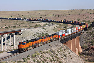
Ratón Pass is a 7,834 ft (2,388 m) elevation mountain pass on the Colorado–New Mexico border in the western United States. It is located on the eastern side of the Sangre de Cristo Mountains between Trinidad, Colorado and Raton, New Mexico, approximately 180 miles (290 km) northeast of Santa Fe. Ratón is Spanish for "mouse". The pass crosses the line of volcanic mesas that extends east from the Sangre de Cristo Mountains along the state line, and furnishes the most direct land route between the valley of the Arkansas River to the north and the upper valley of the Canadian River, leading toward Santa Fe, to the south. The pass now carries Interstate 25 and railroad tracks.

<span class="mw-page-title-main">Salinas Pueblo Missions National Monument</span> United States historic place

The Salinas Pueblo Missions National Monument is a complex of three Spanish missions located in the U.S. state of New Mexico, near Mountainair. The main park visitor center is in Mountainair. Construction of the missions began in 1622 and was completed in 1635.

<span class="mw-page-title-main">Santa Fe Plaza</span> National Historic Landmark in downtown Santa Fe, New Mexico

The Santa Fe Plaza is a National Historic Landmark in downtown Santa Fe, New Mexico in the style of traditional Spanish-American colonial cities. The plaza, or city square is a gathering place for locals and also a tourist attraction. It is home to annual events including Fiestas de Santa Fe, the Spanish Market, the Santa Fe Bandstand, and the Santa Fe Indian Market.

<span class="mw-page-title-main">Index of New Mexico–related articles</span>

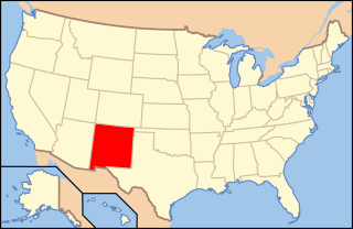
The following is an alphabetical list of articles related to the U.S. state of New Mexico.

<span class="mw-page-title-main">Barrio de Analco Historic District</span> Historic district in New Mexico, United States

The Barrio de Analco Historic District is a National Historic Landmark District centered at the junction of East De Vargas Street and Old Santa Fe Trail in Santa Fe, New Mexico. The seven buildings of the district represent one of the oldest clusters of what were basically working-class or lower-class residences in North America, and are in a cross-section of pre-statehood architectural styles. It includes two of the oldest colonial-era buildings in the southwest, the San Miguel Mission church (1710), and the "Oldest House", built in 1620 and now a museum. The district was declared a National Historic Landmark in 1968.

<span class="mw-page-title-main">Glorieta Pass Battlefield</span> United States historic place

The Glorieta Pass Battlefield was the site of an American Civil War battle that ended Confederate ambitions to cut off the West from the Union. The Battle of Glorieta Pass took place on March 26–28, 1862, at Glorieta Pass, on the Santa Fe Trail between the Pecos River and Santa Fe, New Mexico. The pass, and the battlefield, are now bisected by Interstate 25. Two portions of the battlefield, now publicly owned and operated by the National Park Service as part of Pecos National Historical Park, were declared a National Historic Landmark in 1961.

<span class="mw-page-title-main">Hispanic Heritage Site</span> National park site

The National Park System is well endowed to commemorate Hispanic contributions to American society. Some 20 national parklands represent Hispanic heritage in the United States. Some sites remotely display Hispanic contributions to American culture. The National Park System not only preserves the history and contributions of Hispanic Americans, it is also a part of the nation's history. Over the years, the National Park Service has reflected the nation's social history. Among the first Hispanics who influenced the course of the National Parks were:

<span class="mw-page-title-main">Villanueva State Park</span>

Villanueva State Park is a state park of New Mexico, United States, located on the banks of the Pecos River. The park features red and yellow sandstone cliffs, cottonwood trees, and other native plants. Villanueva State Park's elevation is 6,110 feet above sea level. The park sits in the shift from The Rocky Mountains and The Great Plains. The park is located southwest of the town of Las Vegas, 35 miles (56 km) New Mexico. While on the lookout trails of Villanueva State Park, one would be able to view the Pecos River. Water in the Pecos River south headed to Villanueva State Park, there are showed signs of base metals and mercury. Elevated levels of copper, lead, and zinc.

<span class="mw-page-title-main">José Guadalupe Gallegos</span>

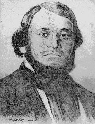
José Guadalupe Gallegos was a native New Mexican military leader, county sheriff, rancher and politician. In 1854 he served as brigadier general in the volunteer Mounted Militia of New Mexico (Territory) formed for the purpose of protecting communities against Native American attacks. Prior to the Battle of Glorieta Pass, he was a Union field and staff Colonel in the Civil War, serving as commander of the 3rd New Mexico Volunteer Infantry and as commander of the Hatch's Ranch military post. He represented San Miguel County in four of the six Assemblies of the Territorial Legislature between 1855-1861 and served as House Speaker and as Council President. José was one of the founding members of the Historical Society of New Mexico and was a founding associate in the incorporation of the Montezuma Copper Mining Company of Santa Fé, New Mexico the New Mexican Railway Company and the New Mexico Wool Manufacturing Company.

<span class="mw-page-title-main">Northern Rio Grande National Heritage Area</span> United States National Heritage Area in New Mexico

Northern Rio Grande National Heritage Area is a federally designated National Heritage Area in the U.S. state of New Mexico. The national heritage area includes a section of the upper Rio Grande Valley that has been inhabited by the Puebloan peoples since the early Pre-Columbian era.

<span class="mw-page-title-main">San Miguel del Vado, New Mexico</span> Unincorporated community in New Mexico, United States

San Miguel del Vado is an unincorporated community in San Miguel County, New Mexico, United States.

<span class="mw-page-title-main">San Miguel del Vado Land Grant</span>

The San Miguel del Vado Land Grant is one of the Spanish land grants in New Mexico. On November 24, 1794, 53 men submitted a petition for land and were granted temporary possession on November 24, 1794, pending satisfaction of prescribed criteria. A second grant was obtained by 58 men and their respective families on March 12, 1803. Two days later, the procedure was repeated at San José del Vado, 6 kilometres (3.7 mi) north of San Miguel del Vado, distributing farm land to an additional 47 heads of household, including two women.

<span class="mw-page-title-main">Abo Canyon</span> Mountain pass in New Mexico, United States

Abo Canyon, also known as Abo Pass, is a mountain pass at the southern end of the Manzano Mountains of central New Mexico in the Southwest United States.

References

  1. "National Park Service Visitor Use Statistics". National Park Service. Retrieved October 6, 2012.
  2. 1 2 "National Register Information System". National Register of Historic Places . National Park Service. July 9, 2010.
  3. "2020 CENSUS - CENSUS BLOCK MAP: San Miguel County, NM" (PDF). U.S. Census Bureau. p. 26 (PDF p. 27/85). Retrieved September 2, 2022. Pecos Natl Hist Pk
  4. "Pueblo Mission". Pecos, New Mexico. Retrieved December 3, 2020.
  5. 1 2 3 Abarr, James (August 31, 1997). "Once-Mighty City". Albuquerque Journal. Retrieved December 3, 2020.
  6. "People of the Pecos". U.S. Department of the Interior, National Park Service. February 6, 2011. Retrieved October 13, 2011.
  7. 1 2 3 4 5 "Spanish Encounters: The Pueblo Revolt, in Pecos National Historical Park". U.S. National Park Service. Retrieved December 3, 2020.
  8. "People of Pecos". U.S. National Park Service. Retrieved December 3, 2020.
  9. Dean R. Snow (2010). Archeology of Native North America. Prentice Hall.
  10. "Chaoter IX: Toward Extinction 1794-1849". National Park Service. Retrieved December 4, 2023.. Chapter IX of Kiva, Cross, and Crown by John L. Kessell.
  11. Powell, Melissa S. "PECOS From Folsom to Fogelson: The Cultural Resources Inventory Survey of Pecos National Historical Park, Chapter 8: Ceramics". Pecos National Historical Site. National Park Service. Retrieved December 3, 2020.
  12. "Pecos Pueblo". National Historic Landmark summary listing. National Park Service. Archived from the original on October 29, 2011. Retrieved June 26, 2008.
  13. "National Register of Historic Places Inventory-Nomination" (pdf). National Park Service. May 15, 1958. Retrieved August 13, 2009.
    "Accompanying 3 photos, exterior and interior, from 1946" (pdf). National Park Service. Retrieved August 13, 2009.
  14. "Last Church" marker, Pecos National Historical Park: "The Spanish returned to New Mexico 12 years after the 1680 Pueblo Revolt. In front of you are the remains of the smaller church they completed in 1717. . . . "
  15. "Spanish Encounters", Pecos National Historical Park (U.S. National Park Service)
  16. "Pecos National Historical Park: Integrated Resources Stewardship Strategy". National Park Service. Retrieved April 11, 2017.
  17. 1 2 "NOAA Online Weather Data – NWS Albuquerque". National Weather Service. Retrieved November 29, 2023.
  18. "U.S. Climate Normals Quick Access – Station: Pecos NM, NM". National Oceanic and Atmospheric Administration. Retrieved November 29, 2023.