Bonita, Oregon

Last updated

Bonita
Bonita Road crossing I-5 (Beaverton, Oregon Historical Photo Gallery) (288).jpg
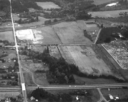
Bonita Road crossing Interstate 5
USA Oregon location map.svg
Red pog.svg
Bonita
Location within Oregon [1]
Coordinates: 45°25′1″N122°45′54″W / 45.41694°N 122.76500°W / 45.41694; -122.76500
Country United States
State Oregon
County Washington
Elevation
187 ft (57 m)
Time zone UTC-8 (Pacific (PST))
  Summer (DST) UTC-7 (PDT)
ZIP codes
97224
GNIS feature ID1166618 [2]

Bonita is a former unincorporated community in Washington County, Oregon, United States, now located within the boundaries of the city of Tigard.

History

The name "Bonita" derives from the Spanish word meaning "beautiful"; and it was named by local resident George W. Cassaday. Bonita was a former station of the Oregon Electric Railway. [3]

Related Research Articles

<span class="mw-page-title-main">Tigard, Oregon</span> City in Oregon, United States

Tigard is a city in Washington County, Oregon, United States. The population was 54,539 at the 2020 census. As of 2007, Tigard was the state's 12th largest city. Incorporated in 1961, the city is located south of Beaverton and north of Tualatin, and is part of the Portland metropolitan area. Interstate 5 and Oregon Route 217 are the main freeways in the city, with Oregon Route 99W and Oregon Route 210 serving as other major highways. Public transit service is provided by TriMet, via several bus routes and the WES Commuter Rail line.

<span class="mw-page-title-main">Washington County, Oregon</span> County in Oregon, United States

Washington County is one of 36 counties in the U.S. state of Oregon and part of the Portland metropolitan area. The 2020 census recorded the population as 600,372, making it the second most populous county in the state and most populous "Washington County" in the United States. Hillsboro is the county seat and largest city, while other major cities include Beaverton, Tigard, Cornelius, Banks, Gaston, Sherwood, North Plains, and Forest Grove, the county's oldest city. Originally named Twality when created in 1843, the Oregon Territorial Legislature renamed it for the nation's first president in 1849 and included the entire northwest corner of Oregon before new counties were created in 1854. The Tualatin River and its drainage basin lie almost entirely within the county, which shares its boundaries with the Tualatin Valley. It is bordered on the west and north by the Northern Oregon Coast Range, on the south by the Chehalem Mountains, and on the north and east by the Tualatin Mountains, or West Hills.

<span class="mw-page-title-main">Bonita, California</span> Census-designated place in California, United States

Bonita is a census-designated place (CDP) in southern San Diego County, California, nestled between the cities of Chula Vista, National City, and San Diego. The population was 12,538 at the 2010 census.

<span class="mw-page-title-main">Oregon Electric Railway</span>

The Oregon Electric Railway (OE) was an interurban railroad line in the U.S. state of Oregon that linked Portland to Eugene. Service from Portland to Salem began in January 1908. The Spokane, Portland and Seattle Railway purchased the system in 1910, and extended service to Eugene in 1912. Regular passenger service in the Willamette Valley ended in May 1933. Freight operations continued and the railway survived into the 1990s, ultimately as a Burlington Northern feeder. Operation as an electric railroad ended July 10, 1945.

Bonita may refer to:

<span class="mw-page-title-main">Nimrod, Oregon</span> Unincorporated community in the state of Oregon, United States

Nimrod is an unincorporated community in Lane County, Oregon, United States, on the McKenzie River. It is located along Oregon Route 126, between Vida and Blue River, 35 miles (56 km) east of Eugene, in the Willamette National Forest. As of 2003, its population was roughly 190. Nimrod is the site of a former ferry that crossed the McKenzie. Nimrod is served by the Vida post office, zip code 97488.

<span class="mw-page-title-main">Westfield Plaza Bonita</span> Shopping mall in National City, California

Westfield Plaza Bonita commonly known as Plaza Bonita and Plaza is a shopping mall located in National City, California, and is owned by Unibail-Rodamco-Westfield. Anchor stores at the center include Macy's, JCPenney, Crunch Fitness, Target, Nordstrom Rack and one vacant space once occupied by John’s Incredible Pizza.

<span class="mw-page-title-main">Laurelwood, Oregon</span> Unincorporated community in the state of Oregon, United States

Laurelwood is an unincorporated community in Washington County, Oregon, United States. The community is located southwest of the Portland metropolitan area near Oregon Route 47 along Laurelwood Road, to the east of the city of Gaston and Wapato Lake. Laurelwood, a farming community, has a population of approximately 500 people. Settled in the 1860s, the community was home to Laurelwood Academy from 1904 until 2007. A large portion of the community is of the Seventh-day Adventist faith.

<span class="mw-page-title-main">Del Bonita, Alberta</span> Hamlet in Alberta, Canada

Del Bonita is a hamlet in southern Alberta, Canada within Cardston County. It is located approximately 49 km (30 mi) south of Magrath at the junction of Highway 62 and Highway 501. Due to its location near the Canada–United States border, it serves as a port of entry into the U.S. state of Montana at the nearby Del Bonita Border Crossing which is located 3 km (1.9 mi) to the south. Del Bonita is a name derived from Spanish meaning "of the pretty".

<span class="mw-page-title-main">Oregon Township, Clark County, Indiana</span> Township in Indiana, United States

Oregon Township is one of twelve townships in Clark County, Indiana. As of the 2010 census, its population was 1,769 and it contained 692 housing units.

<span class="mw-page-title-main">Glencoe, Oregon</span> Unincorporated community in the state of Oregon, United States

Glencoe is a neighborhood and former community in Washington County, Oregon, United States. Founded in 1842, the town, which was north of Hillsboro, died off after 1910 when neighboring North Plains was created to the west. Most of Glencoe is now a part of North Plains. Glencoe gives its name to the road connecting Hillsboro to North Plains, as well as the name of the second high school built in Hillsboro, Glencoe High School.

<span class="mw-page-title-main">Fanno Creek</span> River in Oregon, United States

Fanno Creek is a 15-mile (24 km) tributary of the Tualatin River in the U.S. state of Oregon. Part of the drainage basin of the Columbia River, its watershed covers about 32 square miles (83 km2) in Multnomah, Washington, and Clackamas counties, including about 7 square miles (18 km2) within the Portland city limits.

<span class="mw-page-title-main">Midway, Washington County, Oregon</span> Unincorporated community in the state of Oregon, United States

Midway is an unincorporated rural community in Washington County, Oregon, United States. It is located on Oregon Route 219 about 2.5 miles (4.0 km) west of Scholls. The area is the halfway point between Hillsboro to the north and Sherwood to the southeast, thus it became known as Midway. Midway has a large plant nursery business, a bar and grill and a rural fire station for Washington County Fire District 2.

Bonita is an unincorporated community in Madera County, California. It is 8 miles (13 km) west of Madera, at an elevation of 207 feet.

<span class="mw-page-title-main">Greenville, Washington County, Oregon</span>

Greenville is an unincorporated historic community in Washington County, Oregon, United States. It is located approximately two miles south of Banks on Oregon Route 47.

Dixie is an unincorporated historic community in Washington County, Oregon, United States. Dixie post office was established five or six miles southwest of Scappoose in 1887, with John Dix as the first postmaster. The office was named for the Dix family and not for the U.S. South. The office closed in 1924, but when real estate was being sold in the area in 1933, a name for the locality was needed for marketing reasons. When a vote was held at a community picnic circa 1936 or 1937, 80 of the attendees chose the name "Dixie" to commemorate the former post office and its postmaster.

<i>Bonita</i> (1900 sternwheeler)

Bonita was a steamboat which operated on the Willamette and Yamhill rivers. This boat was renamed Metlako in 1902, and operated under that name until 1924 on the Columbia River and its tributaries, the Cowlitz, Lewis and Lake rivers. In 1924, Metlako was renamed B. H. Smith Jr., operating under that name until 1931, when the steamer was abandoned. As Bonita, in September 1900, this vessel was the first steamer to pass through the Yamhill locks.

Bonita is an extinct town in Douglas County, in the U.S. state of Washington.

<span class="mw-page-title-main">Huber, Oregon</span> Unincorporated community in the state of Oregon, United States

Huber is an unincorporated community in Washington County, Oregon, United States, now mostly located within Aloha near the Tualatin Hills Nature Park.

<span class="mw-page-title-main">Hispanics and Latinos in Portland, Oregon</span>

There were approximately 60,000 people of Hispanic or Latino origin in Portland, Oregon, as of 2020; about 10% of the city’s population.

References

  1. "Bonita (in Washington County, OR) Populated Place Profile". HomeTownLocator. Retrieved October 18, 2016.
  2. U.S. Geological Survey Geographic Names Information System: Bonita, Oregon
  3. McArthur, Lewis L. (1992). Oregon Geographic Names (sixth edition). Oregon Historical Society Press. p. 84. ISBN   0-87595-236-4.