Hazeldale, Oregon

Last updated

Hazeldale
Location of former Hazeldale store - Hazeldale, Oregon.JPG
Location of former store in Hazeldale, 2010
Hillsboro Beaverton Oregon - OpenStreetMap.png
Red pog.svg
Hazeldale
Location within Washington County, Oregon
Coordinates: 45°27′59″N122°53′35″W / 45.46639°N 122.89306°W / 45.46639; -122.89306
Country United States
State Oregon
County Washington
Elevation
253 ft (77 m)
Time zone UTC-8 (Pacific (PST))
  Summer (DST) UTC-7 (PDT)
GNIS feature ID1136368 [1]

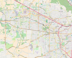
Hazeldale is an unincorporated community in Washington County, Oregon, United States. [2] It is located along Farmington Road south of Reedville and west of Aloha. [3]

Related Research Articles

<span class="mw-page-title-main">Hells Canyon</span> Canyon in the western United States

Hells Canyon is a ten-mile-wide (16 km) canyon in the Western United States, located along the border of eastern Oregon, a small section of eastern Washington and western Idaho. It is part of the Hells Canyon National Recreation Area which is also located in part of the Wallowa-Whitman National Forest. It is North America's deepest river gorge at 7,993 feet (2,436 m), running deeper than the Grand Canyon in Arizona.

<span class="mw-page-title-main">Oxbow, Oregon</span> Unincorporated community in the state of Oregon, United States

Oxbow is an unincorporated community in Baker County, Oregon, United States. Oxbow is along Oregon Route 86 next to the Snake River near the Oxbow Dam on the Oregon-Idaho border, about 17 miles (27 km) northeast of Halfway. Oxbow is just south of the site of the former mining town of Copperfield. Oxbow has a post office with a ZIP code 97840.

<span class="mw-page-title-main">Nehalem Bay State Park</span> State park in Oregon, United States

Nehalem Bay State Park is a state park in the United States located on the Oregon Coast, near the communities of Nehalem and Manzanita on the Nehalem Spit, a sand spit west of Nehalem Bay.

London Springs is an unincorporated community in Lane County, Oregon, United States. It lies 11.33 miles (18.23 km) south-southwest of Cottage Grove at an elevation of 896 feet (273 m). London Springs is near the Coast Fork Willamette River, south of Cottage Grove Lake.

Falkner Glacier, is an east-flowing valley glacier, 4 nautical miles long, located 2 nautical miles south of Oakley Glacier in the Mountaineer Range, Victoria Land, Antarctica. The glacier descends steeply to Lady Newnes Bay where it forms a floating glacier tongue. It was named by the Advisory Committee on Antarctic Names (2008) after Kelly K. Falkner, Professor of Chemical Oceanography at Oregon State University, who served from 2006 as the first Program Director for the Antarctic Integrated System Science Program in the Division of Antarctic Sciences, Office of Antarctic Programs, National Science Foundation.

Cold Springs is an unincorporated community in Umatilla County, Oregon, United States, south of the Columbia River in the Hermiston area. Cold Springs Junction is a populated place and highway junction about 4 miles (6 km) northeast of Cold Springs at the junction of Oregon Route 37 and U.S. Route 730.

<span class="mw-page-title-main">Cow Creek (South Umpqua River tributary)</span> River in Oregon, United States

Cow Creek is a medium-sized river in southwestern Oregon, a tributary of the South Umpqua River. It drains an area of over 400 square miles (1,000 km2) on the western foothills of the Cascade Range and within the Oregon Coast Range. Although the vast majority of the basin is within Douglas County, a tiny portion in the southeast extends into northern Jackson County.

<span class="mw-page-title-main">Neahkahnie Beach, Oregon</span> Unincorporated community in the state of Oregon, United States

Neahkahnie Beach is a census-designated place and unincorporated community in Tillamook County, Oregon, United States. It is located west of U.S. Route 101, comprising approximately 370 residences north of the city of Manzanita, at the foot of Neahkahnie Mountain. For statistical purposes, the United States Census Bureau has defined Neahkahnie as a census-designated place (CDP). The census definition of the area may not precisely correspond to local understanding of the area with the same name. According to the 2020 Census. the population was 197.

Nolin is an unincorporated community in Umatilla County, Oregon, United States. Nolin is about 8 miles (13 km) southeast of Echo, next to the Umatilla River. At one time the area was known as "Happy Canyon". Adam "Ad" W. Nye, a settler of the 1860s, named the Nolin area Happy Canyon, for the spirit of the people who lived there. The name was later adopted by Pendleton Round-Up for its indoor show in commemoration of this time. Nye was County Sheriff in 1872–74. The nearby community of Nye was named for him.

Flagg, Oregon, began as a railroad station on the Southern Pacific Line from Eugene to Coos Bay and later became an unincorporated community in Lane County, Oregon, United States, on Penn Road approximately 5 miles (8 km) west of Vaughn. Wildcat Creek, a tributary of the Siuslaw River, flows by Flagg.

Fort Hill is an unincorporated community in Polk and Yamhill counties in Oregon, United States. It is located about a mile east of Spirit Mountain Casino on Oregon Route 22 near the South Yamhill River. For statistical purposes, the United States Census Bureau has defined Fort Hill as a census-designated place (CDP). The census definition of the area may not precisely correspond to local understanding of the area with the same name. The hill of the same name, located just east of Valley Junction, was the site of a blockhouse built by settlers in 1855–1856. The blockhouse became part of Fort Yamhill, and was later moved to Grand Ronde Agency and is now located in Dayton.

References

  1. U.S. Geological Survey Geographic Names Information System: Hazeldale, Oregon
  2. "Hazeldale". Geographic Names Information System . United States Geological Survey, United States Department of the Interior. November 28, 1980. Retrieved February 21, 2016.
  3. Oregon Atlas & Gazetteer (7th ed.). Yarmouth, Maine: DeLorme. 2008. p. 28. ISBN   0-89933-347-8.

Inspiration for the town of Hazel in Neville Shute's novel "Beyond the Black Stump"?