Laurelwood, Oregon

Last updated

Laurelwood, Oregon
Laurelwood, Oregon.JPG
View from the west with Chehalem Mountain in the background
USA Oregon location map.svg
Red pog.svg
Laurelwood, Oregon
Location within the state of Oregon
Usa edcp location map.svg
Red pog.svg
Laurelwood, Oregon
Laurelwood, Oregon (the United States)
Coordinates: 45°25′22″N123°04′51″W / 45.42278°N 123.08083°W / 45.42278; -123.08083
Country United States
State Oregon
County Washington
Elevation
243 ft (74 m)
Population
 (2000)
  Total503
Time zone UTC-8 (Pacific (PST))
  Summer (DST) UTC-7 (PDT)
ZIP code
97119
Area code(s) 503 and 971
GNIS feature ID1163093 [1]

Laurelwood is an unincorporated community in Washington County, Oregon, United States. The community is located southwest of the Portland metropolitan area near Oregon Route 47 along Laurelwood Road, to the east of the city of Gaston and Wapato Lake. Laurelwood, a farming community, has a population of approximately 500 people. Settled in the 1860s, the community was home to Laurelwood Academy from 1904 until 2007. A large portion of the community is of the Seventh-day Adventist faith.

Contents

History

Church in the community Laurelwood, Oregon church.JPG
Church in the community

Laurelwood was settled circa 1860 in a small valley to the east of what is now Gaston. [2] Most of the community is on the former Donation Land Claim of R. D. Walker. [3] In 1904, the Laurelwood Academy was founded in the community as a Seventh-day Adventist school. [4] Adventist-owned Harris Pine Mills opened a furniture plant and milling plant in the village in 1965, growing to a 60-employee operation. [5] At one time, residents called each other villagers as opposed to the students of the academy. [3]

In August 1977, four people were murdered in the community, shot execution-style. [6] The victimstwo seven-year-old girls, their 24-year-old mother, and the 19-year-old son of her boyfriendwere killed after the mother had testified against a leader of the Hells Angels. [6] [7] Robert G. McClure was convicted of the killings and Hells Angels leader Odis Garrett was convicted of ordering the murders, in 1994 and 1995 respectively. [7]

Laurelwood Academy closed in 1985 and was sold to an alumni group, who re-opened the school in 1988. [5]

In March 1986, the milling operations of the Harris Pine Mills was closed, followed by the furniture manufacturing facility in 1988. [5] Laurelwood was one of sixteen places studied for a possible minimum security prison in 1988. [8] The prison would have been at the former Laurelwood Academy after it shutdown in 1985, but there was local opposition and the prison was never built. [4] [9] Later that year the Adventist school re-opened. [5]

In 1992, Marvin McDougal, a Laurelwood Academy alumnus, proposed developing 165 acres (0.67 km2) in the area into 54 homes to support the academy. [2] [10] Local residents formed an opposition group and fought the development. [2] The county initially approved the development, [11] but residents appealed the decision. [10] Washington County eventually denied approval for the development. [12] In 2007, Laurelwood Academy moved to a new campus near Eugene, Oregon. [13]

Details

Laurelwood from Hartley Road Laurelwood Oregon vista.JPG
Laurelwood from Hartley Road

The population is composed partially of retirees and former students and teachers of Laurelwood Academy. Much of the community is of the Adventist faith. [3] [14] Laurelwood is still mostly made up of homes situated on one to 10 acres (40,000 m2). At the 2000 census, the area had 503 people. [15] [16] The community has the Gaston ZIP Code of 97119. [17] Gaston Rural Fire District covers the community, [18] drinking water is supplied by the Laurelwood Water Co-op, [19] and public education is provided by the Gaston School District. [2] Oregon House of Representatives District 32 (Suzanne Weber) and Oregon Senate District 16 (Betsy Johnson) cover Laurelwood. [20] Laurelwood is within Oregon's 1st congressional district, represented by Congresswoman Suzanne Bonamici. [21]

The main road through the community is Laurelwood Road, which windingly descends through dense tree cover from the top of the Chehalem Mountains and past the academy on its way towards Gaston. [22] [23] The name comes from the abundance of laurel trees above the valley that stretch to the top of Bald Peak atop the mountain to the east. [3] By 1981, one of the trees was still standing, but the compiler of Oregon Geographic Names was informed that the trees were in fact Pacific Madrones. [24] The Washington County Scenic Loop passes through the hamlet. [22] The area also lends its name to a type of soil composed of silt loam. [25] [26]

Laurelwood Academy

Former Seventh-day Adventist academy Laurelwood, Oregon, Mission College of Evangelism.JPG
Former Seventh-day Adventist academy

Laurelwood Academy was established in 1904 on the Walker land claim, with a chapel added in 1908. [3] Initially 5 acres (20,000 m2), Walker sold more land to the school in subsequent years. [3] When it opened it taught grades one through ten under the direction of principal Robert Arye. [3] The first graduate of the academy was Henry Dirkson. [3] In 1907, J. L. Kay became the principal and expanded the school to twelve grades. [3] A Seventh-day Adventist school, the four-year academy grew to as large as 350 students by 1976. [3] The unaffiliated, but adjacent, Laurelwood Adventist Elementary School opened in 1950. [27]

The academy added a manual labor building in 1925 followed by an administration structure in 1943 and a new church in 1957. [3] Laurelwood Academy was closed in 1985 after enrollment had declined at the schools of the Oregon Conference of Seventh-day Adventists. [4] After re-opening in the late 1980s, the school relocated in 2007 when enrollment was at 90 students. [13] Laurelwood Seventh-Day Adventist Elementary School still exists, and now has enrollment of about 20, in grades 1–8. Recently, the former academy buildings housed the Mission College of Evangelism run by Carol and Louis Torres. [28] Even more recently, prior to the COVID-19 pandemic, half of the academy buildings housed Ananda Laurelwood, a spiritual retreat. [29]

Related Research Articles

<span class="mw-page-title-main">Portland, Oregon</span> Largest city in Oregon, United States

Portland is a port city in the Pacific Northwest and the most populous city in the U.S. state of Oregon. Situated in the northwestern area of the state at the confluence of the Willamette and Columbia rivers, Portland is the county seat of Multnomah County, the most populous county in Oregon. As of 2020, Portland had a population of 652,503, making it the 26th-most populated city in the United States, the sixth-most populous on the West Coast, and the second-most populous in the Pacific Northwest, after Seattle. Approximately 2.5 million people live in the Portland–Vancouver–Hillsboro, OR–WA metropolitan statistical area, making it the 25th most populous in the United States. About half of Oregon's population resides within the Portland metropolitan area.

<span class="mw-page-title-main">Beaverton, Oregon</span> City in Oregon, United States

Beaverton is a city in Washington County, in the U.S. state of Oregon with a small portion bordering Portland in the Tualatin Valley. The city is among the main cities that make up the Portland metropolitan area. Its population was 97,494 at the 2020 census, making it the second-largest city in the county and the seventh-largest city in Oregon. Beaverton is an economic center for Washington County along with neighboring Hillsboro. It is home to the world headquarters of Nike, Inc., although it sits outside of city limits on unincorporated county land.

<span class="mw-page-title-main">Cedar Mill, Oregon</span> Unincorporated community in the state of Oregon, United States

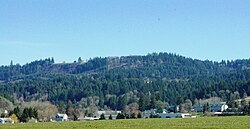
Cedar Mill is a suburb in the Portland, Oregon metropolitan area of the United States; it is a census-designated place and an unincorporated community in Washington County, north of U.S. Route 26 and west of the Willamette Stone. It received its name from a sawmill on Cedar Mill Creek, which cut Western Redcedars that were once the dominant tree in the area. The mill's pond was near the intersection of 119th and Cornell Road, and could still be seen into the 1960s, although the mill itself had ceased operating in 1891. The name was established in 1874 with the opening of a U.S. post office named Cedar Mill. As of the 2010 census, the community population was 14,546.

<span class="mw-page-title-main">Hillsboro, Oregon</span> City in Oregon, United States

Hillsboro is the fifth-largest city in the U.S. state of Oregon and is the county seat of Washington County. Situated in the Tualatin Valley on the west side of the Portland metropolitan area, the city hosts many high-technology companies, such as Intel, locally known as the Silicon Forest. At the 2020 census, the city's population was 106,447.

<span class="mw-page-title-main">Sheridan, Oregon</span> City in Oregon, United States

Sheridan is a city in Yamhill County, Oregon, United States. Platted in the 1860s when it received a post office, the city was incorporated in 1880. A major fire burned much of the city in 1913, and a flood covered much of the city in 1964. The population of the city as of the 2020 Census was 6,100, a decrease from 6,127 at the 2010 census.

<span class="mw-page-title-main">Wilsonville, Oregon</span> City in Oregon, United States

Wilsonville is a city primarily in Clackamas County, Oregon, United States. A portion of the northern section of the city is in Washington County. It was founded as Boones Landing because of the Boones Ferry which crossed the Willamette River at the location; the community became Wilsonville in 1880. The city was incorporated in 1969 with a population of approximately 1,000. The population was 13,991 at the 2000 census, and grew to 19,509 as of 2010. Slightly more than 90% of residents at the 2000 census were white, with Hispanics comprising the largest minority group.

The Beaverton School District is a school district in and around Beaverton, Oregon, United States. It serves students throughout Beaverton, Hillsboro, Aloha, and unincorporated neighborhoods of Portland, OR. The Beaverton Elementary School District 48 was established in 1876, with other elementary districts later merged into the district. The elementary district was later merged with the high school district (10J) to create a unified school district. It is the third-largest school district in the state, with an enrollment of 39,180 students as of 2022. For the 2021–2022 school year the district had a total budget of $622.8 million.

<span class="mw-page-title-main">Tualatin Valley</span> Farming and suburban region southwest of Portland, Oregon

The Tualatin Valley is a farming and suburban region southwest of Portland, Oregon. The valley is formed by the meandering Tualatin River, a tributary of the Willamette River at the northwest corner of the Willamette Valley, east of the Northern Oregon Coast Range. Most of the valley is located within Washington County, separated from Portland by the Tualatin Mountains. Communities in the Tualatin Valley include Banks, Forest Grove, Cornelius, Hillsboro, Aloha, Beaverton, Sherwood, Tigard, and Tualatin.

<span class="mw-page-title-main">Portland Public Schools (Oregon)</span> School district in Portland, Oregon, United States

Portland Public Schools (PPS) is a public school district located in Portland, Oregon, United States. It is the largest school district in the state of Oregon. It is a PK–12 district with an enrollment of more than 49,000 students. It comprises more than 100 locations, including 79 schools and other sites that are maintained within the district.

<span class="mw-page-title-main">Providence St. Vincent Medical Center</span> Hospital in Oregon, United States

Providence St. Vincent Medical Center, is a non-profit, acute care teaching hospital in an unincorporated section of Washington County, Oregon, in the West Haven-Sylvan area north of Beaverton, Oregon and west of Portland, Oregon, United States – and within the Portland metropolitan area. The hospital was founded in 1875 by the Sisters of Providence, a Roman Catholic sisterhood from Montreal, Quebec, Canada. It is Providence Health & Services’s largest Oregon hospital.

<span class="mw-page-title-main">Tualatin River National Wildlife Refuge</span> Wetlands and lowlands sanctuary in the U.S. state of Oregon

The Tualatin River National Wildlife Refuge is a 1,856 acres (751 ha) wetlands and lowlands sanctuary in the northwestern part of the U.S. state of Oregon. Established in 1992 and opened to the public in 2006, it is managed by the United States Fish and Wildlife Service. Located in southeastern Washington County, 15 miles (24 km) southwest of Portland, the refuge is bordered by Sherwood, Tualatin and Tigard. A newer area, extending into northern Yamhill County, is located further west near the city of Gaston surrounding the former Wapato Lake.

<span class="mw-page-title-main">Cherry Grove, Oregon</span> Unincorporated community in the state of Oregon, United States

Cherry Grove is an unincorporated community in Washington County, Oregon, United States. Cherry Grove is situated on the north bank of the Tualatin River near where it exits the Northern Oregon Coast Range and enters Patton Valley.

<span class="mw-page-title-main">Tualatin Valley Academy</span> Private school in Hillsboro, Washington County, Oregon, United States

Tualatin Valley Academy (TVA) is a preschool-through-tenth-grade private school in Hillsboro, Oregon, United States. Founded in 1916 as Tualatin Valley Junior Academy, the school is affiliated with the Seventh-day Adventist Church. TVA was affiliated with the Ring of Fire handbell choir from its inception in 1997 until 2004.

<span class="mw-page-title-main">Providence Newberg Medical Center</span> Hospital in Oregon, United States

Providence Newberg Medical Center is a not-for-profit acute care hospital in Newberg, Oregon, United States. Opened at a different location as Newberg Community Hospital, a new 40-licensed-hospital-bed and Leadership in Energy and Environmental Design (LEED)-certified facility was opened in 2006, the first gold certified hospital in the nation. The three building medical center is located on 56 acres (23 ha) on the eastern edge of the city along Oregon Route 99W and is owned by Providence Health & Services.

<span class="mw-page-title-main">Education in Portland, Oregon</span> Overview of education in Portland, Oregon, United States

Portland, Oregon contains six public school districts, many private schools, as well as public and private colleges and universities including Portland State University, the largest public university in Oregon.

<span class="mw-page-title-main">Laurelwood Academy</span> Private school in Jasper, Lane County, Oregon, United States

Laurelwood Academy is a private secondary school affiliated with the Seventh-day Adventist Church near Jasper, Oregon, United States. It is a part of the Seventh-day Adventist education system, the world's second largest Christian school system. Founded in 1904 in Laurelwood, Oregon, the boarding school moved to a new 20-acre (8.1 ha) campus in rural Lane County outside of Eugene in 2007. The school has grades 9 through 12 and focuses on agriculture in addition to academics.

<span class="mw-page-title-main">Dilley, Oregon</span> Unincorporated community in the state of Oregon, United States

Dilley is an unincorporated community in Washington County, Oregon, United States. It is located south of Forest Grove and north of the city of Gaston on Oregon Route 47 in the Portland metropolitan area. Settled in the late 1840s, the community was platted in 1874 after the arrival of the railroad. The population of the area in 2000 was approximately 2,000.

<span class="mw-page-title-main">Wilsonville Public Library</span> Public library in Wilsonville, Oregon

The Wilsonville Public Library (WPL) is the single-location public library of the city of Wilsonville in the U.S. state of Oregon. Established in 1982, the library moved to its present location near Wilsonville Memorial Park in 1988. WPL is a part of the Library Information Network of Clackamas County and serves a population of about 21,900. The library has approximately 155,000 items in its collection with a total circulation of approximately 515,000.

<span class="mw-page-title-main">Tualatin Valley Fire and Rescue</span> Regional fire district in Oregon

Tualatin Valley Fire & Rescue (TVF&R) is a special-purpose government fire fighting and emergency services district in the Portland metropolitan area of Oregon. Established in 1989 with a merger between Washington County Fire District 1 and the Tualatin Rural Fire Protection District, it primarily provides fire and emergency medical services in eastern Washington County, but also provides services in neighboring Multnomah, Clackamas, and Yamhill counties. It serves unincorporated areas along with the cities of Beaverton, Tigard, Tualatin, West Linn, Wilsonville, and Sherwood, among others. With over 400 firefighters and 27 fire stations, the district is the second largest fire department in the state and has an annual budget of $197 million.

<span class="mw-page-title-main">Washington County Fire District 2</span>

Washington County Fire District 2 (WCFD2) was a special-purpose government fire fighting and emergency services district in Washington County on the west side of the Portland metropolitan area of Oregon. Established in 1952, it primarily provided fire and emergency medical services in the central portion of the county surrounding Hillsboro, including the city of North Plains. The District had two fire stations when it was absorbed by Tualatin Valley Fire and Rescue in 2017.

References

  1. "Laurelwood, Oregon". Geographic Names Information System . United States Geological Survey, United States Department of the Interior.
  2. 1 2 3 4 Goetze, Janet (February 25, 1992). "Laurelwood residents organize to combat development". The Oregonian. Portland, Oregon. p. B2.
  3. 1 2 3 4 5 6 7 8 9 10 11 "Communities: Laurelwood Academy built on land claim". The Hillsboro Argus . October 19, 1976. p. 12.
  4. 1 2 3 "Adventists sell Laurelwood properties to alumni organization", The Oregonian, August 3, 1988, p. B4.
  5. 1 2 3 4 Ostergren, Jack (September 15, 1988). "Doors opening, shutting in Laurelwoo". The Oregonian. West Zoner. p. 1.
  6. 1 2 Haynes, Dana (June 17, 1994). "Woman who found execution victims testifies". The Oregonian. p. E2.
  7. 1 2 Ortiz, Fiona (July 27, 1995). "Former Hell's Angels leader guilty of ordering 4 murders". The Oregonian. p. B5.
  8. Moore, Elizabeth (January 21, 1988). "Panel suggests 16 locations for new prisons". The Oregonian. p. C3.
  9. Green, Ashbel S. (February 11, 1988). "Plan for Gaston-area prison draws fire at hearing". The Oregonian. p. D4.
  10. 1 2 Goetze, Janet (September 11, 1992). "Housing project debated". The Oregonian. p. C2.
  11. Goetze, Janet (April 3, 1992). "County planners OK 54-lot development in Laurelwood". The Oregonian. p. B2.
  12. Goetze, Janet (February 4, 1993). "Land-use officer denies Laurelwood proposal". The Oregonian. p. B2.
  13. 1 2 Bishop, Bill (April 2, 2007). "Adventist training academy blossoms; Church; The school is moving from Portland and building on a Jasper-Lowell Road site". The Register-Guard . Eugene, Oregon. p. C1.
  14. Smith, Jill (December 27, 2001). "Feeding the whole family without hoofs and horns". The Oregonian. West Zoner. p. 10.
  15. "Census 2000 Block Map: Washington County: Washington County (067)" (PDF). U.S. Census Bureau. Retrieved March 15, 2009.
  16. "Washington County, Census Tract 330: Census Data For Block Group 3 (part). Blocks: 3020–3029; 3031; 3069–3070". gCensus. Retrieved March 15, 2009.
  17. "How to Help: Who: Laurelwood Academy". The Oregonian. West Zoner. December 26, 1996. p. 9.
  18. "Gaston, as in Cherry Grove, Patton Valley, Laurelwood, Scoggins Valley ..." Gaston Rural Fire District. Retrieved March 9, 2009.
  19. "Service Providers in Washington County" (PDF). Washington County. June 24, 2008. p. 1. Archived from the original (PDF) on March 24, 2009.
  20. "Oregon State Legislature Lookup" . Retrieved December 30, 2021.
  21. "Oregon Congressional Districts" (PDF). Oregon Secretary of State. Retrieved March 15, 2009.
  22. 1 2 Mandel, Michelle (November 4, 1999). "Scenic Sojourn". The Oregonian. West Zoner. p. 1.
  23. Gardner, Fran (August 22, 1991). "A little looping the Loop". The Oregonian. West Zoner. p. 10.
  24. McArthur, Lewis A.; Lewis L. McArthur (2003) [1928]. Oregon Geographic Names (7th ed.). Portland, Oregon: Oregon Historical Society Press. p. 564. ISBN   0-87595-277-1.
  25. "Hydric Soils List - All Components: Yamhill Area, Oregon" (PDF). U.S. Department of Agriculture, Natural Resources Conservation Service. Retrieved March 14, 2009.[ permanent dead link ]
  26. "Geomorphology and Soils: Willamette Valley, Oregon" (PDF). Oregon State University. November 1968. Retrieved March 14, 2009.
  27. Leeson, Jeanne (September 13, 1990). "Washington County private schools grow". The Oregonian. West Zoner. p. 6.
  28. "Home". Mission College of Evangelism. Retrieved March 9, 2009.
  29. "Ananda Laurelwood" . Retrieved October 18, 2020.

Commons-logo.svg Media related to Laurelwood, Oregon at Wikimedia Commons