Kinton, Oregon

Last updated

Kinton
Kinton Oregon Grange.JPG
The Kinton Grange hall
USA Oregon location map.svg
Red pog.svg
Kinton
Location within the state of Oregon
Usa edcp location map.svg
Red pog.svg
Kinton
Kinton (the United States)
Coordinates: 45°25′23″N122°52′40″W / 45.42306°N 122.87778°W / 45.42306; -122.87778
Country United States
State Oregon
County Washington
Time zone UTC-8 (Pacific (PST))
  Summer (DST) UTC-7 (PDT)
ZIP code
97007
Area code(s) 503 and 971

Kinton is an unincorporated community in Washington County, Oregon, United States. It is located near the northern shore of the Tualatin River, near the intersection of Oregon Route 210 and River Road, a major county arterial that runs northwest towards Hillsboro. Kinton is located approximately eight miles north of Newberg, six miles southwest of Beaverton, and seven miles southeast of Hillsboro. The community was once the site of a ferry (the Scholls Ferry) crossing the Tualatin River between Kinton and nearby Scholls. While the ferry has long since been replaced with a bridge, OR 210 is still known locally as Scholls Ferry Road. Kinton is in Oregon's wine country, with several notable wineries in the area.

Contents

History

Kinton was named for Peter Kindt, a pioneer who took up a donation land claim nearby. [1] Kinton had its own post office from 1894–1903. [1] Today Kinton has a Beaverton mailing address.

Quoted from Ghosttowns.com

"Twenty million years ago, lava flows from eastern Oregon snaked down the Columbia River and deposited a bed of basalt lava in the area known today as Washington County. During the last ice age, the region was engulfed repeatedly by the raging Missoula floods, which deposited rich silt and topsoil.

A few thousand years later, the Donation Land Claim Act of 1850, enacted by congress to encourage settlement in Oregon Territory, prompted a surge of immigration to the new Territory via the Oregon Trail. (This law is the precursor to the Homestead Act.) Before the Act expired in 1855, a total of 7,437 patents were issued, one of them to a Peter Kindt. Mr. Kindt’s Donation Land claim lay near the banks of the Tualatin River, and the town of Kinton was named after this early pioneer.

Kinton was fortunate to be situated near the Ferry that Peter Scholl built around 1848 across the Tualatin River. Mr. Scholl operated the ferry for many years, later establishing a toll bridge. (That covered bridge existed at least until the 1920s, but is now gone.) The road that runs through Kinton, down to the community of Scholls, is still called Scholl’s Ferry Road.

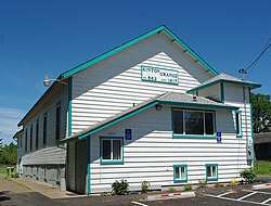
Kinton had a post office from 1894 to 1903. Aside from an old a schoolhouse, the administrative buildings and stores seem to be gone. However, it may be that such buildings reside hidden on private property, out of sight from the road. Today Scholl’s Ferry Road (HW 210) and SW River Road are important highways, very scenic and pleasant to drive. Historic houses and barns may be seen from the road. Be sure to visit Scholls, a semi-ghost town just a few miles SW. Follow Highway 210. ~Kathryn Davidson" [2]

Related Research Articles

<span class="mw-page-title-main">Beaverton, Oregon</span> City in Oregon, United States

Beaverton is a city in Washington County, in the U.S. state of Oregon with a small portion bordering Portland in the Tualatin Valley. The city is among the main cities that make up the Portland metropolitan area. Its population was 97,494 at the 2020 census, making it the second-largest city in the county and the seventh-largest city in Oregon. Beaverton is an economic center for Washington County along with neighboring Hillsboro. It is home to the world headquarters of Nike, Inc., although it sits outside of city limits on unincorporated county land.

<span class="mw-page-title-main">Washington County, Oregon</span> County in Oregon, United States

Washington County is one of 36 counties in the U.S. state of Oregon and part of the Portland metropolitan area. The 2020 census recorded the population as 600,372, making it the second most populous county in the state and most populous "Washington County" in the United States. Hillsboro is the county seat and largest city, while other major cities include Beaverton, Tigard, Cornelius, Banks, Gaston, Sherwood, North Plains, and Forest Grove, the county's oldest city. Originally named Twality when created in 1843, the Oregon Territorial Legislature renamed it for the nation's first president in 1849 and included the entire northwest corner of Oregon before new counties were created in 1854. The Tualatin River and its drainage basin lie almost entirely within the county, which shares its boundaries with the Tualatin Valley. It is bordered on the west and north by the Northern Oregon Coast Range, on the south by the Chehalem Mountains, and on the north and east by the Tualatin Mountains, or West Hills.

<span class="mw-page-title-main">Aloha, Oregon</span> Unincorporated community in the state of Oregon, United States

Aloha is a census-designated place and unincorporated community in Washington County, Oregon, United States. By road it is 10.9 miles (17.5 km) west of downtown Portland. As of the 2020 Census, the population was 53,828. Fire protection and EMS services are provided through Tualatin Valley Fire and Rescue. and Metro West Ambulance.

<span class="mw-page-title-main">Garden Home–Whitford, Oregon</span> CDP in Oregon, United States

Garden Home-Whitford is a census-designated place (CDP) consisting of the neighborhoods of Garden Home and the smaller Whitford area in Washington County, Oregon, United States. They are located in the southwest hills of Portland, near Beaverton. As of the 2020 census, the CDP population was 7,081.

<span class="mw-page-title-main">Hillsboro, Oregon</span> City in Oregon, United States

Hillsboro is the fifth-largest city in the U.S. state of Oregon and is the county seat of Washington County. Situated in the Tualatin Valley on the west side of the Portland metropolitan area, the city hosts many high-technology companies, such as Intel, locally known as the Silicon Forest. At the 2020 census, the city's population was 106,447.

<span class="mw-page-title-main">Tualatin River</span> River in Oregon, United States

The Tualatin River is a tributary of the Willamette River in Oregon in the United States. The river is about 83 miles (134 km) long, and it drains a fertile farming region called the Tualatin Valley southwest and west of Portland at the northwest corner of the Willamette Valley. There are approximately 500,000 people residing on 15 percent of the land in the river's watershed.

<span class="mw-page-title-main">Tualatin Valley</span> Farming and suburban region southwest of Portland, Oregon

The Tualatin Valley is a farming and suburban region southwest of Portland, Oregon. The valley is formed by the meandering Tualatin River, a tributary of the Willamette River at the northwest corner of the Willamette Valley, east of the Northern Oregon Coast Range. Most of the valley is located within Washington County, separated from Portland by the Tualatin Mountains. Communities in the Tualatin Valley include Banks, Forest Grove, Cornelius, Hillsboro, Aloha, Beaverton, Sherwood, Tigard, and Tualatin.

<span class="mw-page-title-main">Orenco, Oregon</span> Neighborhood in Washington County, Oregon, United States

Orenco is a former company town in Washington County, Oregon, United States, located between Hillsboro and Aloha. The former community of Orenco now forms the Orenco neighborhood in Hillsboro, which is the site of the Orenco Station housing development.

<span class="mw-page-title-main">Oregon Route 210</span> Highway in Oregon

Oregon Route 210 is a state highway which runs between the community of Scholls, Oregon and the Raleigh Hills neighborhood west of Portland, terminating at the Sylvan overpass on Highway 26. It has become an important route for both commuters and agriculture through Washington County. Oregon Route 210 is signed from east-to-west; though in actuality it runs in a northeast-to-southwest direction.

<span class="mw-page-title-main">Oregon Route 219</span> Highway in Oregon

Oregon Route 219 is an Oregon state highway which runs between the cities of Hillsboro and Woodburn, Oregon, in the United States. The Hillsboro-Silverton Highway continues further south to Silverton, signed as OR 214. The highway mainly serves local residents and agricultural traffic; despite its proximity to the Portland area it lies outside the Portland Urban Growth Boundary and so maintains its character as a country road.

<span class="mw-page-title-main">Oregon Route 141</span> Highway in Oregon

Oregon Route 141, known as the Beaverton–Tualatin Highway No. 141, is an Oregon state highway which runs from the city of Wilsonville to the southern edge of Beaverton. The highway is 10.46 miles (16.83 km) long.

<span class="mw-page-title-main">Scholls, Oregon</span> Unincorporated community in the state of Oregon, United States

Scholls, Oregon is an unincorporated community in Washington County, Oregon, United States. It is located along the southern shore of the Tualatin River, near the intersection of Oregon Routes 210 and 219. Scholls is located approximately seven miles north of Newberg, seven miles west of Tigard and eight miles south of Hillsboro. The area around Scholls is primarily agricultural.

Historic ferries in Oregon are water transport ferries that operated in Oregon Country, Oregon Territory, and the state of Oregon, United States. These ferries allowed people to cross bodies of water, mainly rivers such as the Willamette in the Willamette Valley, and the Columbia, in order to transport goods, move people, and further communications until permanent bridges were built to allow faster crossing of the water. The early ferries were used by wagons and pedestrians, while later ones transported trains and then automobiles. Oregon has a few automobile ferries still in operation.

<span class="mw-page-title-main">Noble Woods Park</span> Nature trail in Hillsboro, OR

Noble Woods Park is a wooded city park in Hillsboro, Oregon, United States. Located on approximately 40 acres (160,000 m2) along Rock Creek, the nature park with wetlands and forests is situated between West Baseline Road on the north and Southwest Borwick Road to the south near the Orenco neighborhood. The city acquired the land for the park in 1992 and opened the park in the eastern section of the city in 1998. Noble Woods has two entrances, a picnic area, and hiking trails.

<span class="mw-page-title-main">Fanno Creek</span> River in Oregon, United States

Fanno Creek is a 15-mile (24 km) tributary of the Tualatin River in the U.S. state of Oregon. Part of the drainage basin of the Columbia River, its watershed covers about 32 square miles (83 km2) in Multnomah, Washington, and Clackamas counties, including about 7 square miles (18 km2) within the Portland city limits.

Cornelius Pass Road is an arterial road over Cornelius Pass in the Tualatin Mountains west of Portland, Oregon, United States, also extending several miles to the south. Running north–south, the road stretches between U.S. Route 30 (US 30) on the north and Kinnaman Street, just south of Oregon Route 8 (OR 8), on the south. The road passes through Washington and Multnomah counties, crossing the Tualatin Mountains at Cornelius Pass, 581 feet (177 m) above sea level. TriMet's MAX Light Rail line travels over the road on a bridge. The section between US 30 in Burlington and U.S. Route 26 in Hillsboro is Oregon Route 127 , known in the Oregon state highway system as Cornelius Pass Highway No. 127.

<span class="mw-page-title-main">Augustus Fanno Farmhouse</span> Historic house in Oregon, United States

The Augustus Fanno Farmhouse was the home of Augustus Fanno, one of the first European American settlers in what became Washington County in the U.S. state of Oregon. Born in Maine in 1804, Fanno lived in Missouri as a young adult and in 1846 moved to Oregon with his first wife, Martha, and son. After Martha died in childbirth in Linn City in the Willamette Valley, Fanno and his son settled a 640-acre (2.6 km2) donation land claim 12 miles (19 km) to the northwest on a small tributary of the Tualatin River. It was the first such claim to be filed in the county.

<span class="mw-page-title-main">Farmington, Oregon</span> Unincorporated community in the state of Oregon, United States

Farmington is an unincorporated community in Washington County, Oregon, United States. It is located on the Tualatin River, a tributary of the Willamette, about eight miles southwest of Beaverton, at the intersection of Oregon Route 10 and River Road. It is about two miles east of the junction of OR 10 with Oregon Route 219. Farmington was one of the earliest settlements in Oregon and was prominent for a time as an important milling and grain-shipping point on the Tualatin when steamships were the principal means of shipping grain along the Willamette River. Farmington was the site of an early Christian Church, founded by 1845 pioneers in Sarah and Philip Harris, who arrived in Oregon via the Meek Cutoff. At that time the locale was called "Bridgeport". Baptisms were in the Tualatin River.

<span class="mw-page-title-main">Tualatin Valley Fire and Rescue</span> Regional fire district in Oregon

Tualatin Valley Fire & Rescue (TVF&R) is a special-purpose government fire fighting and emergency services district in the Portland metropolitan area of Oregon. Established in 1989 with a merger between Washington County Fire District 1 and the Tualatin Rural Fire Protection District, it primarily provides fire and emergency medical services in eastern Washington County, but also provides services in neighboring Multnomah, Clackamas, and Yamhill counties. It serves unincorporated areas along with the cities of Beaverton, Tigard, Tualatin, West Linn, Wilsonville, and Sherwood, among others. With over 400 firefighters and 27 fire stations, the district is the second largest fire department in the state and has an annual budget of $197 million.

<span class="mw-page-title-main">Cornell Road</span> Street in Portland and Washington County, Oregon, United States

Cornell Road is an east–west street and traffic corridor in the Portland metropolitan area, in Multnomah and Washington counties in the U.S. state of Oregon. It crosses the Tualatin Mountains between the Willamette Valley and the city of Portland on the east and the Tualatin Valley and the city of Hillsboro on the west.

References

  1. 1 2 McArthur, Lewis A.; Lewis L. McArthur (2003) [1928]. Oregon Geographic Names (7th ed.). Portland, Oregon: Oregon Historical Society Press. ISBN   0-87595-277-1.
  2. "Kinton - Oregon Ghost Town".