Brownstown, Cambria County, Pennsylvania

Last updated
Brownstown, Pennsylvania
Habicht near Gilbert in Brownstown.jpg
Houses on Habicht St. at dusk
Cambria County Pennsylvania Incorporated and Unincorporated areas Brownstown Highlighted.svg
Location of Brownstown in Cambria County, Pennsylvania.
USA Pennsylvania location map.svg
Red pog.svg
Brownstown
Coordinates: 40°20′01″N78°56′14″W / 40.33361°N 78.93722°W / 40.33361; -78.93722 Coordinates: 40°20′01″N78°56′14″W / 40.33361°N 78.93722°W / 40.33361; -78.93722
Country United States
State Pennsylvania
County Cambria
Incorporated1908
Government
  TypeBorough Council
Area
[1]
  Total0.24 sq mi (0.61 km2)
  Land0.24 sq mi (0.61 km2)
  Water0.00 sq mi (0.00 km2)
Elevation
[2]
1,470 ft (450 m)
Population
 (2020) [3]
  Total696
  Density2,936.71/sq mi (1,132.44/km2)
Time zone UTC-5 (Eastern (EST))
  Summer (DST) UTC-4 (EDT)
ZIP code
15906
Area code 814
FIPS code 42-09400
GNIS feature ID1215010 [2]

Brownstown is a borough in Cambria County, Pennsylvania, United States. The population was 744 at the 2010 census. [4] It is part of the Johnstown, Pennsylvania Metropolitan Statistical Area and also part of Johnstown's urban area.

Contents

Geography

Brownstown is located in southwestern Cambria County at 40°20′01″N78°56′14″W / 40.33361°N 78.93722°W / 40.33361; -78.93722 (40.3336,-78.9371). [5] It is bordered to the south by Westmont. The borough sits on a hill on the west side of the Conemaugh River valley and is 2 miles (3 km) northwest of the center of Johnstown by road.

According to the United States Census Bureau, the borough has a total area of 0.23 square miles (0.6 km2), all of it land. [4]

Demographics

Historical population
CensusPop.
1890 550
1910 1,300
1920 1,48914.5%
1930 1,5866.5%
1940 1,5980.8%
1950 1,508−5.6%
1960 1,379−8.6%
1970 1,035−24.9%
1980 1,0774.1%
1990 937−13.0%
2000 883−5.8%
2010 744−15.7%
2020 696−6.5%
Sources: [6] [7] [8] [3]

As of the census [7] of 2000, there were 883 people, 354 households, and 259 families living in the borough. The population density was 3,467.6 people per square mile (1,363.7/km2). There were 372 housing units at an average density of 1,460.9/sq mi (574.5/km2). The racial makeup of the borough was 99.32% White, 0.23% African American, 0.11% Asian, and 0.34% from two or more races.

There were 354 households, out of which 31.1% had children under the age of 18 living with them, 56.8% were married couples living together, 9.6% had a female householder with no husband present, and 26.6% were non-families. 23.4% of all households were made up of individuals, and 13.6% had someone living alone who was 65 years of age or older. The average household size was 2.49 and the average family size was 2.94.

In the borough the population was spread out, with 21.5% under the age of 18, 7.0% from 18 to 24, 27.5% from 25 to 44, 25.4% from 45 to 64, and 18.6% who were 65 years of age or older. The median age was 41 years. For every 100 females there were 92.4 males. For every 100 females age 18 and over, there were 88.8 males.

The median income for a household in the borough was $33,043, and the median income for a family was $36,645. Males had a median income of $25,000 versus $17,386 for females. The per capita income for the borough was $13,494. About 5.3% of families and 8.0% of the population were below the poverty line, including 8.3% of those under the age of 18 and 5.2% who were 65 or older.

Related Research Articles

<span class="mw-page-title-main">Carrolltown, Pennsylvania</span> Borough in Pennsylvania, United States

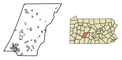
Carrolltown is a borough in Cambria County, Pennsylvania, United States. The population was 853 at the 2010 census, down from 1,049 at the 2000 census. It is part of the Johnstown, Pennsylvania Metropolitan Statistical Area.

<span class="mw-page-title-main">Chest Springs, Pennsylvania</span> Borough in Pennsylvania, United States

Chest Springs is a borough in Cambria County, Pennsylvania, United States. It is part of the Johnstown, Pennsylvania Metropolitan Statistical Area. The population was 149 at the 2010 census.

<span class="mw-page-title-main">Daisytown, Pennsylvania</span> Borough in Pennsylvania, United States

Daisytown is a borough in Cambria County, Pennsylvania, United States. It is part of the Johnstown, Pennsylvania Metropolitan Statistical Area. The population was 326 at the 2010 census.

<span class="mw-page-title-main">Dale, Pennsylvania</span> Borough in Pennsylvania, United States

Dale is a borough in Cambria County, Pennsylvania, United States. It is part of the Johnstown, Pennsylvania Metropolitan Statistical Area. The population was 1,234 at the 2010 census, down from 1,503 at the 2000 census.

<span class="mw-page-title-main">East Conemaugh, Pennsylvania</span> Borough in Pennsylvania, United States

East Conemaugh is a borough in Cambria County, Pennsylvania, United States. It is part of the Johnstown, Pennsylvania Metropolitan Statistical Area. The population was 1,220 at the 2010 census.

<span class="mw-page-title-main">East Taylor Township, Cambria County, Pennsylvania</span> Township in Pennsylvania, United States

East Taylor Township is a township in Cambria County, Pennsylvania, United States, The population was 2,726 at the 2010 census, unchanged since the 2000 census. It is part of the Johnstown, Pennsylvania Metropolitan Statistical Area.

<span class="mw-page-title-main">Ehrenfeld, Pennsylvania</span> Borough in Pennsylvania, United States

Ehrenfeld is a borough in Cambria County, Pennsylvania, United States. It is part of the Johnstown, Pennsylvania Metropolitan Statistical Area. The population was 228 at the 2010 census.

<span class="mw-page-title-main">Ferndale, Pennsylvania</span> Borough in Pennsylvania, United States

Ferndale is a borough in Cambria County, Pennsylvania, United States. It is part of the Johnstown, Pennsylvania Metropolitan Statistical Area. The population was 1,636 at the 2010 census, down from 1,834 at the 2000 census.

<span class="mw-page-title-main">Geistown, Pennsylvania</span> Borough in Pennsylvania, United States

Geistown is a borough in Cambria County, Pennsylvania, United States. It is part of the Johnstown, Pennsylvania Metropolitan Statistical Area. The population was 2,467 at the 2010 census.

<span class="mw-page-title-main">Hastings, Pennsylvania</span> Borough in Pennsylvania, United States

Hastings is a borough in Cambria County, Pennsylvania, United States. It is part of the Johnstown, Pennsylvania Metropolitan Statistical Area. The population was 1,278 at the 2010 census.

<span class="mw-page-title-main">Lilly, Pennsylvania</span> Borough in Pennsylvania, United States

Lilly is a borough in Cambria County, Pennsylvania, United States. It is part of the Johnstown, Pennsylvania Metropolitan Statistical Area. The population was 968 at the 2010 census.

<span class="mw-page-title-main">Lorain, Pennsylvania</span> Borough in Pennsylvania, United States

Lorain is a borough in Cambria County, Pennsylvania, United States. It is part of the Johnstown, Pennsylvania Metropolitan Statistical Area. The population was 759 at the 2010 census.

<span class="mw-page-title-main">Loretto, Pennsylvania</span> Borough in Pennsylvania, United States

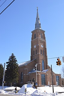
Loretto is a borough in Cambria County, Pennsylvania. As of the 2010 census it had a population of 1,302. Like the rest of Cambria County, it is part of the Johnstown, Pennsylvania Metropolitan Statistical Area. Loretto is the home of Saint Francis University.

<span class="mw-page-title-main">Lower Yoder Township, Cambria County, Pennsylvania</span> Township in Pennsylvania, United States

Lower Yoder Township is a township in Cambria County, Pennsylvania, United States. The population was 2,699 at the 2010 census, down from 3,029 at the 2000 census. It is part of the Johnstown, Pennsylvania Metropolitan Statistical Area.

<span class="mw-page-title-main">Richland Township, Cambria County, Pennsylvania</span> Township in Pennsylvania, United States

Richland Township is a township in Cambria County, Pennsylvania, United States. The population was 12,814 at the 2010 census. It is part of the Johnstown, Pennsylvania Metropolitan Statistical Area.

<span class="mw-page-title-main">Scalp Level, Pennsylvania</span> Borough in Pennsylvania, United States

Scalp Level is a borough in Cambria County, Pennsylvania, United States. It is part of the Johnstown, Pennsylvania Metropolitan Statistical Area. The population was 778 at the 2010 census.

<span class="mw-page-title-main">South Fork, Pennsylvania</span> Borough in Pennsylvania, United States

South Fork is a borough in Cambria County, Pennsylvania, United States. It is part of the Johnstown, Pennsylvania Metropolitan Statistical Area. The population was 928 at the 2010 census, down from 1,138 at the 2000 census.

<span class="mw-page-title-main">Southmont, Pennsylvania</span> Borough in Pennsylvania, United States

Southmont is a borough in Cambria County, Pennsylvania, United States. It is part of the Johnstown, Pennsylvania Metropolitan Statistical Area. The population was 2,284 at the 2010 census. It was incorporated in 1919 out of Upper Yoder Township.

<span class="mw-page-title-main">Vintondale, Pennsylvania</span> Borough in Pennsylvania, United States

Vintondale is a borough in Cambria County, Pennsylvania, United States. It is part of the Johnstown, Pennsylvania Metropolitan Statistical Area. The population was 414 as of the 2010 census.

<span class="mw-page-title-main">Franklin, Cambria County, Pennsylvania</span> Borough in Pennsylvania, United States

Franklin is a borough in Cambria County, Pennsylvania, United States. It is part of the Johnstown, Pennsylvania Metropolitan Statistical Area. At the 2010 census the borough population was 323, down from 442 at the 2000 census.

References

  1. "ArcGIS REST Services Directory". United States Census Bureau. Retrieved October 12, 2022.
  2. 1 2 U.S. Geological Survey Geographic Names Information System: Brownstown, Cambria County, Pennsylvania
  3. 1 2 "Census Population API". United States Census Bureau. Retrieved Oct 12, 2022.
  4. 1 2 "Geographic Identifiers: 2010 Demographic Profile Data (G001): Brownstown borough, Pennsylvania". U.S. Census Bureau, American Factfinder. Archived from the original on March 11, 2015. Retrieved March 11, 2015.
  5. "US Gazetteer files: 2010, 2000, and 1990". United States Census Bureau. 2011-02-12. Retrieved 2011-04-23.
  6. "Census of Population and Housing". U.S. Census Bureau. Retrieved 11 December 2013.
  7. 1 2 "U.S. Census website". United States Census Bureau . Retrieved 2008-01-31.
  8. "Incorporated Places and Minor Civil Divisions Datasets: Subcounty Resident Population Estimates: April 1, 2010 to July 1, 2012". Population Estimates. U.S. Census Bureau. Archived from the original on 11 June 2013. Retrieved 11 December 2013.