
Cambria County is a county in the Commonwealth of Pennsylvania. As of the 2020 census, the population was 133,472. Its county seat is Ebensburg. The county was created on March 26, 1804, from parts of Bedford, Huntingdon, and Somerset counties and later organized in 1807. It was named for the nation of Wales, which in Latin is known as "Cambria".

Blair Township is a township in Blair County, Pennsylvania, United States. The population was 4,792 at the 2020 census.

Greenfield Township is a township in Blair County, Pennsylvania, United States. It is part of the Altoona, PA Metropolitan Statistical Area. The population was 3,797 at the 2020 census.
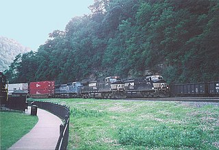
Logan Township is a township in Blair County, Pennsylvania, United States. It is part of the Altoona, PA Metropolitan Statistical Area. It is the most populous township in Blair County, with a population of 12,413 at the 2020 census. Logan Township is home to Horseshoe Curve, a National Historic Landmark.

Snyder Township is a township in Blair County, Pennsylvania, United States. It is part of the Altoona, PA Metropolitan Statistical Area. The population was 3,360 at the 2020 census.

Adams Township in Cambria County, Pennsylvania, United States, is a township that is part of the Johnstown, Pennsylvania Metropolitan Statistical Area. The population was 5,972 at the 2010 census, down from 6,495 at the 2000 census.

Beaverdale is an unincorporated community and census-designated place (CDP) in Cambria County, Pennsylvania, United States. The population was 1,035 at the 2010 census. Prior to that time, the CDP was known as Beaverdale-Lloydell.

Cresson is a borough in Cambria County, Pennsylvania, United States. Cresson is 80 miles (130 km) east of Pittsburgh. It is above 2,000 feet (600 m) in elevation. Lumber, coal, and coke yards were industries that had supported the population, which numbered 1,470 in 1910. The borough is part of the Johnstown Metropolitan Statistical Area, although state and local sources list it as part of the Altoona area due to being much closer to that city. The population of Cresson at the 2010 census was 1,711.

Cresson Township is a township in Cambria County, Pennsylvania, United States. The population was 2,820 at the 2020 census. The township surrounds the boroughs of Cresson and Sankertown but is separate from them. It is part of the Johnstown, Pennsylvania Metropolitan Statistical Area.

Elim is an unincorporated community and census-designated place (CDP) in Upper Yoder Township, Cambria County, Pennsylvania, United States. The population was 3,727 at the 2010 census, down from 4,175 at the 2000 census.

Gallitzin Township is a township in Cambria County, Pennsylvania, United States. The township nearly surrounds, but is a separate entity from, Gallitzin borough. As of the 2010 census, the township population was 1,324. It is part of the Johnstown, Pennsylvania Metropolitan Statistical Area.

Jackson Township is an American township which is located in Cambria County, Pennsylvania. The population was 4,392 at the time of the 2010 census, down from 4,925 at the 2000 census.

Loretto is a borough in Cambria County, Pennsylvania, United States. As of the 2010 census it had a population of 1,302. Like the rest of Cambria County, it is part of the Johnstown, Pennsylvania Metropolitan Statistical Area. Loretto is the home of Saint Francis University.

Portage Township is a township in Cambria County, Pennsylvania, United States. It surrounds the borough of Portage. The township population was 3,640 at the 2010 census. It is part of the Johnstown, Pennsylvania Metropolitan Statistical Area.

Summerhill is a borough in Cambria County, Pennsylvania, United States. The population was 490 at the 2010 census.

Summerhill Township is a township in Cambria County, Pennsylvania, United States. The population was 2,467 at the 2010 census. It is part of the Johnstown, Pennsylvania Metropolitan Statistical Area.

Susquehanna Township is a township in Cambria County, Pennsylvania, United States. The population was 2,007 at the 2010 census. It is part of the Johnstown, Pennsylvania Metropolitan Statistical Area.

Imperial is a census-designated place (CDP) in Allegheny County, Pennsylvania, United States and part of the Pittsburgh metropolitan area. The population was 2,722 at the 2020 census. The CDP is located in North Fayette and Findlay Townships, and geographically close to Pittsburgh International Airport.

St. Michael is an unincorporated community and census-designated place in Cambria County, Pennsylvania, United States. Its ZIP code is 15951. It was formerly part of the St. Michael-Sidman census-designated place in Cambria County, before splitting into two separate CDPs for the 2010 census. As of the 2010 census the population of St. Michael was 408.
The Pennsylvania State Game Lands Number 26 are Pennsylvania State Game Lands in Bedford, Blair, Cambria, and Somerset Counties in Pennsylvania in the United States providing hunting, bird watching, equestrian, snowmobiling, and other activities.

