
Cambria County is a county in the Commonwealth of Pennsylvania. As of the 2020 census, the population was 133,472. Its county seat is Ebensburg. The county was created on March 26, 1804, from parts of Bedford, Huntingdon, and Somerset Counties and later organized in 1807. It was named for the nation of Wales, which in Latin is known as "Cambria".

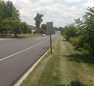
Adams Township in Cambria County, Pennsylvania, United States, is a township that is part of the Johnstown, Pennsylvania Metropolitan Statistical Area. The population was 5,972 at the 2010 census, down from 6,495 at the 2000 census.

Beaverdale is an unincorporated community and census-designated place (CDP) in Cambria County, Pennsylvania, United States. The population was 1,035 at the 2010 census. Prior to that time, the CDP was known as Beaverdale-Lloydell.

Farmington is an unincorporated community and census-designated place in Wharton Township, Fayette County, Pennsylvania, United States.

New Tripoli is an unincorporated community and census-designated place (CDP) in Lynn Township in Lehigh County, Pennsylvania. As of the 2020 census, the population was 840. New Tripoli is part of the Lehigh Valley, which had a population of 861,899 and was the 68th-most populous metropolitan area in the U.S. as of the 2020 census.
Allenport is an unincorporated community and census-designated place (CDP) in Huntingdon County, Pennsylvania, United States. It lies southeast of Mount Union on the Juniata River in Shirley Township. The population was 648 as of the 2010 census.
Hopeland is a small unincorporated hamlet and census-designated place (CDP) in Lancaster County in the south of the U.S. state of Pennsylvania. The hamlet's ZIP code is 17533. As of the 2010 census the population was 738.

Ronks is a small unincorporated farming community and census-designated place (CDP) in East Lampeter Township, Lancaster County, Pennsylvania, United States, just west of Paradise. As of the 2010 census the population was 362.
Cetronia is a census-designated place (CDP) in South Whitehall Township in Lehigh County, Pennsylvania, located near Allentown. As of the 2020 census, its population was 2,421.

Howard is a census-designated place (CDP) and post office in and governed by Fremont County, Colorado, United States. The CDP is a part of the Cañon City, CO Micropolitan Statistical Area. The Howard post office has the ZIP Code 81233. At the United States Census 2020, the population of the Howard CDP was 852.
McConnellstown is a census-designated place in Walker Township, Huntingdon County, Pennsylvania, United States. Due to its long name, the village is often nicknamed "Mactown". The population of McConnellstown was 1,194 as of the 2010 census.

Reinholds is an unincorporated community and census-designated place (CDP) in West Cocalico Township, Lancaster County, Pennsylvania, United States. As of the 2010 census the population was 1,803.

Refton is an unincorporated community and census-designated place (CDP) in Strasburg Township, Lancaster County, Pennsylvania, United States, with a ZIP code of 17560. The community is located along U.S. Route 222. As of the 2010 census, the population was 298.
Clarkrange is an unincorporated community and census-designated place (CDP) in Fentress County, Tennessee, United States. It is concentrated around the intersection of U.S. Route 127 and Tennessee State Route 62, in Tennessee's western Cumberland Plateau region. The 2010 census reported the population of Clarkrange as 575.
Sidman is an unincorporated community and census-designated place in Cambria County, Pennsylvania, United States. Its ZIP code is 15955. It was part of the St. Michael-Sidman census-designated place, before it was split into two separate CDPs during the 2010 census. The population of Sidman as of the 2010 census was 431.
Detmold is an unincorporated community and census-designated place (CDP) in Allegany County, Maryland, United States. As of the 2010 census it had a population of 71.
Verdunville is an unincorporated community and census-designated place (CDP) in Logan County, West Virginia, United States. It is 3.5 miles (5.6 km) west of Logan, the county seat. Verdunville has a post office with ZIP code 25649. The Verdunville CDP includes the neighboring community of Shegon. As of the 2010 census, the total CDP population was 687.
Stollings is an unincorporated community and census-designated place (CDP) in central Logan County, West Virginia, United States. As of the 2010 census, it had a population of 316.

Grimsley is an unincorporated community and census-designated place (CDP) in Fentress County, Tennessee, United States. Its population was 1,167 as of the 2010 census. Its ZIP code is 38565.
Livonia Center is a hamlet and census-designated place (CDP) in the town of Livonia, Livingston County, New York, United States. Its population was 421 as of the 2010 census. Livonia Center has a post office with ZIP code 14488, which opened on April 9, 1811.


