Southmont, Pennsylvania

Last updated
Southmont, Pennsylvania
Borough
King from Dahlia, Southmont.jpg
Houses on King Street
Cambria County Pennsylvania Incorporated and Unincorporated areas Southmont Highlighted.svg
Location of Southmont in Cambria County, Pennsylvania.
Coordinates: 40°18′39″N78°56′02″W / 40.31083°N 78.93389°W / 40.31083; -78.93389
Country United States
State Pennsylvania
County Cambria
Settled1850
Incorporated1919
Government
  TypeBorough council
Area
[1]
  Total1.05 sq mi (2.73 km2)
  Land1.05 sq mi (2.73 km2)
  Water0.00 sq mi (0.00 km2)
Elevation
[2]
1,568 ft (478 m)
Population
 (2020) [3]
  Total2,045
  Density1,943.92/sq mi (750.25/km2)
Time zone UTC-5 (Eastern (EST))
  Summer (DST) UTC-4 (EDT)
Area code 814
FIPS code 42-72344
GNIS feature ID1215035 [2]
Website www.southmontborough.com

Southmont is a borough in Cambria County, Pennsylvania, United States. It is part of the Johnstown, Pennsylvania Metropolitan Statistical Area. The population was 2,284 at the 2010 census. [4] It was incorporated in 1919 out of Upper Yoder Township.

Contents

Geography

Southmont is located in southwestern Cambria County at 40°18′39″N78°56′2″W / 40.31083°N 78.93389°W / 40.31083; -78.93389 (40.310874, -78.934005). [5] It is bordered to the east by the city of Johnstown, to the north by the borough of Westmont, and to the southwest by the unincorporated community of Elim in Upper Yoder Township. Southmont is located on heights rising nearly 600 feet (180 m) above the valley of the Stonycreek River which flows through Johnstown.

According to the United States Census Bureau, the borough has a total area of 1.0 square mile (2.7 km2), all land. [4]

Demographics

Historical population
CensusPop.Note
1920 281
1930 1,925585.1%
1940 2,14611.5%
1950 2,2786.2%
1960 2,85725.4%
1970 2,653−7.1%
1980 2,6831.1%
1990 2,415−10.0%
2000 2,262−6.3%
2010 2,2841.0%
2020 2,045−10.5%
U.S. Decennial Census [6]

As of the census [7] of 2000, there were 2,262 people, 965 households, and 660 families residing in the borough. The population density was 2,151.1 inhabitants per square mile (830.5/km2). There were 1,021 housing units at an average density of 970.9 per square mile (374.9/km2). The racial makeup of the borough was 98.28% White, 0.22% African American, 0.04% Native American, 0.44% Asian, 0.13% from other races, and 0.88% from two or more races. Hispanic or Latino of any race were 0.49% of the population.

There were 965 households, out of which 27.2% had children under the age of 18 living with them, 58.1% were married couples living together, 8.7% had a female householder with no husband present, and 31.6% were non-families. 29.5% of all households were made up of individuals, and 13.6% had someone living alone who was 65 years of age or older. The average household size was 2.32 and the average family size was 2.87.

In the borough the population was spread out, with 22.0% under the age of 18, 4.2% from 18 to 24, 25.5% from 25 to 44, 27.4% from 45 to 64, and 20.9% who were 65 years of age or older. The median age was 44 years. For every 100 females there were 89.3 males. For every 100 females age 18 and over, there were 87.1 males.

The median income for a household in the borough was $38,125, and the median income for a family was $49,297. Males had a median income of $36,553 versus $25,398 for females. The per capita income for the borough was $25,750. About 4.5% of families and 5.2% of the population were below the poverty line, including 7.7% of those under age 18 and 2.7% of those age 65 or over.

Related Research Articles

<span class="mw-page-title-main">Brownstown, Cambria County, Pennsylvania</span> Borough in Pennsylvania, United States

Brownstown is a borough in Cambria County, Pennsylvania, United States. The population was 744 at the 2010 census. It is part of the Johnstown, Pennsylvania Metropolitan Statistical Area and also part of Johnstown's urban area.

<span class="mw-page-title-main">Blacklick Township, Cambria County, Pennsylvania</span> Township in Pennsylvania, United States

Blacklick Township is a township in Cambria County, Pennsylvania, United States. The population was 1,880 at the 2020 census. It is part of the Johnstown, Pennsylvania Metropolitan Statistical Area.

<span class="mw-page-title-main">Cambria Township, Cambria County, Pennsylvania</span> Township in Pennsylvania, United States

Cambria Township is a township in Cambria County, Pennsylvania, United States. The population was 5,781 at the 2020 census. It is part of the Johnstown, Pennsylvania Metropolitan Statistical Area and geographically surrounds the borough of Ebensburg, the Cambria County seat.

<span class="mw-page-title-main">Cassandra, Pennsylvania</span> Borough in Pennsylvania, United States

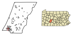
Cassandra is a borough in Cambria County, Pennsylvania, United States. The population was 147 at the 2010 census. It is part of the Johnstown, Pennsylvania Metropolitan Statistical Area.

<span class="mw-page-title-main">Daisytown, Pennsylvania</span> Borough in Pennsylvania, United States

Daisytown is a borough in Cambria County, Pennsylvania, United States. It is part of the Johnstown, Pennsylvania Metropolitan Statistical Area. The population was 326 at the 2010 census.

<span class="mw-page-title-main">Dale, Pennsylvania</span> Borough in Pennsylvania, United States

Dale is a borough in Cambria County, Pennsylvania, United States. It is part of the Johnstown, Pennsylvania Metropolitan Statistical Area. The population was 1,234 at the 2010 census, down from 1,503 at the 2000 census.

<span class="mw-page-title-main">East Conemaugh, Pennsylvania</span> Borough in Pennsylvania, United States

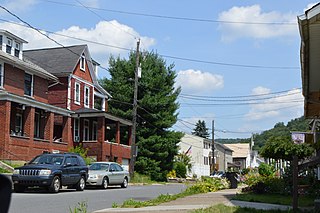
East Conemaugh is a borough in Cambria County, Pennsylvania, United States. It is part of the Johnstown, Pennsylvania Metropolitan Statistical Area. The population was 1,220 at the 2010 census.

<span class="mw-page-title-main">Elder Township, Cambria County, Pennsylvania</span> Township in Pennsylvania, United States

Elder Township is a township in Cambria County, Pennsylvania, United States, about 24 miles (39 km) northwest of Altoona. As of the 2010 census, the township had a population of 1,038. It is part of the Johnstown, Pennsylvania Metropolitan Statistical Area.

<span class="mw-page-title-main">Elim, Pennsylvania</span> Census-designated place in Pennsylvania, United States

Elim is an unincorporated community and census-designated place (CDP) in Upper Yoder Township, Cambria County, Pennsylvania, United States. The population was 3,727 at the 2010 census, down from 4,175 at the 2000 census.

<span class="mw-page-title-main">Ferndale, Pennsylvania</span> Borough in Pennsylvania, United States

Ferndale is a borough in Cambria County, Pennsylvania, United States. It is part of the Johnstown, Pennsylvania Metropolitan Statistical Area. The population was 1,636 at the 2010 census, down from 1,834 at the 2000 census.

<span class="mw-page-title-main">Geistown, Pennsylvania</span> Borough in Pennsylvania, United States

Geistown is a borough in Cambria County, Pennsylvania, United States. It is part of the Johnstown, Pennsylvania Metropolitan Statistical Area. The population was 2,467 at the 2010 census.

<span class="mw-page-title-main">Loretto, Pennsylvania</span> Borough in Pennsylvania, United States

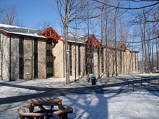
Loretto is a borough in Cambria County, Pennsylvania, United States. As of the 2010 census it had a population of 1,302. Like the rest of Cambria County, it is part of the Johnstown, Pennsylvania Metropolitan Statistical Area. Loretto is the home of Saint Francis University.

<span class="mw-page-title-main">Lower Yoder Township, Cambria County, Pennsylvania</span> Township in Pennsylvania, United States

Lower Yoder Township is a township in Cambria County, Pennsylvania, United States. The population was 2,699 at the 2010 census, down from 3,029 at the 2000 census. It is part of the Johnstown, Pennsylvania Metropolitan Statistical Area.

<span class="mw-page-title-main">Portage Township, Cambria County, Pennsylvania</span> Township in Pennsylvania, United States

Portage Township is a township in Cambria County, Pennsylvania, United States. It surrounds the borough of Portage. The township population was 3,640 at the 2010 census. It is part of the Johnstown, Pennsylvania Metropolitan Statistical Area.

<span class="mw-page-title-main">Richland Township, Cambria County, Pennsylvania</span> Township in Pennsylvania, United States

Richland Township is a township in Cambria County, Pennsylvania, United States. The population was 12,814 at the 2010 census. It is part of the Johnstown, Pennsylvania Metropolitan Statistical Area.

<span class="mw-page-title-main">Upper Yoder Township, Cambria County, Pennsylvania</span> Township in Pennsylvania, United States

Upper Yoder Township is a township in Cambria County, Pennsylvania, United States. The population was 5,449 at the 2010 census. It is part of the Johnstown, Pennsylvania Metropolitan Statistical Area.

<span class="mw-page-title-main">Vintondale, Pennsylvania</span> Borough in Pennsylvania, United States

Vintondale is a borough in Cambria County, Pennsylvania, United States. It is part of the Johnstown, Pennsylvania Metropolitan Statistical Area. The population was 414 as of the 2010 census.

<span class="mw-page-title-main">Westmont, Pennsylvania</span> Place in Pennsylvania, United States

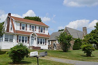
Westmont is a borough in Cambria County, Pennsylvania, United States. It is part of the Johnstown, Pennsylvania Metropolitan Statistical Area. The population was 5,181 at the 2010 census, down from 5,523 at the 2000 census.

<span class="mw-page-title-main">Westmont Hilltop School District</span> School district in Pennsylvania

The Westmont Hilltop School District is a small public school district located in Cambria County, Pennsylvania. The WHSD encompasses approximately 15 square miles (39 km2). It serves the communities of: Upper Yoder Township, Westmont Borough, and Southmont Borough in the western suburbs of Johnstown, Pennsylvania. According to 2000 federal census data, it served a resident population of 13,647. By 2010, the district's population declined to 12,898 people. The educational attainment levels for the Westmont Hilltop School District population were 96.5% high school graduates and 37% college graduates. The district is one of the 500 public school districts of Pennsylvania.

<span class="mw-page-title-main">Franklin, Cambria County, Pennsylvania</span> Borough in Pennsylvania, United States

Franklin is a borough in Cambria County, Pennsylvania, United States. It is part of the Johnstown, Pennsylvania Metropolitan Statistical Area. At the 2010 census the borough population was 323, down from 442 at the 2000 census.

References

  1. "ArcGIS REST Services Directory". United States Census Bureau. Retrieved October 16, 2022.
  2. 1 2 U.S. Geological Survey Geographic Names Information System: Southmont, Pennsylvania
  3. "Census Population API". United States Census Bureau. Retrieved Oct 12, 2022.
  4. 1 2 "Geographic Identifiers: 2010 Demographic Profile Data (G001): Southmont borough, Pennsylvania". U.S. Census Bureau, American Factfinder. Archived from the original on March 19, 2015. Retrieved March 19, 2015.
  5. "US Gazetteer files: 2010, 2000, and 1990". United States Census Bureau. 2011-02-12. Retrieved 2011-04-23.
  6. "Census of Population and Housing". Census.gov. Retrieved June 4, 2016.
  7. "U.S. Census website". United States Census Bureau . Retrieved 2008-01-31.