Hastings, Pennsylvania

Last updated
Hastings, Pennsylvania
Borough
Motto: 
Always Help others
Cambria County Pennsylvania Incorporated and Unincorporated areas Hastings Highlighted.svg
Location of Hastings in Cambria County, Pennsylvania.
USA Pennsylvania location map.svg
Red pog.svg
Hastings
Coordinates: 40°39′56″N78°42′43″W / 40.66556°N 78.71194°W / 40.66556; -78.71194
Country United States
State Pennsylvania
County Cambria
Settled1889
Incorporated1894
Government
  TypeBorough council
Area
[1]
  Total0.56 sq mi (1.46 km2)
  Land0.56 sq mi (1.46 km2)
  Water0.00 sq mi (0.00 km2)
Elevation
[2]
1,745 ft (532 m)
Population
 (2020) [3]
  Total1,213
  Density2,154.53/sq mi (831.98/km2)
Time zone UTC-5 (Eastern (EST))
  Summer (DST) UTC-4 (EDT)
ZIP code
16646
Area code 814
FIPS code 42-33080
GNIS feature ID1215024 [2]
Website hastingsborough.com

Hastings is a borough in Cambria County, Pennsylvania, United States. It is part of the Johnstown, Pennsylvania Metropolitan Statistical Area. The population was 1,278 at the 2010 census. [4]

Contents

Geography

Hastings is located in northwestern Cambria County at 40°39′56″N78°42′43″W / 40.66556°N 78.71194°W / 40.66556; -78.71194 (40.665473, -78.711903). [5] It is in the valley of Brubaker Run, a tributary of Chest Creek, which in turn flows northward to the West Branch Susquehanna River. Hastings is 13 miles (21 km) north of Ebensburg, the Cambria County Seat, 24 miles (39 km) northwest of Altoona, and 31 miles (50 km) northeast of Johnstown.

According to the United States Census Bureau, Hastings has a total area of 0.56 square miles (1.44 km2), all land. [4]

Demographics

Historical population
CensusPop.Note
1890 1,070
1900 1,62151.5%
1910 2,12531.1%
1920 2,2927.9%
1930 2,011−12.3%
1940 2,1054.7%
1950 1,846−12.3%
1960 1,751−5.1%
1970 1,7912.3%
1980 1,574−12.1%
1990 1,431−9.1%
2000 1,398−2.3%
2010 1,278−8.6%
2020 1,213−5.1%
Sources: [6] [7] [8] [3]

As of the census [7] of 2000, there were 1,398 people, 557 households, and 382 families residing in the borough. The population density was 2,484.1 inhabitants per square mile (959.1/km2). There were 603 housing units at an average density of 1,071.5 per square mile (413.7/km2). The racial makeup of the borough was 99.43% White, 0.07% Native American, 0.14% Asian, 0.29% from other races, and 0.07% from two or more races. Hispanic or Latino of any race were 0.64% of the population.

There were 557 households, out of which 29.1% had children under the age of 18 living with them, 51.3% were married couples living together, 13.5% had a female householder with no husband present, and 31.4% were non-families. 29.8% of all households were made up of individuals, and 17.1% had someone living alone who was 65 years of age or older. The average household size was 2.37 and the average family size was 2.92.

In the borough the population was spread out, with 21.2% under the age of 18, 8.2% from 18 to 24, 24.8% from 25 to 44, 20.7% from 45 to 64, and 25.1% who were 65 years of age or older. The median age was 42 years. For every 100 females there were 85.4 males. For every 100 females age 18 and over, there were 80.8 males.

The median income for a household in the borough was $25,192, and the median income for a family was $33,462. Males had a median income of $28,125 versus $16,786 for females. The per capita income for the borough was $13,429. About 10.4% of families and 13.1% of the population were below the poverty line, including 18.0% of those under age 18 and 10.3% of those age 65 or over.

Notable people

Related Research Articles

<span class="mw-page-title-main">Brownstown, Cambria County, Pennsylvania</span> Borough in Pennsylvania, United States

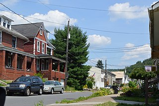
Brownstown is a borough in Cambria County, Pennsylvania, United States. The population was 744 at the 2010 census. It is part of the Johnstown, Pennsylvania Metropolitan Statistical Area and also part of Johnstown's urban area.

<span class="mw-page-title-main">Blacklick Township, Cambria County, Pennsylvania</span> Township in Pennsylvania, United States

Blacklick Township is a township in Cambria County, Pennsylvania, United States. The population was 1,880 at the 2020 census. It is part of the Johnstown, Pennsylvania Metropolitan Statistical Area.

<span class="mw-page-title-main">Cambria Township, Cambria County, Pennsylvania</span> Township in Pennsylvania, United States

Cambria Township is a township in Cambria County, Pennsylvania, United States. The population was 5,781 at the 2020 census. It is part of the Johnstown, Pennsylvania Metropolitan Statistical Area and geographically surrounds the borough of Ebensburg, the Cambria County seat.

<span class="mw-page-title-main">Conemaugh Township, Cambria County, Pennsylvania</span> Township in Pennsylvania, United States

Conemaugh Township is a township in Cambria County, Pennsylvania, United States. The population was 1,943 at the 2020 census. It is part of the Johnstown, Pennsylvania Metropolitan Statistical Area.

<span class="mw-page-title-main">Daisytown, Pennsylvania</span> Borough in Pennsylvania, United States

Daisytown is a borough in Cambria County, Pennsylvania, United States. It is part of the Johnstown, Pennsylvania Metropolitan Statistical Area. The population was 326 at the 2010 census.

<span class="mw-page-title-main">Dale, Pennsylvania</span> Borough in Pennsylvania, United States

Dale is a borough in Cambria County, Pennsylvania, United States. It is part of the Johnstown, Pennsylvania Metropolitan Statistical Area. The population was 1,234 at the 2010 census, down from 1,503 at the 2000 census.

<span class="mw-page-title-main">East Conemaugh, Pennsylvania</span> Borough in Pennsylvania, United States

East Conemaugh is a borough in Cambria County, Pennsylvania, United States. It is part of the Johnstown, Pennsylvania Metropolitan Statistical Area. The population was 1,220 at the 2010 census.

<span class="mw-page-title-main">Ehrenfeld, Pennsylvania</span> Borough in Pennsylvania, United States

Ehrenfeld is a borough in Cambria County, Pennsylvania, United States. It is part of the Johnstown, Pennsylvania Metropolitan Statistical Area. The population was 228 at the 2010 census.

<span class="mw-page-title-main">Elder Township, Cambria County, Pennsylvania</span> Township in Pennsylvania, United States

Elder Township is a township in Cambria County, Pennsylvania, United States, about 24 miles (39 km) northwest of Altoona. As of the 2010 census, the township had a population of 1,038. It is part of the Johnstown, Pennsylvania Metropolitan Statistical Area.

<span class="mw-page-title-main">Ferndale, Pennsylvania</span> Borough in Pennsylvania, United States

Ferndale is a borough in Cambria County, Pennsylvania, United States. It is part of the Johnstown, Pennsylvania Metropolitan Statistical Area. The population was 1,636 at the 2010 census, down from 1,834 at the 2000 census.

<span class="mw-page-title-main">Geistown, Pennsylvania</span> Borough in Pennsylvania, United States

Geistown is a borough in Cambria County, Pennsylvania, United States. It is part of the Johnstown, Pennsylvania Metropolitan Statistical Area. The population was 2,467 at the 2010 census.

<span class="mw-page-title-main">Lorain, Pennsylvania</span> Borough in Pennsylvania, United States

Lorain is a borough in Cambria County, Pennsylvania, United States. It is part of the Johnstown, Pennsylvania Metropolitan Statistical Area. The population was 759 at the 2010 census.

<span class="mw-page-title-main">Loretto, Pennsylvania</span> Borough in Pennsylvania, United States

Loretto is a borough in Cambria County, Pennsylvania, United States. As of the 2010 census it had a population of 1,302. Like the rest of Cambria County, it is part of the Johnstown, Pennsylvania Metropolitan Statistical Area. Loretto is the home of Saint Francis University.

<span class="mw-page-title-main">Lower Yoder Township, Pennsylvania</span> Township in Pennsylvania, United States

Lower Yoder Township is a township in Cambria County, Pennsylvania, United States. The population was 2,699 at the 2010 census, down from 3,029 at the 2000 census. It is part of the Johnstown, Pennsylvania Metropolitan Statistical Area.

<span class="mw-page-title-main">Richland Township, Cambria County, Pennsylvania</span> Township in Pennsylvania, United States

Richland Township is a township in Cambria County, Pennsylvania, United States. The population was 12,814 at the 2010 census. It is part of the Johnstown, Pennsylvania Metropolitan Statistical Area.

<span class="mw-page-title-main">South Fork, Pennsylvania</span> Borough in Pennsylvania, United States

South Fork is a borough in Cambria County, Pennsylvania, United States. It is part of the Johnstown, Pennsylvania Metropolitan Statistical Area. The population was 928 at the 2010 census, down from 1,138 at the 2000 census.

<span class="mw-page-title-main">Southmont, Pennsylvania</span> Borough in Pennsylvania, United States

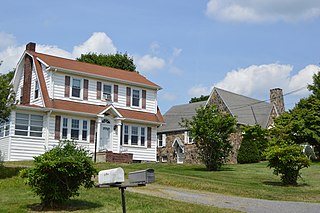
Southmont is a borough in Cambria County, Pennsylvania, United States. It is part of the Johnstown, Pennsylvania Metropolitan Statistical Area. The population was 2,284 at the 2010 census. It was incorporated in 1919 out of Upper Yoder Township.

<span class="mw-page-title-main">Susquehanna Township, Cambria County, Pennsylvania</span> Township in Pennsylvania, United States

Susquehanna Township is a township in Cambria County, Pennsylvania, United States. The population was 2,007 at the 2010 census. It is part of the Johnstown, Pennsylvania Metropolitan Statistical Area.

<span class="mw-page-title-main">Upper Yoder Township, Pennsylvania</span> Township in Pennsylvania, United States

Upper Yoder Township is a township in Cambria County, Pennsylvania, United States. The population was 5,449 at the 2010 census. It is part of the Johnstown, Pennsylvania Metropolitan Statistical Area.

<span class="mw-page-title-main">Franklin, Cambria County, Pennsylvania</span> Borough in Pennsylvania, United States

Franklin is a borough in Cambria County, Pennsylvania, United States. It is part of the Johnstown, Pennsylvania Metropolitan Statistical Area. At the 2010 census the borough population was 323, down from 442 at the 2000 census.

References

  1. "ArcGIS REST Services Directory". United States Census Bureau. Retrieved October 12, 2022.
  2. 1 2 U.S. Geological Survey Geographic Names Information System: Hastings, Pennsylvania
  3. 1 2 "Census Population API". United States Census Bureau. Retrieved Oct 12, 2022.
  4. 1 2 "Geographic Identifiers: 2010 Demographic Profile Data (G001): Hastings borough, Pennsylvania". U.S. Census Bureau, American Factfinder. Archived from the original on March 16, 2015. Retrieved March 15, 2015.
  5. "US Gazetteer files: 2010, 2000, and 1990". United States Census Bureau. 2011-02-12. Retrieved 2011-04-23.
  6. "Census of Population and Housing". U.S. Census Bureau. Retrieved 11 December 2013.
  7. 1 2 "U.S. Census website". United States Census Bureau . Retrieved 2008-01-31.
  8. "Incorporated Places and Minor Civil Divisions Datasets: Subcounty Resident Population Estimates: April 1, 2010 to July 1, 2012". Population Estimates. U.S. Census Bureau. Archived from the original on 11 June 2013. Retrieved 11 December 2013.

Founded 1889.