2020 census
As of the 2020 census, there were 3,978 people, 1,516 households, and 1,106 families residing in Castle Hills. The median age was 48.4 years; 19.5% of residents were under the age of 18 and 25.5% of residents were 65 years of age or older. For every 100 females there were 96.1 males, and for every 100 females age 18 and over there were 94.4 males age 18 and over. [7]
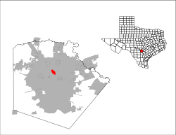
100.0% of residents lived in urban areas, while 0% lived in rural areas. [8]
Of the 1,516 households in Castle Hills, 30.5% had children under the age of 18 living in them. Of all households, 59.4% were married-couple households, 14.5% were households with a male householder and no spouse or partner present, and 21.6% were households with a female householder and no spouse or partner present. About 20.4% of all households were made up of individuals and 12.6% had someone living alone who was 65 years of age or older. [7]
There were 1,847 housing units, of which 17.9% were vacant. Among occupied housing units, 88.9% were owner-occupied and 11.1% were renter-occupied. The homeowner vacancy rate was 1.4% and the rental vacancy rate was 29.8%. [7]
2010 census
As of the census [3] of 2010, there were 4,116 people, 1,887 households, and 1,124 families residing in the city. There were 2,047 housing units. The racial makeup of the city was 90.5% White, 1.0% African American, 0.3% Native American, 1.7% Asian, 4.8% from other races, and 1.7% from two or more races. 38.9% of the population were Hispanic or Latino of any race, with the majority being Mexican American. [3]
There were 1,877 households, out of which 18.0% had children under the age of 18 living with them, 49.0% were married couples living together, 7.8% had a female householder with no husband present, and 40.4% were non-families. 35.8% of all households were made up of individuals, and 26.3% had someone living alone who was 65 years of age or older. The average household size was 2.18 and the average family size was 2.83. [3]
In the city, the population was spread out, with 17.1% under the age of 18, 4.8% from 18 to 24, 15.2% from 25 to 44, 30.0% from 45 to 64, and 32.8% who were 65 years of age or older. The median age was 54 years. [3]
The median income for a household in the city was $69,637, and the median income for a family was $104,716. Males had a median income of $59,911 versus $36,676 for females. The per capita income for the city was $49,137. 5.9% of the population and 4.2% of families were below the poverty line. Out of the total population, none of those under the age of 18 and 11.8% of those 65 and older were living below the poverty line. [3]