Staples, Texas

Last updated

Staples, Texas
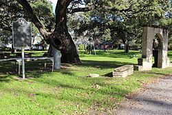
Staples-tx2016-13(camp-clark-CSA).jpg
USA Texas location map.svg
Red pog.svg
Staples
Usa edcp location map.svg
Red pog.svg
Staples
Coordinates: 29°46′53″N97°50′10″W / 29.78139°N 97.83611°W / 29.78139; -97.83611
Country United States
State Texas
County Guadalupe
Incorporated2008
Area
[1]
  Total1.50 sq mi (3.89 km2)
  Land1.50 sq mi (3.88 km2)
  Water0.00 sq mi (0.01 km2)
Elevation
522 ft (159 m)
Population
 (2020)
  Total193
ZIP code
78670
Area code(s) 210, 726 (planned)
FIPS code 48-70052
GNIS feature ID1369103
Website www.cityofstaples.com

Staples is a city in northeastern Guadalupe County, Texas, United States. In an election held on May 10, 2008, its residents voted to incorporate the community as a city. A total of 125 votes were cast, with 87 (69.6%) in favor of incorporation and 38 (30.4%) against. [2] [3] The population is approximately 220 [4] and it is part of the San Antonio Metropolitan Statistical Area.

Contents

The city held its first municipal election on November 4, 2008. Eddie Daffern, an organizer of the incorporation effort, was elected unopposed as Mayor. A total of seven candidates ran for the five Alderman positions. [5] Those elected include Carol Wester, who received 70 votes, followed by Ronnie Clark with 67 votes, Bert "Bubba" Reinke and William A. York—both winning 52 votes, and Shaun Seale with 40. [6]

As of the 2020 census, Staples had a population of 193, [7] along with a barber shop, two beauty shops, and a cafe. [8]

Geography

Staples is located in northeastern Guadalupe County, just west of the San Marcos River, which forms the border with Caldwell County. It is 11 miles (18 km) southeast of San Marcos, 21 miles (34 km) northeast of Seguin, the Guadalupe County seat, 16 miles (26 km) northwest of Luling, and 16 miles southwest of Lockhart. Texas State Highway 130 runs through the southern part of Staples, providing a new freeway route between Austin, 41 miles (66 km) to the north, and San Antonio, 56 miles (90 km) to the southwest.

According to the U.S. Census Bureau, the city of Staples has a total area of 1.5 square miles (3.9 km2), of which 0.004 square miles (0.01 km2), or 0.30%, are water. [9]

Demographics

Historical population
CensusPop.Note
1870 30
1880 4550.0%
1890 125177.8%
1900 15020.0%
1920 120
1930 100−16.7%
1940 250150.0%
1950 150−40.0%
1960 140−6.7%
1970 70−50.0%
1980 65−7.1%
1990 7515.4%
2000 350366.7%
2010 267−23.7%
2020 193−27.7%
U.S. Decennial Census [10]

Education

Students living in Staples are zoned to schools in the San Marcos Consolidated Independent School District.

Related Research Articles

<span class="mw-page-title-main">Hays County, Texas</span> County in Texas, United States

Hays County is a county in the cental portion of the U.S. state of Texas. It is part of the Austin-Round Rock metropolitan area. As of the 2020 census, its official population had reached 241,067. The county seat is San Marcos. Hays, along with Comal and Kendall Counties, was listed in 2017 as one of the nation's fastest-growing counties with a population of at least 10,000. From 2015 to 2016, Hays County, third on the national list, had nearly 10,000 new residents during the year.

<span class="mw-page-title-main">Guadalupe County, Texas</span> County in Texas, United States

Guadalupe County is a county located in the U.S. state of Texas. As of the 2020 census, its population was 172,706. The county seat is Seguin. The county was founded in 1846 and is named after Guadalupe River.

<span class="mw-page-title-main">Gonzales County, Texas</span> County in Texas, United States

Gonzales County is a county in the U.S. state of Texas, adjacent to Greater Austin-San Antonio. As of the 2020 census, its population was 19,653. The county is named for its county seat, the city of Gonzales. The county was created in 1836 and organized the following year. As of August 2020, under strict budgetary limitations, the County of Gonzales government-body is unique in that it claims to have no commercial paper, regarding it as "the absence of any county debt."

<span class="mw-page-title-main">Luling, Texas</span> City in Texas, United States

Luling is a city in Caldwell and Guadalupe counties, Texas, United States, along the San Marcos River. The population as of the 2020 census was 5,599.

<span class="mw-page-title-main">Goliad, Texas</span> City in Texas, United States

Goliad is a city in Goliad County, Texas, United States. It is known for the 1836 Goliad massacre during the Texas Revolution. It had a population of 1,620 at the 2020 census. Founded on the San Antonio River, it is the county seat of Goliad County. It is part of the Victoria, Texas, Metropolitan Statistical Area.

<span class="mw-page-title-main">Geronimo, Texas</span> Census-designated place in Texas, United States

Geronimo is an unincorporated community and census-designated place (CDP) in Guadalupe County, Texas, United States. The population was 1,032 at the 2010 census, up from 619 at the 2000 census. It is part of the San Antonio Metropolitan Statistical Area.

<span class="mw-page-title-main">Kingsbury, Texas</span> City in Texas, United States

Kingsbury is a city in eastern Guadalupe County, Texas, United States. Kingsbury was a Census-designated place in 2010, when the census reported a population of 782. It is part of the San Antonio Metropolitan Statistical Area. The election to incorporate Kingsbury into a Type-C Liberty City passed by a landslide vote of 66–2 on May 9, 2015 and the Order to declare Kingsbury a municipality was signed by County Judge Kyle Kutscher on May 19, 2015.

<span class="mw-page-title-main">Marion, Texas</span> City in Texas, United States

Marion is a city in Guadalupe County, Texas, United States. The town was incorporated by 1941. The population was 1,034 at the 2020 census. It is part of the San Antonio Metropolitan Statistical Area.

<span class="mw-page-title-main">McQueeney, Texas</span> Census-designated place in Texas, United States

McQueeney is an unincorporated community and census-designated place (CDP) in Guadalupe County, Texas, United States. The population was 2,545 at the 2010 census. It is part of the San Antonio Metropolitan Statistical Area.

<span class="mw-page-title-main">New Berlin, Texas</span> City in Texas, United States

New Berlin is a city in Guadalupe County, Texas, United States. The population was 511 at the 2010 census. New Berlin is a German-Texan town settled by German emigrants in the 1800s as a farming community. New Berlin is named after Berlin, Germany and boasts many residents being descendants of the original German founders.

<span class="mw-page-title-main">Redwood, Texas</span> Unincorporated community in Texas, United States

Redwood is an unincorporated community and census-designated place (CDP) in Guadalupe County, Texas, United States. The population was 4,003 at the 2020 census, down from 4,338 at the 2010 census. It is part of the San Antonio Metropolitan Statistical Area.

<span class="mw-page-title-main">Santa Clara, Texas</span> City in Texas, United States

Santa Clara is a city in Guadalupe County, Texas, United States. The population was 725 at the 2010 census, down from 889 at the 2000 census. It is part of the San Antonio Metropolitan Statistical Area.

<span class="mw-page-title-main">Seguin, Texas</span> City in Texas, United States

Seguin is a city in and the county seat of Guadalupe County, Texas, United States; as of the 2020 census, its population was 29,433. Its economy is primarily supported by a regional hospital, as well as the Schertz-Seguin Local Government Corporation water-utility, that supplies the surrounding Greater San Antonio areas from nearby aquifers as far as Gonzales County. Several dams in the surrounding area are governed by the main offices of the Guadalupe-Blanco River Authority, headquartered in downtown Seguin.

<span class="mw-page-title-main">Zuehl, Texas</span> Census-designated place in Texas, United States

Zuehl is an unincorporated area and census-designated place in western Guadalupe County, Texas, United States. It is part of the San Antonio Metropolitan Statistical Area. Located on Cibolo Creek, it lies 13 miles (21 km) southwest of Seguin. The population was 362 at the 2010 census.

<span class="mw-page-title-main">Cibolo, Texas</span> City in Texas, United States

Cibolo is a city in Guadalupe County, Texas, United States. It is part of the San Antonio–New Braunfels metropolitan statistical area. Cibolo voted to become an independent township on October 9, 1965. As of the 2020 census, Cibolo had a population of 32,276, up from 15,349 at the 2010 census.

<span class="mw-page-title-main">Greater San Antonio</span> Metropolitan area in Texas, United States

Greater San Antonio, officially designated San Antonio–New Braunfels, is an eight-county metropolitan area in the U.S. state of Texas defined by the Office of Management and Budget (OMB). The metropolitan area straddles South Texas and Central Texas and is on the southwestern corner of the Texas Triangle. The official 2020 U.S. census showed the metropolitan area's population at 2,558,143—up from a reported 1,711,103 in 2000—making it the 24th largest metropolitan area in the United States. Austin–Round Rock lies about 80 mi (130 km) northeast of Greater San Antonio.

<span class="mw-page-title-main">KWED</span> Radio station in Seguin, Texas

KWED is a radio station in Seguin, Texas broadcasting a full service country music format. It is currently owned by Guadalupe Media, Ltd. Programming is sourced from Premiere Networks and Westwood One, along with news and weather updates every hour from CBS News Radio and an in-house news staff. KWED also operates an online newspaper, Seguin Daily News, produced by the news staff every business day and available for free on the station's website.

<span class="mw-page-title-main">Leesville, Texas</span> Unincorporated City

Leesville is an unincorporated city of 384 residents distributed over 51 square miles in the Gonzales—Guadalupe County area in Texas, United States, electorally known as local Precinct 13; defined by the south of its Capote Hills at the "Leesville Quad" intersection and the north of Sandies Creek, twelve miles southeast of Seguin. Beginning in the 19th-century, the municipal identity of Leesville was founded upon being one of the first Justice of the Peace Precincts of its original county-area, as prescribed in the Texas Constitution; as well as once generally serving as the primary seat of a former Texas House District 90, once rated at more than 1,000 constituents. Straddling and nearing the southeastern border of Guadalupe County, the real estate origins of Leesville go back to the 1800s survey-plots of Texas Revolution figures Ezekiel Wimberly Cullen and Count Joseph de la Baume of France ; the latter retaining Texas's founding father Stephen F. Austin as an attorney, to reacquire the early-1800s Spanish land-tract, after Mexico's Independence from Spain in 1825. Divided by Farm to Market Road 1682 joining with Gonzales—Guadalupe County Road 121 West, Leesville's northern territory is closest to the Austin Metropolitan Areas through Texas State Highway 80 / U.S. Route 183 in Texas, while the southern territory is closest to the San Antonio Metropolitan Areas through Texas State Highway 97 / U.S. Route 87 in Texas.

<span class="mw-page-title-main">Belmont, Texas</span> Unincorporated area in Gonzales County, Texas

Belmont, officially known as the "Belmont Site," is an unincorporated area of approximately 40 square miles in extreme western Gonzales County adjacent to Greater Austin, north of the "Belmont intersection" at the “Leesville Quad” water-testing site, electorally known as local Precinct 5. The population of Belmont-proper has been rated at 36 employees, with the greater area rated at 1,169 residents. The area is defined by the limits of the northern and western county line, bordered by the significant 1800s land grants of Eliza Dewitt, Ira Nash, Samuel Robbins and Thomas Decrew. It is served by the Belmont Volunteer Fire Department.

Lake Dunlap is a census-designated place in Guadalupe County, Texas, United States. The population was 1,934 at the 2010 census. It is part of the San Antonio–New Braunfels metropolitan area.

References

  1. "2019 U.S. Gazetteer Files". United States Census Bureau. Retrieved August 7, 2020.
  2. "Voters in Staples opt to become new city". Seguin Gazette-Enterprise. May 10, 2008. Retrieved June 1, 2008.[ permanent dead link ]
  3. "May 10, 2008 Staples Election" (PDF). Guadalupe County, Texas Elections Office. May 19, 2008. Retrieved June 1, 2008.[ dead link ]
  4. "Welcome to the city of Staples?". Seguin Gazette-Enterprise. February 29, 2008. Retrieved June 1, 2008.[ permanent dead link ]
  5. "First council for new city looking forward". Seguin Gazette-Enterprise. November 6, 2008. Retrieved November 12, 2008.[ permanent dead link ]
  6. "November 4, 2008 Staples Special Election" (PDF). Guadalupe County, Texas Elections Office. November 5, 2008. Retrieved November 12, 2008.[ dead link ]
  7. "Staples Demographics - Get Current Census Data for Staples, TX". www.texas-demographics.com. Retrieved September 26, 2023.
  8. Staples at TSHA Online
  9. "Geographic Identifiers: 2010 Demographic Profile Data (G001): Staples city, Texas". U.S. Census Bureau, American Factfinder. Retrieved March 27, 2017.[ dead link ]
  10. "Census of Population and Housing". Census.gov. Retrieved June 4, 2015.

29°46′53″N97°50′10″W / 29.78139°N 97.83611°W / 29.78139; -97.83611