Windcrest, Texas

Last updated

Windcrest, Texas
Nickname: 
City of Lights
TXMap-doton-Windcrest.PNG
Location of Windcrest, Texas
Bexar Windcrest.svg
Coordinates: 29°30′57″N98°22′47″W / 29.51583°N 98.37972°W / 29.51583; -98.37972
Country United States
State Texas
County Bexar
Government
  Type Council-Manager
   City Council Mayor Dan Reese
Wes Manning
Cindy Strzelecki, Mayor Pro Tem
Greg Turner

Marcus Yax
Adam Astleford
   City Manager Rafael Castillo
Area
[1]
  Total2.15 sq mi (5.58 km2)
  Land2.15 sq mi (5.57 km2)
  Water0.01 sq mi (0.01 km2)
Elevation
[2]
791 ft (241 m)
Population
 (2020)
  Total5,865
  Density2,733.02/sq mi (1,055.37/km2)
Time zone UTC-6 (Central (CST))
  Summer (DST) UTC-5 (CDT)
ZIP code
78239
Area code(s) 210, 726 (planned)
FIPS code 48-79672 [3]
GNIS feature ID1350289 [2]
ANSI Code2412280 [4]
Website www.ci.windcrest.tx.us

Windcrest is a city in Bexar County, Texas, United States. Its population was 5,865 at the 2020 census. [5] It is part of the San Antonio metropolitan area.

Contents

Geography

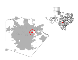
Windcrest is located in northeastern Bexar County. It is bordered to the north, west, and south by San Antonio and to the east by unincorporated neighborhoods in Bexar County. It is 11 miles (18 km) northeast of downtown San Antonio.

According to the United States Census Bureau, it has a total area of 2.2 square miles (5.6 km2), of which 0.004 square miles (0.01 km2), or 0.23%, is water. [5]

Demographics

Historical population
CensusPop.Note
1960 441
1970 3,371664.4%
1980 5,33258.2%
1990 5,3310.0%
2000 5,105−4.2%
2010 5,3645.1%
2020 5,8659.3%
U.S. Decennial Census [6]
Windcrest racial composition as of 2020 [7]
(NH = Non-Hispanic) [lower-alpha 1]
RaceNumberPercentage
White (NH)2,68145.71%
Black or African American (NH)66911.41%
Native American or Alaska Native (NH)210.36%
Asian (NH)2364.02%
Pacific Islander (NH)80.14%
Some Other Race (NH)210.36%
Mixed/Multi-Racial (NH)1933.29%
Hispanic or Latino 2,03634.71%
Total5,865

As of the 2020 United States census, there were 5,865 people, 1,903 households, and 1,317 families residing in the city.

As of the census [3] of 2000, 5,105 people, 2,232 households, and 1,618 families were residing in the city. The population density was 2,808.9 inhabitants per square mile (1,084.5/km2). The 2,297 housing units averaged 1,263.9 per square mile (487.3/km2). The racial makeup of the city was 79.00% White, 8.23% African American, 0.31% Native American, 7.10% Asian, 0.20% Pacific Islander, 3.80% from other races, and 1.37% from two or more races. Hispanics or Latinos of any race were 14.93% of the population.

Of the 2,232 households, 16.8% had children under the age of 18 living with them, 62.5% were married couples living together, 8.0% had a female householder with no husband present, and 27.5% were not families. About 24.1% of all households were made up of individuals, and 16.2% had someone living alone who was 65 years of age or older. The average household size was 2.23, and the average family size was 2.59.

In the city, the age distribution was 14.6% under 18, 5.0% from 18 to 24, 15.9% from 25 to 44, 28.0% from 45 to 64, and 36.6% who were 65 or older. The median age was 56 years. For every 100 females, there were 84.3 males. For every 100 females age 18 and over, there were 81.7 males.

The median income for a household in the city was $60,596, and for a family was $69,156. Males had a median income of $38,545 versus $32,457 for females. The per capita income for the city was $30,120. About 4.6% of families and 6.5% of the population were below the poverty line, including 19.7% of those under age 18 and 0.4% of those age 65 or over.

Education

The city is served by North East Independent School District. [10] Windcrest Elementary School in Windcrest, [11] Ed White Middle School in San Antonio, [12] and Roosevelt High School in San Antonio serve it. [13]

Related Research Articles

<span class="mw-page-title-main">Medina County, Texas</span> County in Texas, United States

Medina County is a county located in the U.S. state of Texas. As of the 2020 census, its population was 50,748. Its county seat is Hondo. The county is named for the Medina River. The extreme northern part of the county lies within the Edwards Plateau, which elevates into the Texas Hill Country. The Medina Dam, the fourth largest in the nation when completed in 1913, is listed on the National Register of Historic Places. The irrigation project, creating Medina Lake, was built by 1500 skilled workers who worked in shifts operating 24 hours a day to complete the dam in two years. Medina County is part of the San Antonio, TX Metropolitan Statistical Area.

<span class="mw-page-title-main">Bexar County, Texas</span> County in Texas, United States

Bexar County is a county in the U.S. state of Texas. It is in South Texas and its county seat is San Antonio.

<span class="mw-page-title-main">Atascosa County, Texas</span> County in Texas, United States

Atascosa County is a county located in the U.S. state of Texas. It is in South Texas and its county seat is Jourdanton.

<span class="mw-page-title-main">Balcones Heights, Texas</span> City in Texas, United States

Balcones Heights is a city in Bexar County, Texas, United States. Its population was 2,746 at the 2020 census, and it was incorporated in 1948. Balcones Heights is an enclave of San Antonio, surrounded entirely by the city, thus some residents and out-of-town visitors erroneously consider it merely a neighborhood of the larger city rather than its own unique community that did so to prevent annexation.

<span class="mw-page-title-main">Castle Hills, Texas</span> City in Texas, United States

Castle Hills is an enclave city located in northern Bexar County, Texas, United States. As of the 2020 census, the city had a total population of 3,978. It is an enclave city surrounded by San Antonio.

<span class="mw-page-title-main">China Grove, Texas</span> Town in Texas, United States

China Grove is a town in Bexar County, Texas, United States, located on the far east side of San Antonio. The population was 1,141 at the 2020 census. It is part of the San Antonio Metropolitan Statistical Area.

<span class="mw-page-title-main">Converse, Texas</span> City in Texas, United States

Converse is a city in Bexar County, Texas, United States, 15 miles (24 km) northeast of downtown San Antonio. As of the 2020 census, it had a population of 27,466. It is part of the San Antonio Metropolitan Statistical Area.

<span class="mw-page-title-main">Cross Mountain, Texas</span> Census-designated place in Texas, United States

Cross Mountain is a census-designated place (CDP) in Bexar County, Texas, United States. The population was 3,944 at the 2020 census, an increase over the figure of 3,124 tabulated in 2010. It is part of the San Antonio Metropolitan Statistical Area.

<span class="mw-page-title-main">Elmendorf, Texas</span> City in Texas, United States

Elmendorf is a city in Bexar County, Texas, United States. It is part of the San Antonio—New Braunfels metropolitan statistical area. Its population was 1,862 at the 2020 census. It was founded in 1885, and named after Henry Elmendorf, a former mayor of San Antonio, and a German-Texan. For a long time, the biggest employer was Star Clay Products.

<span class="mw-page-title-main">Grey Forest, Texas</span> City in Texas, United States

Grey Forest is a city in northwestern Bexar County, Texas, United States. The population was 492 at the 2020 census. It is part of the San Antonio Metropolitan Statistical Area.

<span class="mw-page-title-main">Hill Country Village, Texas</span> City in Texas, United States

Hill Country Village is a city in Bexar County, Texas, United States. The population was 942 at the 2020 census. It is a very affluent enclave city, home to old money families. It is part of the San Antonio Metropolitan Statistical Area. It is the 7th wealthiest location in Texas by per capita income.

<span class="mw-page-title-main">Leon Valley, Texas</span> City in Texas, United States

Leon Valley is a city in Bexar County, Texas, United States. It is an enclave on the northwestern side of San Antonio and is part of the San Antonio-New Braunfels metropolitan statistical area. Its population was 11,542 at the 2020 census. Leon Valley is an independent municipality surrounded by the city of San Antonio.

<span class="mw-page-title-main">Scenic Oaks, Texas</span> Census-designated place in Texas, United States

Scenic Oaks is a census-designated place (CDP) in Bexar County, Texas, United States. It is part of the San Antonio Metropolitan Statistical Area. The population was 10,458 at the 2010 census, up from 4,957 at the 2010 census.

<span class="mw-page-title-main">Shavano Park, Texas</span> City in Texas, United States

Shavano Park is a city located in Bexar County, Texas, United States. As of the 2020 census, the population was 3,524, an increase over the figure of 3,035 tabulated in 2010. It is part of the San Antonio Metropolitan Statistical Area, despite being much different in terms of demographics and having some of the wealthiest families in Bexar County.

<span class="mw-page-title-main">Somerset, Texas</span> City in Texas, United States

Somerset is a city located in Bexar County, Texas, United States. It is located less than 20 miles south of Downtown San Antonio and is part of the San Antonio–New Braunfels metropolitan area. The population was 1,756 at the 2020 census.

<span class="mw-page-title-main">Universal City, Texas</span> City in Texas, United States

Universal City is a city in Bexar County, Texas, United States with a small portion in Guadalupe County, Texas. It borders San Antonio to the northeast, and is adjacent to Randolph Air Force Base. The city also borders Schertz, Texas and Selma, Texas to its east, Live Oak, Texas to its north, and Converse, Texas to its south. Selma, Texas is one of the cities that make up the San Antonio Northeast Metrocom, which includes Cibolo, Texas, Converse, Texas, Garden Ridge, Texas, Kirby, Texas, Live Oak, Texas, Marion, Texas, New Berlin, Texas, Santa Clara, Texas, Selma, Texas, Schertz, Texas, Universal City, Texas, and Windcrest, Texas. The population was 19,720 at the 2020 census. It is part of the San Antonio Metropolitan Statistical Area.

<span class="mw-page-title-main">Fair Oaks Ranch, Texas</span> City in Texas, United States

Fair Oaks Ranch is a city in Bexar, Comal, and Kendall counties in the U.S. state of Texas. The population was 5,986 at the 2010 census and an estimated 9,700 in 2018. It is part of the San Antonio-New Braunfels Metropolitan Statistical Area. The city was named after Ralph Fair Sr, an oilman who had a large cattle ranch on the now residential town. The Fair family decided to sell a portion of the ranch to build what is now Fair Oaks Ranch in 1975.

<span class="mw-page-title-main">Schertz, Texas</span> City in Texas, United States

Schertz is a city in Guadalupe, Bexar, and Comal counties in the U.S. state of Texas, within the San Antonio–New Braunfels metropolitan area. The population was 42,002 at the 2020 census, up from 31,465 at the 2010 census. Schertz was settled by Alsatian emigrants in the 1800s.

<span class="mw-page-title-main">Selma, Texas</span> City in Texas, United States

Selma is a city in Bexar, Comal, and Guadalupe counties in the U.S. state of Texas. It is part of the San Antonio metropolitan statistical area. Its population was 10,952 at the 2020 census, up from 5,540 at the 2010 census. Selma was settled by German and Polish immigrants in the mid 1800s.

<span class="mw-page-title-main">Alamo Heights, Texas</span> City in Texas, United States

Alamo Heights is an incorporated city that is surrounded by the city of San Antonio in Bexar County in the U.S. state of Texas. At the time of the 2020 census, the population of Alamo Heights was 7,357. It is part of the Greater San Antonio metropolitan area. A portion of the University of the Incarnate Word is in Alamo Heights.

References

  1. "2019 U.S. Gazetteer Files". United States Census Bureau. Retrieved August 7, 2020.
  2. 1 2 U.S. Geological Survey Geographic Names Information System: Windcrest, Texas
  3. 1 2 "U.S. Census website". United States Census Bureau . Retrieved January 31, 2008.
  4. "US Gazetteer Files 2016-Places-Texas". US Census. Retrieved January 24, 2017.
  5. 1 2 "Geographic Identifiers: 2010 Demographic Profile Data (G001): Windcrest city, Texas". U.S. Census Bureau, American Factfinder. Archived from the original on February 12, 2020. Retrieved April 15, 2014.
  6. "Census of Population and Housing". Census.gov. Retrieved June 4, 2015.
  7. "Explore Census Data". data.census.gov. Retrieved May 24, 2022.
  8. https://www.census.gov/ [ not specific enough to verify ]
  9. "About the Hispanic Population and its Origin". www.census.gov. Retrieved May 18, 2022.
  10. "Zoning Map of the City of Windcrest." City of Windcrest. Retrieved on March 24, 2010. North Map and South Map
  11. "Windcrest Elementary School" Map. North East Independent School District. Retrieved on March 24, 2010.
  12. "Ed White Middle School" Map. North East Independent School District. Retrieved on March 24, 2010.
  13. "Roosevelt High School" Map. North East Independent School District. Retrieved on March 24, 2010.
  1. Note: the US Census treats Hispanic/Latino as an ethnic category. This table excludes Latinos from the racial categories and assigns them to a separate category. Hispanics/Latinos can be of any race. [8] [9]