Selma, Texas

Last updated

Selma, Texas
Selma texas city hall 2014.jpg
Selma City Hall
TXMap-doton-Selma.PNG
Location of Selma, Texas
Bexar Selma.svg
Coordinates: 29°35′14″N98°18′57″W / 29.58722°N 98.31583°W / 29.58722; -98.31583
Country United States
State Texas
Counties Bexar, Guadalupe, and Comal
Incorporated 1964
Government
   Mayor Tom Daly
Area
[1]
  Total5.04 sq mi (13.06 km2)
  Land5.04 sq mi (13.04 km2)
  Water0.00 sq mi (0.01 km2)
Elevation
[2]
755 ft (230 m)
Population
 (2020)
  Total10,952
  Density2,210.48/sq mi (853.40/km2)
Time zone UTC-6 (Central (CST))
  Summer (DST) UTC-5 (CDT)
ZIP code
78154
Area code(s) 210, 726 (planned)
FIPS code 48-66704 [3]
GNIS feature ID1346886 [2]
Website ci.selma.tx.us

Selma is a city in Bexar, Comal, [4] and Guadalupe counties in the U.S. state of Texas. It is part of the San Antonio metropolitan statistical area. Its population was 10,952 at the 2020 census, [5] up from 5,540 at the 2010 census. [6] Selma was settled by German and Polish immigrants in the mid 1800s. [7]

Contents

The Retama Park horse-racing track is located in Selma. [8]

History

Selma was settled in 1847 by immigrants from several European countries. The name Selma is a traditional German feminine name. In 1849, the Harrison and Brown stagecoach stop was built in Selma to handle passengers and freight on the San Antonio to Austin stagecoach line. John Harrison and his wife Martha moved to Selma in 1852, and he became the first postmaster of the town when the post office opened in 1856. Harrison was also co-owner of the Harrison and McCulloch stage line, which ran a postal route through Selma. Harrison's house still stands by Cibolo Creek, where it was built and is listed on the National Register of Historic Places.

German and Polish immigrants constituted most of the next wave of immigrants who settled in the area. By 1885, the population was 145, and at the turn of the century, the population peaked at 600. The population went into a rapid decline, so much so that by 1906, the post office was closed. Selma's population dropped to 100 in 1940. The city incorporated in 1964 and has seen tremendous growth along the Interstate 35 corridor since 2000.

The Retama Racing Park opened in 1995, and The Forum, a 110-shop outdoor mall, opened in 2000. The old Harrison and Brown stagecoach stop was restored and rechristened the Selma Stage Stop, along with a visitor's center and park.

Today, Selma is a bustling suburb of San Antonio, but it retains its German and European heritage in its name and in the descendants of Europeans who still call this town home.

Geography

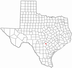
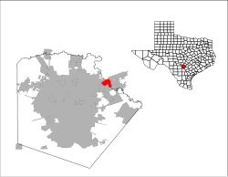
Selma has territory in Guadalupe, Bexar and Comal Counties. The coordinates of the city center, 29°35′4″N98°18′21″W / 29.58444°N 98.30583°W / 29.58444; -98.30583 , [9] is located in northern Bexar County, but City Hall, at 9375 Corporate Drive, is located in Guadalupe County, across the border from the city center. The city is bordered by Schertz to the east, Universal City to the south, Live Oak to the southwest, and part of San Antonio to the northwest. The center of Selma is 18 miles (29 km) northeast of downtown San Antonio and 13 miles (21 km) southwest of New Braunfels.

According to the United States Census Bureau, the city has a total area of 5.1 square miles (13.1 km2), of which 0.004 square miles (0.01 km2), or 0.09%, is covered by water. [5]

Demographics

Historical population
CensusPop.Note
1970 207
1980 528155.1%
1990 520−1.5%
2000 78851.5%
2010 5,540603.0%
2020 10,95297.7%
2021 (est.)11,619 [10] 6.1%
U.S. Decennial Census [11]
Selma racial composition as of 2020 [12]
(NH = Non-Hispanic) [lower-alpha 1]
RaceNumberPercentage
White (NH)4,28239.1%
Black or African American (NH)1,19310.89%
Native American or Alaska Native (NH)310.28%
Asian (NH)4904.47%
Pacific Islander (NH)310.28%
Some Other Race (NH)250.23%
Mixed/multiracial (NH)4744.33%
Hispanic or Latino 4,42640.41%
Total10,952

As of the 2020 United States census, 10,952 people, 3,871 households, and 2,728 families were residing in the city.

As of the census [3] of 2000, 788 people, 286 households, and 217 families were residing in the town. The population density was 161.9 inhabitants per square mile (62.5/km2). The 298 housing units had an average density of 61.2 per square mile (23.6/km2). The racial makeup of the city was 86.55% White, 4.57% African American, 1.14% Native American, 1.27% Asian, 0.38% Pacific Islander, 3.93% from other races, and 2.16% from two or more races. Hispanics or Latinos of any race were 30.46% of the population.

Of the 286 households, 33.9% had children under 18 living with them, 67.1% were married couples living together, 5.2% had a female householder with no husband present, and 24.1% were not families. About 17.8% of all households were made up of individuals, and 4.9% had someone living alone who was 65 or older. The average household size was 2.73, and the average family size was 3.17.

In the town. the age distribution was 25.4% under 18, 8.1% from 18 to 24, 24.9% from 25 to 44, 31.5% from 45 to 64, and 10.2% who were 65 or older. The median age was 40 years. For every 100 females, there were 107.9 males. For every 100 females 18 and over, there were 104.9 males.

The median income for a household in the town was $51,979, and for a family was $62,344. Males had a median income of $39,479 versus $27,222 for females. The per capita income for the city was $22,492. About 5.1% of families and 5.5% of the population were below the poverty line, including 7.8% of those under age 18 and none of those age 65 or over.

The town was famous as a speed trap as referenced in the Steve Earle song "Guitar Town". Texas Monthly published a feature on Selma in 1974, describing it as "the perfect speed trap". [15]

Notable person

Related Research Articles

<span class="mw-page-title-main">La Salle County, Texas</span> County in Texas, United States

La Salle County is a county in Texas. As of the 2020 census, its population was 6,664. Its county seat is Cotulla. The county was created in 1858 and later organized in 1880. It is named for René-Robert Cavelier, Sieur de La Salle, a 17th-century French explorer.

<span class="mw-page-title-main">Guadalupe County, Texas</span> County in Texas, United States

Guadalupe County is a county located in the U.S. state of Texas. As of the 2020 census, its population was 172,706. The county seat is Seguin. The county was founded in 1846 and is named after Guadalupe River.

<span class="mw-page-title-main">Comal County, Texas</span> County in Texas, United States

Comal County is a county located on the Edwards Plateau in the U.S. state of Texas. As of the 2020 census, its population was 161,501. Comal County is known for its rich German-Texan and European history. Its county seat is New Braunfels.

<span class="mw-page-title-main">Bexar County, Texas</span> County in Texas, United States

<span class="mw-page-title-main">Converse, Texas</span> City in Texas, United States

Converse is a city in Bexar County, Texas, United States, 15 miles (24 km) northeast of downtown San Antonio. As of the 2020 census, it had a population of 27,466. It is part of the San Antonio Metropolitan Statistical Area.

<span class="mw-page-title-main">Cross Mountain, Texas</span> Census-designated place in Texas, United States

Cross Mountain is a census-designated place (CDP) in Bexar County, Texas, United States. The population was 3,944 at the 2020 census, up from 3,124 at the 2010 census. It is part of the San Antonio Metropolitan Statistical Area.

<span class="mw-page-title-main">Elmendorf, Texas</span> City in Texas, United States

Elmendorf is a city in Bexar County, Texas, United States. It is part of the San Antonio—New Braunfels metropolitan statistical area. Its population was 1,862 at the 2020 census. It was founded in 1885, and named after Henry Elmendorf, a former mayor of San Antonio, and a German-Texan. For a long time, the biggest employer was Star Clay Products.

<span class="mw-page-title-main">Helotes, Texas</span> City in Texas, United States

Helotes is a city in Bexar County, Texas, United States, located on the far northwest side of San Antonio. It is part of the San Antonio-New Braunfels metropolitan statistical area. Its population was 9,030 at the 2020 census.

<span class="mw-page-title-main">Live Oak, Texas</span> City in Texas, United States

Live Oak is a city in Bexar County, Texas, United States. The population was 15,781 at the 2020 census. It is part of the San Antonio Metropolitan Statistical Area.

<span class="mw-page-title-main">Shavano Park, Texas</span> City in Texas, United States

Shavano Park is a city located in Bexar County, Texas, United States. As of the 2020 census, the population was 3,524, up from 3,035 at the 2010 census. It is part of the San Antonio Metropolitan Statistical Area, despite being much different in terms of demographics and having some of the wealthiest families in Bexar County.

<span class="mw-page-title-main">Universal City, Texas</span> City in Texas, United States

Universal City is a city in Bexar County, Texas with a small portion in Guadalupe County, Texas, United States. It borders San Antonio to the northeast, and is adjacent to Randolph Air Force Base. The population was 19,720 at the 2020 census. It is part of the San Antonio Metropolitan Statistical Area.

<span class="mw-page-title-main">Windcrest, Texas</span> City in Texas, United States

Windcrest is a city in Bexar County, Texas, United States. Its population was 5,865 at the 2020 census. It is part of the San Antonio metropolitan area.

<span class="mw-page-title-main">Marion, Texas</span> City in Texas, United States

Marion is a city in Guadalupe County, Texas, United States. The town was incorporated by 1941. The population was 1,034 at the 2020 census. It is part of the San Antonio Metropolitan Statistical Area.

Northcliffe is a former census-designated place (CDP) in Guadalupe County, Texas, United States. The population was 1,819 at the 2000 census. The area is now part of the city of Schertz and did not have its population recorded separately at the 2010 census. It is part of the San Antonio Metropolitan Statistical Area.

<span class="mw-page-title-main">Redwood, Texas</span> Unincorporated community in Texas, United States

Redwood is an unincorporated community and census-designated place (CDP) in Guadalupe County, Texas, United States. The population was 4,003 at the 2020 census, down from 4,338 at the 2010 census. It is part of the San Antonio Metropolitan Statistical Area.

<span class="mw-page-title-main">Comfort, Texas</span> Census-designated place in Texas, United States

Comfort is an unincorporated community and census-designated place (CDP) in Kendall County, Texas, United States. As of the 2010 census, it had a population of 2,363. Comfort was founded by German emigrants on the western end of the Texas-German belt. Many residents of the town today are descendants of those same Germans. Comfort is known for its German Heritage and large ranches outside of town.

<span class="mw-page-title-main">George West, Texas</span> City in Texas, United States

George West is a city in Live Oak County, Texas, United States, and named for cattle rancher George Washington West. The population was 2,445 at the 2010 census. It is the county seat of Live Oak County. George West was named the "storytelling capital of Texas" in 2005 by the Texas Senate; and it hosts the George West Storyfest, a festival that features storytelling, cowboy poetry, and music. Numerous ranches surround George West.

<span class="mw-page-title-main">Cibolo, Texas</span> City in Texas, United States

Cibolo is a city in Guadalupe County, Texas, United States. It is part of the San Antonio–New Braunfels metropolitan statistical area. Cibolo voted to become an independent township on October 9, 1965. As of the 2020 census, Cibolo had a population of 32,276, up from 15,349 at the 2010 census.

<span class="mw-page-title-main">Schertz, Texas</span> City in Texas, United States

Schertz is a city in Guadalupe, Bexar, and Comal counties in the U.S. state of Texas, within the San Antonio–New Braunfels metropolitan area. The population was 42,002 at the 2020 census, up from 31,465 at the 2010 census. Schertz was settled by Alsatian emigrants in the 1800s.

<span class="mw-page-title-main">Greater San Antonio</span> Metropolitan area in Texas, United States

Greater San Antonio, officially designated San Antonio–New Braunfels, is an eight-county metropolitan area in the U.S. state of Texas defined by the Office of Management and Budget (OMB). The metropolitan area straddles South Texas and Central Texas and is on the southwestern corner of the Texas Triangle. The official 2020 U.S. census showed the metropolitan area's population at 2,558,143—up from a reported 1,711,103 in 2000—making it the 24th largest metropolitan area in the United States. Austin–Round Rock lies about 80 mi (130 km) northeast of Greater San Antonio.

References

  1. "2019 U.S. Gazetteer Files". United States Census Bureau. Retrieved August 7, 2020.
  2. 1 2 U.S. Geological Survey Geographic Names Information System: Selma, Texas
  3. 1 2 "U.S. Census website". United States Census Bureau . Retrieved January 31, 2008.
  4. "Subcounty population estimates: Texas 2000-2006". United States Census Bureau, Population Division. June 28, 2007. Archived from the original (CSV) on November 26, 2007. Retrieved January 9, 2008.
  5. 1 2 "Geographic Identifiers: 2010 Demographic Profile Data (G001): Selma city, Texas". U.S. Census Bureau, American Factfinder. Archived from the original on February 12, 2020. Retrieved April 14, 2014.
  6. "Population and Housing Unit Estimates" . Retrieved September 14, 2019.
  7. "History of Selma | Selma, TX - Official Website".
  8. Retama Park
  9. U.S. Geological Survey 7.5-minute topographic map series, Schertz quadrangle, 2013. Acme Mapper.
  10. "Quickfacts: Selma, Texas". census.gov. Retrieved August 17, 2022.
  11. "Census of Population and Housing". Census.gov. Retrieved June 4, 2015.
  12. "Explore Census Data". data.census.gov. Retrieved May 24, 2022.
  13. https://www.census.gov/ [ not specific enough to verify ]
  14. "About the Hispanic Population and its Origin". www.census.gov. Retrieved May 18, 2022.
  15. The Perfect Speed Trap
  1. Note: the US Census treats Hispanic/Latino as an ethnic category. This table excludes Latinos from the racial categories and assigns them to a separate category. Hispanics/Latinos can be of any race. [13] [14]