Chicken 224

Last updated

Chicken 224
Chicken Indian Reserve No. 224
CAN SK Chicken 224 Locator.svg
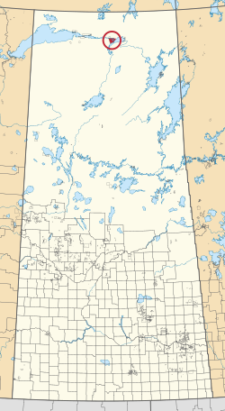
Location in Saskatchewan
First Nation Black Lake
Country Canada
Province Saskatchewan
Area
[1]
  Total25,819.4 ha (63,801.1 acres)
Population
 (2016) [2]
  Total1,379
  Density5.3/km2 (14/sq mi)
Community Well-Being Index [3] 42

Chicken 224 is an Indian reserve of the Black Lake Denesuline First Nation in Saskatchewan. [1] [4] It is 170 kilometres southeast of Uranium City. In the 2016 Canadian Census, it recorded a population of 1379 living in 263 of its 280 total private dwellings. [2] In the same year, its Community Well-Being index was calculated at 42 of 100, compared to 58.4 for the average First Nations community and 77.5 for the average non-Indigenous community. [3]

Contents

Etymology

The three Chicken reserves were named after a Chief Chicken, early leader of the Black Lake band. [5]

See also

Related Research Articles

<span class="mw-page-title-main">Canoe Lake 165</span> Indian reserve in Saskatchewan, Canada

Canoe Lake 165 is an Indian reserve of the Canoe Lake Cree First Nation in the boreal forest of northern Saskatchewan, Canada. Its location is on Canoe Lake approximately thirty miles west of Beauval, within the ancient hunting grounds of the Woodland Cree. In the 2016 Canadian Census, it recorded a population of 912 living in 250 of its 273 total private dwellings. In the same year, its Community Well-Being index was calculated at 53 of 100, compared to 58.4 for the average First Nations community and 77.5 for the average non-Indigenous community. The reserve includes the settlement of Canoe Narrows. The name of the reserve and the settlement in Cree is nêhiyaw-wapâsihk ᓀᐦᐃᔭᐤ ᐘᐹᓯᕽ.

<span class="mw-page-title-main">Black Lake Denesuline First Nation</span>

Black Lake is a Denesuline First Nations band government in the boreal forest of northern Saskatchewan, Canada. It is located on the northwest shore of Black Lake where the Fond du Lac River leaves the lake to flow to Lake Athabasca.

<span class="mw-page-title-main">Star Blanket 83</span> Indian reserve in Canada, Star Blanket

Star Blanket 83 is an Indian reserve of the Star Blanket Cree Nation in Saskatchewan. It is 18 kilometres northeast of Fort Qu'Appelle. In the 2016 Canadian Census, it recorded a population of 175 living in 48 of its 59 total private dwellings. In the same year, its Community Well-Being index was calculated at 50 of 100, compared to 58.4 for the average First Nations community and 77.5 for the average non-Indigenous community.

<span class="mw-page-title-main">Chicken 225</span> Indian reserve in Saskatchewan, Canada

Chicken 225 is an Indian reserve of the Black Lake Denesuline First Nation in Saskatchewan. In the 2016 Canadian Census, it recorded a population of 0 living in 0 of its 0 total private dwellings.

<span class="mw-page-title-main">Fishing Lake 89</span> Indian reserve in Canada, Fishing Lake

Fishing Lake 89 is an Indian reserve of the Fishing Lake First Nation in Saskatchewan. It is 119 kilometres north of Fort Qu'Appelle. In the 2016 Canadian Census, it recorded a population of 406 living in 128 of its 161 total private dwellings. In the same year, its Community Well-Being index was calculated at 54 of 100, compared to 58.4 for the average First Nations community and 77.5 for the average non-Indigenous community.

<span class="mw-page-title-main">Cote 64</span> Indian reserve in Canada, Cote

Cote 64 is an Indian reserve of the Cote First Nation in Saskatchewan. It is 16 kilometres west of the Manitoba border. In the 2016 Canadian Census, it recorded a population of 748 living in 220 of its 269 total private dwellings. In the same year, its Community Well-Being index was calculated at 51 of 100, compared to 58.4 for the average First Nations community and 77.5 for the average non-Indigenous community.

<span class="mw-page-title-main">Eagles Lake 165C</span> Indian reserve in Canada, Canoe Lake

Eagles Lake 165C is an Indian reserve of the Canoe Lake Cree First Nation in Saskatchewan. It consists of all that portion of Township 59, Range 14, west of the Third Meridian. In the 2016 Canadian Census, it recorded a population of 92 living in 29 of its 32 total private dwellings. In the same year, its Community Well-Being index was calculated at 72 of 100, compared to 58.4 for the average First Nations community and 77.5 for the average non-Indigenous community.

<span class="mw-page-title-main">Flying Dust 105</span> Indian reserve in Canada, Flying Dust

Flying Dust 105 is an Indian reserve of the Flying Dust First Nation in Saskatchewan. It is less than a kilometre northwest of Meadow Lake. In the 2016 Canadian Census, it recorded a population of 577 living in 169 of its 187 total private dwellings. In the same year, its Community Well-Being index was calculated at 63 of 100, compared to 58.4 for the average First Nations community and 77.5 for the average non-Indigenous community.

<span class="mw-page-title-main">Fond du Lac 227</span> Indian reserve in Canada, Fond du Lac

Fond du Lac 227 is an Indian reserve of the Fond du Lac Denesuline First Nation in Saskatchewan. It is at the east end of Lake Athabasca. In the 2016 Canadian Census, it recorded a population of 903 living in 206 of its 231 total private dwellings. In the same year, its Community Well-Being index was calculated at 52 of 100, compared to 58.4 for the average First Nations community and 77.5 for the average non-Indigenous community.

<span class="mw-page-title-main">Lac la Ronge 156</span> Indian reserve in Canada, Lac La Ronge

Lac la Ronge 156 is an Indian reserve of the Lac La Ronge Indian Band in Saskatchewan. It is 10 kilometres southwest of Lac la Ronge. In the 2016 Canadian Census, it recorded a population of 2017 living in 441 of its 480 total private dwellings. In the same year, its Community Well-Being index was calculated at 50 of 100, compared to 58.4 for the average First Nations community and 77.5 for the average non-Indigenous community.

<span class="mw-page-title-main">Little Red River 106C</span> Indian reserve in Canada, Lac La Ronge Indian Band

Little Red River 106C is an Indian reserve of the Lac La Ronge Indian Band in Saskatchewan. It is 34 kilometres north of Prince Albert. In the 2016 Canadian Census, it recorded a population of 354 living in 88 of its 98 total private dwellings. In the same year, its Community Well-Being index was calculated at 48 of 100, compared to 58.4 for the average First Nations community and 77.5 for the average non-Indigenous community.

<span class="mw-page-title-main">Morin Lake 217</span> Indian reserve in Canada, Lac La Ronge

Morin Lake 217 is an Indian reserve of the Lac La Ronge Indian Band in Saskatchewan. It is 24 kilometres east of Lac la Ronge. In the 2016 Canadian Census, it recorded a population of 577 living in 135 of its 155 total private dwellings. In the same year, its Community Well-Being index was calculated at 45 of 100, compared to 58.4 for the average First Nations community and 77.5 for the average non-Indigenous community.

<span class="mw-page-title-main">Muscowpetung 80</span> Indian Reserve in Saskatchewan

Muscowpetung 80 is an Indian reserve of the Muscowpetung First Nation in Saskatchewan. It is 31 kilometres west of Fort Qu'Appelle along the south-west shore of Pasqua Lake, which is one of four Fishing Lakes. In the 2016 Canadian Census, it recorded a population of 275 living in 87 of its 112 total private dwellings. In the same year, its Community Well-Being index was calculated at 54 of 100, compared to 58.4 for the average First Nations community and 77.5 for the average non-Indigenous community.

<span class="mw-page-title-main">Muskoday Reserve</span> Indian reserve in Canada, Muskoday

The Muskoday Reserve is an Indian reserve of the Muskoday First Nation in Saskatchewan. It is 19 kilometres southeast of Prince Albert. In the 2016 Canadian Census, it recorded a population of 647 living in 205 of its 217 total private dwellings. In the same year, its Community Well-Being index was calculated at 64 of 100, compared to 58.4 for the average First Nations community and 77.5 for the average non-Indigenous community.

<span class="mw-page-title-main">Pasqua 79</span> Indian Reserve in Saskatchewan

Pasqua 79 is an Indian reserve of the Pasqua First Nation in Saskatchewan. It is 16 kilometres west of Fort Qu'Appelle. In the 2016 Canadian Census, it recorded a population of 517 living in 173 of its 200 total private dwellings. In the same year, its Community Well-Being index was calculated at 56 of 100, compared to 58.4 for the average First Nations community and 77.5 for the average non-Indigenous community.

<span class="mw-page-title-main">Standing Buffalo 78</span> Indian Reserve in Saskatchewan

Standing Buffalo 78 is an Indian reserve of the Standing Buffalo Dakota Nation in Saskatchewan. It is 8 kilometres north-west of Fort Qu'Appelle. In the 2016 Canadian Census, it recorded a population of 569 living in 184 of its 198 total private dwellings. In the same year, its Community Well-Being index was calculated at 59 of 100, compared to 58.4 for the average First Nations community and 77.5 for the average non-Indigenous community.

<span class="mw-page-title-main">Sucker River 156C</span> Indian reserve in Canada, Lac La Ronge Indian Band

Sucker River 156C is an Indian reserve of the Lac La Ronge Indian Band in Saskatchewan. It is 230 kilometres north of Prince Albert. In the 2016 Canadian Census, it recorded a population of 416 living in 109 of its 124 total private dwellings. In the same year, its Community Well-Being index was calculated at 49 of 100, compared to 58.4 for the average First Nations community and 77.5 for the average non-Indigenous community.

<span class="mw-page-title-main">Turnor Lake 193B</span> Indian reserve in Canada, Birch Narrows

Turnor Lake 193B is an Indian reserve of the Birch Narrows Dene Nation in Saskatchewan. It is 124 kilometres northwest of Île-à-la-Crosse. In the 2016 Canadian Census, it recorded a population of 476 living in 131 of its 146 total private dwellings. In the same year, its Community Well-Being index was calculated at 58 of 100, compared to 58.4 for the average First Nations community and 77.5 for the average non-Indigenous community.

<span class="mw-page-title-main">Wahpaton 94A</span> Indian reserve in Canada, Wahpeton

Wahpaton 94A is an Indian reserve of the Wahpeton Dakota Nation in Saskatchewan. It is 10 kilometres north of Prince Albert. In the 2016 Canadian Census, it recorded a population of 309 living in 70 of its 80 total private dwellings. In the same year, its Community Well-Being index was calculated at 58 of 100, compared to 58.4 for the average First Nations community and 77.5 for the average non-Indigenous community.

<span class="mw-page-title-main">White Bear 70</span> Indian reserve in Canada, White Bear

White Bear 70 is an Indian reserve of the White Bear First Nations in Saskatchewan. It is 13 kilometres north of Carlyle and encompasses a total of 12,038.4 hectares. In the 2016 Canadian Census, it recorded a population of 691 living in 237 of its 972 total private dwellings. In the same year, its Community Well-Being index was calculated at 60 of 100, compared to 58.4 for the average First Nations community and 77.5 for the average non-Indigenous community.

References

  1. 1 2 "Reserve/Settlement/Village Detail". Crown–Indigenous Relations and Northern Affairs Canada . Government of Canada. Retrieved 12 August 2019.
  2. 1 2 "Census Profile, 2016 Census". Statistics Canada. 8 February 2017. Retrieved 10 August 2019.
  3. 1 2 "The Community Well-Being index". Indigenous Services Canada. 24 May 2019. Retrieved 9 October 2019.
  4. "Canada Lands Survey System - CLSS Map Browser". Natural Resources Canada. Retrieved 9 October 2019.
  5. Barry, Bill (September 2005). Geographic Names of Saskatchewan . Regina, Saskatchewan: People Places Publishing, Ltd. p. 82. ISBN   1-897010-19-2.

59°11′56″N105°37′33″W / 59.1988°N 105.6259°W / 59.1988; -105.6259 (Chicken 224)