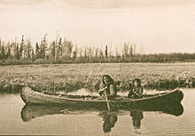
The Chipewyan are a Dene Indigenous Canadian people of the Athabaskan language family, whose ancestors are identified with the Taltheilei Shale archaeological tradition. They are part of the Northern Athabascan group of peoples, and hail from what is now Western Canada.

Chipewyan or Dënesųłinë́, often simply called Dëne, is the language spoken by the Chipewyan people of northwestern Canada. It is categorized as part of the Northern Athabaskan language family. It has nearly 12,000 speakers in Canada, mostly in Saskatchewan, Alberta, Manitoba and the Northwest Territories. It has official status only in the Northwest Territories, alongside 8 other aboriginal languages: Cree, Tlicho, Gwich'in, Inuktitut, Inuinnaqtun, Inuvialuktun, North Slavey and South Slavey.
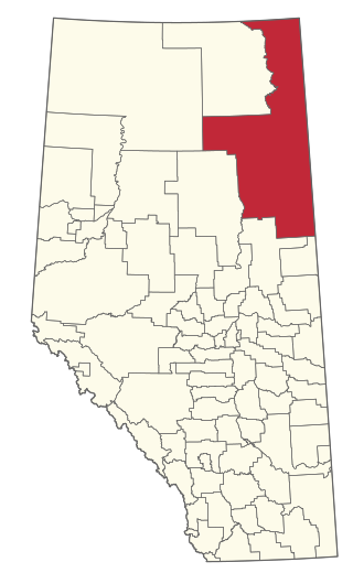
The Regional Municipality of Wood Buffalo is a specialized municipality in northeast Alberta, Canada. It is the largest regional municipality in Canada by area and is home to oil sand deposits known as the Athabasca oil sands.
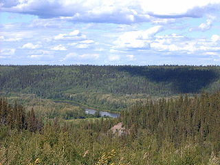
The Clearwater River is located in the Canadian provinces of Saskatchewan and Alberta. It rises in the northern forest region of north-western Saskatchewan and joins the Athabasca River in north-eastern Alberta. It was part of an important trade route during the fur trade era and has been designated as a Canadian Heritage River.
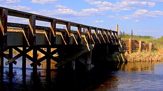
The Methye Portage or Portage La Loche in northwestern Saskatchewan was one of the most important portages in the old fur trade route across Canada. The 19 km (12 mi) portage connected the Mackenzie River basin to rivers that ran east to the Atlantic. It was reached by Peter Pond in 1778 and abandoned in 1883 when steamboats began running on the Athabasca River with links to the railroad. It ranks with Grand Portage as one of the two most important and difficult portages used during the fur trade era.
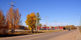
La Loche is a village in northwest Saskatchewan. It is located at the end of Highway 155 on the eastern shore of Lac La Loche in Canada's boreal forest. La Loche had a population of 2,827 in 2016 and is within the Northern Saskatchewan Administration District.
Highway 956, also known as the Garson Lake Road, is a provincial highway in the Canadian province of Saskatchewan. It runs from the Alberta border until Highway 155. It is about 44 kilometres (27 mi).

Highway 955, also known as Semchuk Trail, is a provincial highway in the Canadian province of Saskatchewan. It runs from Highway 155 near La Loche to Cluff Lake mine. The mine has been closed since the early 2000s and its adjacent airstrip is also closed now, meaning there are no formal services at the northern turn-around point. Drivers using the route need to carry extra fuel and other supplies, including spare tires owing to the sharp gravel used on the road. The name "Semchuk Trail" comes from Martin Semchuk who, along with John F. Midgett, and Jonas Clarke, were involved in building the original trail in 1955–56.
Buffalo Narrows is a northern village in Saskatchewan, Canada. It is a community of 1,110 people. Located at the "Narrows" between Peter Pond Lake and Churchill Lake, tourism and resource extraction are its main economic activities.
Turnor Lake is a community on the southern shore of Turnor Lake. From Highway 155 it is accessible by Highway 909. The community includes the Northern Hamlet of Turnor Lake and Turnor Lake 193B of the Birch Narrows First Nation.
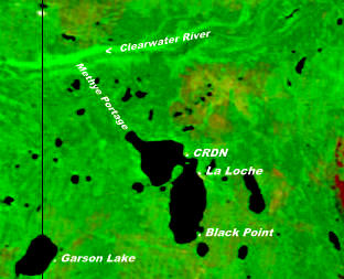
Black Point is a northern hamlet in Saskatchewan situated on the southern shore of Lac La Loche close to the northern village of La Loche. It is accessible by road by Highway 956 which is off Highway 155.
Bear Creek is a northern settlement in northwest Saskatchewan located on Highway 155. This community of 47 people is midway between the towns of Buffalo Narrows to the south and La Loche to the north. It is near the junction of Highway 909 that leads to Turnor Lake to the east. The chairman of this northern settlement is Dean Herman. The northern settlement is an unincorporated community in the Northern Saskatchewan Administration District.
Descharme Lake is a northern settlement on Descharme Lake in the boreal forest of northwest Saskatchewan. A 10-kilometre (6.2 mi) access road leads west to the community from the Saskatchewan Highway 955 turn-off 87 km north of La Loche. The northern settlement is an unincorporated community in the Northern Saskatchewan Administration District.
Hatchet Lake Denesuline Nation is a Denesuline First Nation in northern Saskatchewan. The main settlement, Wollaston Lake, is an unincorporated community on Wollaston Lake in the boreal forest of north-eastern Saskatchewan, Canada.
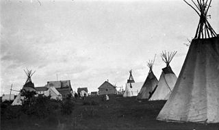
The Clearwater River Dene Nation is a Dene First Nations band government in the boreal forest area of northern Saskatchewan, Canada. It maintains offices in the village of Clearwater River situated on the eastern shore of Lac La Loche. The Clearwater River Dene Nation reserve of Clearwater River shares its southern border with the village of La Loche.

Clearwater River Provincial Park is a Canadian wilderness park in the boreal forest of northern Saskatchewan. The park begins at the south end of Lloyd Lake on the Clearwater River and includes territory on both sides of the river until it reaches the Alberta border.

Lac La Loche is a lake in north west Saskatchewan near the Alberta border. The lake is part of the Churchill River system that flows into the Hudson Bay. The La Loche River at the southern end flows into Peter Pond Lake which is connected to Churchill Lake.
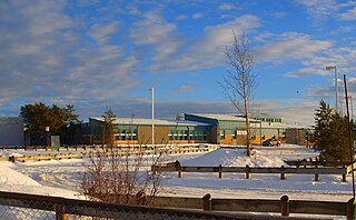
La Loche Community School is located in the village of La Loche in northern Saskatchewan, Canada. The school consists of two campuses. One campus, Ducharme School(56°28′56″N109°26′18″W), offers kindergarten to grade six; and the other, Dene High School(56°29′18″N109°26′43″W), offers grades seven to twelve. The school has an enrollment of 900 students and a support staff of 110.
Clearwater River Dene Band 221 is an Indian reserve of the Clearwater River Dene Nation in Saskatchewan. It is 24 kilometres (15 mi) east of La Loche.

Clearwater River Dene Band 222 is an Indian reserve of the Clearwater River Dene Nation in Saskatchewan. It is 11 kilometres (6.8 mi) south-west of La Loche. In the 2016 Canadian Census, it recorded a population of 822 living in 188 of its 218 total private dwellings. In the same year, its Community Well-Being index was calculated at 49 of 100, compared to 58.4 for the average First Nations community and 77.5 for the average non-Indigenous community.