Coyote Acres, Texas

Last updated

Coyote Acres, Texas
Jim Wells CoyoteAcres.svg
Coordinates: 27°43′21″N98°8′3″W / 27.72250°N 98.13417°W / 27.72250; -98.13417
Country United States
State Texas
County Jim Wells
Area
  Total5.1 sq mi (13.3 km2)
  Land5.1 sq mi (13.3 km2)
  Water0.0 sq mi (0.0 km2)
Elevation
230 ft (70 m)
Population
 (2020)
  Total570
  Density110/sq mi (43/km2)
Time zone UTC-6 (Central (CST))
  Summer (DST) UTC-5 (CDT)
FIPS code 48-17426 [1]
GNIS feature ID1852695 [2]

Coyote Acres is a census-designated place (CDP) in Jim Wells County, Texas, United States. The population was 570 at the 2020 census, up from 508 at the 2010 census. [3]

Contents

Geography

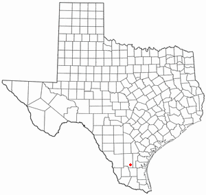
Coyote Acres is located in central Jim Wells County at 27°43′21″N98°8′3″W / 27.72250°N 98.13417°W / 27.72250; -98.13417 (27.722475, -98.134288), [4] about 6 miles (10 km) southwest of Alice, the county seat. It is bordered to the east by Alice Acres.

According to the United States Census Bureau, the Coyote Acres CDP has a total area of 5.1 square miles (13.3 km2), all land. [3]

Demographics

Historical population
CensusPop.Note
2000 389
2010 50830.6%
2020 57012.2%
US Decennial Census [4]
2020 Census [5]

As of the census [1] of 2000, there were 389 people, 109 households, and 92 families residing in the CDP. The population density was 76.2 inhabitants per square mile (29.4/km2). There were 113 housing units at an average density of 22.1/sq mi (8.5/km2). The racial makeup of the CDP was 65.55% White, 0.77% African American, 32.90% from other races, and 0.77% from two or more races. Hispanic or Latino of any race were 86.63% of the population.

There were 109 households, out of which 45.9% had children under the age of 18 living with them, 60.6% were married couples living together, 20.2% had a female householder with no husband present, and 14.7% were non-families. 11.0% of all households were made up of individuals, and 1.8% had someone living alone who was 65 years of age or older. The average household size was 3.57 and the average family size was 3.83.

In the CDP, the population was spread out, with 37.5% under the age of 18, 11.1% from 18 to 24, 25.2% from 25 to 44, 20.6% from 45 to 64, and 5.7% who were 65 years of age or older. The median age was 26 years. For every 100 females, there were 105.8 males. For every 100 females age 18 and over, there were 102.5 males.

The median income for a household in the CDP was $19,250, and the median income for a family was $14,083. Males had a median income of $26,518 versus $12,083 for females. The per capita income for the CDP was $6,709. About 45.8% of families and 57.3% of the population were below the poverty line, including 69.4% of those under age 18 and none of those age 65 or over.

Education

Coyote Acres is served by the Alice Independent School District. [6] The district operates Alice High School.

Related Research Articles

<span class="mw-page-title-main">Jim Wells County, Texas</span> County in Texas, United States

Jim Wells County is a county in the U.S. state of Texas. As of the 2020 census, its population was 38,891. The county was founded in 1911 and is named for James B. Wells Jr. (1850–1923), for three decades a judge and Democratic Party political boss in South Texas.

<span class="mw-page-title-main">Mountain View Acres, California</span> Census-designated place in California, United States

Mountain View Acres is a census-designated place (CDP) in the Victor Valley of the Mojave Desert, within San Bernardino County, California.

St. George was a census-designated place (CDP) in Broward County, Florida, United States. The population was 2,450 at the 2000 census. It now serves as a neighborhood of Lauderhill, Florida.

<span class="mw-page-title-main">South Lockport, New York</span> CDP in New York, United States

South Lockport is a hamlet located in the Town of Lockport in Niagara County, New York, United States. The population was 8,234 at the 2010 census. It is part of the Buffalo–Niagara Falls Metropolitan Statistical Area.

<span class="mw-page-title-main">Cantu Addition, Texas</span> Census-designated place in Texas, United States

Cantu Addition is a census-designated place (CDP) in Brooks County, Texas, United States. Its population was 188 at the 2010 census.
<span class="mw-page-title-main">Concepcion, Texas</span> Census-designated place in Texas, United States

Concepcion is an unincorporated community and census-designated place (CDP) in Duval County, Texas, United States. The population was 62 at the 2010 census.

<span class="mw-page-title-main">Bigfoot, Texas</span> Census-designated place and Unincorporated Community in Texas, United States

Bigfoot is an unincorporated community and census-designated place (CDP) in Frio County, Texas, United States. The population was 450 at the 2010 census, up from 304 at the 2000 census.

<span class="mw-page-title-main">North Alamo, Texas</span> Census-designated place in Texas, United States

North Alamo is a census-designated place (CDP) in Hidalgo County, Texas, United States. The population was 3,722 at the 2020 United States Census. It is part of the McAllen–Edinburg–Mission Metropolitan Statistical Area.

<span class="mw-page-title-main">South Alamo, Texas</span> Census-designated place in Texas

South Alamo is a census-designated place (CDP) in Hidalgo County, Texas, United States. The area is known locally as "Little Mex (Mexico)". The population was 3,414 at the 2020 United States Census. It is part of the McAllen–Edinburg–Mission Metropolitan Statistical Area.

<span class="mw-page-title-main">Las Lomitas, Texas</span> Census-designated place & Unincorporated community in Texas, United States

Las Lomitas is an unincorporated community and census-designated place (CDP) in Jim Hogg County, Texas, United States. The population was 244 at the 2010 census.

<span class="mw-page-title-main">South Fork Estates, Texas</span> Census-designated place in Texas, United States

South Fork Estates is a census-designated place (CDP) in Jim Hogg County, Texas, United States. The population was 70 at the 2010 census, up from 47 at the 2000 census.

<span class="mw-page-title-main">Alice Acres, Texas</span> Census-designated place in Texas, United States

Alice Acres is a census-designated place (CDP) in Jim Wells County, Texas, United States. The population was 465 at the 2020 census.
<span class="mw-page-title-main">K-Bar Ranch, Texas</span> Census-designated place in Texas, United States

K-Bar Ranch is a census-designated place (CDP) in Jim Wells County, Texas, United States. The population was 375 at the 2020 census.

<span class="mw-page-title-main">Loma Linda East, Texas</span> Census-designated place in Texas, United States

Loma Linda East is a census-designated place (CDP) in Jim Wells County, Texas, United States. The population was 305 at the 2020 census, up from 254 at the 2010 census.

<span class="mw-page-title-main">Owl Ranch-Amargosa, Texas</span> CDP in Texas, United States

Owl Ranch-Amargosa is a census-designated place (CDP) in Jim Wells County, Texas, United States. The population was 527 at the 2000 census. The area is widely referred to as "Tecolote", the Spanish term for "owl".

<span class="mw-page-title-main">Rancho Alegre, Texas</span> Census-designated place in Texas, United States

Rancho Alegre is an unincorporated area and census-designated place (CDP) in Jim Wells County, Texas, United States. The population was 1,415 at the 2020 census.

<span class="mw-page-title-main">Sandia, Texas</span> Census-designated place in Texas, United States

Sandia is an unincorporated community and census-designated place (CDP) in Jim Wells County, Texas, United States. The population was 326 at the 2020 census, down from 379 at the 2010 census.

<span class="mw-page-title-main">Westdale, Texas</span> Census-designated place in Texas, United States

Westdale is a census-designated place (CDP) in Jim Wells County, Texas, United States. The population was 325 at the 2020 census, up from 372 at the 2010 census.

<span class="mw-page-title-main">Los Alvarez, Texas</span> CDP in Texas, United States

Los Alvarez is a census-designated place (CDP) in Starr County, Texas, United States. The population was 303 at the 2010 census, a decline from the figure of 1,434 tabulated in 2000.

<span class="mw-page-title-main">Inglewood-Finn Hill, Washington</span> Neighborhood in King, Washington, United States

Inglewood-Finn Hill was a census-designated place (CDP) in King County, Washington, United States. The population was 22,707 at the 2010 census. The community was largely annexed into neighboring Kirkland in 2011.
References

  1. 1 2 "U.S. Census website". United States Census Bureau . Retrieved January 31, 2008.
  2. "US Board on Geographic Names". United States Geological Survey. October 25, 2007. Retrieved January 31, 2008.
  3. 1 2 "Geographic Identifiers: 2010 Census Summary File 1 (G001): Coyote Acres CDP, Texas". American Factfinder. U.S. Census Bureau. Archived from the original on February 13, 2020. Retrieved December 14, 2018.
  4. 1 2 "US Gazetteer files: 2010, 2000, and 1990". United States Census Bureau. February 12, 2011. Retrieved April 23, 2011.
  5. "Census Bureau profile: Coyote Acres, Texas". United States Census Bureau. May 2023. Retrieved May 27, 2024.
  6. "2020 CENSUS - SCHOOL DISTRICT REFERENCE MAP: Jim Wells County, TX" (PDF). U.S. Census Bureau . Retrieved June 28, 2022.