Westdale, Texas

Last updated

Westdale, Texas
Jim Wells Westdale.svg
Coordinates: 27°58′2″N97°58′29″W / 27.96722°N 97.97472°W / 27.96722; -97.97472
Country United States
State Texas
County Jim Wells
Area
  Total4.03 sq mi (10.43 km2)
  Land4.03 sq mi (10.43 km2)
  Water0.0 sq mi (0.0 km2)
Elevation
213 ft (65 m)
Population
 (2020)
  Total325
  Density81/sq mi (31/km2)
Time zone UTC-6 (Central (CST))
  Summer (DST) UTC-5 (CDT)
FIPS code 48-77422 [1]
GNIS feature ID1852780 [2]

Westdale is a census-designated place (CDP) in Jim Wells County, Texas, United States. The population was 325 at the 2020 census, up from 372 at the 2010 census. [3]

Contents

Geography

Westdale is located in northeastern Jim Wells County at 27°58′2″N97°58′29″W / 27.96722°N 97.97472°W / 27.96722; -97.97472 (27.967294, -97.974830). [4] It is 3 miles (5 km) west of Orange Grove and 20 miles (32 km) northeast of Alice, the county seat.

According to the United States Census Bureau, the CDP has a total area of 4.0 square miles (10.4 km2), all land. [3]

Demographics

Historical population
CensusPop.Note
2000 295
2010 37226.1%
2020 325−12.6%
US Decennial Census [4]
2020 Census [5]

As of the census [1] of 2000, there were 295 people, 92 households, and 80 families residing in the CDP. The population density was 78.0 inhabitants per square mile (30.1/km2). There were 106 housing units at an average density of 28.0 per square mile (10.8/km2). The racial makeup of the CDP was 71.86% White, 0.68% African American, 3.73% Native American, 17.63% from other races, and 6.10% from two or more races. Hispanic or Latino of any race were 46.78% of the population.

There were 92 households, out of which 48.9% had children under the age of 18 living with them, 80.4% were married couples living together, 3.3% had a female householder with no husband present, and 12.0% were non-families. 10.9% of all households were made up of individuals, and 4.3% had someone living alone who was 65 years of age or older. The average household size was 3.21 and the average family size was 3.33.

In the CDP, the population was spread out, with 30.8% under the age of 18, 9.8% from 18 to 24, 30.2% from 25 to 44, 24.1% from 45 to 64, and 5.1% who were 65 years of age or older. The median age was 31 years. For every 100 females, there were 110.7 males. For every 100 females age 18 and over, there were 117.0 males.

The median income for a household in the CDP was $39,773, and the median income for a family was $46,094. Males had a median income of $32,188 versus $15,156 for females. The per capita income for the CDP was $15,640. About 19.5% of families and 30.8% of the population were below the poverty line, including 44.9% of those under the age of eighteen and none of those 65 or over.

Education

Westdale is served by the Orange Grove Independent School District. [6]

Related Research Articles

<span class="mw-page-title-main">Arroyo Colorado Estates, Texas</span> CDP in Texas, United States

Arroyo Colorado Estates is a census-designated place (CDP) in Cameron County, in the U.S. state of Texas. The population was 997 at the 2010 census. It is part of the Brownsville–Harlingen Metropolitan Statistical Area.

<span class="mw-page-title-main">El Camino Angosto, Texas</span> Census-designated place in Texas, United States

El Camino Angosto is a census-designated place (CDP) in Cameron County, Texas, United States. The population was 186 at the 2020 census. It is part of the Brownsville–Harlingen Metropolitan Statistical Area.

<span class="mw-page-title-main">Green Valley Farms, Texas</span> Census-designated place in Texas, United States

Green Valley Farms is a census-designated place (CDP) in Cameron County, Texas, United States. The population was 655 at the 2020 census, down from 1,272 at the 2010 census. It is part of the Brownsville–Harlingen Metropolitan Statistical Area.

<span class="mw-page-title-main">La Feria North, Texas</span> Census-designated place in Texas, United States

La Feria North is a census-designated place (CDP) in Cameron County, Texas, United States. The population was 225 at the 2020 census. It is part of the Brownsville–Harlingen Metropolitan Statistical Area.

<span class="mw-page-title-main">La Paloma, Texas</span> Census-designated place in Texas, United States

La Paloma is a census-designated place (CDP) in Cameron County, Texas, United States. The population was 2,903 at the 2010 census, up from 354 at the 2000 census, when it was drawn to cover a much smaller area. By the 2020 census, the population further increased to 3,218. It is part of the Brownsville–Harlingen Metropolitan Statistical Area. La Paloma means "the dove" in Spanish.

<span class="mw-page-title-main">Lago, Texas</span> Census-designated place in Texas, United States

Lago is a census-designated place (CDP) in Cameron County, Texas, United States. The population was 204 at the 2010 census. It is part of the Brownsville–Harlingen Metropolitan Statistical Area.

<span class="mw-page-title-main">Lasana, Texas</span> Census-designated place in Texas, United States

Lasana is a census-designated place (CDP) in Cameron County, Texas, United States. The population was 84 at the 2010 census, down from 135 at the 2000 census. It is part of the Brownsville–Harlingen Metropolitan Statistical Area.

<span class="mw-page-title-main">Laureles, Texas</span> CDP in Texas, United States

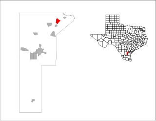
Laureles is a census-designated place (CDP) in Cameron County, Texas, United States. The population was 4,111 at the 2020 census. It is part of the Brownsville–Harlingen Metropolitan Statistical Area. Laureles is an area between Los Fresnos and San Benito.

<span class="mw-page-title-main">Olmito, Texas</span> Census-designated place in Texas, United States

Olmito is a census-designated place (CDP) in Cameron County, Texas, United States. Olmito is Spanish for "little elm". The population was 1,021 at the 2020 census. It is part of the Brownsville–Harlingen Metropolitan Statistical Area. Olmito is the self-described "mesquite capital of the world."

<span class="mw-page-title-main">San Pedro, Texas</span> Census-designated place in Texas, United States

San Pedro is a census-designated place (CDP) in Cameron County, Texas, United States. The population was 442 at the 2020 census. It is part of the Brownsville–Harlingen Metropolitan Statistical Area.

<span class="mw-page-title-main">Tierra Bonita, Texas</span> Census-designated place in Texas, United States

Tierra Bonita is a census-designated place (CDP) in Cameron County, Texas, United States. The population was 179 at the 2020 census. It is part of the Brownsville–Harlingen Metropolitan Statistical Area.

<span class="mw-page-title-main">Villa Pancho, Texas</span> Census-designated place in Texas, United States

Villa Pancho is a census-designated place (CDP) in Cameron County, Texas, United States. The population was 467 at the 2020 census, up from 788 at the 2010 census. It is part of the Brownsville–Harlingen Metropolitan Statistical Area.

<span class="mw-page-title-main">Yznaga, Texas</span> Census-designated place in Texas, United States

Yznaga is a census-designated place (CDP) in Cameron County, Texas, United States. The population was 108 at the 2020 census. It is part of the Brownsville–Harlingen Metropolitan Statistical Area.

<span class="mw-page-title-main">K-Bar Ranch, Texas</span> Census-designated place in Texas, United States

K-Bar Ranch is a census-designated place (CDP) in Jim Wells County, Texas, United States. The population was 375 at the 2020 census.

<span class="mw-page-title-main">Loma Linda East, Texas</span> Census-designated place in Texas, United States

Loma Linda East is a census-designated place (CDP) in Jim Wells County, Texas, United States. The population was 305 at the 2020 census, up from 254 at the 2010 census.

<span class="mw-page-title-main">Sandy Hollow-Escondidas, Texas</span> CDP in Texas, United States

Sandy Hollow-Escondidas is a census-designated place (CDP) in Nueces County, Texas, United States. The population was 342 at the 2020 census, down from 296 at the 2010 census.

<span class="mw-page-title-main">Taft Southwest, Texas</span> CDP in Texas, United States

Taft Southwest is a census-designated place (CDP) in San Patricio County, Texas, United States. The population was 1,296 at the 2020 census.

Eagle Mountain is a former census-designated place (CDP) in Tarrant County, Texas, United States. The population was 6,599 at the 2000 census. It is now a part of the city of Saginaw.

<span class="mw-page-title-main">Santa Monica, Texas</span> CDP in Texas, United States

Santa Monica is a census-designated place (CDP) in Willacy County, Texas, United States. The population was 86 at the 2020 census.

<span class="mw-page-title-main">Ames Lake, Washington</span> Census-designated place in Washington, United States

Ames Lake is an unincorporated community and census-designated place (CDP) in King County, Washington, United States. The population was 1,524 at the 2020 census, up from 1,486 at the 2010 census.

References

  1. 1 2 "U.S. Census website". United States Census Bureau . Retrieved January 31, 2008.
  2. "US Board on Geographic Names". United States Geological Survey. October 25, 2007. Retrieved January 31, 2008.
  3. 1 2 "Geographic Identifiers: 2010 Census Summary File 1 (G001): Westdale CDP, Texas". American Factfinder. U.S. Census Bureau. Archived from the original on February 13, 2020. Retrieved December 17, 2018.
  4. 1 2 "US Gazetteer files: 2010, 2000, and 1990". United States Census Bureau. February 12, 2011. Retrieved April 23, 2011.
  5. "Census Bureau profile: Westdale, Texas". United States Census Bureau. May 2023. Retrieved May 27, 2024.
  6. "2020 CENSUS - SCHOOL DISTRICT REFERENCE MAP: Jim Wells County, TX" (PDF). U.S. Census Bureau . Retrieved June 28, 2022.