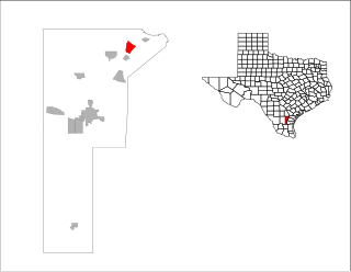
Kleberg County is a county in the U.S. state of Texas. As of the 2020 census, its population was 31,040. The county seat is Kingsville. The county was organized in 1913 and is named for Robert J. Kleberg, an early settler.

Jim Wells County is a county in the U.S. state of Texas. As of the 2020 census, its population was 38,891. The county was founded in 1911 and is named for James B. Wells Jr. (1850–1923), for three decades a judge and Democratic Party political boss in South Texas.

Alice Acres is a census-designated place (CDP) in Jim Wells County, Texas, United States. The population was 490 at the 2010 census.

Coyote Acres is a census-designated place (CDP) in Jim Wells County, Texas, United States. The population was 508 at the 2010 census, up from 389 at the 2000 census.

K-Bar Ranch is a census-designated place (CDP) in Jim Wells County, Texas, United States. The population was 358 at the 2010 census.

Loma Linda East is a census-designated place (CDP) in Jim Wells County, Texas, United States. The population was 254 at the 2010 census, up from 214 at the 2000 census.

Orange Grove is a city in Jim Wells County, Texas, United States. The population was 1,318 at the 2010 census.

Owl Ranch-Amargosa is a census-designated place (CDP) in Jim Wells County, Texas, United States. The population was 527 at the 2000 census. The area is widely referred to as "Tecolote", the Spanish term for "owl".

Premont is a city in Jim Wells County, Texas, United States. The population was 2,653 at the 2010 census.

Rancho Alegre is an unincorporated area and census-designated place (CDP) in Jim Wells County, Texas, United States. The population was 1,704 at the 2010 census.

Sandia is an unincorporated community and census-designated place (CDP) in Jim Wells County, Texas, United States. The population was 379 at the 2010 census, down from 431 at the 2000 census.
Alice Independent School District is a public school district based in Alice, Texas (USA). In addition to Alice, the district also serves the communities of Alice Acres, Amargosa, Coyote Acres, Owl Ranch, Rancho Alegre, and portions of Loma Linda East and Ben Bolt.
The Corpus Christi–Kingsville–Alice Combined Statistical Area is made up of six counties in South Texas. The statistical area consists of the Corpus Christi Metropolitan Statistical Area, the Kingsville Micropolitan Statistical Area, and the Alice Micropolitan Statistical Area. As of the 2010 census, the CSA had a population of 501,500.

Ben Bolt is an unincorporated community and census-designated place (CDP) in south central Jim Wells County, Texas, United States, 7 miles (11 km) south of Alice on U.S. Route 281. It was first listed as a CDP in the 2020 census, with a population of 1,662.
Alfred is an unincorporated community and census-designated place northeast of Alice in Jim Wells County, Texas, United States. Its population was 291 as of the 2010 census. It is known for the outdoor flea markets held on the first whole weekend of the month.

Boys Ranch is a census-designated place and unincorporated community in northeastern Oldham County, Texas, United States, on the site of the original county seat, Tascosa. It lies along U.S. Route 385, northeast of the city of Vega, the county seat of Oldham County. Although Boys Ranch is unincorporated, it has a post office, with the ZIP Code of 79010. Boys Ranch is a residential community serving boys and girls ages 5 to 18. It was founded in 1939 by Cal Farley for troubled youth and is now a census-designated place. This was a new CDP for the 2010 census with a population of 282.
The Alice Micropolitan Statistical Area is in Jim Wells County, Texas. It principal city is Alice, 44 miles from Corpus Christi, Texas, the closest Metropolitan Statistical Area. The closest Micropolitan Statistical Area is 39 miles in Beeville.
Amargosa is an unincorporated community and census-designated place in Jim Wells County, Texas, United States. Its population was 291 at the 2010 census. Prior to 2010, the community was grouped with nearby Owl Ranch as part of the Owl Ranch-Amargosa census-designated place. The community is named for the Amargosa Creek that runs nearby. The word amargosa means "bitter" in Spanish.
South La Paloma is an unincorporated community and census-designated place in Jim Wells County, Texas, United States. Its population was 345 as of the 2010 census. Prior to 2010, the community was grouped with nearby Alfred as part of the Alfred-South La Paloma census-designated place.
La Moca Ranch is a colonia and census-designated place (CDP) in Webb County, Texas, United States. It was first listed as a CDP prior to the 2020 census.


