San Patricio County is located in the U.S. state of Texas. As of the 2020 census, its population was 68,755. Its county seat is Sinton. San Patricio County is part of the Corpus Christi metropolitan statistical area.

Nueces County is located in the U.S. state of Texas. As of the 2020 census, the population was 353,178, making it the 16th-most populous county in the state. The county seat is Corpus Christi. The county was formed in 1846 from portions of San Patricio County and organized the following year. It is named for the Nueces River, which marks the county's northwestern boundary with San Patricio County before emptying into its mouth at Nueces Bay north of the port of Corpus Christi. Nueces County is part of the Corpus Christi metropolitan statistical area.

Live Oak County is a county in the U.S. state of Texas. It was named for its native groves of live oak. George West is its county seat. Its population was 11,335 in the 2020 census.

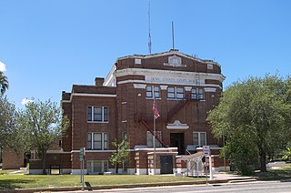
Jim Wells County is a county in the U.S. state of Texas. As of the 2020 census, its population was 38,891. The county was founded in 1911 and is named for James B. Wells Jr. (1850–1923), for three decades a judge and Democratic Party political boss in South Texas.
Duval County is a county located in the U.S. state of Texas. As of the 2020 census, its population was 9,831. The county seat is San Diego. The county was founded in 1858 and later organized in 1876. It is named for Burr H. Duval, a soldier in the Texas Revolution who died in the Goliad Massacre.

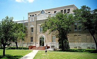
Denton County is located in the U.S. state of Texas. As of the 2020 census, its population was 906,422, making it the 7th-most populous county in Texas. The county seat is Denton. The county, which was named for John B. Denton, was established in 1846. Denton County constitutes part of the Dallas–Fort Worth metroplex. In 2007, it was one of the fastest-growing counties in the United States.
Encantada-Ranchito-El Calaboz, also known as El Calaboz Rancheria in the San Pedro de Carricitos Land Grant, is a census-designated place (CDP) in Cameron County, Texas, United States. The population was 2,255 at the 2010 census. It is part of the Brownsville–Harlingen Metropolitan Statistical Area.
La Paloma is a census-designated place (CDP) in Cameron County, Texas, United States. The population was 2,903 at the 2010 census, up from 354 at the 2000 census, when it was drawn to cover a much smaller area. It is part of the Brownsville–Harlingen Metropolitan Statistical Area. La Paloma means "the dove" in Spanish.

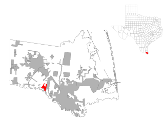
Alfred-South La Paloma is a former census-designated place (CDP) in Jim Wells County, Texas, United States. The population was 451 at the 2000 census. For the 2010 census, the CDP was split into Alfred and South La Paloma.

Premont is a city in Jim Wells County, Texas, United States. The population was 2,653 at the 2010 census.
Orange Grove Independent School District is a public school district based in Orange Grove, Texas (USA).

Ben Bolt is an unincorporated community and census-designated place (CDP) in south central Jim Wells County, Texas, United States, 7 miles (11 km) south of Alice on U.S. Route 281. It was first listed as a CDP in the 2020 census with a population of 1,662.
Alfred is an unincorporated community and census-designated place northeast of Alice in Jim Wells County, Texas, United States. Its population was 291 as of the 2010 census. It is known for the outdoor flea markets held on the first whole weekend of the month.
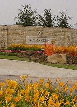
Paloma Creek is a master-planned community in Northeastern Denton County, Texas, United States. The community is listed by the U.S. Census Bureau as two separate census-designated places, "Paloma Creek" and "Paloma Creek South", separated by U.S. Highway 380. As of the 2010 census, the Paloma Creek CDP had a population of 2,501, while Paloma Creek South had a population of 2,753. As of 2022, the HOA currently estimates the population to be approximately 20,000.
Paloma Creek South is a census-designated place (CDP) in eastern Denton County, Texas, United States. It is part of the Paloma Creek master-planned community. As of the 2010 census, Paloma Creek South had a population of 2,753.
Las Palomas is a census-designated place in Sierra County, New Mexico, United States. Its population was 173 as of the 2010 census. The community is located near Exit 71 of Interstate 25; New Mexico State Road 187 also passes through the community.
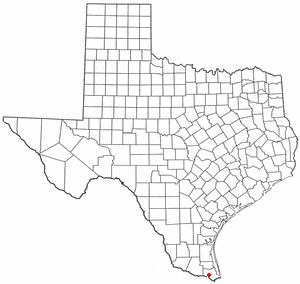
La Paloma Ranchettes is a census-designated place (CDP) in Starr County, Texas, United States. This was a new CDP for the 2010 census with a population of 239.
Amargosa is an unincorporated community and census-designated place in Jim Wells County, Texas, United States. Its population was 291 at the 2010 census. Prior to 2010, the community was grouped with nearby Owl Ranch as part of the Owl Ranch-Amargosa census-designated place. The community is named for the Amargosa Creek that runs nearby. The word amargosa means "bitter" in Spanish.
Owl Ranch is an unincorporated community and census-designated place in Jim Wells County, Texas, United States. Its population was 225 as of the 2010 census. Prior to 2010, the community was grouped with nearby Amargosa as part of the Owl Ranch-Amargosa census-designated place.
Palmer is a colonia and census-designated place (CDP) in Cameron County, Texas, United States. It was first listed as a CDP prior to the 2020 census.


