Crossnore, North Carolina

Last updated
Crossnore, North Carolina
Crossnore post office 28616.jpg
Crossnore post office
NCMap-doton-Crossnore.PNG
Location of Crossnore, North Carolina
Coordinates: 36°01′20″N81°55′51″W / 36.02222°N 81.93083°W / 36.02222; -81.93083
Country United States
State North Carolina
County Avery
Named for George Crossnore [1]
Government
  Type Mayor-alderman
  MayorTudor Vance
Area
[2]
  Total0.45 sq mi (1.16 km2)
  Land0.45 sq mi (1.16 km2)
  Water0.00 sq mi (0.00 km2)
Elevation
[3]
3,360 ft (1,020 m)
Population
 (2020)
  Total143
  Density319.20/sq mi (123.32/km2)
Time zone UTC-5 (Eastern (EST))
  Summer (DST) UTC-4 (EDT)
ZIP code
28616
Area code 828
FIPS code 37-15580 [4]
GNIS feature ID2406340 [3]

Crossnore is a town in Avery County, North Carolina, United States. The population was 143 at the 2020 census.

Contents

Geography

According to the United States Census Bureau, the town has a total area of 0.4 square miles (1.0 km2), all land.

History

The Crossnore Presbyterian Church, Crossnore School Historic District, Weaving Room of Crossnore School, and Milligan Shuford Wise and Theron Colbert Dellinger Houses are listed on the National Register of Historic Places. [5]

Demographics

Historical population
CensusPop.Note
1930 181
1940 26647.0%
1950 240−9.8%
1960 27715.4%
1970 264−4.7%
1980 29712.5%
1990 271−8.8%
2000 242−10.7%
2010 192−20.7%
2020 143−25.5%
U.S. Decennial Census [6]

As of the census [4] of 2000, there were 242 people, 96 households, and 62 families residing in the town. The population density was 548.8 inhabitants per square mile (211.9/km2). There were 119 housing units at an average density of 269.9 per square mile (104.2/km2). The racial makeup of the town was 93.80% White, 0.41% African American, 4.13% Native American, and 1.65% from two or more races. Hispanic or Latino of any race were 4.55% of the population.

There were 96 households, out of which 29.2% had children under the age of 18 living with them, 54.2% were married couples living together, 8.3% had a female householder with no husband present, and 35.4% were non-families. 33.3% of all households were made up of individuals, and 13.5% had someone living alone who was 65 years of age or older. The average household size was 2.42 and the average family size was 3.13.

In the town, the population was spread out, with 29.8% under the age of 18, 6.6% from 18 to 24, 27.3% from 25 to 44, 24.0% from 45 to 64, and 12.4% who were 65 years of age or older. The median age was 34 years. For every 100 females, there were 87.6 males. For every 100 females age 18 and over, there were 82.8 males.

The median income for a household in the town was $24,688, and the median income for a family was $40,000. Males had a median income of $26,250 versus $23,125 for females. The per capita income for the town was $13,960. About 12.5% of families and 12.8% of the population were below the poverty line, including 16.5% of those under the age of eighteen and 14.6% of those 65 or over.

Education

A group home named The Crossnore School, Inc., was established in 1913 and now houses approximately 100 students. Crossnore School has been praised for providing high-quality care at a lower cost than typical for most orphanages. [7]

Notable people

Related Research Articles

<span class="mw-page-title-main">Peachland, North Carolina</span> Town in North Carolina, United States

Peachland is a town in Anson County, North Carolina, United States. The population was 402 at the 2020 census.

<span class="mw-page-title-main">Elk Park, North Carolina</span> Town in North Carolina, United States

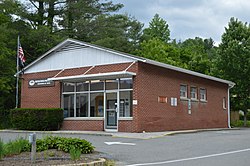
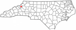
Elk Park is a town in Avery County, North Carolina, United States. The town was so named because of the number of elk killed there. The population was 452 at the 2010 census.

<span class="mw-page-title-main">Newland, North Carolina</span> Town in North Carolina, United States

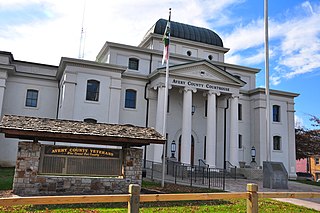
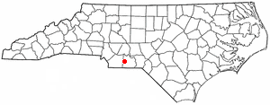
Newland is a town in Avery County, North Carolina, United States. The population was 698 at the 2010 census. It is the county seat of Avery County.

<span class="mw-page-title-main">Cooleemee, North Carolina</span> Town in North Carolina, United States

Cooleemee is a town in Davie County, North Carolina, United States. The population was 940 at the 2020 census.

Magnolia is a town in Duplin County, North Carolina, United States. The population was 939 at the 2010 census.

<span class="mw-page-title-main">Pinetops, North Carolina</span> Town in North Carolina, United States

Pinetops is a town in Edgecombe County, North Carolina, United States. It is part of the Rocky Mount, North Carolina Metropolitan Statistical Area. The population was 1,374 at the 2010 census.

<span class="mw-page-title-main">Dortches, North Carolina</span> Town in North Carolina, United States

Dortches is a town in Nash County, North Carolina, United States. It is part of the Rocky Mount, NC Metropolitan Statistical Area. The population was 1,082 in 2020.

<span class="mw-page-title-main">Seaboard, North Carolina</span> Town in North Carolina, United States

Seaboard is a township in Northampton County, North Carolina, United States, created as a company town by the Seaboard and Roanoke Railroad, approximately 10 miles northeast of Weldon in the mid-1840s as a place for railroad employees to live.

<span class="mw-page-title-main">Columbus, North Carolina</span> Town in North Carolina, United States

Columbus is a town and the county seat of Polk County, North Carolina, United States. The population was 999 at the 2010 census.

<span class="mw-page-title-main">Staley, North Carolina</span> Town in North Carolina, United States

Staley is a town in Randolph County, North Carolina, United States. The population was 393 at the 2010 census.

<span class="mw-page-title-main">Raynham, North Carolina</span> Town in North Carolina, United States

Raynham is a town in Robeson County, North Carolina, United States. The population was 72 at the 2010 census.

<span class="mw-page-title-main">Salemburg, North Carolina</span> Town in North Carolina, United States

Salemburg is a town in Sampson County, North Carolina, United States. The population was 435 at the 2010 census.

<span class="mw-page-title-main">Donalds, South Carolina</span> Town in South Carolina, United States

Donalds is a town in Abbeville County, South Carolina. As of the 2020 United States Census, its population was 328.

<span class="mw-page-title-main">Meggett, South Carolina</span> Town in South Carolina, United States

Meggett is a town in Charleston County, South Carolina, United States. The population was 1,226 at the 2010 census. Meggett is part of the Charleston-North Charleston-Summerville metropolitan area.

<span class="mw-page-title-main">Lowrys, South Carolina</span> Town in South Carolina, United States

Lowrys is a small rural town in Chester County, South Carolina, United States. The population was 200 at the 2010 census.

<span class="mw-page-title-main">Waterloo, South Carolina</span> Town in South Carolina, United States

Waterloo is a town in Laurens County, South Carolina, United States. The population was 166 at the 2010 census.

<span class="mw-page-title-main">Cope, South Carolina</span> Town in South Carolina, United States

Cope is a town in Orangeburg County, South Carolina, United States. The population was 65 at the 2020 census, a decline from 80 in 2010.

<span class="mw-page-title-main">Rowesville, South Carolina</span> Town in South Carolina, United States

Rowesville is a town in Orangeburg County, South Carolina, United States. The population was 304 at the 2010 census.

<span class="mw-page-title-main">Lockhart, South Carolina</span> Town in South Carolina, United States

Lockhart is a town in Union County, South Carolina, United States. The population was 488 at the 2010 United States Census.

<span class="mw-page-title-main">Ridgeway, Virginia</span> Town in Virginia, United States

Ridgeway is a town in Henry County, Virginia, United States. The population was 742 at the 2010 census. It is part of the Martinsville Micropolitan Statistical Area. Martinsville Speedway, a NASCAR racetrack, is located between Ridgeway and the Martinsville city limits.

References

  1. Hardy, Michael (May 17, 2017). "A few Avery County place names". The Avery Journal Times. Retrieved December 23, 2020.
  2. "ArcGIS REST Services Directory". United States Census Bureau. Retrieved September 20, 2022.
  3. 1 2 U.S. Geological Survey Geographic Names Information System: Crossnore, North Carolina
  4. 1 2 "U.S. Census website". United States Census Bureau . Retrieved 2008-01-31.
  5. "National Register Information System". National Register of Historic Places . National Park Service. July 9, 2010.
  6. "Census of Population and Housing". Census.gov. Retrieved June 4, 2015.
  7. McKenzie, Richard B. (14 January 2010). "The Best Thing About Orphanages". The Wall Street Journal.