Currowan

Last updated

Currowan
New South Wales
Australia New South Wales location map blank.svg
Red pog.svg
Currowan
Location in New South Wales
Currowan
Coordinates 35°34′11.7″S150°03′31.1″E / 35.569917°S 150.058639°E / -35.569917; 150.058639
Population72 (SAL 2021) [1]
Postcode(s) 2536
Elevation104 m (341 ft)
Location
LGA(s) Eurobodalla Shire
Region South Coast
County St Vincent
Parish Currowan
State electorate(s) Bega
Federal division(s) Eden-Monaro
Localities around Currowan:
Budawang Range Bimberamala National Park Shallow Crossing
Monga Currowan Clyde River
Monga National Park Nelligen Batemans Bay

Currowan is a locality in the Eurobodalla Shire, on the South Coast of New South Wales, Australia. At the 2016 census, it had a population of 53. [2]

Contents

Location

Currowan is about 42 km south-east of Braidwood. [3] [4]

The locality can be considered as having three distinct parts. The western part of the locality, near where the Kings Highway runs close to Currowan Creek below Clyde Mountain, the largely forested and hilly central area, and the eastern part adjacent to the right bank of the Clyde River. Currowan Creek links the three parts of the locality.

History

Aboriginal history

Currowan lies on the traditional lands of Walbanga people, [5] a group of Yuin.

Settlement and 'town' of Currowan

There was a planned village or township of the same name. Its site was on the right bank of the Clyde River estuary and the right bank of Currowan Creek, where the two waterways converge. This site of the village of Currowan was fixed in 1844 [6] and a village plan laid out, in that same year, by then colonial surveyor and later ill-fated explorer, Edmund Kennedy. The village site had been reserved by another colonial surveyor, James Larmer, in 1841. [7] The site was remote and, at the time, only accessible by water. As a result of the Crown Lands Act of 1884, Currowan was proclaimed a town on 20 March 1885. [8]

After completion of the Clyde Road in 1858, town allotments were put on sale in 1859, in both Nelligen and Currowan. [9] Closer to the river mouth, it was Nelligen that was chosen to become the terminus of the new road connection to the Southern Tablelands and the port town on the Clyde. [10] Although the Clyde follows a meandering course upstream of Nelligen, it was navigable to Currowan and the town had a stone wharf, plenty of flat land and a good water supply. However, the town of Currowan never prospered. [11] [12]

The absence of a road connection from the Braidwood district to Currowan remained an obstacle to its growth as a port, [13] [12] [14] and the floods of 1860 showed that the town's site was flood-prone. [15] Even so, Currowan remained a minor landing place that allowed easier access than Nelligen to gold mines in the district. [16] By 1859, there was a better road connecting Currowan to Nelligen and gold had been mined in the hills within four or five miles of Currowan. [17] The most significant period of quartz reef mining activity in the area seems to have begun in earnest around 1890. It was relatively short lived and on a small scale. The last mine to close, in 1915, was the Phoenix Mine, which was probably also the largest of the mines close to Currowan village. [18] [19] [20]

The town held a race meeting in 1901. [21] However, a visitor in the same year mentions seeing only the school, some farms and a sawmill. It seems the 'town', by then, was only the very smallest of settlements. [22]

Land was reserved in the town for a Public School in 1893. [23] Currowan had a 'provisional school' (Oct 1882 to May 1884), later a public school (May 1884 to May 1888) and finally a 'half-time school' (May 1888 to May 1907, and May 1910 to May 1916). [24] There was also a separate school in the western part of the locality at Currowan Creek. It was a 'house-to-house school' from November 1883 until December 1891. Later, it was a 'half-time school', called Clyde Mountain, from January 1892 until it closed in December 1893. [25] [26]

In 1920, a factory was established, by the Austral Starch Company Limited, to extract starch from the burrawong plant ( Macrozamia communis ). The factory was near the mouth of Currowan Creek. [27] [28] [29] A tramway running, along Mimosa Street, linked the factory to the town's wharf. [30] [8] The venture was unsuccessful and had closed by April 1923. [31] [32] [33] [34] There were two small gold mines west of the Currowan village operating from around 1934 to 1935. [35] [36]

Currowan became a locality, under the Geographical Names Act of 1966. [37] Little remains of the 'town' of Currowan today. Some of its street names and town allotments still appear on modern-day maps. The old town site is accessible via the River Road from Nelligen, [38]

Currowan Creek Aboriginal Reserve

On the opposite bank of Currowan Creek to the town site, [39] "about 60 acres" of land was set aside, in April 1893, as an Aboriginal reserve. [40] This became the Currowan Creek Aboriginal Reserve, which lasted until 1956. [41] [42] It was recorded as 50 acres in size. [39]

In June 1910, there were just three huts, with two adults and five children—three of school age—living there. The people living there had employment, at times, cutting sleepers and stripping wattle bark (for tanning), and three acres of land were under cultivation for maize and vegetables. [43]

Currowan bushfire

The locality gave its name to one of the disastrous bushfires of the 2019-2020 Australian summer, the Currowan fire. It broke out at Currowan on 26 November 2019 and, over 74 days and after merging with other fires—some of which were caused by the main fire spreading beyond erstwhile containment lines—it burnt 499,621 hectares (1,234,590 acres), destroyed 312 homes, and damaged another 173. It took three human lives and also killed countless wild animals, birds, reptiles, amphibians and invertebrates. It has been observed that the Currowan fire was only really contained by reaching the coastline, which it did at multiple locations. The final extinguishing of the fire came only with torrential rain, on 8 February 2020. [44] [45] [46]

Related Research Articles

<span class="mw-page-title-main">Moruya, New South Wales</span> Town in New South Wales, Australia

Moruya pronounced, is a town located on the far south coast of New South Wales, Australia, situated on the Moruya River. The Princes Highway runs through the town that is about 305 km (190 mi) south of Sydney and 175 km (109 mi) from Canberra. At the 2021 census, Moruya had a population of 4,295. Its built up area had a population of 2,762. The town relies predominantly on agriculture, aquaculture, and tourism. Moruya is administered by the Eurobodalla Shire Council and the shire chambers are located in the town.

<span class="mw-page-title-main">Batemans Bay</span> Town in New South Wales, Australia

Batemans Bay is a town on the South Coast region of the state of New South Wales, Australia. Batemans Bay is administered by the Eurobodalla Shire council. The town is situated on the shores of an estuary formed where the Clyde River meets the southern Pacific Ocean.

<span class="mw-page-title-main">Eurobodalla Shire</span> Local government area in New South Wales, Australia

Eurobodalla Shire is a local government area located in the South Coast region of New South Wales, Australia. The Shire is located in a largely mountainous coastal region and situated adjacent to the Tasman Sea, the Princes Highway and the Kings Highway.

<span class="mw-page-title-main">Clyde River (New South Wales)</span> River in Australia

The Clyde River is an open intermediate tide-dominated drowned valley estuary or perennial river that flows into the Tasman Sea at Batemans Bay, located in the South Coast region of New South Wales, Australia.

<span class="mw-page-title-main">Kings Highway (Australia)</span> Highway in the Australian Capital Territory and New South Wales

Kings Highway is an interstate highway located within the Australian Capital Territory and New South Wales, Australia. The highway connects Canberra with Batemans Bay on the South Coast. It is designated route B52.

<span class="mw-page-title-main">Mongarlowe, New South Wales</span> Town in New South Wales, Australia

Mongarlowe is a village in the Southern Tablelands of New South Wales, Australia in Queanbeyan-Palerang Regional Council. In former times, it was also known, in various contexts, as Little River, Monga, and Sergeants Point. The name, Mongarlowe, also applies to the surrounding area, for postal and statistical purposes.

<span class="mw-page-title-main">Araluen, New South Wales</span> Town in New South Wales, Australia

Araluen is a small town near Braidwood in the Southern Tablelands of New South Wales, Australia, in Queanbeyan-Palerang Regional Council. It lies in the valley of Araluen Creek, that joins the Deua River at roughly the midpoint in its course. At the 2021 census, Araluen had a population of 209 people.

<span class="mw-page-title-main">Deua River</span> River in New South Wales, Australia

The Deua River, being the main perennial river of the Moruya River catchment, is located in the South Coast region of New South Wales, Australia.

<span class="mw-page-title-main">Nerrigundah, New South Wales</span> City in New South Wales, Australia

Nerrigundah is a small village on the Eurobodalla Nature Coast in south eastern New South Wales. Situated at the head of the Tuross River Valley, it is nineteen kilometres inland from Bodalla. At the 2016 census, Nerrigundah had a population of 25.

<span class="mw-page-title-main">Nelligen, New South Wales</span> Town in New South Wales, Australia

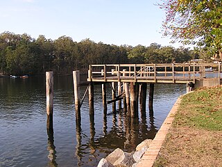
Nelligen is a village on the Clyde River on the South Coast of New South Wales, Australia. It is located on the Kings Highway.

<span class="mw-page-title-main">Jembaicumbene</span> Town in New South Wales, Australia

Jembaicumbene is a locality in the Southern Tablelands of New South Wales, Australia, located 8 km (5 miles) out along the Braidwood–Majors Creek Road. Once a thriving goldfield, it is now a peaceful valley on the way to Majors Creek. The mining village of the same name is now virtually a ghost town.

<span class="mw-page-title-main">Colinton, New South Wales</span> Town in New South Wales, Australia

Colinton is a locality in the Snowy Monaro Region, New South Wales, Australia. At the 2016 census, it had a population of 127. There was once a village and railway station of the same name.

<span class="mw-page-title-main">Larbert, New South Wales</span> Town in New South Wales, Australia

Larbert is a locality in the Queanbeyan-Palerang Region of the Southern Tablelands region of New South Wales. It lies mostly north of the Kings Highway between Bungendore and Braidwood where it crosses the Shoalhaven River. At the 2021 census, it had a population of 34.

<span class="mw-page-title-main">Merricumbene</span> Town in New South Wales, Australia

Merricumbene is a locality in the Eurobodalla Shire, New South Wales, Australia. It is located about 43 km south of Braidwood and 40 km northwest of Moruya in the valley of the Deua River. At the 2016 census, it had a population of 19.

<span class="mw-page-title-main">Monga, New South Wales</span> Town in New South Wales, Australia

Monga is a locality in the Queanbeyan-Palerang Region, Southern Tablelands, New South Wales, Australia. It lies on the Kings Highway at the top of the Clyde Mountain, about 110 km east of Canberra and 22 km southeast of Braidwood. A large part of the locality forms part of the Monga National Park. At the 2016 census, it had a population of 14.

<span class="mw-page-title-main">Tianjara</span> Town in New South Wales, Australia

Tianjara is a locality in the City of Shoalhaven in New South Wales, Australia. It lies generally south of the Braidwood Road between Nowra and Nerriga. It is about 47 kilometres southwest of Nowra. Tianjara is fairly rugged sandstone country and largely consists of forest. Most of it lies within the Morton National Park or state forests.

<span class="mw-page-title-main">The Wool Road</span> Historic road in New South Wales, Australia

The Wool Road was a historic road in New South Wales, Australia, that ran from Nerriga to what is now called Vincentia on Jervis Bay. It was constructed privately in 1841, using convict labour. Its purpose was to provide a shorter route to a seaport for wool grown at Braidwood and beyond. The historical significance of The Wool Road is that it was the first road, capable of being used by wheeled vehicles, linking the inland area around Braidwood to the South Coast. The road led to the foundation of the privately-owned port town of South Huskisson and the adjacent 'government townshIp' of Huskisson.

<span class="mw-page-title-main">James Larmer</span>

James Larmer was a government surveyor in the colony of New South Wales. Between 1830 and 1859, he surveyed land, roads and settlements in New South Wales. He was an Assistant Surveyor to the Surveyor-General, Sir Thomas Mitchell, from 1835 to 1855. In 1835, he was second in command of Mitchell's second expedition. He is also noteworthy for his recording of Aboriginal words from various parts of New South Wales.

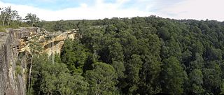
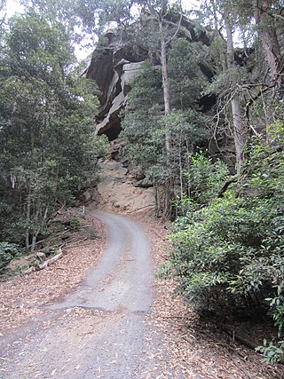
The Corn Trail was an early bridle track linking the Southern Tablelands to the coastal valley of the Buckenbowra River, in New South Wales, Australia. It was restored and reopened as a walking track in 1988.

Captain William Oldrey (1787—1851) was an officer in the Royal Navy and later a colonial settler of New South Wales, Australia. He is particularly associated with the early days of Broulee, on the South Coast of New South Wales.

References

  1. Australian Bureau of Statistics (28 June 2022). "Currowan (suburb and locality)". Australian Census 2021 QuickStats. Retrieved 28 June 2022.  OOjs UI icon edit-ltr-progressive.svg
  2. "2016 Census QuickStats: Currowan". quickstats.censusdata.abs.gov.au. Retrieved 24 January 2021.
  3. "Currowan". Geographical Names Register (GNR) of NSW. Geographical Names Board of New South Wales . Retrieved 26 January 2021. OOjs UI icon edit-ltr-progressive.svg
  4. "Currowan". OpenStreetMap. Retrieved 26 January 2021.
  5. "Tindale Tribes - Walbanga". archives.samuseum.sa.gov.au. Archived from the original on 21 April 2021. Retrieved 24 January 2021.
  6. "Domestic Intelligence". Weekly Register of Politics, Facts and General Literature (Sydney, NSW : 1843 - 1845). 7 December 1844. p. 278. Retrieved 24 January 2021.
  7. "wragge/srnsw-indexes - A list of data harvested from the NSW State Archives Online Indexes". GitHub. Archived from the original on 13 June 2018. Retrieved 3 April 2021.
  8. 1 2 "Town of Currowan and adjoining lands [cartographic material] : Parish - Currowan, County - St Vincent, Land Districts - Moruya & Nowra, Shires - Eurobodalla & Shoalhaven". Trove. Retrieved 24 January 2021.
  9. "SALE OF TOWN ALLOTMENTS AT NELLIGEN AND CURROWAN, CLYDE RIVER". New South Wales Government Gazette (Sydney, NSW : 1832 - 1900). 12 August 1859. p. 1754. Retrieved 24 January 2021.
  10. "The Dray Trail to Prosperity, Batemans Bay - South Coast NSW". 29 August 2007. Archived from the original on 29 August 2007. Retrieved 17 March 2021.
  11. "THE CLYDE RIVER". Illawarra Mercury (Wollongong, NSW : 1856 - 1950). 19 September 1859. p. 2. Retrieved 24 January 2021.
  12. 1 2 "SYDNEY NEWS". Maitland Mercury and Hunter River General Advertiser (NSW : 1843 - 1893). 11 March 1858. p. 2. Retrieved 24 January 2021.
  13. "SOUTHERN DISTRICTS". Empire (Sydney, NSW : 1850 - 1875). 9 March 1858. p. 2. Retrieved 24 January 2021.
  14. "BATEMAN'S BAY". Braidwood Dispatch and Mining Journal (NSW : 1888 - 1954). 13 April 1901. p. 2. Retrieved 24 January 2021.
  15. "THE LATE FLOODS IN THE SOUTHERN DISTRICTS". Sydney Morning Herald (NSW : 1842 - 1954). 13 March 1860. p. 9. Retrieved 24 January 2021.
  16. "Forgotten Gold Mines of Nelligen, Batemans Bay - South Coast NSW". 29 August 2007. Archived from the original on 29 August 2007. Retrieved 17 March 2021.
  17. "CURROWAN". Empire (Sydney, NSW : 1850 - 1875). 14 June 1859. p. 5. Retrieved 17 March 2021.
  18. "Currowan Mine, Nelligen, St Vincent Co., New South Wales, Australia". www.mindat.org. Retrieved 17 March 2021.
  19. "Phoenix Mine, Nelligen, St Vincent Co., New South Wales, Australia". www.mindat.org. Retrieved 17 March 2021.
  20. "The Clyde Goldfields". Ulladulla and Milton Times (NSW : 1891 - 1917). 23 September 1893. p. 7. Retrieved 18 March 2021.
  21. "LOCAL AND GENERAL MEMS". Ulladulla and Milton Times (NSW : 1891 - 1917). 16 November 1901. p. 4. Retrieved 24 January 2021.
  22. "CURROWAN". Braidwood Dispatch and Mining Journal (NSW : 1888 - 1954). 24 April 1901. p. 2. Retrieved 24 January 2021.
  23. "RESERVES FROM SALE FOR PUBLIC SCHOOL PURPOSES". New South Wales Government Gazette (Sydney, NSW : 1832 - 1900). 8 April 1893. p. 2760. Retrieved 24 January 2021.
  24. "Currowan". nswgovschoolhistory.cese.nsw.gov.au. Archived from the original on 29 January 2021. Retrieved 24 January 2021.
  25. "Currowan Creek / Clyde Mountain". nswgovschoolhistory.cese.nsw.gov.au. Retrieved 24 January 2021.
  26. "Glossary of school types". education.nsw.gov.au. 3 December 2019. Archived from the original on 26 March 2020. Retrieved 16 January 2021.
  27. "Starch". Nowra Leader (NSW : 1909 - 1939). 26 November 1920. p. 1. Retrieved 24 January 2021.
  28. ""Starch and Paper."". Illawarra Mercury (Wollongong, NSW : 1856 - 1950). 11 June 1920. p. 1. Retrieved 24 January 2021.
  29. "TRADE AND FINANCE". Daily Telegraph (Sydney, NSW : 1883 - 1930). 16 April 1920. p. 7. Retrieved 25 January 2021.
  30. "APPLICATION FOR LEASE FOR A SPECIAL PURPOSE". Government Gazette of the State of New South Wales (Sydney, NSW : 1901 - 2001). 31 December 1920. p. 7721. Retrieved 24 January 2021.
  31. "AUSTRAL STARCH COMPANY LIMITED". Government Gazette of the State of New South Wales (Sydney, NSW : 1901 - 2001). 27 October 1922. p. 5800. Retrieved 25 January 2021.
  32. "MORUYA". South Coast Times and Wollongong Argus (NSW : 1900 - 1954). 7 September 1923. p. 22. Retrieved 24 January 2021.
  33. "TELEPHONIC". Braidwood Dispatch and Mining Journal (NSW : 1888 - 1954). 6 April 1923. p. 2. Retrieved 24 January 2021.
  34. "Advertising". Braidwood Dispatch and Mining Journal (NSW : 1888 - 1954). 20 April 1923. p. 7. Retrieved 24 January 2021.
  35. "Turners Mine, Nelligen, St Vincent Co., New South Wales, Australia". www.mindat.org. Retrieved 17 March 2021.
  36. "Lees reef, Nelligen, St Vincent Co., New South Wales, Australia". www.mindat.org. Retrieved 17 March 2021.
  37. "GEOGRAPHICAL NAMES ACT, 1966". Government Gazette of the State of New South Wales (Sydney, NSW : 1901 - 2001). 22 December 1967. p. 4878. Retrieved 24 January 2021.
  38. "Oldrey St, Currowan". Google Maps. Retrieved 24 January 2021.
  39. 1 2 "Parish of Currowan, County of St. Vincent [cartographic material] : Land Districts of Moruya & Milton, Clyde & Eurobodalla Shires, Eastern Division N.S.W." Trove. Retrieved 24 January 2021.
  40. "RESERVE FROM ANNUAL LEASE FOR USE OF ABORIGINES". New South Wales Government Gazette (Sydney, NSW : 1832 - 1900). 15 April 1893. p. 2954. Retrieved 24 January 2021.
  41. "REVOCATION OF RESERVES FROM SALE, LEASE, ETC". Government Gazette of the State of New South Wales (Sydney, NSW : 1901 - 2001). 9 March 1956. p. 677. Retrieved 24 January 2021.
  42. "Formation of Aboriginal Reserves". Moruya Community. Retrieved 24 January 2021.
  43. "THE WELFARE OF THE BLACKS". Evening News (Sydney, NSW : 1869 - 1931). 1 June 1910. p. 3. Retrieved 24 January 2021.
  44. "South Coast's Currowan bushfire extinguished as torrential rain falls across NSW". ABC News . Australia. 9 February 2020. Retrieved 9 February 2020.
  45. Dingwall, Doug (11 January 2020). "The Currowan fire: a monster on the loose". The Canberra Times. Retrieved 24 January 2021.
  46. "Only containment option for Currowan bushfire was the ocean, inquiry hears". ABC News. 27 September 2021. Retrieved 21 November 2021.