The material in this section is derived from a brief history of Rosedale, written by Ian Harrison and published in the Rosedale Association newsletters of January 2004 and March 2004
There was clearing of bush at South and North Rosedale for grazing. There were very few buildings in Rosedale prior to the second world war. In the 1950s the council approved a subdivision plan by Miller, a builder, in which many blocks were below 600 m². However, notwithstanding this subdivision, Rosedale is one of very few seaside settlements in Australia where the bush is more prominent than the buildings.
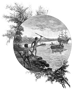
Farming in the nineteenth century
The Rosedale valley includes portions 11, 12, 32, 81, 98, 118, 213, 214, 215 and 221 in the Parish of Bateman, County of St Vincent. Land intended for settlement was usually marked in 40-acre (16ha) lots due to the then official view that this was an area suitable for sustaining a living. Portions 11 and 12 were taken up by Thomas Hollands in 1878, while John Hollands was granted portion 32, also straddling the creek but further west, in the same year. However, there is no evidence that either man settled in the area.
Rosedale Farm was first settled by James Sebbens, while the western end of the valley was settled by Karl Thomsen. Both men cleared the bush to establish their farms.
The father of James, also called James Sebbens was born in Essex in 1814. He was transported as a convict on the ‘John Barry’ in 1838 and was assigned to serve his time at Broulee. He received his certificate of freedom in 1848. In 1851 he married Celia Ann Barlings. Celia had arrived at Broulee from England with her parents in 1832 at the age of four years. The Sebbens family lived in the Tomakin area on a property called Oaks Ranch, southwest of Candlagan Creek. They had 14 children. James Sebbens died in 1876 and is buried at Moruya. His widow married Henry Rose (1820–1906), who is buried at Mogo.
Cecilia’s father, Richard Henry Barling, who was a free overseer, formalised his conditional purchase of portion 5 in 1852. Portion 5 is now the site of the Barlings Beach caravan park.
Joseph Sebbens, the eldest son of James and Cecilia, operated a steam mill at Malua Bay in the latter part of the 1800s with the help of his brother, William. This mill had been originally set up at Tomakin by a Robert Jennings in 1874 but was salvaged and moved by Joseph after Jennings abandoned it in the 1880s.
James Sebbens (junior), born 1858, cleared and developed Rosedale and parts of Burri/Guerilla Bay. His wife's brother (maybe father?), Karl Thomsen, cleared all of portions 32, 213 and 221.
A surveyor's report of 1884 noted that there was 2 acres (0.81ha) of cleared land, 38 acres (15ha) of land with ring barked trees, and a house. Sebbens cleared all the land in portions 81, 214, 215 and most of 98, although it is not clear whether he cleared right to the cliff edge at what is now called North Rosedale. While significant regrowth has occurred, particularly during the last decades, the distinction in tree height and density can be seen.
From 1870 to 1908 the Sebbens family developed a farm of 700 acres (280ha). They owned 430 acres (170ha) and occupied but had no title to 285 acres (115ha) of the land they farmed. They were mainly dairy farmers producing cheddar cheese. A set of old bails remains from this period near the creek downhill from the present farmhouse.
The farmhouse burnt down in the late nineteenth century. The present day farmhouse was constructed from two existing houses.
In 1908 the Sebbens family sold to Herman Nibbe and moved to western Sydney where they farmed poultry. At the time of the sale the property was consolidated into one title under freehold with all the conditional purchase areas being converted.
Twentieth-century developments
Nibbe had tried to farm sheep as well as maintaining production of cheddar. In financial difficulty he sold the property in 1913 but continued to farm under lease until 1921. Horace Benjamin O’Neil purchased the farm in 1921. The farm was starting to become less productive as the soils were not good and became depleted once the trees were cleared.
The first car in the district was an International Motor Buggy purchased in 1908 by Adolf Thomsen, a grazier at Tomakin. (The car is still owned by a Batemans Bay family.) The development of better transport through the availability of motor cars opened up the area.
Rosedale Association and the Keep Australia Beautiful NSW awards
Rosedale has an active association that was established in the early 1970s. Recent achievements include willing regional and state honours in the 2003 NSW Clean Beach Challenge, organised by Keep Australia Beautiful NSW. Rosedale was also awarded a highly commended certificate in the Natural Heritage Award (regional). An award was also received in 2004.
The 2003 citation reads:
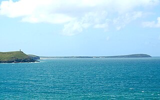
‘Rosedale Beach, just south of Malua Bay, is a comparatively small beach which is notable for the great rock formations along the beach and headlands and the position of Jimmies Island, which also offers some protection against southerlies. When the water level is high enough, Saltwater Creek flows into the ocean at the northern end of the beach. At the time of inspection, there was not enough water to flow out of the lagoon and into the ocean. Despite this, the creek/lagoon is healthy and appeared to be a haven for wildlife.
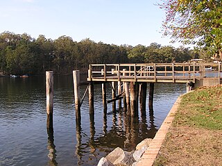
‘The beach is pretty much surrounded by the village of Rosedale, which is separated from the beach by a small reserve. Rosedale is a typical holiday village, with the population more than doubling during summer. The community is very dedicated to maintaining the quality of their beach, which forms a major part of their lives. There is an historic community boat shed at the northern end of the beach, which has been in existence since the thirties and which is maintained in good repair by local boat owners.
‘Locals are motivated to try and stabilise the fore dune of the beach after some major erosion damage caused by storms some years ago. With this aim, there has been an extensive program of environmental weed control and revegetation with natives, which has been fairly successful. A major part of this work has been the encouragement of the whole community to lend a hand to undertake the work.’
Our judge stated, ‘The level of community involvement, along with partnerships between Landcare and council, in restoration and maintenance work at the beach is very impressive indeed. There is a regular newsletter which goes out to local residents (including the "part-time" residents), and this helps both educate the community and coordinate clean-up and Landcare efforts. The level of attendance at regular beach clean-ups and working bees is also astounding, getting up to 70 per cent of the local population (and in summer, includes many of the "part-time" residents). The locals ability to motivate even the nonpermanent resident holiday home owners to participate in helping keeping a clean and healthy beach is nothing short of amazing. The fact that residents decided that they wanted a regular monthly activity is a testament to the success of the Landcare/Residents’ Groups education efforts.’
Batemans Marine Park
Batemans Marine Park in 2017
Batemans Marine Park was established on 30 June 2007 and encompasses all waters at Rosedale.[2] The waters split into two zones commencing at a north-east position on the rock ledge at the southern headland, with the boundary line extending eastwards along latitude 35⁰ 49.030", via the north-east tip of Jimmies Island to a longitude 150⁰ 14.341" position at sea.[3]
The Habitat Protection Zone extends northwards from the boundary line along Rosedale's beaches and coves, McKenzies Beach, Pretty Point and on past Batemans Bay to Wasp Island at Durras South. Minor restrictions apply to Recreational fishing and major restrictions on Commercial fishing in the Habitat Protection Zone.
The Burrewarra Point Sanctuary Zone which includes Jimmies Island, commences south of the boundary line and extends around to Nuns Beach, Tranquil Bay, Guerilla Bay, around Burrewarra Point to Long Nose Point. All Recreational and Commercial fishing is prohibited in the Sanctuary Zone (there was an Amnesty for Recreational line fishing from mainland ocean beaches and headlands, with an exclusion area around Burrewarra Point that operated from March 2013 to December 2014).[4] The Burrewarra Point Sanctuary Zone is a breeding ground for grey nurse sharks (critically endangered).
Nature walks
The Rosedale - Guerilla Bay Circuit is a popular walking track starting at the southern end of Tranquil Bay Place, Rosedale and ending up at Guerilla Bay. Highlights of the walk include possible sea eagle and cockatoo sightings, crossing Nuns Beach, and views of Jimmies Island and Guerilla Bay.[5]
Protected areas of Tasmania consists of protected areas located within Tasmania and its immediate onshore waters, including Macquarie Island. It includes areas of crown land managed by Tasmanian Government agencies as well as private reserves. As of 2016, 52% of Tasmania's land area has some form of reservation classification, the majority is managed by the Tasmania Parks & Wildlife Service. Marine protected areas cover about 7.9% of state waters.
The Jervis Bay Territory is a territory of the Commonwealth of Australia. It was surrendered by the state of New South Wales to the Commonwealth Government in 1915 so that the Australian Capital Territory would have access to the sea.
The Bundjalung National Park is a 210-square-kilometre (81 sq mi) national park located on the north coast of New South Wales, Australia, 554 kilometres (344 mi) north-east of Sydney. It protects an area of coastal plain, heathland and solitary beaches between the towns of Iluka and Evans Head.
Batemans Bay is a city in the South Coast region of the state of New South Wales, Australia. Batemans Bay is administered by the Eurobodalla Shire council. The city is situated on the shores of an estuary formed where the Clyde River meets the South Pacific Ocean.
Cape Byron is the easternmost point of the mainland of Australia, located in New South Wales. It is about 3 km (1.9 mi) east of the town of Byron Bay, New South Wales and projects into the Pacific Ocean at 28.6335° S, 153.6383° E. A lighthouse is situated there. It is a popular area for hiking and for whale watching. Two national parks, one a conservation area and a marine park, are on the bay.
Eurobodalla Shire is a local government area located in the South Coast region of New South Wales, Australia. The Shire is located in a largely mountainous coastal region and situated adjacent to the Tasman Sea, the Princes Highway and the Kings Highway.
Port Stephens, an open youthful tide-dominated drowned-valley estuary, is a large natural harbour of approximately 134 square kilometres (52 sq mi) located in the Hunter Region of New South Wales, Australia.
Kurnell is a suburb in Sydney, in the state of New South Wales, Australia. It is 21.4 kilometres (13.3 mi) south of the Sydney central business district, in the local government area of the Sutherland Shire along the east coast. Cronulla and Woolooware are the only adjacent suburbs. La Perouse is located opposite, on the northern headland of Botany Bay. The Cronulla sand dunes are on the south eastern headland of Botany Bay. The eastern side of the peninsula is part of Botany Bay National Park, and Towra Point Nature Reserve is located on the western side of the suburb.
Broulee is a town on the south coast of New South Wales between Batemans Bay and Moruya. At the 2016 census, the town had a population of 1,717. Just off the beach is Broulee Island, currently joined to the mainland, but in past years the connecting spit has been covered by water, at times a very deep navigable channel with a strong current.
Marine Park is a neighborhood in the New York City borough of Brooklyn. The neighborhood lies between Flatlands and Mill Basin to the east, and Gerritsen Beach, Midwood, and Sheepshead Bay to the south and west. It is mostly squared off in area by Gerritsen Avenue, Flatbush Avenue, Avenue U and Kings Highway. The neighborhood's eponymous park is the largest public park in Brooklyn. Charles Downing Lay won a silver medal in town planning at the 1936 Olympics for the planning of Marine Park.
Narooma is a town in the Australian state of New South Wales on the far south coast. The town is on the Princes Highway and the name Narooma is said to be derived from the Aboriginal word meaning ‘clear blue waters’. At the 2016 census, Narooma had an urban population of over 3,000 people.
The Broulee Island Nature Reserve is a protected nature reserve located on the south coast of New South Wales, Australia. The 43 ha reserve was created in 1972 and is managed by the NSW National Parks & Wildlife Service. The reserve is situated 23 kilometres (14 mi) south of Batemans Bay and is adjacent to the village of Broulee.
Forresters Beach is a coastal suburb of the Central Coast region of New South Wales, Australia between Terrigal and Bateau Bay. It forms part of the Central Coast Council local government area. Forresters Beach is well known for its reef breaks to surfers. The name "Forresters Beach" comes from Robert Forrester who purchased 50 acres (200,000 m2) of land in 1861.
Potato Point is a village in the Eurobodalla Shire lying on the south coast of New South Wales, Australia. It is connected by road to the town of Bodalla, and surrounded by the Eurobodalla National Park. The Yuin are considered to be the traditional owners of the region. At the 2016 census, Potato Point had a population of 135 and 56 occupied and 78 unoccupied dwellings. The only non-residential facilities are the local rural fire brigade depot which houses two appliances, toilet and shower block, boat ramp, two small parks and a telephone box.
Garrapata State Park is a state park of California, USA, located on Highway 1 6.7 miles (10.8 km) south of Carmel and 18 miles (29 km) north of Big Sur on the Monterey coast. It is marked only with one sign on the west side of the road. Numbered turnouts mark each parking area. The 2,939-acre (1,189 ha) park was established in 1979.
Nelligen is a village on the Clyde River on the South Coast of New South Wales, Australia. It is located on the Kings Highway.
Hearst San Simeon State Park is a state park of California, USA, preserving rocky coast and rare habitats. It is located between Cambria and San Simeon. The 3,409-acre (1,380 ha) park was first established in 1932. The park includes the Santa Rosa Creek Natural Preserve, the San Simeon Natural Preserve and the Pa-nu Cultural Preserve, which were established in 1990.
South Durras is a small village on the South Coast of New South Wales, Australia. South Durras is located approximately 280 kilometres south of Sydney and 15 kilometres north of Batemans Bay, in the local government area of Eurobodalla Shire. The village is surrounded by the Murramarang National Park.
Trevose Head is a headland on the Atlantic coast of north Cornwall, United Kingdom. It is situated approximately 5 miles (8.0 km) west of Padstow. The South West Coast Path runs around the whole promontory and is within the Cornwall Area of Outstanding Natural Beauty and the Trevose Head Heritage Coast. In clear weather, visitors to Trevose Head can see virtually the whole length of the north Cornwall coast; to the north, the view extends beyond the Cornwall county boundary to Hartland Point, Devon; to the south, it extends beyond St Ives to the headland at Pendeen Watch.
Tomakin is a small seaside village on the south coast of New South Wales between the major towns of Batemans Bay and Moruya. At the 2016 census, the town had a population of 1,001. It is more closely flanked by the other small villages of Guerilla Bay and Mossy Point.
This page is based on this Wikipedia article Text is available under the CC BY-SA 4.0 license; additional terms may apply. Images, videos and audio are available under their respective licenses.