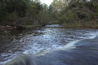
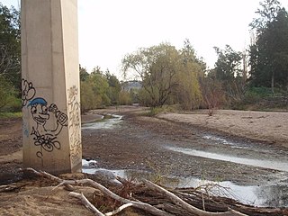
The Wollemi Creek, a partly perennial stream of the Hawkesbury-Nepean catchment, is located in the Central Tablelands and Blue Mountains regions of New South Wales, Australia.
Cochrane Dam is a minor earthfill embankment dam with concrete spillway across Georges Creek, located in the South Coast region of New South Wales, Australia. The main purpose of the dam is to supply water for hydro-power at the downstream Brown Mountain Power Station and for irrigation purposes. The impounded reservoir is called Cochrane Lake.

The Mooney Mooney Creek, a perennial river that is part of the Hawkesbury-Nepean catchment, is located in the Central Coast region of New South Wales, Australia.
The Billabong Creek, a perennial river of the Murrumbidgee catchment within the Murray–Darling basin, is located in the South West Slopes region of New South Wales, Australia.

The Wolgan River, a watercourse of the Hawkesbury-Nepean catchment, is located in the Central Tablelands region of New South Wales, Australia.

Barnard River, a perennial river of the Manning River catchment, is located in the Northern Tablelands and Mid North Coast districts of New South Wales, Australia.
Bow River, a partly perennial stream of the Hunter River catchment, is located in the Hunter district of New South Wales, Australia.
Brogo River, a perennial river that is part of the Bega River catchment, is located in the South Coast region of New South Wales, Australia.
Dry River is a perennial river of the Murrah River catchment, located in the South Coast region of New South Wales, Australia.
Murrah River is an open mature wave dominated barrier estuary or perennial river located in the South Coast region of New South Wales, Australia.
The Nunnock River, a perennial stream of the Bega River catchment, is located in the Monaro region of New South Wales, Australia.
Oxley River, a perennial river of the Tweed River catchment, is located in the Northern Rivers region of New South Wales, Australia.

The Bega River is an intermittently open intermediate wave dominated barrier estuary that is located in the South Coast region of New South Wales, Australia.

Paddys River, a watercourse of the Murray catchment within the Murray–Darling basin, is located in the Australian Alpine region of New South Wales, Australia.

Brown Mountain, at an elevation of 1,243 metres (4,078 ft) AHD, is the highest mountain in the Monaro region of New South Wales, Australia.
Jerrabattgulla Creek, a perennial stream of the Shoalhaven River catchment, is located in the Southern Tablelands region of New South Wales, Australia.
Bettowynd Creek, a partly perennial stream of the Moruya River catchment, is located in the Southern Tablelands and South Coast regions of New South Wales, Australia.
The Blue Mountain Creek, an intermittent stream that is part of the Macleay River catchment, is located in the Northern Tablelands region of New South Wales, Australia.
The Ralfes Creek, a perennial stream that is part of the Hastings River catchment, is located in the Mid North Coast region of New South Wales, Australia.
Widden Brook, a partly perennial stream of the Hunter River catchment, is located in the Hunter region of New South Wales, Australia.


