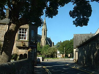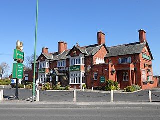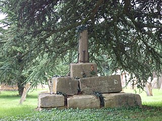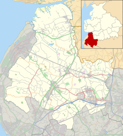
Barnoldswick is a town and civil parish in Lancashire, England, just outside the Yorkshire Dales National Park and the Forest of Bowland Area of Outstanding Natural Beauty. Stock Beck, a tributary of the River Ribble, runs through the town, which has a population of 10,752.

Bolton-le-Sands is a large village and civil parish of the City of Lancaster in Lancashire, England. The parish had a population of 4,098 recorded in the 2001 census, increasing to 4,127 at the 2011 Census.

Thornton is a village in the Metropolitan Borough of Sefton, in Merseyside, England. Situated to the north east of Crosby, it is a residential area of semi-detached and detached housing which dates mainly from the 1930s. Many of the houses, particularly those around Edge Lane and Water Street, feature notably long gardens. The A565 Liverpool-Southport road serves the area. At the 2001 Census the population of the village and civil parish was recorded as 2,262, falling to 2,139 at the Census 2011.

Lathom is a village and civil parish in Lancashire, England, about 3 miles (5 km) northeast of Ormskirk. It is in the district of West Lancashire, and with the parish of Newburgh forms part of Newburgh ward. The population of the civil parish at the 2011 census was 914. The Leeds and Liverpool Canal passes through Lathom.

Haskayne is a small village in the county of Lancashire, England, and on the West Lancashire Coastal Plain. It is to the north of Downholland Cross on the A5147 and the Leeds and Liverpool Canal.

Freckleton is a village and civil parish on the Fylde coast in Lancashire, England, to the south of Kirkham and east of the seaside resort of Lytham St. Annes. In 2001 it had a population of 6,045, reducing to 6,019 at the 2011 Census. The village is near Warton, with its links to BAE Systems. Warton Aerodrome's 1.5 miles (2.4 km) runway is partly within Freckleton's boundary. Freckleton has a parish council, and is part of Fylde Borough, and Fylde constituency.

Downholland is a civil parish in Lancashire, England, on the West Lancashire Coastal Plain. The population at the 2011 census was 913. The area contains several villages including Haskayne, Barton and Downholland Cross, and the Leeds and Liverpool Canal and the A5147.

Burrow-with-Burrow is a civil parish in the English county of Lancashire. The parish of Burrow-with-Burrow had a population of 191 recorded in the 2001 census, decreasing to 182 at the 2011 Census.

Edenham is a village and civil parish in the South Kesteven district of Lincolnshire, England. It is approximately 3 miles (5 km) north-west of Bourne, and on the A151 road. While the civil parish is called "Edenham", the parish council is called Edenham, Grimsthorpe, Elsthorpe & Scottlethorpe Parish Council. The population of the civil parish at the 2011 census was 291. The parish is principally located in the valley of the East Glen which flows through the village.

Thornton in Lonsdale is a village and civil parish in the District of Craven and ceremonial county of North Yorkshire in England. It is very close to the border with Cumbria and Lancashire and is 1 mile (1.6 km) north of Ingleton and 5 miles (8.0 km) south east of Kirkby Lonsdale, and has a population of 308, falling to 288 at the 2011 Census. Its main claims to fame are the Marton Arms pub and St Oswald's Church, Sir Arthur Conan Doyle married his first wife at this church in 1885 and held his reception at The Marton Arms before setting off to Ireland on honeymoon. Doyle's mother resided at nearby Masongill from 1882 to 1917.

Salford Priors is a rural, agricultural village and civil parish about four miles south-west of Alcester, Warwickshire, England. The population of the civil parish as taken at the 2011 census was 1,546. It is on the Warwickshire border with Worcestershire.

Reed is a small village and civil parish in North Hertfordshire. It is situated on a chalk ridge at almost the highest point in the county, approximately 3 miles south of the market town of Royston. The Prime Meridian passes just to the east of the village, between Reed and Barkway. The modern A10 road passes just to the west of the village.

Pendleton is a small village and civil parish in Ribble Valley, within the county of Lancashire, England. It is close to the towns of Whalley and Clitheroe. The parish lies on the north west side of Pendle Hill below the Nick o' Pendle. The village is just off the A59, Liverpool to York main road, since the construction of the Clitheroe By-Pass. Older roads through the parish include one from Clitheroe to Whalley which passes through the Standen area and another to Burnley which passes Pendleton Hall.

Grindleton is a village and civil parish in the Ribble Valley district of the English county of Lancashire, formerly in the West Riding of Yorkshire. Its 3,700 acres sit within the Forest of Bowland. The population of the civil ward taken at the 2011 census was 772.

Over Kellet is a village and civil parish near Carnforth in the English county of Lancashire. The parish, which is in the City of Lancaster, includes the village of Capernwray, at its northern end, and has a population of 778, decreasing slightly to 761 at the 2011 Census. The Lancaster Canal passes through the parish.

Rimington is a rural village and civil parish in the Ribble Valley, Lancashire, England. The population of the civil parish was 382 at the 2001 Census, however at the 2011 Census Middop was included with Rimington giving a total of 480. It is east of Clitheroe and south of the A59 road. The village consists of the hamlets of Howgill, Martin Top, Newby, and Stopper Lane, and was formerly in the West Riding of Yorkshire.

Witnesham is a village situated roughly 4 miles (6 km) to the north of Ipswich, Suffolk. The main road from Ipswich that links the village to the town is the B1077, Westerfield Road.

Paythorne is a small village and civil parish in Ribble Valley, Lancashire, England. It is situated alongside the River Ribble, north-east of Clitheroe, and on the boundary with North Yorkshire. Other parishes adjacent to Paythorne are Halton West, Nappa, Newsholme, Horton, Gisburn, Sawley, Bolton-by-Bowland and Gisburn Forest. The nearest town is Barnoldswick, situated 7 kilometres (4.3 mi) south-east of the village. Paythorne is on the edge of the Forest of Bowland Area of Outstanding Natural Beauty, although only a small area in the west of the parish is within the area's boundary. The Ribble Way long distance walk passes through the village.

Barton is a small village in the county of Lancashire, England. It is situated approximately 4 miles (6 km) west from Ormskirk, and less than 1 mile (2 km) west from the A5147 road. Barton sits on the West Lancashire Coastal Plain, and is 5 miles (8 km) from the Irish Sea coast. The village lies within the civil parish of Downholland.
Downholland is a civil parish in the West Lancashire district of Lancashire, England. It contains eight listed buildings that are recorded in the National Heritage List for England. All the listed buildings are designated at Grade II, the lowest of the three grades, which is applied to "buildings of national importance and special interest". The parish contains the villages of Barton, Haskayne and Downholland Cross, and is otherwise rural. The Leeds and Liverpool Canal passes through the parish. Two milestones by the towpath of the canal are listed, and the other listed buildings are houses and associated structures.


