Hilldale, Lancashire

Last updated

Hilldale
Houses at junction of Chorley Road and Malt Kiln Lane - Geograph 4355225.jpg
Houses at the junction of Chorley Road and Maltkiln Lane
Location map United Kingdom Borough of West Lancashire.svg
Red pog.svg
Hilldale
Location in West Lancashire
Lancashire UK location map.svg
Red pog.svg
Hilldale
Location within Lancashire
Area3.63 km2 (1.40 sq mi)
Population581 (2011 Census)
  Density 160/km2 (410/sq mi)
OS grid reference SD494121
District
Shire county
Region
Country England
Sovereign state United Kingdom
Post town Skelmersdale, Wigan
Postcode district WN8
Post townOrmskirk
Postcode district L40
Post townChorley
Postcode district PR7
Dialling code 01257
Police Lancashire
Fire Lancashire
Ambulance North West
UK Parliament
List of places
UK
England
Lancashire
53°36′11″N2°45′54″W / 53.603°N 2.765°W / 53.603; -2.765

Hilldale is a civil parish in the West Lancashire district of Lancashire, England, containing the village of Hill Dale and the neighbouring hamlet of Andertons Mill. Formerly part of Wrightington, Hilldale became a separate civil parish in 1999. As of 2011, Hilldale has a population of 581.

Contents

History

In the 19th century, Hilldale had a small population and the settlement consisted of scattered farms and worker's cottages. The opening of the local quarry in the 1880s brought new opportunities to the area and it served as one of the main sources of employment until its closure in the 1970s. Hilldale established its own parish council on 1 April 1999, having previously been a ward of Wrightington civil parish. [1] [2]

Geography

Hilldale is located in rural West Lancashire and is bordered by Bispham and Lathom to the west, Parbold to the south and Wrightington to the east; to the north are Mawdesley and Heskin in the borough of Chorley. The boundary with Lathom is formed by the River Douglas. The civil parish includes the hamlet of Andertons Mill, situated northeast of Hill Dale village. [3]

Hilldale is about 11 miles (18 km) southwest of Preston, the administrative centre of Lancashire, and 183 miles (295 km) northwest of London.

Demography

According to the United Kingdom Census 2011, Hilldale parish had a population of 581 people living in 248 households, with an approximate

A majority of

Landmarks

Flooded part of Hunters Hill Quarry Flooded part of Hunters Hill Quarry - geograph.org.uk - 719583.jpg
Flooded part of Hunters Hill Quarry

Hilldale has several listed buildings that are recorded on the National Heritage List for England, including Fairhurst Hall, an 18th-century brick house incorporating some older 16th century remains, [10] a medieval stone cross base, [11] and other farmhouses and farm buildings. In addition, West Lancashire Borough Council publishes its own "list of locally important buildings", [12] which features a large brick villa on Robin Lane divided into two dwellings. [13]

There are two designated conservation areas that lie partially within Hilldale: [14] [15] the Lancaster Lane conservation area is largely in Parbold but extends into the southern part of Hilldale and includes the aforementioned Fairhurst Hall, [16] while the Maltkiln Lane/Chorley Road conservation area straddles the boundary with Bispham. [17]

Hunters Hill, a former quarry to the east of Hill Dale village, has been converted into a countryside park and is maintained by the Borough Council. [18]

Transport

There are no main roads in Hilldale; the B5246 road passes through the southern part of the parish, running southeast from Mere Brow to Parbold, where it terminates at its junction with the A5209 about 0.7 miles (1.1 km) to the south. The nearest motorway link is junction 27 of the M6, about 2.2 miles (3.5 km) to the southeast at Wrightington. [3] Parbold railway station is located about 0.6 miles (0.97 km) to the south and provides services to Manchester (via Wigan) and Southport. [19]

Religious sites

Parbold Evangelical Church Parbold Evangelical Church - Geograph 2660328.jpg
Parbold Evangelical Church

The only place of worship within Hilldale is Parbold Evangelical Church on Chorley Road, which holds a morning and evening service every Sunday. [20] The area of Hilldale is served by the Anglican parish churches of Christ Church in Parbold, [21] and St James the Great Church in Wrightington. [22]

Related Research Articles

<span class="mw-page-title-main">Chorley</span> Town in Lancashire, England

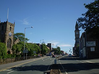
Chorley is a town and the administrative centre of the wider Borough of Chorley in Lancashire, England, 8 miles (13 km) north of Wigan, 11 miles (18 km) south west of Blackburn, 11 miles (18 km) north west of Bolton, 12 miles (19 km) south of Preston and 20 miles (32 km) north west of Manchester. The town's wealth came principally from the cotton industry.

<span class="mw-page-title-main">Ormskirk</span> Market town in Lancashire, England

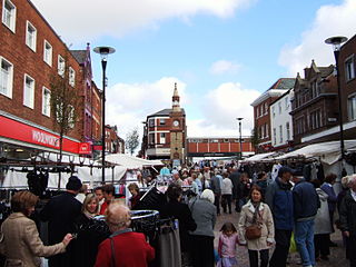
Ormskirk is a market town in the West Lancashire district of Lancashire, England, 13 miles (21 km) north of Liverpool, 11 miles (18 km) northwest of St Helens, 9 miles (14 km) southeast of Southport and 18 miles (29 km) southwest of Preston. Ormskirk is known for its gingerbread. In 2011 it had a population of 24,073.

<span class="mw-page-title-main">Parbold</span> Human settlement in England

Parbold is a village and civil parish in West Lancashire, England.

<span class="mw-page-title-main">West Lancashire</span> District of Lancashire, England

West Lancashire is a local government district with borough status in Lancashire, England. The council is based in Ormskirk, and the largest town is Skelmersdale. The borough also contains the town of Burscough and surrounding rural areas.

<span class="mw-page-title-main">Borough of Chorley</span> Borough and non-metropolitan district in England

The Borough of Chorley is a local government district with borough status in Lancashire, England. It is named after its largest settlement, the town of Chorley. The borough also includes the town of Adlington and several villages.

<span class="mw-page-title-main">Coppull</span> Human settlement in England

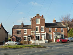
Coppull is a village and civil parish in Lancashire, England. It is part of the Borough of Chorley, lies around 300 feet (91 m) above sea level. Its population is around 8,000, having been counted at 7,959 in the 2011 Census. It is bounded by Whittle Brook, Clancutt Brook, the River Yarrow, Eller Brook, Hic-Bibi Brook and Stars Brook. Coppull is located between Chorley and Standish, Greater Manchester, to the east of the A49 road near Charnock Richard.

<span class="mw-page-title-main">Chorley (UK Parliament constituency)</span> Parliamentary constituency in the United Kingdom, 1885 onwards

Chorley is a constituency in Lancashire represented in the House of Commons of the UK Parliament since 1997 by Lindsay Hoyle. Hoyle was originally elected for the Labour Party, but in 2019 became the Speaker, making him unaffiliated.

<span class="mw-page-title-main">West Lancashire (UK Parliament constituency)</span> Parliamentary constituency in the United Kingdom, 1983 onwards

West Lancashire is a county constituency represented in the House of Commons of the UK Parliament. Following the resignation of Labour MP Rosie Cooper on 30 November 2022, the seat was won by the party's candidate Ashley Dalton in the by-election held on 9 February 2023.

<span class="mw-page-title-main">Eccleston, Lancashire</span> Village and civil parish in England

Eccleston is a village and civil parish of the Borough of Chorley in Lancashire, England. It is beside the River Yarrow, and was formerly an agricultural and later a weaving settlement.

<span class="mw-page-title-main">Clayton-le-Woods</span> Human settlement in England

Clayton-le-Woods is a large village and civil parish of the Borough of Chorley, in Lancashire, England. According to the census of 2001, it has a population of 14,528. At the 2011 census the population of Cuerden civil parish was included within Clayton-le-Woods, giving a total of 14,532.

<span class="mw-page-title-main">Appley Bridge</span> Village in Lancashire, England

Appley Bridge is a village in West Lancashire, England. It straddles the borders of Greater Manchester and Lancashire, England. It is located off Junction 27 of the M6 motorway and is nestled in the Douglas Valley alongside the Leeds and Liverpool Canal.

<span class="mw-page-title-main">Bispham Green</span> Human settlement in England

Bispham Green is a village in the West Lancashire district of Lancashire, England. It is 1 mile (1.6 km) south of Mawdesley and less than 1 mile (1.6 km) north of Parbold.

<span class="mw-page-title-main">Mawdesley</span> Human settlement in England

Mawdesley is a village and civil parish in Lancashire, England, which had a population of 1,702 as per the 2011 Census.

<span class="mw-page-title-main">Wrightington</span> Human settlement in England

Wrightington is a civil parish in West Lancashire, England, with an area of 3,915½ acres. The surface is hilly, rising to over 400 ft. at Harrock on the border of Parbold, and then falling to the north, northeast and southeast. On the southern border, the boundary at Appley Bridge touches the River Douglas. Wrightington Hall is to the north of this point. Tunley and Broadhurst lie to the north of the park, and Fairhurst, to the west of Harrock, reaches down to the River Douglas. At the 2001 census, Wrightington had a population of 4,055, falling to 2,886 at the 2011 Census.

<span class="mw-page-title-main">St James the Great Church, Wrightington</span> Church in Lancashire, England

St James the Great Church is in Church Lane, to the west of Wrightington in Lancashire, England. It is an active Anglican parish church in the deanery of Chorley, the archdeaconry of Blackburn, and the diocese of Blackburn. The church is recorded in the National Heritage List for England as a designated Grade II listed building.

Parbold is a civil parish in the West Lancashire district of Lancashire, England. It contains 15 buildings that are recorded in the National Heritage List for England as designated listed buildings. Of these, two are at Grade II*, the middle grade, and the others are at Grade II, the lowest grade. The parish contains the large village of Parbold and the surrounding countryside. The Leeds and Liverpool Canal passes through the parish and the listed buildings associated with this are four bridges, two milestones, and a lock. The other listed buildings are houses, a farm building, a former windmill, a railway signal box, and two churches.

References

  1. "History". Hilldale Parish Council. Retrieved 29 November 2015.
  2. "The West Lancashire (Parishes) Order 1998" (PDF). Amazon AWS. Retrieved 1 February 2019.
  3. 1 2 "Election Maps". Ordnance Survey . Retrieved 29 November 2015.
  4. UK Census (2011). "Local Area Report – Hilldale Parish (E04005319)". Nomis. Office for National Statistics . Retrieved 26 March 2021.
  5. "Key Figures for 2001 Census: Key Statistics". Office for National Statistics. Retrieved 29 November 2015.
  6. "Country of Birth (detailed), 2011 (QS203EW)". Office for National Statistics. Retrieved 29 November 2015.
  7. "Ethnic Group, 2011 (QS201EW)". Office for National Statistics. Retrieved 29 November 2015.
  8. "Religion, 2011 (QS208EW)". Office for National Statistics. Retrieved 29 November 2015.
  9. "Economic Activity, 2011 (QS601EW)". Office for National Statistics. Retrieved 29 November 2015.
  10. Historic England. "Fairhurst Hall (1365840)". National Heritage List for England . Retrieved 29 November 2015.
  11. Historic England. "Cross Base (1073010)". National Heritage List for England. Retrieved 29 November 2015.
  12. "Local list & buildings at risk". West Lancashire Borough Council . Retrieved 29 November 2015.
  13. "Survey Sheet; List of locally important buildings; Update 2014" (PDF). West Lancashire Borough Council. Retrieved 1 February 2019.
  14. "Heritage and environment: Conservation areas". West Lancashire Borough Council. Retrieved 29 November 2015.
  15. "Maps and directions: Conservation areas". West Lancashire Borough Council. Retrieved 29 November 2015.
  16. "Lancaster Lane, Detailed map" (PDF). West Lancashire Borough Council. Retrieved 29 November 2015.
  17. "Maltkiln Lane/Chorley Road, Detailed map" (PDF). West Lancashire Borough Council. Retrieved 29 November 2015.
  18. "Hunter's Hill, Hilldale". West Lancashire Borough Council. Retrieved 29 November 2015.
  19. "Parbold Station Information". Northern Rail . Retrieved 29 November 2015.
  20. "Parbold Evangelical Church". Fellowship of Independent Evangelical Churches . Retrieved 29 November 2015.
  21. "Christ Church, Parbold". A Church Near You . The Church of England . Retrieved 29 November 2015.
  22. "St James the Great, Wrightington w Heskin". A Church Near You. The Church of England. Retrieved 29 November 2015.