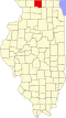
Durand, Illinois

Last updated
Durand
Village of Durand
Durand Town Picture.jpg
Downtown Durand
Nickname(s): 
Village of Volunteers
Winnebago County Illinois Incorporated and Unincorporated areas Durand Highlighted.svg
Location of Durand in Winnebago County, Illinois.
Illinois in United States (US48).svg
Location of Illinois in the United States
Coordinates: 42°26′02″N89°19′41″W / 42.43389°N 89.32806°W / 42.43389; -89.32806 Coordinates: 42°26′02″N89°19′41″W / 42.43389°N 89.32806°W / 42.43389; -89.32806
CountryUnited States
StateIllinois
County Winnebago
Township Durand
Government
  Village PresidentGary Haughton
Area
[1]
  Total0.92 sq mi (2.38 km2)
  Land0.92 sq mi (2.38 km2)
  Water0.00 sq mi (0.00 km2)
Elevation
[2]
778 ft (237 m)
Population
 (2020)
  Total1,390
  Density1,512.51/sq mi (584.02/km2)
Time zone UTC-6 (CST)
  Summer (DST) UTC-5 (CDT)
ZIP Code(s)
61024
Area code(s) 815
FIPS code 17-21280
GNIS ID(s) 407516, 2398762
Wikimedia CommonsDurand, Illinois
Website www.durand-il.com

Durand is a village in Winnebago County, Illinois, United States. It is part of the Rockford, Illinois Metropolitan Statistical Area The population was 1,443 at the 2010 census, up from 1,081 in 2000.

Contents

History

Its township's beginnings initiated originally in a no longer existing settlement called Elton, an area South of Durand and including parts of the Pecatonica and Rock Run townships and settled in 1835 by Nelson Salisbury, Harvey Lower, and Scott Robb. They and nine other families settled the Southwest portion of modern Durand, Pecatonica, and Rock Run area. Durand gave birth to Illinois' first tax-supported volunteer fire department. Since its settlement, Durand has been prone to devastating fires. [3] Durand's early flourishings were closely linked to the development of the Racine-Mississippi Railroad later absorbed into Western Union. [4] The line reached Durand in 1857, en route to Freeport, paving the shift from the Elton community into modern Durand and deriving its name from the railroad's first president, H.S. Durand. At this time, Durand saw the beginning of its prosperity which entailed the demise of the Elton settlement. [5]

Geography

Durand is located at 42°26′2″N89°19′41″W / 42.43389°N 89.32806°W / 42.43389; -89.32806 (42.433928, -89.328007). [6] It is located 14 miles by road north of US 20.svg US Route 20 on Illinois 70.svg Illinois Route 70. Illinois 75.svg Illinois Route 75 also runs south of town.

According to the 2010 census, Durand has a total area of 0.94 square miles (2.43 km2), all land. [7]

Demographics

Historical population
CensusPop.
1880 530
1890 489−7.7%
1900 57116.8%
1910 527−7.7%
1920 5494.2%
1930 5540.9%
1940 5926.9%
1950 67914.7%
1960 79717.4%
1970 97222.0%
1980 1,07310.4%
1990 1,1002.5%
2000 1,081−1.7%
2010 1,44333.5%
2020 1,390−3.7%
U.S. Decennial Census [8]

As of the census [9] of 2000, there were 1,081 people, 441 households, and 288 families residing in the village. The population density was 1,200.9 inhabitants per square mile (463.7/km2). There were 468 housing units at an average density of 519.9 per square mile (200.7/km2). The racial makeup of the village was 97.22% White, 0.56% African American, 0.28% Native American, 0.09% Pacific Islander, 0.65% from other races, and 1.20% from two or more races. Hispanic or Latino of any race were 1.02% of the population.

There were 441 households, out of which 34.9% had children under the age of 18 living with them, 53.1% were married couples living together, 9.5% had a female householder with no husband present, and 34.5% were non-families. 32.2% of all households were made up of individuals, and 15.6% had someone living alone who was 65 years of age or older. The average household size was 2.45 and the average family size was 3.10.

In the village, the population was spread out, with 28.9% under the age of 18, 6.9% from 18 to 24, 28.8% from 25 to 44, 21.8% from 45 to 64, and 13.6% who were 65 years of age or older. The median age was 36 years. For every 100 females, there were 92.0 males. For every 100 females age 18 and over, there were 86.7 males.

The median income for a household in the village was $43,988, and the median income for a family was $51,042. Males had a median income of $41,016 versus $23,068 for females. The per capita income for the village was $19,211. About 5.5% of families and 5.6% of the population were below the poverty line, including 5.1% of those under age 18 and 8.4% of those age 65 or over.

Notable people

Related Research Articles

Winnebago County, Illinois County in Illinois, United States

Winnebago County is a county located in the U.S. state of Illinois. According to the 2020 census, it had a population of 285,350 making it the seventh most populous county in Illinois behind Cook County and its five surrounding collar counties. Its county seat is Rockford. Winnebago County is the central county of the Rockford Metropolitan Statistical Area.

Stephenson County, Illinois County in Illinois, United States

Stephenson County is a county located in the U.S. state of Illinois. According to the 2010 United States Census, it had a population of 47,711. Its county seat is Freeport.

Boone County, Illinois County in Illinois, United States

Boone County is a county located in the U.S. state of Illinois. As of the 2020 census, the population was 53,448. Its county seat is Belvidere.

Caledonia, Illinois Village in Illinois, United States

Caledonia is a village in Caledonia Township, Boone County, Illinois, United States. It is part of the Rockford, Illinois Metropolitan Statistical Area. The population was 183 at the 2020 census.

Capron, Illinois Village in Illinois, United States

Capron is a village in Boone County, Illinois, United States. It is part of the Rockford, Illinois Metropolitan Statistical Area. The population was 1395 at the 2020 census, up from 1,376 at the 2010 census.

Loves Park, Illinois City in Illinois, United States

Loves Park is a city in Boone and Winnebago counties in the U.S. state of Illinois. Most of the city is in Winnebago County, with a tiny sliver in the east located in Boone County. The population was 23,996 at the 2010 census, up from 20,044 in 2000.

Arlington, Illinois Village in Illinois, United States

Arlington is a village in Bureau County, Illinois, United States. The population was 169 at the 2020 census. It is part of the Ottawa Micropolitan Statistical Area, located east of the Quad Cities, north of Peoria and Galesburg, west of LaSalle and Peru, and southwest of Rockford and Chicago.

Palmyra, Illinois Village in Illinois, United States

Palmyra is a village in Macoupin County, Illinois, United States. The population was 698 at the 2010 census.

<span class="mw-page-title-main">Davis Junction, Illinois</span> Village in Illinois, United States

Davis Junction is a village in Ogle County, Illinois, United States. The population was 2,373 at the 2010 census, up from 491 in 2000. Named for Jeremiah Davis, it is located where the Illinois Railway Rockford Line and the Canadian Pacific Railway Chicago Subdivision intersect along Illinois Route 72. It is the site of the Orchard Hills Landfill - one of the largest in the United States.

Mount Morris, Illinois Village in Illinois, United States

Mount Morris is a village in Mount Morris Township, Ogle County, Illinois, United States. The population was 2,998 at the 2010 census, down from 3,013 in 2000.

<span class="mw-page-title-main">German Valley, Illinois</span> Village in Illinois, United States

German Valley is a village in Stephenson County, Illinois, United States. German Valley is located four miles south of U.S. Route 20 between Freeport and Rockford. German Valley had a population of 463 at the 2010 census, down from 481 in 2000.

Machesney Park, Illinois Village in Illinois, United States

Machesney Park is a village located in Winnebago County, Illinois, United States. The population was 23,499 at the 2010 census, up from 20,759 in 2000. Machesney Park is a suburb of Rockford, Il and is part of the Rockford, Illinois Metropolitan Statistical Area.

New Milford, Illinois Village in Illinois, United States

New Milford is a village in Winnebago County, Illinois, United States on the south bank of the Kishwaukee River overlooking the south side of Rockford. It is part of the Rockford, Illinois Metropolitan Statistical Area. The population was 697 at the 2010 census, up from 541 in 2000.

Pecatonica, Illinois Village in Illinois, United States

Pecatonica is a village in Winnebago County, Illinois, United States. It is part of the Rockford, Illinois Metropolitan Statistical Area. The population was 2,195 at the 2010 census, up from 1,997 in 2000.

Rockton, Illinois Village in Illinois, United States

Rockton is a village in Winnebago County, Illinois. It is located in the Rock River Valley and is part of the Rockford metropolitan area. The population was 7,685 at the time of the 2010 census, up from 5,296 at the time of the 2000 census.

Roscoe, Illinois Village in Illinois, United States

Roscoe is a village in Winnebago County, Illinois, along the Rock River. It is in a suburban area of the Rockford, Illinois Metropolitan Statistical Area. As of the 2010 census, the village population was 10,785, up from 6,244 at the 2000 census. The area has been undergoing a period of rapid growth. There have been numerous border disputes with its neighbor to the west, Rockton, Illinois, and development and annexations continue by both villages. Recent growth has included the Promontory Ridge and Hidden Creek custom home subdivisions east of the Illinois Tollway, I-39/I-90.

<span class="mw-page-title-main">South Beloit, Illinois</span> City in Illinois, United States

South Beloit, is a city located in Winnebago County,Illinois, USA. It is part of the Rockford Metropolitan Area, but it is also a suburban extension of Beloit, Wisconsin. South Beloit,is directly along the border of smaller cities and towns north of Rockfords border. At the 2010 census, the city's population was 7,892, up from 5,297 in 2000.

Winnebago, Illinois Village in Illinois, United States

Winnebago is a village in Winnebago County, Illinois. It is part of the Rockford-Winnebago Metropolitan Statistical Area. The population was 3,101 at the 2010 census, up from 2,958 in 2000.

Rockford, Minnesota City in Minnesota, United States

Rockford is a city in Wright and Hennepin counties in the U.S. state of Minnesota. The population was 4,316 at the 2010 census. While Rockford is mainly located within Wright County, a small part of the city extends into Hennepin County. It is part of the Minneapolis–Saint Paul metropolitan statistical area. Minnesota State Highway 55 serves as a main route in the city.

Rockford metropolitan area, Illinois US statistics area

The Rockford Metropolitan Statistical Area, as defined by the United States Census Bureau, is an area consisting of four counties in north-central Illinois, anchored by the city of Rockford. As of the 2010 census, the MSA had a population of 349,431. The Rockford MSA abuts the southern portions of the Janesville-Beloit MSA and the Chicago MSA. It forms the main part of the larger Rockford–Freeport–Rochelle Combined Statistical Area.

References

  1. "2020 U.S. Gazetteer Files". United States Census Bureau. Retrieved March 15, 2022.
  2. "Newtown". Geographic Names Information System . United States Geological Survey, United States Department of the Interior . Retrieved 2007-10-21.
  3. Nelson, C. Hal (January 1, 1968). "Sinnissippi Saga: A History of Rockford and Winnebago County, Illinois". Winnebago.
  4. Grant, H. Roger (December 4, 1996). The North Western: A History of the Chicago & North Western Railway System (first ed.). Dekalb, Illinois: Northern Illinois University Press, First Edition. ISBN   0875802141.
  5. Church, Charles A. (August 1, 2013). "Past and Present of the City of Rockford and Winnebago County Illinois". Repressed Publishing.
  6. "US Gazetteer files: 2010, 2000, and 1990". United States Census Bureau. 2011-02-12. Retrieved 2011-04-23.
  7. "G001 - Geographic Identifiers - 2010 Census Summary File 1". United States Census Bureau. Archived from the original on 2020-02-13. Retrieved 2015-08-02.
  8. "Census of Population and Housing". Census.gov. Retrieved June 4, 2015.
  9. "U.S. Census website". United States Census Bureau . Retrieved 2008-01-31.