Dyker Beach Park and Golf Course

Last updated
The course Dyker Beach Golf Course.JPG
The course

The Dyker Beach Park and Golf Course is a public park and a municipal, 18-hole, [1] championship golf course [2] [3] in the southernmost part of Dyker Heights, Brooklyn, in New York City, United States. The area stretches from the Belt Parkway in the south to 86th Street in the north, between 7th Avenue on the west and 14th Avenue on the east.

Contents

The course totals 217 acres [4] and includes 6,548 yards of golf. [5] Both the park's and the course's roots go back more than 100 years, [6] and it is one of the most played public golf courses in the nation. [7]

The golf course is managed by the American Golf Corporation, which not only won the contract to run the majority of New York City courses in 1999 [8] but also renovated and expanded the club house in 2007-2008. [9] Dyker Beach Golf Course is one of the oldest golf courses in the United States and second oldest in New York City, behind Van Cortlandt Park, in the Bronx. [8] The course is open all year round so long as weather conditions allow for play.

History

The main entrance of the club house Dyker Beach Golf Course Club House.JPG
The main entrance of the club house

The park officially dates back to 1895, but its use as public land goes back to the times of the Canarsee Indians and the original New Utrecht Dutch settlers who referred to it as the "common land." [10] The Indians and the Dutch were unable to farm the land or to build houses on it because it was mainly meadows, marsh, and swamps. During the 17th century, the Van Dyke family tried to drain and reclaim this marshy land by building dykes. Thus the origins of the park’s name – after the Van Dyke family who built dykes or the dykes that the Van Dykes built. [4]

The park evolved in four stages between 1895 and 1934, from upwards of eight parcels of land. [4] Starting in 1895, the City of Brooklyn secured the first parcel, which stretched from the shore of Gravesend Bay to about 92nd street, and hired the landscape architecture firm of Olmsted, Olmsted and Eliot to design a 50-acre (200,000 m2) park, to be "the only seaside park in Greater New York." [11] It was to include a saltwater lagoon, children's playgrounds, bathhouses, lawns, and drives along the shore. [10] According to the NYC Parks Department, the 1896 Annual Report of the Brooklyn Parks Department claimed that Dyker Beach Park would be the "finest seaside park in the world." Although bathhouses were erected and roads were constructed, the plans were revised in 1911 by Mr. Charles D. Lay, a former landscape architect for the Park’s Department, who proposed to decrease the size of the lagoon and to add concert groves. In 1918 work began to fill the swampy areas of the park. [4]

Prior to the 1920s, land stretching from 92nd Street to 86th Street was privately owned. The Dyker Meadow Land and Improvement Company owned the largest parcel and leased the land to both the Dyker Golf Club and Marine and Field Club, who used the Dyker Heights Club House, built in 1898, as their golf club house. [12] In February 1916, the Poly Prep Country Day School, which was moving from 99 Livingston Street in Downtown Brooklyn to Dyker Heights, was unsuccessful in its attempts to purchase this parcel for their new county day school, as they were some $80,000 short. [13] Thus, the land was sold to the NYC Parks Department. However, Parks Commissioner Raymond V. Ingersoll, who had two boys at Poly, offered the school a 25-acre (100,000 m2) site on 92nd Street and 7th Avenue, which was donated to the Parks Department by Frederic B. Pratt, the Chairman of the Brooklyn Committee on City Planning. [13] The school graciously accepted the offer and constructed a neo-Georgian school, which still functions today in this same location.

According to the Parks Department, four additional parcels of land were acquired between 1924 and 1927 by assignment and condemnation and another three lots were transferred to the department in 1934, which concluded the expansion of the park. [4] These later expansions unmapped many streets which ran between 92nd and 86th streets, one such street was ‘De Russy Street’ which was built in the 1870s. In 2008, the New York City Department of Parks and Recreation agreed to name the circular driveway in front of the Dyker Beach Golf Course Club house in his honor. [14]

In 1935, the Club House was constructed, designed by architect John Van Kleek. [9] This building was renovated and expanded in 2008 by American Golf Corporation to house all golf operations as well as a wedding ceremony and reception hall which can accommodate 300 patrons. [15] [16]

Dyker Beach Golf Course was run by the New York City Parks Department until 1984, when operations were turned over to a private operator, American Golf Corporation. [17]

Today, besides the 18-hole golf course and the catering center, the park has baseball, football, and soccer fields as well as bocce, basketball, handball, and tennis courts. [4]

Dyker Beach Golf Course Catering Hall then-and-now main hall.jpg
The main hall in 2005 (left) and 2009 (right)

Usage of the course

During the 1950s and 1960s, Dyker Beach Golf Course was the world’s busiest, with over 100,000 rounds played annually. [8]

In 1965, a total of 103,581 rounds were played. [18] A golf getaway located in the heart of Brooklyn, it was one of the most played golf courses in the United States in the 1960s, averaging over 350 golfers a day during the season. Many of its golfers are locals who line up early in the morning in order to get a number for a round of golf. [19]

Notable golfers

Golf clubs

Dyker Beach Park is also home to four golf clubs that play on the course: the Shore View Golf Club, incorporated in 1930, one of the oldest public men's golf clubs in the United States; the Brookridge Ladies Club, also one of the older public golf clubs in the country; the Sand Trappers Senior Golf Club, that plays on Tuesdays and caters to older golfers; and a new club, Dyker Beach Women's Golf Club, that plays on Tuesday and Sunday mornings.

Related Research Articles

<span class="mw-page-title-main">Flushing Meadows–Corona Park</span> Public park in Queens, New York

Flushing Meadows–Corona Park, often referred to as Flushing Meadows Park, or simply Flushing Meadows, is a public park in the northern part of Queens, New York City. It is bounded by I-678 on the east, Grand Central Parkway on the west, Flushing Bay on the north, and Union Turnpike on the south. Flushing Meadows–Corona Park is the fourth-largest public park in New York City, with a total area of 897 acres (363 ha).
<span class="mw-page-title-main">Staten Island</span> Borough in New York City and county in New York, United States

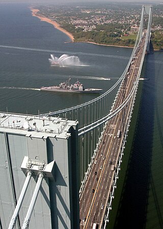
Staten Island is a borough of New York City, coextensive with Richmond County, in the U.S. state of New York. Located in the city's southwest portion, the borough is separated from New Jersey by the Arthur Kill and the Kill Van Kull and from the rest of New York by New York Bay. With a population of 495,747 in the 2020 Census, Staten Island is the least populated borough but the third largest in land area at 58.5 sq mi (152 km2).

<span class="mw-page-title-main">Prospect Park (Brooklyn)</span> Public park in Brooklyn, New York

Prospect Park is an urban park in Brooklyn, New York City. The park is situated between the neighborhoods of Park Slope, Prospect Heights, Prospect Lefferts Gardens, Flatbush, and Windsor Terrace, and is adjacent to the Brooklyn Museum, Grand Army Plaza, and the Brooklyn Botanic Garden. With an area of 526 acres (213 ha), Prospect Park is the second largest public park in Brooklyn, behind Marine Park.

<span class="mw-page-title-main">Bay Ridge, Brooklyn</span> Neighborhood of Brooklyn in New York City

Bay Ridge is a neighborhood in the southwest corner of the New York City borough of Brooklyn. It is bounded by Sunset Park to the north, Dyker Heights to the east, the Narrows and the Belt Parkway to the west, and Fort Hamilton Army Base and the Verrazzano-Narrows Bridge to the south. The section of Bay Ridge south of 86th Street is sometimes considered part of a sub-neighborhood called Fort Hamilton.

<span class="mw-page-title-main">Dyker Heights, Brooklyn</span> Neighborhood in Brooklyn in New York City

Dyker Heights is a predominantly residential neighborhood in the southwest corner of the borough of Brooklyn in New York City. It is on a hill between Bay Ridge, Bensonhurst, Borough Park, and Gravesend Bay. The neighborhood is bounded by 7th and 14th Avenues, 65th Street, and the Belt Parkway on the west, east, north, and south, respectively.
<span class="mw-page-title-main">New York City Department of Parks and Recreation</span> Government agency

The New York City Department of Parks and Recreation, also called the Parks Department or NYC Parks, is the department of the government of New York City responsible for maintaining the city's parks system, preserving and maintaining the ecological diversity of the city's natural areas, and furnishing recreational opportunities for city's residents and visitors.

<span class="mw-page-title-main">Sunset Park, Brooklyn</span> Neighborhood of Brooklyn in New York City

Sunset Park is a neighborhood in the southwestern part of the borough of Brooklyn in New York City, bounded by Park Slope and Green-Wood Cemetery to the north, Borough Park to the east, Bay Ridge to the south, and Upper New York Bay to the west. The neighborhood is named after a 24.5-acre (9.9 ha) public park of the same name, located between 41st and 44th Streets and Fifth and Seventh Avenues. The region north of 36th Street is also known as Greenwood Heights or South Slope.

<span class="mw-page-title-main">Pelham Bay Park</span> Large public park in the Bronx, New York

Pelham Bay Park is a municipal park located in the northeast corner of the New York City borough of the Bronx. It is, at 2,772 acres (1,122 ha), the largest public park in New York City. The park is more than three times the size of Manhattan's Central Park. The park is operated by the New York City Department of Parks and Recreation.
<span class="mw-page-title-main">Howard Beach, Queens</span> Neighborhood of Queens in New York City

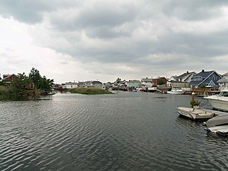
Howard Beach is a neighborhood in the southwestern portion of the New York City borough of Queens. It is bordered to the north by the Belt Parkway and Conduit Avenue in Ozone Park, to the south by Jamaica Bay in Broad Channel, to the east by 102nd–104th Streets in South Ozone Park, and to the west by 75th Street in East New York, Brooklyn. The area consists mostly of low-rise single-family houses.

<span class="mw-page-title-main">Bath Beach, Brooklyn</span> Neighborhood of Brooklyn in New York City

Bath Beach is a neighborhood in Brooklyn, New York City, United States. It is located at the southwestern edge of the borough on Gravesend Bay. The neighborhood borders Bensonhurst and New Utrecht to the northeast across 86th Street; Dyker Beach Park and Golf Course to the northwest across 14th Avenue; and Gravesend to the east across Stillwell Avenue.

<span class="mw-page-title-main">Fresh Meadows, Queens</span> Neighborhood of Queens in New York City

Fresh Meadows is a neighborhood in the northeastern section of the New York City borough of Queens. Fresh Meadows used to be part of the broader town of Flushing and is bordered to the north by the Horace Harding Expressway; to the west by Pomonok, St. John's University and the sub-neighborhoods of Hillcrest and Utopia; to the east by Cunningham Park and the Clearview Expressway; and to the south by the Grand Central Parkway.

<span class="mw-page-title-main">Forest Park (Queens)</span> Public park in Queens, New York

Forest Park is a park in the New York City borough of Queens, spanning 538 acres (218 ha). It is the tenth-largest park in New York City and the third-largest in Queens. Created on August 9, 1895, it was originally referred to as Brooklyn Forest Park, as the area was part of Brooklyn at the time.

<span class="mw-page-title-main">Van Cortlandt Park</span> Large public park in the Bronx, New York

Van Cortlandt Park is a 1,146-acre (464 ha) park located in the borough of the Bronx in New York City. Owned by the New York City Department of Parks and Recreation, it is managed with assistance from the Van Cortlandt Park Alliance. The park, the city's third-largest, was named for the Van Cortlandt family, which was prominent in the area during the Dutch and English colonial periods.

<span class="mw-page-title-main">Kew Gardens Hills, Queens</span> Neighborhood in Queens, New York City

Kew Gardens Hills is a neighborhood in the middle of the New York City borough of Queens. The borders are Flushing Meadows-Corona Park to the west, the Long Island Expressway to the north, Union Turnpike to the south, and Parsons Boulevard to the east.

<span class="mw-page-title-main">Sports in the New York metropolitan area</span>

Sports in the New York metropolitan area have a long and distinguished history.
<span class="mw-page-title-main">Poly Prep</span> Independent school in Dyker Heights, Brooklyn, New York , United States

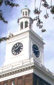
Poly Prep Country Day School is an independent, co-educational day school with two campuses in Brooklyn, New York, United States. The Middle School and Upper School are located in the Dyker Heights section of Brooklyn, while the Lower School is located in Brooklyn's Park Slope neighborhood. Initially founded as part of the Brooklyn Collegiate and Polytechnic Institute, Poly Prep now offers classes from nursery school through 12th grade.

Frank Strafaci was an American amateur golfer, who competed against the top amateurs of his time. He is remembered as one of Brooklyn's top amateur golfers.

<span class="mw-page-title-main">Ferry Point Park</span> Public park in the Bronx, New York

Ferry Point Park is a 413.8-acre (167.5 ha) park in the Bronx, New York City. The park site is a peninsula projecting into the East River roughly opposite the College Point and Malba neighborhoods of Queens. The park is located on the eastern shore of Westchester Creek, adjacent to the neighborhood of Throggs Neck. The park is operated by the New York City Department of Parks and Recreation. The Hutchinson River Expressway crosses the park to the Bronx-Whitestone Bridge, splitting it into east and west sides.

<span class="mw-page-title-main">Calvert Vaux Park</span> Public park in Brooklyn, New York

Calvert Vaux Park is an 85.53-acre (34.61 ha) public park in Gravesend, Brooklyn, in New York City. Created in 1934, it is composed of several disconnected sections along the Belt Parkway between Bay 44th and Bay 49th Streets. The peninsula upon which the park is located faces southwest into Gravesend Bay, immediately north of the Coney Island Creek. The park was expanded in the 1960s by waste from the construction of the Verrazzano-Narrows Bridge, and was renamed after architect Calvert Vaux in 1998. It is operated by the New York City Department of Parks and Recreation, also known as NYC Parks.

References

  1. Dyker Beach Golf Course Brooklyn, NY American Golf
  2. Perry, Jane (August 22, 1955). "Brooklyn's Mad Golf Course". Sports Illustrated. Retrieved May 14, 2013.
  3. Busch, Noel F. (May 21, 1938). "Tea and Green". The New Yorker: 61. Retrieved May 14, 2013.
  4. 1 2 3 4 5 6 Dyker Beach Park
  5. Dyker Beach Golf Course golflink.com
  6. "Dyker Beach Golf Course Hosts Ribbon Cutting Event to Celebrate Renovation of its Historic Clubhouse and Event Venue" (Press release). Dyker Beach Golf Course. June 4, 2009. Retrieved January 20, 2011.
  7. 1 2 Gola, Hank (June 11, 2002). "Earl of New York". Daily News. New York. Retrieved January 20, 2011.[ permanent dead link ]
  8. 1 2 3 4 "Golf and the City - The City Game After years of neglect and despite numerous obstacles, public golf courses in New York City are alive and well" The Met Golfer August/September 2007 By Raphael Tennenbaum
  9. 1 2 Dyker Beach Golf Course golfinnyc.com
  10. 1 2 Brooklyn Eagle, "Dyker Beach Park," October 24, 1896, p. 7, Column 1.
  11. Wall Street Journal, "An Ideal Spot for a Home," October 24, 1899, page 2.
  12. Brooklyn Eagle, "Dyker Links," July 2, 1899, p. 19, Column 1.
  13. 1 2 Poly Prep CDS. “The Poly Prep Sesquicentennial Journal.” Brooklyn: Poly Prep 2004. Page 11.
  14. Dyker Beach Golf & Catering Hall Ribbon Cutting Ceremony, Brooklyn Eagle, 07-09-2009
  15. Dyker Beach Golf Course - Country Club Receptions American Golf Corporation
  16. Dyker Beach Golf Course - New York City Events Archived 2009-12-08 at the Wayback Machine New York City Events – American Golf Corporation
  17. McGeehan, Patrick (September 17, 2002). "Goldman Sachs, A Bowling Bust, Takes Up Golf". The New York Times. Retrieved January 20, 2011.
  18. Golf Digest Magazine, "Opening Day at Dyker Beach" Bob Casey, May 1966, page 39.
  19. Boenzi, Neal (June 10, 1957). "Sunrise Golfers Show Foresight". The New York Times. Retrieved January 20, 2011.
  20. "Willy Cox, Golf Star of 1930's And Former Pro Here', Is Dead". The New York Times. February 21, 1969. Retrieved January 20, 2011.
  21. Fore free! Dyker junior links open The Brooklyn Paper, By Jessica Firger, June 14, 2008
  22. Dyker Beach Park – A Golf Course Just For Kids NYC Parks Department
40°36′39″N74°01′09″W / 40.61083°N 74.01917°W / 40.61083; -74.01917