The New York City Department of Parks and Recreation, also called the Parks Department or NYC Parks, is the department of the government of New York City responsible for maintaining the city's parks system, preserving and maintaining the ecological diversity of the city's natural areas, and furnishing recreational opportunities for city's residents and visitors.
Pelham Bay is a middle class residential neighborhood in the borough of the Bronx, in New York City. It is named for Pelham Bay Park, New York City's largest park, which lies on the neighborhood's northeastern border; and for Pelham Bay, a body of water in that park. The neighborhood is bounded roughly by Pelham Parkway on the north, the New England Thruway (I-95) on the east, the Bruckner Expressway (I-95) on the south, and the Hutchinson River Parkway on the west.

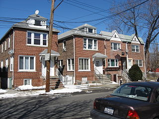
Highbridge is a residential neighborhood geographically located in the central-west section of the Bronx, New York City. Its boundaries, starting from the north and moving clockwise, are the Cross-Bronx Expressway to the north, Jerome Avenue to the east, Macombs Dam Bridge to the south, and the Harlem River to the west. Ogden Avenue is the primary thoroughfare through Highbridge.

Bronx Park is a public park along the Bronx River, in the Bronx, New York City. The park is bounded by Southern Boulevard to the southwest, Webster Avenue to the northwest, Gun Hill Road to the north, Bronx Park East to the east, and East 180th Street to the south. With an area of 718 acres (2.91 km2), Bronx Park is the eighth-largest park in New York City.

Morris Park is a neighborhood in the New York City borough of the Bronx. Its approximate boundaries, starting from the north and moving clockwise, are Neill Avenue and Pelham Parkway to the north, Eastchester Road to the east, the Amtrak Northeast Corridor tracks and Sackett Avenue to the east and south, and Bronxdale Avenue and White Plains Road to the west. It borders the neighborhoods of Van Nest to its southwest and Pelham Parkway to its northeast. Williamsbridge Road and Morris Park Avenue are the primary thoroughfares.

Van Nest is a working-class neighborhood geographically located in the East Bronx section of the Bronx, New York City. Going clockwise, its boundaries are Bronxdale Avenue to the northeast, the Amtrak tracks to the southeast, and Bronx Park to the west. Van Nest predated Morris Park by 20 years and is considered the older of the two communities. Morris Park Avenue and White Plains Road are the primary commercial thoroughfares through Van Nest.

Bronx Community Board 6 is a local government unit of the city of New York, encompassing the neighborhoods of Bathgate, Belmont, East Tremont, and West Farms as Bronx Community District 6. It is delimited by Bronx Park to the east and north, Webster Avenue to the west, and Crotona Park North and the Cross Bronx Expressway to the south.
Bronx Community Board 9 is a local government unit of the city of New York, encompassing the neighborhoods of Castle Hill, Parkchester, Soundview, Harding Park, Bronx River, Clason Point and Unionport. It is delimited by Westchester Creek to the east, Sheridan Boulevard to the west, the Cross Bronx Expressway and East Tremont Avenue to the north and the Bronx River and the East River to the south.

Bronx Community Board 10 is a local government unit of the New York City borough of the Bronx, encompassing the neighborhoods of City Island, Co-op City, Pelham Bay, Throggs Neck and Westchester Square. It is delimited by the Hutchinson River and Pelham Bay Park to the east, New England Thruway, Hutchinson River Parkway, and Westchester Creek to the west, the Bronx/Westchester County Line to the north and the East River to the south.

Bronx Community Board 12 is a local government unit of the New York City borough of the Bronx, encompassing the neighborhoods of Edenwald, Wakefield, Williamsbridge, Woodlawn Heights, Fish Bay, Eastchester, Olinville and Baychester.

Homecrest is a neighborhood situated in the New York City borough of Brooklyn, sometimes considered as part of Sheepshead Bay. It is bordered by Kings Highway to the north, Avenue X to the south, Coney Island Avenue to the west, and Ocean Avenue to the east.
Van Cortlandt Village is a subsection of the Kingsbridge neighborhood in the New York City borough of the Bronx. The neighborhood is part of Bronx Community Board 8. Named after Van Cortlandt Park, it is bordered by the Major Deegan Expressway to the west, the Jerome Park Reservoir to the east, West 238th Street to the south, and Van Cortlandt Park to the north. Its ZIP Code is 10463.

Crotona Park is a public park in the South Bronx in New York City, covering 127.5 acres (51.6 ha). The park is bounded by streets of the same name on its northern, eastern, southern, and western borders, and is adjacent to the Crotona Park East and Morrisania neighborhoods of the Bronx. It is divided into four portions by Claremont Parkway and Crotona Avenue, which run through it.

Community boards of the Bronx are the 12 New York City community boards in the borough of the Bronx, which are the appointed advisory groups of the community districts that advise on land use and zoning, participate in the city budget process, and address service delivery in their district.

Jews comprise approximately 16% of New York City's population, making the Jewish community the largest in the world outside of Israel. As of 2020, just over 1.3 million Jews lived in the five boroughs of New York City, and over 1.912 million Jews lived in New York-Newark-Jersey City overall.
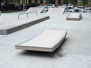
Playground 52 is a 1.8-acre (0.73 ha) playground at 681 Kelly Street in the Longwood neighborhood of the Bronx, in New York City. The playground features basketball and handball courts, bathrooms, a spray shower, and a skate park. as well as an amphitheater with a large dance floor.
St. Mary's Park is a public park in the Mott Haven neighborhood in the South Bronx section of the Bronx, New York City. The park has sporting facilities and an indoor recreation center.

Printer's Park is a small park on Hoe Avenue between Aldus Street and Westchester Avenue, in the Longwood neighborhood of the Bronx, New York City. The park is run by the New York City Department of Parks and Recreation.

Vinmont Veteran Park is a 3.5-acre (1.4-hectare) park and playground in the Riverdale section of The Bronx. It includes bathrooms, a playground, a woodland area and the Sid Augarten baseball field. The site was acquired by New York City in 1945 and 1947 and opened as a park in 1951. Originally named the PS 81 Playground after a neighboring public school it was renamed in 1986 in honor of military veterans in the Vinmont neighborhood.

Claremont Park is a park in the Morrisania section of the Bronx in New York City. The land on which the park sits was once part of the Morris family estate and was the site of the Zborowski Mansion. After becoming a municipal park in 1884 as part of the New Parks Act, the mansion was used for a time as the Bronx headquarters for the Department of Parks and was torn down in 1938.

