East Rockingham, North Carolina

Last updated

East Rockingham, North Carolina
CDP
USA North Carolina location map.svg
Red pog.svg
East Rockingham, North Carolina
Location within the state of North Carolina
Coordinates: 34°54′42″N79°45′58″W / 34.91167°N 79.76611°W / 34.91167; -79.76611
Country United States
State North Carolina
County Richmond
Area
[1]
  Total3.44 sq mi (8.91 km2)
  Land3.42 sq mi (8.85 km2)
  Water0.02 sq mi (0.06 km2)
Elevation
[2]
295 ft (90 m)
Population
 (2020)
  Total3,471
  Density1,015.21/sq mi (392.00/km2)
Time zone UTC-5 (Eastern (EST))
  Summer (DST) UTC-4 (EDT)
FIPS code 37-19800 [3]
GNIS feature ID2402435 [2]

East Rockingham is a census-designated place (CDP) in Richmond County, North Carolina, United States. The population was 3,885 at the 2000 census.

Contents

Geography

According to the United States Census Bureau, the CDP has a total area of 3.5 square miles (9.1 km2), of which 3.4 square miles (8.9 km2) is land and 0.04 square miles (0.10 km2) (0.58%) is water.

Demographics

Historical population
CensusPop.Note
2020 3,471
U.S. Decennial Census [4]

As of the census [3] of 2000, there were 3,885 people, 1,562 households, and 1,071 families residing in the CDP. The population density was 1,132.9 inhabitants per square mile (437.4/km2). There were 1,752 housing units at an average density of 510.9 per square mile (197.3/km2). The racial makeup of the CDP was 82.03% White, 11.94% African American, 1.80% Native American, 0.64% Asian, 0.15% Pacific Islander, 2.01% from other races, and 1.42% from two or more races. Hispanic or Latino of any race were 5.12% of the population.

There were 1,562 households, out of which 28.9% had children under the age of 18 living with them, 46.2% were married couples living together, 15.3% had a female householder with no husband present, and 31.4% were non-families. 27.3% of all households were made up of individuals, and 12.4% had someone living alone who was 65 years of age or older. The average household size was 2.48 and the average family size was 2.96.

In the CDP, the population was spread out, with 24.4% under the age of 18, 9.0% from 18 to 24, 28.4% from 25 to 44, 24.1% from 45 to 64, and 14.1% who were 65 years of age or older. The median age was 37 years. For every 100 females, there were 94.3 males. For every 100 females age 18 and over, there were 93.6 males.

The median income for a household in the CDP was $22,263, and the median income for a family was $26,827. Males had a median income of $26,050 versus $18,608 for females. The per capita income for the CDP was $12,132. About 24.2% of families and 26.9% of the population were below the poverty line, including 35.0% of those under age 18 and 27.0% of those age 65 or over.

Related Research Articles

<span class="mw-page-title-main">Gadsden, Arizona</span> CDP in Yuma County, Arizona

Gadsden is a census-designated place (CDP) in Yuma County, Arizona, United States. The population was 953 at the 2000 census. It is part of the Yuma Metropolitan Statistical Area.

<span class="mw-page-title-main">Wilkerson, California</span> Census-designated place in California, United States

Wilkerson is a census-designated place (CDP) in Inyo County, California, United States. The population was 563 at the 2010 census, up from 562 at the 2000 census.

<span class="mw-page-title-main">Tice, Florida</span> Census-designated place in Florida, United States

Tice is an unincorporated community and census-designated place (CDP) in Lee County, Florida, United States. As of the 2020 census, the CDP population was 4,853. It is part of the Cape Coral-Fort Myers, Florida Metropolitan Statistical Area.

<span class="mw-page-title-main">Lakewood Park, Florida</span> Census-designated place in Florida, United States

Lakewood Park is a Census-designated place in St. Lucie County, Florida, United States. The population was 11,323 at the 2010 census. It is part of the Port St. Lucie Metropolitan Statistical Area.

<span class="mw-page-title-main">Whitmore Village, Hawaii</span> Census-designated place in Hawaii, United States

Whitmore Village is a census-designated place (CDP) in Honolulu County, Hawaiʻi, United States. The population was 4,887 at the 2020 census.

<span class="mw-page-title-main">Wilson-Conococheague, Maryland</span> CDP in Maryland, United States

Wilson-Conococheague is a census-designated place (CDP) in Washington County, Maryland, United States. The population was 2,262 at the 2020 census.

<span class="mw-page-title-main">Orchard Homes, Montana</span> CDP in Montana, United States

Orchard Homes is a census-designated place (CDP) in Missoula County, Montana, United States. It is part of the Missoula Metropolitan Statistical Area. The population was 5,377 at the 2020 census.

<span class="mw-page-title-main">Castle Point, Missouri</span> CDP in Missouri, United States

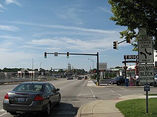
Castle Point is a census-designated place (CDP) in St. Louis County, Missouri, United States. The population was 3,962 at the 2010 census.

<span class="mw-page-title-main">Tuckahoe, Suffolk County, New York</span> Hamlet and census-designated place in New York, United States

Tuckahoe is a hamlet and census-designated place (CDP) in the Town of Southampton, Suffolk County, New York, United States. The population was 1,373 at the 2010 census.

<span class="mw-page-title-main">Saugerties South, New York</span> CDP in New York, United States

Saugerties South is a hamlet in Ulster County, New York, United States. The population was 2,442 at the 2020 census.

<span class="mw-page-title-main">Crystal Lakes, Ohio</span> Census-designated place in Ohio, United States

Crystal Lakes is a census-designated place (CDP) in Clark County, Ohio, United States. The population was 1,394 at the 2020 census. It is part of the Springfield, Ohio Metropolitan Statistical Area.

<span class="mw-page-title-main">Kenwood, Ohio</span> Census-designated place in Ohio, United States

Kenwood is a census-designated place (CDP) in Sycamore Township, Hamilton County, Ohio, United States. The population was 7,570 at the 2020 census. It is a major shopping destination for the Cincinnati area, featuring properties such as Kenwood Towne Centre and The Kenwood Collection.

<span class="mw-page-title-main">Choctaw Lake, Ohio</span> CDP in Ohio, United States

Choctaw Lake is a census-designated place (CDP) in Madison County, Ohio, United States. The population was 2,047 at the 2020 census.

<span class="mw-page-title-main">Winnsboro Mills, South Carolina</span> Census-designated place in South Carolina, United States

Winnsboro Mills is an unincorporated community and census-designated place (CDP) in Fairfield County, South Carolina, United States. The population was 1,898 at the 2010 census, down from 2,263 at the 2000 census. It is part of the Columbia, South Carolina Metropolitan Statistical Area.

<span class="mw-page-title-main">Millwood, South Carolina</span> CDP in South Carolina, United States

Millwood is a census-designated place (CDP) in Sumter County, South Carolina, United States. The population was 885 at the 2000 census. It is included in the Sumter, South Carolina Metropolitan Statistical Area.

<span class="mw-page-title-main">Three Lakes, Washington</span> CDP in Washington, United States

Three Lakes is a census-designated place (CDP) in Snohomish County, Washington, United States. The population was 3,184 at the 2010 census.

<span class="mw-page-title-main">Kennebunk (CDP), Maine</span> Census-designated place in Maine, United States

Kennebunk is a census-designated place (CDP) comprising the central village in the town of Kennebunk in York County, Maine, United States. The population was 5,214 at the 2010 census, out of a total town population of 10,798. It is part of the Portland–South Portland–Biddeford, Maine Metropolitan Statistical Area.

<span class="mw-page-title-main">Kittery (CDP), Maine</span> Census-designated place in Maine, United States

Kittery is a census-designated place (CDP) consisting of the main village in the town of Kittery in York County, Maine, United States. The village is also known as Kittery Foreside. The population of the CDP was 4,562 at the 2010 census. It is part of the Portland–South Portland–Biddeford, Maine Metropolitan Statistical Area.

<span class="mw-page-title-main">Poestenkill (CDP), New York</span> CDP in New York, United States

Poestenkill is a hamlet in Rensselaer County, New York, United States. The population was 1,061 at the 2010 census. The name is taken from Poesten Kill, a stream in the area.

<span class="mw-page-title-main">Clearbrook, New Jersey</span> Populated place in Middlesex County, New Jersey, US

Clearbrook is a gated community and census-designated place (CDP) located in Monroe Township, Middlesex County, in the U.S. state of New Jersey. It is in the western part of the township, bordered to the north by Encore at Monroe and to the east by Concordia and The Ponds. It is 3.5 miles (5.6 km) southwest of Jamesburg and 5 miles (8 km) northeast of Hightstown.

References

  1. "ArcGIS REST Services Directory". United States Census Bureau. Retrieved September 20, 2022.
  2. 1 2 U.S. Geological Survey Geographic Names Information System: East Rockingham, North Carolina
  3. 1 2 "U.S. Census website". United States Census Bureau . Retrieved January 31, 2008.
  4. "Census of Population and Housing". Census.gov. Retrieved June 4, 2016.