Hoffman, North Carolina

Last updated

Hoffman, North Carolina
USA North Carolina location map.svg
Red pog.svg
Hoffman, North Carolina
Location within the state of North Carolina
Coordinates: 35°01′53″N79°32′57″W / 35.03139°N 79.54917°W / 35.03139; -79.54917
Country United States
State North Carolina
County Richmond
Area
[1]
  Total3.40 sq mi (8.81 km2)
  Land3.40 sq mi (8.81 km2)
  Water0.00 sq mi (0.00 km2)
Elevation
[2]
427 ft (130 m)
Population
 (2020)
  Total418
  Density122.87/sq mi (47.44/km2)
Time zone UTC-5 (Eastern (EST))
  Summer (DST) UTC-4 (EDT)
ZIP code
28347
Area codes 910, 472
FIPS code 37-31920 [3]
GNIS feature ID2405848 [2]

Hoffman is a town in Richmond County, North Carolina, United States. The population was 588 at the 2010 census. It was named for a family of settlers. [4]

Contents

Geography

According to the United States Census Bureau, the town has a total area of 3.4 square miles (8.8 km2), all land.

Demographics

Historical population
CensusPop.Note
1900 184
1910 175−4.9%
1920 385120.0%
1930 56947.8%
1940 395−30.6%
1950 3980.8%
1960 344−13.6%
1970 43426.2%
1980 389−10.4%
1990 348−10.5%
2000 62479.3%
2010 588−5.8%
2020 418−28.9%
U.S. Decennial Census [5]

As of the census [3] of 2000, there were 624 people, 219 households, and 167 families residing in the town. The population density was 181.6 inhabitants per square mile (70.1/km2). There were 238 housing units at an average density of 69.3 per square mile (26.8/km2). The racial makeup of the town was 41.19% White, 53.21% African American, 4.17% Native American, and 1.44% from two or more races. Hispanic or Latino of any race were 1.12% of the population.

There were 219 households, out of which 41.6% had children under the age of 18 living with them, 47.0% were married couples living together, 21.5% had a female householder with no husband present, and 23.7% were non-families. 18.7% of all households were made up of individuals, and 7.3% had someone living alone who was 65 years of age or older. The average household size was 2.82 and the average family size was 3.14.

In the town, the population was spread out, with 33.0% under the age of 18, 7.4% from 18 to 24, 32.9% from 25 to 44, 17.8% from 45 to 64, and 9.0% who were 65 years of age or older. The median age was 31 years. For every 100 females, there were 101.3 males. For every 100 females age 18 and over, there were 94.4 males.

The median income for a household in the town was $32,279, and the median income for a family was $34,688. Males had a median income of $25,893 versus $16,838 for females. The per capita income for the town was $14,726. About 17.2% of families and 24.5% of the population were below the poverty line, including 34.3% of those under age 18 and 16.7% of those age 65 or over.

Related Research Articles

<span class="mw-page-title-main">Etna Green, Indiana</span> Town in Indiana, United States

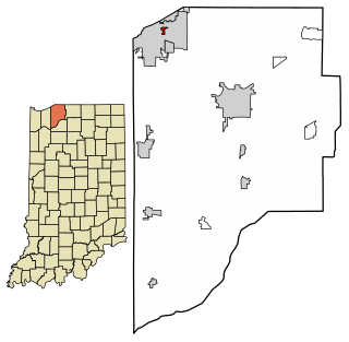
Etna Green is a town in Etna Township, Kosciusko County, in the U.S. state of Indiana. The population was 586 at the 2010 census.

<span class="mw-page-title-main">Pottawattamie Park, Indiana</span> Town in Indiana, United States

Pottawattamie Park is a town in Michigan Township, LaPorte County, Indiana, United States. The population was 235 at the 2010 census. It is included in the Michigan City, Indiana-La Porte, Indiana Metropolitan Statistical Area.

<span class="mw-page-title-main">Hamlin, Maine</span> Town in the state of Maine, United States

Hamlin is a town in Aroostook County, Maine, United States. It is located on the Canada–US border with a border crossing into Grand Falls, New Brunswick and is the closest continental location to Europe in the United States. Hamlin's northeastern corner is the closest point in the mainland United States to Western Europe, situated at a distance of 2,508 miles (4,018 km) from the closest point in Europe to the USA, Achill Head. The population was 166 at the 2020 census.

Carrabassett Valley is a town in Franklin County, Maine, United States. The population was 673 at the 2020 census.

<span class="mw-page-title-main">Industry, Maine</span> Town in Maine, United States

Industry is a town in Franklin County, Maine, United States. The population was 788 at the 2020 census. It was named from the industrious habits of its citizens.

Moose River is a town in Somerset County, Maine, United States. The population was 188 at the 2020 census. It was first settled by Capt. Samuel Holden who in 1820 opened an inn as a stop for cattle drivers en route from Boston to Quebec.

<span class="mw-page-title-main">Friendsville, Maryland</span> Town in Maryland, United States

Friendsville is a town in Garrett County, Maryland, United States. The population was 438 at the 2020 census.

<span class="mw-page-title-main">Boys Town, Nebraska</span> Village in Douglas County, Nebraska, United States

Boys Town is a village in Douglas County, Nebraska, United States. The population was 410 at the 2020 census. Boys Town is an enclave and a suburb of Omaha.

<span class="mw-page-title-main">Hoffman, Oklahoma</span> Town in Oklahoma, United States

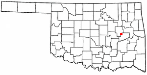
Hoffman is a town in Okmulgee County, Oklahoma, United States. The population was 81 at the 2020 census.

<span class="mw-page-title-main">Sylvania, Pennsylvania</span> Borough in Pennsylvania, United States

Sylvania is a borough in Bradford County, Pennsylvania, United States. It is part of Northeastern Pennsylvania. The population was 216 at the 2020 census. Children residing in the borough are assigned to attend the Troy Area School District.

<span class="mw-page-title-main">Ethan, South Dakota</span> Town in South Dakota, United States

Ethan is a town in Davison County, South Dakota, United States. It is part of the Mitchell, South Dakota Micropolitan Statistical Area. The population was 365 at the 2020 census. Ethan is located 10 miles south of Mitchell.

<span class="mw-page-title-main">Bayard, West Virginia</span> Town in West Virginia, United States

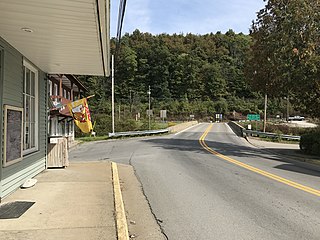
Bayard is a town in Grant County, West Virginia, United States. The population was 200 at the 2020 census. Bayard was incorporated in 1893 and named in honor of Thomas F. Bayard, Jr., who later became a United States senator from Delaware (1923–1929). Bayard was founded on the West Virginia Central and Pittsburgh Railroad as a coal mining community. Coal mining has remained the town's chief industry.

<span class="mw-page-title-main">Durbin, West Virginia</span> Town in West Virginia, United States

Durbin is a town in Pocahontas County, West Virginia, United States. The population was 235 at the 2020 census.

<span class="mw-page-title-main">Bruceton Mills, West Virginia</span> Town in West Virginia, United States

Bruceton Mills is a town in northern Preston County, West Virginia, United States, along Big Sandy Creek. The population was 64 at the 2020 census, making it the second-least populous town in West Virginia, after Thurmond. It is part of the Morgantown metropolitan area.

<span class="mw-page-title-main">Huttonsville, West Virginia</span> Town in West Virginia, United States

Huttonsville is a town in Randolph County, West Virginia, United States, along the Tygart Valley River. The population was 163 at the 2020 census.

<span class="mw-page-title-main">Bear Lake, Wisconsin</span> Town in Wisconsin, United States

Bear Lake is a town in Barron County in the U.S. state of Wisconsin. The population was 659 at the 2010 census.

<span class="mw-page-title-main">Hampden, Wisconsin</span> Town in Wisconsin, United States

Hampden is a town in Columbia County, Wisconsin, United States. The population was 563 at the 2000 census.

<span class="mw-page-title-main">New Hope, Wisconsin</span> Town in Wisconsin, United States

New Hope is a town in Portage County, Wisconsin, United States. The population was 736 at the 2000 census. The unincorporated communities of New Hope, Garfield, and Peru are located in the town.

<span class="mw-page-title-main">Troy, Sauk County, Wisconsin</span> Town in Wisconsin, United States

The Town of Troy is located in Sauk County, Wisconsin, United States. The population was 773 at the 2000 census. The unincorporated communities of Black Hawk, Cassell, and Witwen are located in the town.

<span class="mw-page-title-main">Hutchins, Wisconsin</span> Town in Wisconsin, United States

Hutchins is a town in Shawano County, Wisconsin, United States. The population was 539 at the 2000 census.

References

  1. "ArcGIS REST Services Directory". United States Census Bureau. Retrieved September 20, 2022.
  2. 1 2 U.S. Geological Survey Geographic Names Information System: Hoffman, North Carolina
  3. 1 2 "U.S. Census website". United States Census Bureau . Retrieved January 31, 2008.
  4. Gannett, Henry (1905). The Origin of Certain Place Names in the United States. Govt. Print. Off. pp.  158.
  5. "Census of Population and Housing". Census.gov. Retrieved June 4, 2015.