Eastern Oregon

Last updated

Eastern Oregon population according to the eight-county definition. Eo pop.gif
Eastern Oregon population according to the eight-county definition.

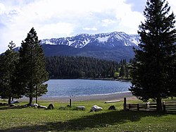
Eastern Oregon is a region of the U.S. state of Oregon. It is not an officially recognized geographic entity; thus, the boundaries of the region vary according to context. It is sometimes understood to include only the eight easternmost counties in the state; in other contexts, it includes the entire area east of the Cascade Range. [1] Cities in the basic eight-county definition include Baker City, Burns, Hermiston, Pendleton, Boardman, John Day, La Grande, and Ontario. Umatilla County is home to the largest population base in Eastern Oregon, accounting for 42% of the region's residents — more than twice that of the region’s second most populous, Malheur County. Hermiston, located in Umatilla County, is the largest city in the region, accounting for 10% of the population. Major industries include transportation/warehousing, timber, agriculture and tourism. The main transportation corridors are I-84, U.S. Route 395, U.S. Route 97, U.S. Route 26, U.S. Route 30, and U.S. Route 20.

Contents

Compared to that of the western part of the state, the climate of Eastern Oregon has a drier continental climate, with much greater seasonal variations in temperature. Unlike the Willamette Valley, Eastern Oregon receives a significant amount of snow in the winter. Some areas receive fewer than 10 inches (250 mm) of rain yearly, classifying them as deserts. This desert climate is in part due to a rain shadow effect caused by the Cascade Range. Pine and juniper forests cover 35% of Eastern Oregon, much in the mountains that include the Blue Mountains, Strawberry Mountains, Wallowa Mountains, Trout Creek Mountains, Ochoco Mountains, and Steens Mountain. Volcanic basalt flows from the Columbia River Basalt Group covered large sections of Eastern Oregon 6 to 17 million years ago. Other landforms include the Alvord Desert, Owyhee Desert, Warner Valley, Deschutes River, Owyhee River, Grande Ronde River, Joseph Canyon, The Honeycombs, and Malheur Butte.

Geography

Mountains and glacial lake in Wallowa County attract tourists to the area. Wallowa mts lake.jpg
Mountains and glacial lake in Wallowa County attract tourists to the area.
Baker City is home to the National Historic Oregon Trail Interpretive Center. Oregon Trail IC Baker City OR.jpg
Baker City is home to the National Historic Oregon Trail Interpretive Center.
Downtown Burns Burns oregon.jpg
Downtown Burns

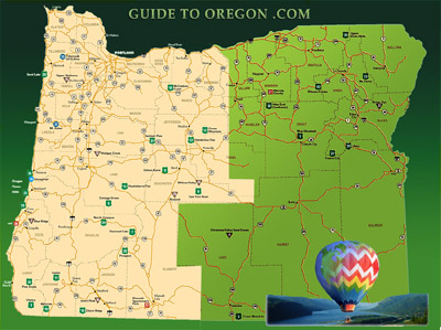
According to the Eastern Oregon Visitors Association, Eastern Oregon includes only the following eight counties: Morrow, Umatilla, Union, Wallowa, Grant, Baker, Harney, and Malheur. [2] Some definitions of the region are more restrictive, [3] while others include the base eight counties listed above plus several adjacent counties. [4] [5] Still others include the entire area east of the Cascade Range; [6] this meaning would also include Sherman, Crook, Deschutes, Gilliam, Jefferson, Klamath, Lake, Wasco, and Wheeler counties.

The extreme eastern section of Oregon in the Snake River Valley, including the city of Ontario, is part of the Treasure Valley, which extends east to Boise, Idaho. Unlike the rest of the state, that section lies within the Mountain Time Zone. Sacajawea Peak is the region's highest mountain.

Joseph Canyon JosephCanyonPanorama.jpg
Joseph Canyon

Politics

Although Oregon as a whole is generally considered a blue state, Eastern Oregon is far more conservative than the west. [7] Morrow County is the only Eastern Oregon county to have supported Democratic presidential nominees after Lyndon Johnson’s 1964 landslide, having voted for Jimmy Carter in 1976 and for Bill Clinton in 1996.[ citation needed ] In the 2012 presidential election, the Republican candidate Mitt Romney received at least 60% of the vote in every county in Eastern Oregon. [8] [ original research? ]

The political divide between the eastern and western parts of the state has led some residents of Eastern Oregon to feel that the state of Oregon, with the majority of its population and political control based in the western part of the state, has neglected the eastern part of the state, preventing it from developing along with the western part. A movement to have Eastern Oregon secede and join the United States as a 51st state was underway in 2008. [9]

"Greater Idaho"

In 2021, five counties in Eastern Oregon voted to direct their County Commissioners to hold annual hearings on the issue of joining Idaho, the state located east of Oregon. It was initiated by the group "Move Oregon's Border for a Greater Idaho", who support the Greater Idaho movement. [10] As of May 2022, eight counties had voted to direct their County Commissioners to examine the issue further. Some counties, such as Douglas and Josephine, had voted against joining the coalition. By November, three more counties in Eastern Oregon, for a total of eleven, had voted to join Idaho, a number that grew to 12 by June of 2023. [11]

On January 10, 2023, Senate Joint Memorial 2, also known as the Greater Idaho Bill, was sponsored in the Oregon Senate by politician Dennis Linthicum. [12] [13]

Cities

Top 15 most populated Eastern Oregon cities (according to the 8-county definition):

RankCityPopulation [14] (2023)County
1 Hermiston 20,322 Umatilla
2 Pendleton 17,006 Umatilla
3 La Grande 12,823 Union
4 Ontario 12,206 Malheur
5 Baker City 10,102 Baker
6 Umatilla 7,810 Umatilla
7 Milton-Freewater 7,490 Umatilla
8 Boardman 4,437 Morrow
9 Nyssa 3,363 Malheur
10 Burns 2,730 Harney
11 Union 2,182 Union
12 Stanfield 2,313 Umatilla
13 Enterprise 2,147 Wallowa
14 Irrigon 2,133 Morrow
15 Vale 1,947 Malheur
The Hermiston Butte, in the middle of Hermiston, features hiking trails and access to the adjacent Hermiston Aquatics Center Hermiston Butte.jpg
The Hermiston Butte, in the middle of Hermiston, features hiking trails and access to the adjacent Hermiston Aquatics Center

By extending the boundary outside to include neighboring counties, Eastern Oregon would include three of the largest population centers east of the Cascade Range: Bend, Redmond, and Klamath Falls. However, these lie outside the stricter boundary.

Climate and ecology

Compared to the maritime rainforest climate of Western Oregon, which is adjacent to the Pacific Ocean, the climate of Eastern Oregon is a drier continental climate, with much greater seasonal variations in temperature. Unlike the Willamette Valley, Eastern Oregon gets a significant amount of snow in the winter. Some parts of Eastern Oregon receive fewer than 10 inches (250 mm) of rain yearly, classifying them as deserts. The driest parts are the southeast and the area near Redmond. This desert climate is in part due to a rain shadow effect caused by the Cascade Range. Pine and juniper forests cover 35% of Eastern Oregon, especially in the mountains east of Klamath Falls and in the Blue Mountains.

Freshly tilled wheat fields on western edge of wheat growing area in central Wasco County 8milewheat.jpg
Freshly tilled wheat fields on western edge of wheat growing area in central Wasco County

Economy

The region's economy is primarily agricultural. [15] Timber and mining, while formerly key industries, have decreased in importance in recent years. [16] Cultural tourism, agritourism and ecotourism continue to develop. [17] [18] The wheat growing region of Eastern Oregon includes the Columbia Plateau portion of northeastern Oregon, which begins with very marginal wheat fields in central Wasco County and extends east through Umatilla County. Its rich loess soils "help make the Columbia Plateau one of the premier wheat-producing regions in the world." [19] South of the wheat lands of northeast Oregon, agricultural activity is generally limited to livestock grazing except where irrigation is available. Irrigated areas are often used to produce alfalfa hay.

Recreation

From the high desert to the rugged mountainous areas of the Eagle Cap Wilderness area, Eastern Oregon has a range of outdoor recreational opportunities such as skiing, rafting, and hiking. [20]

Anthony Lakes is the largest ski resort in Eastern Oregon. [21] Spout Springs, located in the Umatilla National Forest in the Blue Mountains, is popular with families. [22] Rafting is often seasonal on the rivers that are snowpack-dependent and not dammed. The Owyhee River is an example of a desert canyon river experience.[ clarification needed ] The Snake River offers boating experiences that range from a quiet drift through the desert to hair-raising thrills of class II to III+ rapids.[ tone ][ citation needed ]

Transportation

The John Day River passing by Sheep Rock in the John Day Fossil Beds National Monument Joda sheeprock.jpg
The John Day River passing by Sheep Rock in the John Day Fossil Beds National Monument

Historically, the region has been relatively isolated from Western Oregon, due to the difficulty of crossing the Cascades. Early settlers floated down the Columbia River from The Dalles to reach Western Oregon. In 1845, Sam Barlow built a road around the south side of Mount Hood, which served as the final leg of the Oregon Trail. The Applegate Trail and Santiam Wagon Road were constructed soon after, connecting eastern and western Oregon in the southern and central parts of the state. In the early 20th century, Samuel Hill built the Columbia River Highway, allowing automobiles to pass through the Columbia River Gorge.

Railroads began to be important as early as 1858 with the construction of the Oregon Portage Railroad which built a 4.5-mile (7.2 km) bypass around the rapids at Cascade Locks. This was followed by the 1862 incorporation of the Oregon Steam Navigation Company whose operations included building a rail bypass from The Dalles to Celilo Falls. In 1880 these two short sections of rail were incorporated into the Oregon Railway and Navigation Company (OR&N). Shortly thereafter Henry Villard, who then controlled OR&N, moved aggressively to block entry of the then under construction Northern Pacific Railway into the Columbia Gorge. [23] In an agreement first made in March 1880 and formalized in the fall of 1880, the Northern Pacific Railway, then controlled by Frederick Billings, and the OR&N, at that time controlled by Henry Villard, agreed to divide the Columbia Plateau at the Snake River, with the Northern Pacific staying to the north and the OR&N staying to the south. Northern Pacific was not to build down the gorge into Portland, but would receive trackage rights on the tracks that OR&N was building on the south bank into Portland. [23] The first St. Paul-Portland Northern Pacific train arrived in Portland on September 12, 1883, via OR&N trackage down the Oregon side of the Columbia River from Wallula, Washington forever ending the isolation of at least the northern portion of Eastern Oregon. [23] A year later in November 1884, the Oregon Short Line was completed across southern Idaho and met the OR&N at Huntington, [23] providing rail service that essentially paralleled the Oregon Trail all the way from Omaha, Nebraska. Later the OR&N became part of the Union Pacific Railway.

The only other railroad ever built east over the Cascade Mountains was trackage that was to become part of the Southern Pacific Transportation Company, which was opened in 1926 over Willamette Pass to Klamath Falls [24] to bypass the difficult line south of Eugene to Ashland.

All-weather highways over the Cascade Mountains were not completed until the 1930s and 1940s. [25] [26]

Major road routes through eastern Oregon include I-84 from Ontario to the Columbia River Gorge. The only other interstate freeway in the region is an eleven-mile (18 km) stretch of Interstate 82 that ends at the Columbia River in Umatilla. Other major east–west routes include U.S. Route 26, U.S. Route 30, U.S. Route 20 and U.S. Route 730. U.S. Route 395 is a major north–south route, passing through Pendleton, Burns, John Day, and Lakeview. Further west, U.S. Route 97 runs north and south from the California border through Klamath Falls, Bend, and Redmond to Biggs Junction on the Columbia River.

See also

Related Research Articles

<span class="mw-page-title-main">Geography of California</span> Overview of the geography of California

California is a U.S. state on the western coast of North America. Covering an area of 163,696 sq mi (423,970 km2), California is among the most geographically diverse states. The Sierra Nevada, the fertile farmlands of the Central Valley, and the arid Mojave Desert of the south are some of the major geographic features of this U.S. state. It is home to some of the world's most exceptional trees: the tallest, most massive, and oldest. It is also home to both the highest and lowest points in the 48 contiguous states. The state is generally divided into Northern and Southern California, although the boundary between the two is not well defined. San Francisco is decidedly a Northern California city and Los Angeles likewise a Southern California one, but areas in between do not often share their confidence in geographic identity. The US Geological Survey defines the geographic center of California about 7.1 miles driving distance from the United States Forest Service office in the Northern Californian city of North Fork, California.

<span class="mw-page-title-main">Cascade Range</span> Mountain range in western North America

The Cascade Range or Cascades is a major mountain range of western North America, extending from southern British Columbia through Washington and Oregon to Northern California. It includes both non-volcanic mountains, such as many of those in the North Cascades, and the notable volcanoes known as the High Cascades. The small part of the range in British Columbia is referred to as the Canadian Cascades or, locally, as the Cascade Mountains. The highest peak in the range is Mount Rainier in Washington at 14,411 feet (4,392 m).

<span class="mw-page-title-main">Pacific Northwest</span> Region of northwestern North America

The Pacific Northwest (PNW), sometimes referred to as Cascadia, is a geographic region in western North America bounded by its coastal waters of the Pacific Ocean to the west and, loosely, by the Rocky Mountains to the east. Though no official boundary exists, the most common conception includes the U.S. states of Oregon, Washington, northern Idaho, and the Canadian province of British Columbia. Some broader conceptions reach north into Alaska and Yukon, south into northern California, and east into western Montana. Other conceptions may be limited to the coastal areas west of the Cascade and Coast mountains.

<span class="mw-page-title-main">Owyhee County, Idaho</span> County in Idaho, United States

Owyhee County is a county in the southwestern corner of the U.S. state of Idaho. As of the 2020 census, the population was 11,913. The county seat is Murphy, and its largest city is Homedale. In area it is the second-largest county in Idaho, behind Idaho County.

<span class="mw-page-title-main">Scouting in Oregon</span> Overview of Scouting in the State of Oregon

Scouting in the U.S. state of Oregon includes the Boy Scouts of America (BSA) and Girl Scouts (GSUSA) youth organizations, as well as newer organizations like the Baden-Powell Service Association.

<span class="mw-page-title-main">Hermiston, Oregon</span> City in Oregon, United States

Hermiston is a city in Umatilla County, Oregon, United States. Its population of 20,322 makes it the largest city in Eastern Oregon. Hermiston is the largest and fastest-growing city in the Hermiston-Pendleton Micropolitan Statistical Area, the eighth largest Core Based Statistical Area in Oregon with a combined population of 92,261 at the 2020 census. Hermiston sits near the junction of I-82 and I-84, and is 7 miles south of the Columbia River, Lake Wallula, and the McNary Dam. The Hermiston area has become a hub for logistics and data center activity due to the proximity of the I-82 and I-84 interchange, Pacific Northwest fiber optic backbone, and low power costs.

<span class="mw-page-title-main">Blue Mountains (Pacific Northwest)</span> Mountain range in Oregon and Washington, United States

The Blue Mountains are a mountain range in the northwestern United States, located largely in northeastern Oregon and stretching into extreme southeastern Washington. The range has an area of about 15,000 square miles (39,000 km2), stretching east and southeast of Pendleton, Oregon, to the Snake River along the Oregon–Idaho border.

<span class="mw-page-title-main">Eastern Washington</span> Geographic region in Washington, United States

Eastern Washington is the region of the U.S. state of Washington located east of the Cascade Range. It contains the city of Spokane, the Tri-Cities, the Columbia River and the Grand Coulee Dam, the Hanford Nuclear Reservation and the fertile farmlands of the Yakima Valley and the Palouse. Unlike in Western Washington, the climate is dry, including some desert environments.

<span class="mw-page-title-main">Siskiyou Mountains</span> Mountain range in Oregon and California, US

The Siskiyou Mountains are a coastal subrange of the Klamath Mountains, and located in northwestern California and southwestern Oregon in the United States. They extend in an arc for approximately 100 miles (160 km) from east of Crescent City, California, northeast along the north side of the Klamath River into Josephine and Jackson counties in Oregon. The mountain range forms a barrier between the watersheds of the Klamath River to the south and the Rogue River to the north. Accordingly, much of the range is within the Rogue River – Siskiyou and Klamath national forests, and the Pacific Crest Trail follows a portion of the crest of the Siskiyous.

<span class="mw-page-title-main">Central Oregon</span> Region in Oregon, United States

Central Oregon is a geographic region in the U.S. state of Oregon and is traditionally considered to be made up of Deschutes, Jefferson, and Crook counties. Other definitions include larger areas, often encompassing areas to the north towards the Columbia River, eastward towards Burns, or south towards Klamath Falls. These three counties have a combined population of 200,431 as of the 2010 census, with Deschutes the largest of the three counties, having approximately four times the population of the other two counties combined. As of 2015, the most populous city in the region is Bend, with an estimated 87,014 residents. As defined by the three county definition, Central Oregon covers 7,833 square miles (20,290 km2) of land. Central Oregon has had 3 record tourism years beginning in 2012. Over 2.2 million people visited Central Oregon in 2012 and again in 2013.

<span class="mw-page-title-main">Interstate 84 in Oregon</span> Interstate highway in Oregon

Interstate 84 (I-84) in the U.S. state of Oregon is a major Interstate Highway that traverses the state from west to east. It is concurrent with U.S. Route 30 (US 30) for most of its length and runs 376 miles (605 km) from an interchange with I-5 in Portland to the Idaho state line near Ontario. The highway roughly follows the Columbia River and historic Oregon Trail in northeastern Oregon, and is designated as part of Columbia River Highway No. 2 and all of the Old Oregon Trail Highway No. 6; the entire length is also designated as the Vietnam Veterans Memorial Highway. I-84 intersects several of the state's main north–south roads, including US 97, US 197, I-82, and US 395.

Rail transportation is an important element of the transportation network in the U.S. state of Oregon. Rail transportation has existed in Oregon in some form since 1855, and the state was a pioneer in development of electric railway systems. While the automobile has displaced many uses of rail in the state, rail remains a key means of moving passengers and freight, both within the state and to points beyond its borders.

<span class="mw-page-title-main">High Desert (Oregon)</span> A region of the U.S. state of Oregon

The Oregon High Desert is a region of the U.S. state of Oregon located east of the Cascade Range and south of the Blue Mountains, in the central and eastern parts of the state. Divided into a southern region and a northern region, the desert covers most of five Oregon counties and averages 4,000 feet (1,200 m) above sea level. The southwest region is part of the Great Basin and the southeast is the lower Owyhee River watershed. The northern region is part of the Columbia Plateau, where higher levels of rainfall allow the largest industry on private land to be the cultivation of alfalfa and hay. Public land within the region is owned primarily by the Bureau of Land Management, which manages more than 30,000 square miles (78,000 km2) including five rivers designated as Wild and Scenic.

<span class="mw-page-title-main">Malheur Indian Reservation</span>

The Malheur Indian Reservation was an American Indian reservation established for the Northern Paiute in eastern Oregon and northern Nevada from 1872 to 1879. The federal government discontinued the reservation after the Bannock War of 1878, under pressure from European-American settlers who wanted the land. This negative recommendation against continuing by its agent William V. Rinehart, led to the internment of more than 500 Paiute on the Yakama Indian Reservation, as well as the reluctance of the Bannock and Paiute to return to the lands after the war.

<span class="mw-page-title-main">Geography of Oregon</span> Overview of the Geography of Oregon

Oregon is 295 miles (475 km) north to south at longest distance, and 395 miles (636 km) east to west. With an area of 98,381 square miles (254,810 km2), Oregon is slightly larger than the United Kingdom. It is the ninth largest state in the United States. Oregon's highest point is the summit of Mount Hood, at 11,249 feet (3,429 m), and its lowest point is the sea level of the Pacific Ocean along the Oregon Coast. Oregon's mean elevation is 3,300 feet (1,006 m). Crater Lake National Park, the state's only national park, is the site of the deepest lake in the United States at 1,943 feet (592 m). Oregon claims the D River as the shortest river in the world, though the state of Montana makes the same claim of its Roe River. Oregon is also home to Mill Ends Park, the smallest park in the world at 452 square inches (0.29 m2).

<span class="mw-page-title-main">Geography of Idaho</span> Overview of the Geograpny of Idaho

The U.S. state of Idaho borders six other U.S. states and one Canadian province. The states of Washington and Oregon are to the west, Nevada and Utah are to the south, and Montana and Wyoming are to the east. Idaho also shares a short border with the Canadian province of British Columbia to the north.

<span class="mw-page-title-main">Eastern Cascades Slopes and Foothills</span> Temperate coniferous forests ecoregion of the United States

The Eastern Cascades Slopes and Foothills ecoregion is a Level III ecoregion designated by the United States Environmental Protection Agency (EPA) in the U.S. states of Oregon, Washington, and California. In the rain shadow of the Cascade Range, the eastern side of the mountains experiences greater temperature extremes and receives less precipitation than the west side. Open forests of ponderosa pine and some lodgepole pine distinguish this region from the Cascades ecoregion, where hemlock and fir forests are more common, and from the lower, drier ecoregions to the east, where shrubs and grasslands are predominant. The vegetation is adapted to the prevailing dry, continental climate and frequent wildfire. Volcanic cones and buttes are common in much of the region.

<span class="mw-page-title-main">Blue Mountains (ecoregion)</span> Temperate coniferous forests ecoregion of the United States

The Blue Mountains ecoregion is a Level III ecoregion designated by the United States Environmental Protection Agency (EPA) in the Pacific Northwest, mainly in the state of Oregon, with small areas over the state border in Idaho and southeastern Washington. It is also contiguous with the World Wildlife Fund's Blue Mountain forests ecoregion.

References

  1. Davenport, Timothy Woodbridge (1903). "An Object Lesson in Paternalism"  . Oregon Historical Quarterly . 4 (1).
  2. "Eastern Oregon Visitor's Association". Archived from the original on October 12, 2007. Retrieved October 24, 2007.
  3. "Frommer's: Eastern Oregon". Archived from the original on August 4, 2008. Retrieved October 26, 2007.
  4. Explore Eastern Oregon. Oregon Parks and Recreation Department. Retrieved on October 26, 2007.
  5. Eastern Oregon. Guide to Oregon. Retrieved on October 26, 2007.
  6. Are Introduced Plants Common in Eastern Oregon Forests? United States Forest Service. Retrieved on October 26, 2007.
  7. Cohen, Micah (August 16, 2012). "Oregon, Sitting at the Border of Safe and In Play". FiveThirtyEight . The New York Times. Archived from the original on April 12, 2016. Retrieved January 3, 2016. Oregon, like Wisconsin, is an ideologically polarized state. The Cascade Mountains are a convenient dividing line, politically and geographically.
  8. "Oregon 2012 Presidential Election Results". US Election Atlas.
  9. Wright, Phil (April 25, 2008). "Group eyes Eastern Oregon as 51st state". East Oregonian . Retrieved October 14, 2022.
  10. Perry, Douglas (May 19, 2021). "More Oregon counties vote to consider joining Idaho, part of rural effort to 'gain political refuge from blue states'". oregonlive. Retrieved May 20, 2021.
  11. "11 of 15 Eastern Oregon Counties Have Already Voted for a "Greater" Idaho". KMVT. November 13, 2022.
  12. Bourgeois, Michaela; Boddie, Ken (January 15, 2023). "'This is possible': Greater Idaho Movement on border change bill". KOIN.
  13. Rawlings, Matt (January 10, 2023). "Greater Idaho bill introduced in Oregon State Senate reading". KOIN.
  14. "Population Estimate Reports". Portland State University. December 18, 2023. Retrieved December 19, 2023.
  15. "Cattlemen Care: About Oregon's Economy". Oregon Cattlemen's Association. Archived from the original on January 13, 2016. Retrieved January 3, 2016. Agriculture and related economic activity accounts for over 12 percent of Oregon's economy. Agricultural products lead all Oregon exports by volume and rank second by value; and agriculture creates more than 234,000 jobs in the state.
  16. Wilson, Jason (January 14, 2016). "The Oregon militia revolt recipe: timber, despair and a crippling political isolation". The Guardian . Archived from the original on November 8, 2020. Retrieved January 17, 2016.
  17. Margulis, Jennifer (July 8, 2013). "Wolf tourism in Eastern Oregon". Oregon Business. p. 3. Archived from the original on August 6, 2015. Retrieved January 17, 2016.
  18. "Fishing, Hunting, Wildlife Viewing and Shellfishing in Oregon 2008". Dean Runyan Associates. Archived from the original on April 28, 2016. Retrieved January 17, 2016.
  19. Rost, Bob (2005). "Blessed with Soil and Precious Little Water". Oregon's Agricultural Progress. Oregon State University. Archived from the original on April 27, 2016. Retrieved January 17, 2016.
  20. "Eastern Oregon Find Things to See & Do". Travel Oregon. Oregon Travel Commission. Retrieved January 17, 2016.
  21. The resort has three lifts that offer access to over 1500 acres of dry Eastern Oregon powder. On the Snow.
  22. On the Snow.
  23. 1 2 3 4 Armbruster, Kurt E. (1999). Orphan Railroad: The railroad comes to Seattle, 1953-1911. Pullman, WA: Washington State University Press. pp. 63, 80. ISBN   0-87422-186-2. LCCN   99037058.
  24. "Southern Pacific Railroad." Trainweb.org.
  25. Engeman, Richard H. (2005; revised and updated 2014). Subtopic : Revival Styles, Highway Alignment: 1890-1940: One Big City, Many Small Towns. The Oregon History Project. Oregon Historical Society. Retrieved on June 17, 2016.
  26. Tonsfeldt, Ward and Paul G. Claeyssens (2004; revised and updated 2014). Subtopic : Post-Industrial Years: 1970-Present: Tourism and Recreation. The Oregon History Project. Retrieved on June 17, 2016.

44°10′56″N118°39′08″W / 44.182204°N 118.652344°W / 44.182204; -118.652344