Happy Valley, Oregon

Last updated

Happy Valley, Oregon
Mount Scott and Happy Valley.jpg
Happy Valley, on the southeast flank of Mount Scott
Clackamas County Oregon Incorporated and Unincorporated areas Happy Valley Highlighted.svg
Location in Oregon
Coordinates: 45°26′09″N122°30′29″W / 45.43583°N 122.50806°W / 45.43583; -122.50806
CountryUnited States
State Oregon
County Clackamas
Incorporated 1965
Government
   Mayor Tom Ellis [ citation needed ]
Area
[1]
  Total11.65 sq mi (30.17 km2)
  Land11.60 sq mi (30.04 km2)
  Water0.05 sq mi (0.12 km2)
Elevation
[2]
643 ft (196 m)
Population
 (2020) [3]
  Total23,733
  Estimate 
(2022) [4]
26,456
  Density2,046.12/sq mi (789.99/km2)
Time zone UTC-8 (Pacific (PST))
  Summer (DST) UTC-7 (PDT)
ZIP code
97086
Area code(s) 503 and 971
FIPS code 41-32050
GNIS feature ID2410698 [2]
Website happyvalleyor.gov

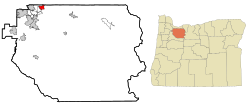
Happy Valley is a suburban city in the Portland, Oregon metropolitan area. Happy Valley is near the northwest edge of Clackamas County, Oregon, United States approximately 10 miles to the southeast of downtown Portland, Oregon. The population was 23,733 at the 2020 census. [3]

Contents

History

Happy Valley was originally settled by Christian and Matilda Deardorff after receiving 640 acres from The Donation Land Claim Act of 1850 in Clackamas County between a cinder cone volcano later name Mt. Scott and a knoll later named Scouters' Mountain. The settled region become known as Deardorff Valley, Deardorff Settlement and most popularly Christilla Valley (name formed by combining "Chris" from Christian and "Tilla" from Matilda). [5] [6]

The city was officially incorporated in 1965 and remained a small community until the late 1990s, when it became one of the fastest-growing cities in Oregon.[ citation needed ]

Geography

According to the United States Census Bureau, the city has a total area of 8.32 square miles (21.55 km2), of which, 8.28 square miles (21.45 km2) is land and 0.04 square miles (0.10 km2) is water. [7] It is a member of the Portland, Oregon metropolitan area, bordering Portland, Clackamas, Damascus, Pleasant Valley, and Sunnyside.

Mount Scott, an extinct volcano that is part of the Boring Lava Field, is the highest point in Happy Valley at 1,050 feet (320 m).[ citation needed ] Scouters Mountain is also a prominent feature.

Climate

Happy Valley experiences much rain in the Portland metro area, with a recorded annual rainfall average of 48 inches. [8]

Demographics

Historical population
CensusPop.Note
1970 1,392
1980 1,4997.7%
1990 1,5191.3%
2000 4,519197.5%
2010 13,903207.7%
2020 23,73370.7%
2022 (est.)26,456 [4] 11.5%
U.S. Decennial Census [9]
2020 Census [3]

2010 census

The rapid growth of Happy Valley led to the construction of many new housing developments Happyvalley.jpg
The rapid growth of Happy Valley led to the construction of many new housing developments

As of the census of 2010, there were 13,903 people, 4,408 households, and 3,724 families living in the city. The population density was 1,679.1 inhabitants per square mile (648.3/km2). There were 4,708 housing units at an average density of 568.6 per square mile (219.5/km2). The ethnic makeup of the city was 76.2% White, 1.1% African American, 0.5% Native American, 17.4% Asian, 0.2% Pacific Islander, 0.9% from other ethnicities, and 3.8% from two or more ethnicities. Hispanic or Latino of any ethnicity were 4.0% of the population.

There were 4,408 households, of which 48.8% had children under the age of 18 living with them, 74.4% were married couples living together, 6.3% had a female householder with no husband present, 3.7% had a male householder with no wife present, and 15.5% were non-families. 11.0% of all households were made up of individuals, and 3% had someone living alone who was 65 years of age or older. The average household size was 3.15 and the average family size was 3.40.

The median age in the city was 37 years. 30.2% of residents were under the age of 18; 6.8% were between the ages of 18 and 24; 27% were from 25 to 44; 27.9% were from 45 to 64; and 8.2% were 65 years of age or older. The gender makeup of the city was 49.7% male and 50.3% female.

2000 census

As of the census of 2000, there were 4,519 people, 1,431 households, and 1,302 families living in the city. The population density was 1,674.2 inhabitants per square mile (646.4/km2). There were 1,500 housing units at an average density of 555.7 per square mile (214.6/km2). The ethnic makeup of the city was 87.39% White, 8.85% Asian, 0.77% African American, 0.29% Native American, 0.15% Pacific Islander, 0.44% from other ethnicities, and 2.10% from two or more ethnicities. Hispanic or Latino of any ethnicity were 1.88% of the population.

There were 1,431 households, out of which 49.0% had children under the age of 18 living with them, 83.4% were married couples living together, 4.9% had a female householder with no husband present, and 9.0% were non-families. 6.3% of all households were made up of individuals, and 2.2% had someone living alone who was 65 years of age or older. The average household size was 3.16 and the average family size was 3.28.

In the city, the population was spread out, with 31.4% under the age of 18, 5.0% from 18 to 24, 30.1% from 25 to 44, 26.7% from 45 to 64, and 6.8% who were 65 years of age or older. The median age was 37 years. For every 100 females, there were 99.2 males. For every 100 females age 18 and over, there were 98.2 males.

The median income for a household in the city was $93,131, and the median income for a family was $95,922. Males had a median income of $68,125 versus $43,667 for females. The per capita income for the city was $36,665. About 0.6% of families and 1.2% of the population were below the poverty line, including 1.2% of those under age 18 and none of those age 65 or over.

Government

The City of Happy Valley is governed by the Happy Valley City Council which comprises a mayor (currently Tom Ellis), city council president (currently David Emami), and three other city council members (currently Joshua Callahan, Brett Sherman, and David Golobay). Mayor and Council members are elected to four year terms that are staggered to ensure at least two members are experienced at all times. [10] There is also a planning commission, as well as a Park Advisory/Urban Forestry Commission and Citizen Traffic and Public Safety Committee.

Education

Happy Valley is served by the North Clackamas School District. There are two high schools, two middle schools and eight elementary schools. [11] [12]

Notable people

Related Research Articles

<span class="mw-page-title-main">Washington County, Oregon</span> County in Oregon, United States

Washington County is one of 36 counties in the U.S. state of Oregon and part of the Portland metropolitan area. The 2020 census recorded the population as 600,372, making it the second most populous county in the state and most populous "Washington County" in the United States. Hillsboro is the county seat and largest city, while other major cities include Beaverton, Tigard, Cornelius, Banks, Gaston, Sherwood, North Plains, and Forest Grove, the county's oldest city. Originally named Twality when created in 1843, the Oregon Territorial Legislature renamed it for the nation's first president in 1849 and included the entire northwest corner of Oregon before new counties were created in 1854. The Tualatin River and its drainage basin lie almost entirely within the county, which shares its boundaries with the Tualatin Valley. It is bordered on the west and north by the Northern Oregon Coast Range, on the south by the Chehalem Mountains, and on the north and east by the Tualatin Mountains, or West Hills.

<span class="mw-page-title-main">Marion County, Oregon</span> County in Oregon, United States

Marion County is one of the 36 counties in the U.S. state of Oregon. The population was 345,920 at the 2020 census, making it the 5th most populous county in Oregon. The county seat is Salem, which is also the state capital of Oregon. The county was originally named the Champooick District, after Champoeg, a meeting place on the Willamette River. On September 3, 1849, the territorial legislature renamed it in honor of Francis Marion, a Continental Army general from South Carolina who served in the American Revolutionary War.

<span class="mw-page-title-main">Clackamas County, Oregon</span> County in Oregon, United States

Clackamas County is one of the 36 counties in the U.S. state of Oregon. As of the 2020 census, the population was 421,401, making it Oregon's third-most populous county. Its county seat is Oregon City. The county was named after the native people living in the area at the time of the coming of Europeans, the Clackamas people, who are part of the Chinookan peoples.

<span class="mw-page-title-main">Barlow, Oregon</span> City in Oregon, United States

Barlow is a city in Clackamas County, Oregon, United States. The population was 133 at the 2020 census. The mayor of Barlow is Michael Lundsten, as of the most recent election in 2018.

<span class="mw-page-title-main">Canby, Oregon</span> City in Oregon, United States

Canby is a city in Clackamas County, Oregon, United States. The population was 18,171 at the 2020 census. It is along Oregon Route 99E, 2 miles (3 km) northeast of Barlow.

<span class="mw-page-title-main">Clackamas, Oregon</span> Unincorporated community in the state of Oregon, United States

Clackamas is an unincorporated community and former census-designated place (CDP) in Clackamas County, Oregon, United States, and is a suburb of Portland. The population was approximately 7,000 as of 2010.

<span class="mw-page-title-main">Estacada, Oregon</span> City in Oregon, USA

Estacada is a city in Clackamas County, Oregon, United States, about 30 miles (48 km) southeast of Portland. The 2020 population is estimated to be 3,700. According to the 2010 census, the population in 2010 was 2,695.

<span class="mw-page-title-main">Jennings Lodge, Oregon</span> Unincorporated community in the state of Oregon, United States

Jennings Lodge is a census-designated place and unincorporated community in Clackamas County, Oregon, United States, between Milwaukie and Gladstone. For statistical purposes, the United States Census Bureau has defined Jennings Lodge as a census-designated place (CDP). The census definition of the area may not precisely correspond to local understanding of the area with the same name. As of the United States Census, 2010, it had a total population of 7,315.

<span class="mw-page-title-main">Johnson City, Oregon</span> City in Oregon, United States

Johnson City is a city in Clackamas County, Oregon, United States. The population was 566 at the 2010 census. Because of its small area, its population density is over 8,000 per square mile, making it the most densely populated city in Oregon.

<span class="mw-page-title-main">Molalla, Oregon</span> City in Oregon, United States

Molalla is a city in Clackamas County, Oregon. The population was 10,228 at the time of the 2020 census.

<span class="mw-page-title-main">Oak Grove, Oregon</span> Unincorporated community in the state of Oregon, United States

Oak Grove is an unincorporated community in Clackamas County, Oregon, United States, in the Portland metropolitan area. For statistical purposes, the United States Census Bureau has defined Oak Grove as a census-designated place (CDP). The census definition of the area may not precisely correspond to local understanding of the area with the same name. The population was 16,629 at the 2010 census.

<span class="mw-page-title-main">Oatfield, Oregon</span> Unincorporated community in the state of Oregon, United States

Oatfield is an unincorporated community and census-designated place in Clackamas County, Oregon, United States. It is in the Portland metropolitan area. As of the 2010 census, the population of the CDP was 13,415.

<span class="mw-page-title-main">Sunnyside, Clackamas County, Oregon</span> Unincorporated community in the state of Oregon, United States

Sunnyside is a former census-designated place in Clackamas County in the U.S. state of Oregon. Located in the Portland metropolitan area along Interstate 205, the population was 6,791 at the 2000 census. The area was not recorded as a distinct place for the 2010 census.

<span class="mw-page-title-main">Seneca, Oregon</span> City in Oregon, United States

Seneca is a city in Grant County, Oregon, United States. It is located in the Blue Mountains about 23 miles (37 km) south of Canyon City, on U.S. Route 395, on the edge of the Malheur National Forest. The population was 199 at the 2010 census.

<span class="mw-page-title-main">Central Point, Oregon</span> City in Oregon, United States

Central Point is a city in Jackson County, Oregon, United States. The population was 17,169 as of 2010. The city shares its southern border with Medford and is a part of the Medford metropolitan area. Central Point is home of the Jackson County Fair that occurs in July.

<span class="mw-page-title-main">Troutdale, Oregon</span> City in Oregon, United States

Troutdale is a city in Multnomah County, Oregon, United States, immediately north of Gresham and east of Wood Village. As of the 2020 census, the city population was 16,300. The city serves as the western gateway to the Historic Columbia River Highway, the Mount Hood Scenic Byway, and the Columbia River Gorge. It is approximately 12 miles (19 km) east of Portland.

<span class="mw-page-title-main">Sherwood, Oregon</span> City in Oregon, United States

Sherwood is a city in Washington County, Oregon, United States. Located in the southeast corner of the county, it is a residential community in the Tualatin Valley, southwest of Portland. The population was 20,450 at the 2020 census. Sherwood was first incorporated in 1893 as a town. Originally named Smockville after its founder, James Christopher Smock, the town was given its current name by local businessman Robert Alexander in 1891. The name "Sherwood" may have come from Sherwood, Michigan or the Sherwood Forest in England.

<span class="mw-page-title-main">Milwaukie, Oregon</span> City in Oregon, United States

Milwaukie is a city mostly in Clackamas County, Oregon, United States; a very small portion of the city extends into Multnomah County. The population was 21,119 at the 2020 census. Founded in 1847 on the banks of the Willamette River, the city, known as the Dogwood City of the West, was incorporated in 1903 and is the birthplace of the Bing cherry. The city is now a suburb of Portland and also adjoins the unincorporated areas of Clackamas and Oak Grove.

<span class="mw-page-title-main">Rivergrove, Oregon</span> City in Oregon, United States

Rivergrove is a city in Clackamas County, Oregon, United States. A small portion of the city extends into nearby Washington County. Its name is a portmanteau of the Tualatin River, which forms its southern border, and Lake Grove, a community that is now part of Lake Oswego. Interstate 5 forms the western border, with Childs Road serving as the northern border for much of the city. The population was 545 at the 2020 census.

<span class="mw-page-title-main">Damascus, Oregon</span> Unincorporated community in the state of Oregon, United States

Damascus is a census-designated place and former city in Clackamas County, Oregon, United States. Established in 1867, it was incorporated in 2004 in an effort to enable local land use decision-making control by the community. Its residents voted to disincorporate in 2016, and, after a legal challenge, its disincorporation was completed in 2020. Damascus is located east of Happy Valley and Interstate 205 and west of Boring. The population was 11,050 residents as of the 2020 census.

References

  1. "ArcGIS REST Services Directory". United States Census Bureau. Retrieved October 12, 2022.
  2. 1 2 U.S. Geological Survey Geographic Names Information System: Happy Valley, Oregon
  3. 1 2 3 "Explore Census Data". United States Census Bureau . Retrieved August 28, 2023.
  4. 1 2 "City and Town Population Totals: 2020-2022". United States Census Bureau. August 28, 2023. Retrieved August 28, 2023.
  5. Hurlburt, Mark. "The Deardorffs: The First Settlers in Happy Valley" (PDF). City of Happy Valley. Retrieved July 1, 2020.
  6. Grade 5, Happy Valley School (May 1969). "History of Happy Valley". Happy Valley on the Web. gustaf.com. Retrieved November 8, 2009.{{cite web}}: CS1 maint: numeric names: authors list (link)
  7. "US Gazetteer files 2010". United States Census Bureau . Retrieved December 21, 2012.
  8. "Climate in Happy Valley, Oregon". Best Places.
  9. "U.S. Decennial Census". Census.gov. Retrieved June 7, 2013.
  10. "City Council". City of Happy Valley. July 19, 2019. Retrieved June 29, 2020.
  11. "Schools - North Clackamas School District". www.nclack.k12.or.us.
  12. "ArcGIS Web Application". drcmetro.maps.arcgis.com. Retrieved May 15, 2024.
  13. Jacobson, Rebecca (December 2017) [online date November 20, 2017]. "This Oregon-Raised Teen Could Be Broadway's Next Big Star". Portland Monthly . Retrieved May 5, 2018.