Mulino, Oregon

Last updated

Mulino, Oregon
Howards Gristmill 2017 - Mulino Oregon.jpg
Howard's Gristmill in Mulino
USA Oregon location map.svg
Red pog.svg
Mulino
Location within the state of Oregon
Usa edcp location map.svg
Red pog.svg
Mulino
Mulino (the United States)
Coordinates: 45°13′25″N122°33′40″W / 45.22361°N 122.56111°W / 45.22361; -122.56111
Country United States
State Oregon
County Clackamas
Area
[1]
  Total13.81 sq mi (35.76 km2)
  Land13.78 sq mi (35.68 km2)
  Water0.03 sq mi (0.09 km2)
Elevation
[2]
240 ft (70 m)
Population
 (2020) [3]
  Total2,250
  Density163.3/sq mi (63.06/km2)
Time zone UTC−08:00 (Pacific (PST))
  Summer (DST) UTC−07:00 (PDT)
ZIP Code
97042
FIPS code 41-50450
GNIS feature ID2584419 [2]
Website www.hamletofmulino.us//

Mulino, Oregon is a hamlet and census-designated place (CDP) located in Clackamas County, Oregon, United States, on Oregon Route 213 between the cities of Oregon City and Molalla. As of the 2010 census it had a population of 2,103. [4]

Contents

History

The community was named after a flour mill erected there in 1851, when the community was known as "Howards Mill." [5] "Mulino" is a corruption of the Spanish word molino, or mill, and was chosen for the name when postal authorities objected that "Molino" was easily confused with nearby Molalla. [5] The Mulino post office was established in 1882. [5]

As of 2007, the mill building, remodeled into a private residence, still stands. According to a plaque given by the National Register of Historic Places, it is the oldest industrial building to remain standing in Oregon and the oldest building to serve continuously as the local post office. The mill, listed as Howard's Gristmill, was added to the National Register of Historic Places in 1981. [6]

Local government

In May 2007, Mulino residents voted to become a hamlet, the third such community in Oregon, and the community was granted official hamlet status by the county on June 7, 2007. [7]

Points of interest

Mulino is home to the Mulino State Airport, a general aviation facility owned and operated by the Oregon Department of Aviation.

Climate

This region experiences warm (but not hot) and dry summers, with no average monthly temperatures above 71.6 °F. According to the Köppen Climate Classification system, Mulino has a warm-summer Mediterranean climate, abbreviated "Csb" on climate maps. [8]

Demographics

Historical population
CensusPop.Note
2020 2,250
U.S. Decennial Census [9] [3]

Notable people

Related Research Articles

<span class="mw-page-title-main">Oregon City, Oregon</span> City in Oregon, United States

Oregon City is the county seat of Clackamas County, Oregon, United States, located on the Willamette River near the southern limits of the Portland metropolitan area. As of the 2020 census, the city population was 37,572. Established in 1829 by the Hudson's Bay Company, in 1844 it became the first U.S. city west of the Rocky Mountains to be incorporated.

<span class="mw-page-title-main">Clackamas County, Oregon</span> County in Oregon, United States

Clackamas County is one of the 36 counties in the U.S. state of Oregon. As of the 2020 census, the population was 421,401, making it Oregon's third-most populous county. Its county seat is Oregon City. The county was named after the American Indians living in the area, the Clackamas people, who are part of the Chinookan peoples.

<span class="mw-page-title-main">Canby, Oregon</span> City in Oregon, United States

Canby is a city in Clackamas County, Oregon, United States. The population was 18,171 at the 2020 census. It is along Oregon Route 99E, 2 miles (3 km) northeast of Barlow.

<span class="mw-page-title-main">Molalla, Oregon</span> City in Oregon, United States

Molalla is a city in Clackamas County, Oregon. The population was 10,228 at the time of the 2020 census.

<span class="mw-page-title-main">Oak Grove, Oregon</span> Unincorporated community in the state of Oregon, United States

Oak Grove is an unincorporated community in Clackamas County, Oregon, United States, in the Portland metropolitan area. For statistical purposes, the United States Census Bureau has defined Oak Grove as a census-designated place (CDP). The census definition of the area may not precisely correspond to local understanding of the area with the same name. The population was 16,629 at the 2010 census.

<span class="mw-page-title-main">Scotts Mills, Oregon</span> City in Oregon, United States

Scotts Mills is a city in Marion County, Oregon, United States. The population was 419 at the 2020 census. It is 2 miles (3 km) south of Marquam and Oregon Route 213, between Silverton and Molalla.

<span class="mw-page-title-main">Eola, Oregon</span> Unincorporated community in the state of Oregon, United States

Eola is an unincorporated community in Polk County, Oregon, United States four miles west of Salem on Oregon Route 22 at the confluence of Rickreall Creek and the Willamette River.

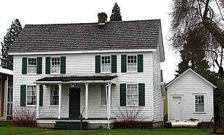
Beavercreek is an unincorporated hamlet and census-designated place in Clackamas County, Oregon, United States, located 6 miles (10 km) southeast of Oregon City. The population was 4,485 at the 2010 census.

<span class="mw-page-title-main">Mount Hood, Oregon</span> Unincorporated community in the state of Oregon, United States

Mount Hood is an unincorporated community and census-designated place (CDP) in Hood River County, Oregon, United States, about 3 miles (5 km) northeast of Parkdale on Oregon Route 35. As of the 2010 census it had a population of 286. Mount Hood is the terminus of Oregon Route 281, the Hood River Highway.

<span class="mw-page-title-main">Camp Sherman, Oregon</span> Unincorporated community in the state of Oregon, United States

Camp Sherman is an unincorporated community and census-designated place (CDP) in Jefferson County, Oregon, United States. It is located on the Metolius River. The year-round population as of the 2010 census was 233, with that number tripling or more during the summer. The community includes an elementary school, Black Butte School, a general store and a post office. The community also has a volunteer fire department. Camp Sherman was founded by vacationers from Sherman County in the latter part of the 19th century.

<span class="mw-page-title-main">Layton, New Jersey</span> Populated place in Sussex County, New Jersey, US

Layton is an unincorporated community and census-designated place (CDP) located within Sandyston Township in Sussex County, in the U.S. state of New Jersey. The area is served as United States Postal Service ZIP Code 07851.

<span class="mw-page-title-main">Prospect, Oregon</span> Unincorporated community in the state of Oregon, United States

Prospect is an unincorporated community and census-designated place (CDP) in Jackson County, in the U.S. state of Oregon. It lies along Oregon Route 62 on the Rogue River, in the Rogue River – Siskiyou National Forest. As of the 2010 census it had a population of 455.

<span class="mw-page-title-main">Days Creek, Oregon</span> Unincorporated community in the state of Oregon, United States

Days Creek is an unincorporated community and census-designated place in Douglas County, Oregon, United States. At the 2010 census it had a population of 272.

<span class="mw-page-title-main">Stafford, Oregon</span> Unincorporated community in Oregon, United States

Stafford is an unincorporated community, classified as a hamlet, in Clackamas County, Oregon, United States. It is a census-designated place (CDP), with a population of 1,577 as of the 2010 census. The community covers approximately 15.7 km2 located in a rough triangle south of Lake Oswego, east of Tualatin, and west of West Linn. Students in the area attend the schools of the West Linn-Wilsonville School District.

<span class="mw-page-title-main">Gardiner, Oregon</span> Unincorporated community in the state of Oregon, United States

Gardiner is an unincorporated community and census-designated place in Douglas County, Oregon, United States, across the Umpqua River from Reedsport. It is located on U.S. Route 101. As of the 2010 census, it had a population of 248.

Shedd is an unincorporated community and census-designated place (CDP) in Linn County, Oregon, United States, on Oregon Route 99E. As of the 2010 census it had a population of 204.

<span class="mw-page-title-main">Williams, Oregon</span> Unincorporated community in the state of Oregon, United States

Williams is an unincorporated community and census-designated place (CDP) in Josephine County, Oregon, United States. As of the 2010 census it had a population of 1,072.

Freedom is an unincorporated community in both northeastern Caribou County, Idaho, and northwestern Lincoln County, Wyoming, in the United States; the Wyoming portion of the community is also a census-designated place (CDP). The population was 247 at the 2020 census.

Liberal is an unincorporated community in Clackamas County, Oregon, United States. It lies on Oregon Route 213 between Mulino and Molalla.

<span class="mw-page-title-main">Lookingglass, Oregon</span> Unincorporated community in the state of Oregon, United States

Lookingglass is an unincorporated community and census-designated place in the Lookingglass Valley of Douglas County, Oregon, United States, about 9 miles (14 km) southwest of Roseburg. As of the 2010 census it had a population of 855. Lookingglass is considered a suburb of Roseburg.

References

  1. "ArcGIS REST Services Directory". United States Census Bureau. Retrieved October 12, 2022.
  2. 1 2 U.S. Geological Survey Geographic Names Information System: Mulino, Oregon
  3. 1 2 "Census Population API". United States Census Bureau. Retrieved October 12, 2022.
  4. "Geographic Identifiers: 2010 Demographic Profile Data (G001): Mulino CDP, Oregon". U.S. Census Bureau, American Factfinder. Archived from the original on March 10, 2015. Retrieved March 9, 2015.
  5. 1 2 3 McArthur, Lewis A.; Lewis L. McArthur (2003) [1928]. Oregon Geographic Names (Seventh ed.). Portland, Oregon: Oregon Historical Society Press. ISBN   0-87595-277-1.
  6. "Oregon National Register List" (PDF). Retrieved August 31, 2007.
  7. "Clackamas County Complete Communities". Clackamas County. Retrieved June 7, 2007.
  8. Climate Summary for Mulino, Oregon
  9. "Census of Population and Housing". Census.gov. Retrieved June 4, 2016.

Further reading