Oregon City is the county seat of Clackamas County, Oregon, United States, located on the Willamette River near the southern limits of the Portland metropolitan area. As of the 2020 census, the city population was 37,572. Established in 1829 by the Hudson's Bay Company, in 1844 it became the first U.S. city west of the Rocky Mountains to be incorporated.

Clackamas County is one of the 36 counties in the U.S. state of Oregon. As of the 2020 census, the population was 421,401, making it Oregon's third-most populous county. Its county seat is Oregon City. The county was named after the American Indians living in the area, the Clackamas people, who are part of the Chinookan peoples.
Clackamas is an unincorporated community and former census-designated place (CDP) in Clackamas County, Oregon, United States, and is a suburb of Portland. The population was approximately 7,000 as of 2010.
Riverside, Oregon may refer to one of these places in the U.S. state of Oregon:

The Clackamas River is an approximately 83-mile (134 km) tributary of the Willamette River in northwestern Oregon, in the United States. Draining an area of about 940 square miles (2,435 km2), the Clackamas flows through mostly forested and rugged mountainous terrain in its upper reaches, and passes agricultural and urban areas in its lower third. The river rises in eastern Marion County, about 55 miles (89 km) east-southeast of Salem. The headwaters are on the slopes of Olallie Butte in the Mount Hood National Forest, about 10 miles (16 km) north of Mount Jefferson, at an elevation of 4,909 feet (1,496 m) in the Cascade Range. The Clackamas flows briefly north and then flows northwest through the mountains, passing through North Fork Reservoir and Estacada. It then emerges from the mountains southeast of Portland. It joins the Willamette near Oregon City and forms the boundary between Oregon City and Gladstone.
Beavercreek is an unincorporated hamlet and census-designated place in Clackamas County, Oregon, United States, located 6 miles (10 km) southeast of Oregon City. The population was 4,485 at the 2010 census.

The Portland metropolitan area is a metro area with its core in the U.S. states of Oregon and Washington. It has 5 principal cities the largest being Portland, Oregon. The U.S. Office of Management and Budget (OMB) identifies it as the Portland–Vancouver–Hillsboro, OR–WA Metropolitan Statistical Area, a metropolitan statistical area used by the United States Census Bureau (USCB) and other entities. The OMB defines the area as comprising Clackamas, Columbia, Multnomah, Washington, and Yamhill Counties in Oregon, and Clark and Skamania Counties in Washington. The area had a population of 2,512,859 at the 2020 census, an increase of over 12% since 2010.

Damascus is a census-designated place and former city in Clackamas County, Oregon, United States. Established in 1867, it was incorporated in 2004 in an effort to enable local land use decision-making control by the community. Its residents voted to disincorporate in 2016, and, after a legal challenge, its disincorporation was completed in 2020. Damascus is located east of Happy Valley and Interstate 205 and west of Boring. The population was 11,050 residents as of the 2020 census.

This is a list of properties and historic districts in Oregon that are listed on the National Register of Historic Places. There are listings in all of Oregon's 36 counties.

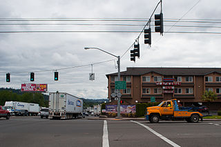
Mulino, Oregon is a hamlet and census-designated place (CDP) located in Clackamas County, Oregon, United States, on Oregon Route 213 between the cities of Oregon City and Molalla. As of the 2010 census it had a population of 2,103.

Carver is an unincorporated community in Clackamas County, Oregon, United States, which, between 2004 and 2016, was part of the city of Damascus, Oregon. Before 2004, when the city of Damascus incorporated, Carver was an independent, unincorporated community. The city of Damascus disincorporated in 2016 returning Carver to its previous status.

Oregon's 5th congressional district stretches from the Southeast suburbs of Portland through the eastern half of the Willamette Valley and then reaches across the Cascades to take in Sisters and Bend. It includes a sliver of Multnomah County, the majority of Clackamas County, the rural eastern portion of Marion County, all of Linn County, a very small section of southwest Jefferson County, and the populated northwest portion of Deschutes County. It was significantly redrawn when Oregon gained a 6th congressional district after the 2020 census.

Oregon's 3rd congressional district covers most of Multnomah County, including Gresham, Troutdale, and most of Portland east of the Willamette River. It also includes the northeastern part of Clackamas County and all of Hood River County. Generally, most of Portland east of the Willamette River is in the 3rd District.

Mount Talbert is a volcanic cinder cone in Clackamas County, Oregon. It is part of the Boring Lava Field, a zone of ancient volcanic activity in the area around Portland. Its summit rises to an elevation of 740+ ft.
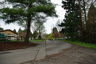
Shadowood is an unincorporated community in Clackamas County, Oregon, United States, about four miles south of Lake Oswego on the Tualatin River east of Shipley Bridge. Shadowood has a West Linn ZIP code.
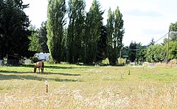
Milwaukie Heights is an unincorporated community in Clackamas County, Oregon, United States.
Mountain Air Park is an unincorporated community in Clackamas County, Oregon, United States, served by the Brightwood, Oregon 97011 post office. It is on Mount Hood Highway 26 northwest of Mount Hood Village, Oregon near Wildwood Recreation Site.
Needy, also known as Hardscrabble, is an unincorporated community in Clackamas County, Oregon, United States. James H. Brents gave the community its names, which may be such because of its poverty. Needy's post office was established on February 16, 1885 and John M. Bacon was its postmaster. It closed on September 19, 1903. It is now served by the Canby post office.
James Hieb is an American politician who is a member of the Oregon House of Representatives for the 51st district.