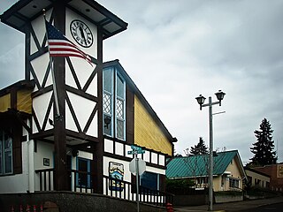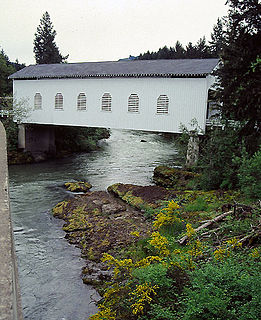
Wasco County is one of the 36 counties in the U.S. state of Oregon. As of the 2020 census, the population was 25,213. Its county seat is The Dalles. The county is named for a local tribe of Native Americans, the Wasco, a Chinook tribe who live on the south side of the Columbia River. It is near the Washington state line. Wasco County comprises The Dalles Micropolitan Statistical Area.

Jefferson County is one of the 36 counties in the U.S. state of Oregon. At the 2020 census, the population was 24,502. The county seat is Madras. The county is named after Mount Jefferson.

Lake Wildwood is a census-designated place (CDP) in Nevada County, California, United States. The population was 4,991 at the 2010 census, up from 4,868 at the 2000 census.

Wildwood is a city in Sumter County, Florida, United States. The population was 6,709 at the 2010 census. According to the U.S. Census Bureau's 2018 estimates, the city had a population of 7,024.

Wildwood is a city in St. Louis County, Missouri, United States. It is located in the far western portion of the county. As of the 2020 census, the population was 35,417. Wildwood is the home of the Al Foster Trail, and numerous other trails, parks, and reserves such as Rockwoods Reservation and Babler State Park.

North Wildwood is a city located on the Jersey Shore in Cape May County, New Jersey, United States. It is part of the Ocean City Metropolitan Statistical Area. As of the 2010 United States Census, the city's population was 4,041, reflecting a decline of 894 (−18.1%) from the 4,935 counted in the 2000 Census, which had in turn declined by 82 (−1.6%) from the 5,017 counted in the 1990 Census. North Wildwood is home to the Hereford Inlet Lighthouse.

Wildwood is a city in Cape May County, New Jersey, United States. It is part of the Ocean City Metropolitan Statistical Area and is a popular summer resort destination along the Jersey Shore. As of the 2010 United States Census, the city's year-round population was 5,325, reflecting a decline of 111 (−2.0%) from the 5,436 counted in the 2000 Census, which had in turn increased by 952 (+21.2%) from the 4,484 counted in the 1990 Census. With visitors, the population can swell to 250,000 during the summer months. Wildwood was the first city in New Jersey to have a female mayor, Doris W. Bradway, who was ousted in a 1938 recall election.

Parkdale is an unincorporated community and census-designated place (CDP) in Hood River County, Oregon, United States. As of the 2010 census, the population was 311, up from 266 at the 2000 census.

Dufur is a city in Wasco County, Oregon, United States. The population was 604 at the 2010 census. It is a farming community where wheat, tree fruit, Marijuana and grapes are important crops.

Bingen is a city in Klickitat County, Washington, United States. The population was 712 at the 2010 census, a 6% increase over the 2000 census.

White Salmon is a city in Klickitat County, Washington, United States. It is located in the Columbia River Gorge. The population was 2,193 at the 2000 census and increased 1.4% to 2,224 at the 2010 census.

The Mount Hood Corridor is a part of Oregon between Sandy and Government Camp, in Clackamas County. It is named after Mount Hood and has served travelers going in both directions since the days of Native Americans and Oregon Trail migrants. The area between Alder Creek and Government Camp is sometimes known as Hoodland.

Tumalo Creek is a tributary, about 20 miles (32 km) long, of the Deschutes River, located in Deschutes County in Central Oregon, United States. It rises in the Cascade Range at 44.04706°N 121.598647°W, where Middle Fork Tumalo Creek and North Fork Tumalo Creek meet, and forms several waterfalls, including the 97-foot (30 m) Tumalo Falls. Its mouth is on the Deschutes at 44.1159506°N 121.3394783°W.

Snow Bunny is a small snow play area in Mount Hood National Forest on the south face of Mount Hood in Oregon, United States, about 65 miles (105 km) east of Portland. Inner tubing, tobogganing and other snow sports are on a maintained 20-foot (6.1 m) to 30-foot (9.1 m) hill of snow, popular with young children and families. It was established in 1952 as Mount Hood's first snow play area for children.

Ortley is a former town in Wasco County, Oregon, in the United States. It was about 1 mile (2 km) south of Rowena and about 7 miles (11 km) southeast of Mosier; the site is now on private land and no evidence of the townsite exists today. It is still classed as a populated place by the USGS.

The Row River is a river, approximately 20 miles (32 km) long, in Lane County, Oregon, United States. It rises in the Cascade Range and flows into the Coast Fork Willamette River near Cottage Grove. The stream was originally known as the "East Fork Coast Fork", but was later renamed after a dispute between neighbors and brothers-in-law George Clark and Joseph Southwell over "trespassing" livestock. Clark was killed as a result of the row. The name rhymes with "cow" rather than with "slow". A post office named Row River operated from 1911 to 1914 a little north of the present site of Dorena at 43.740123°N 122.880347°W.
Wyeth is an unincorporated locale in Hood River County, Oregon, United States. It is the site of a campground area in the Columbia River Gorge National Scenic Area off Interstate 84 (I-84).
Clifton is an unincorporated locale in Hood River County, Oregon, United States. It is located about 3 miles west of the city of Hood River. The name originates from the drop in elevation Interstate 84 takes from the cliffs there, which are 250 feet above the Columbia River.
Faubion is an unincorporated community in Clackamas County, Oregon, United States. It is located about 2 miles northwest of Rhododendron, in the Mount Hood Corridor on a loop road off U.S. Route 26 near the Zigzag River.
Wildwood is an unincorporated community in Lane County, Oregon, United States. It is located between Culp Creek and Disston on the former line of the Oregon, Pacific and Eastern Railway (OP&E), about 16 miles southeast of Cottage Grove.


