
Oregon City is the county seat of Clackamas County, Oregon, United States, located on the Willamette River near the southern limits of the Portland metropolitan area. As of the 2020 census, the city population was 37,572. Established in 1829 by the Hudson's Bay Company, in 1844 it became the first U.S. city west of the Rocky Mountains to be incorporated.

Clackamas County is one of the 36 counties in the U.S. state of Oregon. As of the 2020 census, the population was 421,401, making it Oregon's third-most populous county. Its county seat is Oregon City. The county was named after the native people living in the area at the time of the coming of Europeans, the Clackamas people, who are part of the Chinookan peoples.

Canby is a city in Clackamas County, Oregon, United States. The population was 18,171 at the 2020 census. It is along Oregon Route 99E, 2 miles (3 km) northeast of Barlow.
Molalla is a city in Clackamas County, Oregon. The population was 10,228 at the time of the 2020 census.

The administrative divisions of New York are the various units of government that provide local services in the American state of New York. The state is divided into boroughs, counties, cities, towns, and villages. They are municipal corporations, chartered (created) by the New York State Legislature, as under the New York State Constitution the only body that can create governmental units is the state. All of them have their own governments, sometimes with no paid employees, that provide local services. Centers of population that are not incorporated and have no government or local services are designated hamlets. Whether a municipality is defined as a borough, city, town, or village is determined not by population or land area, but rather on the form of government selected by the residents and approved by the New York State Legislature. Each type of local government is granted specific home rule powers by the New York State Constitution. There are still occasional changes as a village becomes a city, or a village dissolves, each of which requires legislative action. New York also has various corporate entities that provide local services and have their own administrative structures (governments), such as school and fire districts. These are not found in all counties.

Boring is an unincorporated community in Clackamas County, Oregon, United States. It is located along Oregon Route 212 in the foothills of the Cascade mountain range, approximately twelve miles (19 km) southeast of downtown Portland, and fourteen miles (23 km) northeast of Oregon City. A bedroom community, Boring is named after William Harrison Boring, a Union soldier and pioneer whose family built a farm in the area in 1856, before Oregon had received statehood.
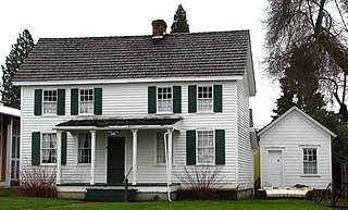
Beavercreek is an unincorporated hamlet and census-designated place in Clackamas County, Oregon, United States, located 6 miles (10 km) southeast of Oregon City. The population was 4,485 at the 2010 census.

The Portland metropolitan area is a metro area with its core in the U.S. states of Oregon and Washington. It has 5 principal cities the largest being Portland, Oregon. The U.S. Office of Management and Budget (OMB) identifies it as the Portland–Vancouver–Hillsboro, OR–WA Metropolitan Statistical Area, a metropolitan statistical area used by the United States Census Bureau (USCB) and other entities. The OMB defines the area as comprising Clackamas, Columbia, Multnomah, Washington, and Yamhill Counties in Oregon, and Clark and Skamania Counties in Washington. The area had a population of 2,512,859 at the 2020 census, an increase of over 12% since 2010.
The South Clackamas Transportation District (SCTD) is a bus service that provides public transportation in Molalla, Oregon, connecting that city to Clackamas Community College in Oregon City, and Canby. The cost to ride to or from CCC is only US$1; rides to or from Canby used to be free, but now also cost US$1.
A hamlet is a model of local governance in Clackamas County in the U.S. state of Oregon. Like hamlets elsewhere, it is a county subdivision; like New York's hamlets, the definition is unique to a state.
A village in the U.S. state of Oregon is a model of local governance that as of 2006 only exists in Clackamas County. Like villages elsewhere, it is a subnational entity; like New York's villages, the definition is unique to a state.

The Oregon School Activities Association (OSAA) is a non-profit, board-governed organization that regulates high school athletics and competitive activities via athletic conferences in the U.S. state of Oregon, providing equitable competition among its members, both public and private. The OSAA is based in Wilsonville.

Mulino, Oregon is a hamlet and census-designated place (CDP) located in Clackamas County, Oregon, United States, on Oregon Route 213 between the cities of Oregon City and Molalla. As of the 2010 census it had a population of 2,103.

Stafford is an unincorporated community, classified as a hamlet, in Clackamas County, Oregon, United States. It is a census-designated place (CDP), with a population of 1,577 as of the 2010 census. The community covers approximately 15.7 km2 located in a rough triangle south of Lake Oswego, east of Tualatin, and west of West Linn. Students in the area attend the schools of the West Linn-Wilsonville School District.
The Molalla Buckeroo Rodeo is an annual rodeo in Molalla, Oregon, United States. It is held on Independence Day, July 4.
Libraries in Clackamas County (LINCC) is a consortium of the public libraries of Clackamas County, Oregon. It was established in 1977 when the first county-wide funding levy was approved by county voters. LINCC is a resource and revenue sharing network with a single library computer system.
Macksburg is an unincorporated community in Clackamas County, Oregon, United States four miles southeast of Canby. It is located on Gribble Prairie between the Pudding River and the Molalla River.
Tualatin Hills Park & Recreation District (THPRD) is a special parks district located in the eastern part of Washington County in the U.S. state of Oregon. Created in 1955, the district covers all of the city of Beaverton and many of those communities surrounding Beaverton in the Portland metropolitan area. The district covers an area of 50 square miles (130 km2) and serves a population of about 220,000, making it the largest parks district in Oregon. Tualatin Hills operates over 200 facilities totaling 2,100 acres (850 ha), including eight swimming centers. The district has an annual budget of $40 million and is overseen by a five-person board of directors.
Tootie Smith is an American politician and hazelnut farmer from the state of Oregon. A Republican, she served in the state legislature from 2001 until 2005, and on the Clackamas County Board of Commissioners from 2013 until 2017.


