Oatfield, Oregon

Last updated

Oatfield, Oregon
ORMap-doton-Oatfield.png
Location of Oatfield, Oregon
Coordinates: 45°24′45″N122°35′49″W / 45.41250°N 122.59694°W / 45.41250; -122.59694
Country United States
State Oregon
County Clackamas
Area
[1]
  Total3.40 sq mi (8.79 km2)
  Land3.40 sq mi (8.79 km2)
  Water0.00 sq mi (0.00 km2)
Elevation
[2]
112 ft (34 m)
Population
 (2020) [3]
  Total13,977
  Density4,116.94/sq mi (1,589.57/km2)
Time zone UTC-8 (Pacific (PST))
  Summer (DST) UTC-7 (PDT)
ZIP code
97267
Area code(s) 503 and 971
FIPS code 41-54325 [4]
GNIS feature ID2408970 [2]

Oatfield is an unincorporated community and census-designated place in Clackamas County, Oregon, United States. It is in the Portland metropolitan area. As of the 2010 census, the population of the CDP was 13,415. [5]

Contents

It is named after Oatfield Road, which runs between Milwaukie and Gladstone. Oatfield Road was named for the Oatfield family, well-known pioneers of the area. [6]

Geography

Oatfield is located in northwestern Clackamas County and is bordered by the city of Milwaukie to the northwest, unincorporated Oak Grove to the west, unincorporated Jennings Lodge to the southwest, and the city of Gladstone to the south. Interstate 205 forms the eastern edge of the community, separating Oatfield from unincorporated Clackamas. Oatfield also completely surrounds the small city of Johnson City.

According to the United States Census Bureau, the Oatfield CDP has a total area of 3.4 square miles (8.8 km2), all land. [5]

Demographics

Historical population
CensusPop.Note
2020 13,977
U.S. Decennial Census [7] [3]

As of the census [4] of 2000, there were 15,750 people, 5,903 households, and 4,563 families residing in the CDP. The population density was 3,608.1 inhabitants per square mile (1,393.1/km2). There were 6,110 housing units at an average density of 1,399.7 per square mile (540.4/km2). The racial makeup of the CDP was 93.43% White, 0.47% African American, 0.53% Native American, 1.99% Asian, 0.12% Pacific Islander, 0.93% from other races, and 2.52% from two or more races. Hispanic or Latino of any race were 2.64% of the population.

There were 5,903 households, out of which 30.6% had children under the age of 18 living with them, 65.9% were married couples living together, 8.5% had a female householder with no husband present, and 22.7% were non-families. 17.8% of all households were made up of individuals, and 7.1% had someone living alone who was 65 years of age or older. The average household size was 2.65 and the average family size was 2.99.

In the CDP, the population was spread out, with 23.2% under the age of 18, 7.0% from 18 to 24, 24.7% from 25 to 44, 30.8% from 45 to 64, and 14.4% who were 65 years of age or older. The median age was 42 years. For every 100 females, there were 95.2 males. For every 100 females age 18 and over, there were 92.3 males.

The median income for a household in the CDP was $59,769, and the median income for a family was $66,469. Males had a median income of $46,351 versus $33,247 for females. The per capita income for the CDP was $25,148. About 2.9% of families and 4.2% of the population were below the poverty line, including 4.5% of those under age 18 and 4.0% of those age 65 or over.

Related Research Articles

<span class="mw-page-title-main">Clackamas County, Oregon</span> County in Oregon, United States

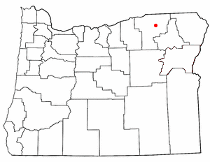
Clackamas County is one of the 36 counties in the U.S. state of Oregon. As of the 2020 census, the population was 421,401, making it Oregon's third-most populous county. Its county seat is Oregon City. The county was named after the American Indians living in the area, the Clackamas people, who are part of the Chinookan peoples.

<span class="mw-page-title-main">Clackamas, Oregon</span> Unincorporated community in the state of Oregon, United States

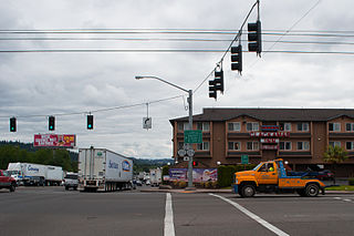
Clackamas is an unincorporated community and former census-designated place (CDP) in Clackamas County, Oregon, United States, and is a suburb of Portland. The population was approximately 7,000 as of 2010.

<span class="mw-page-title-main">Jennings Lodge, Oregon</span> Unincorporated community in the state of Oregon, United States

Jennings Lodge is a census-designated place and unincorporated community in Clackamas County, Oregon, United States, between Milwaukie and Gladstone. For statistical purposes, the United States Census Bureau has defined Jennings Lodge as a census-designated place (CDP). The census definition of the area may not precisely correspond to local understanding of the area with the same name. As of the United States Census, 2010, it had a total population of 7,315.

<span class="mw-page-title-main">Johnson City, Oregon</span> City in Oregon, United States

Johnson City is a city in Clackamas County, Oregon, United States. The population was 566 at the 2010 census. Because of its small area, its population density is over 8,000 per square mile, making it the most densely populated city in Oregon.

<span class="mw-page-title-main">Mount Hood Village, Oregon</span> Unincorporated community in the state of Oregon, United States

Mount Hood Village is the name of a census-designated place (CDP) within the Mount Hood Corridor in Clackamas County, Oregon, United States. As of the 2010 census, the CDP had a population of 4,864. The Villages at Mount Hood is the name of the combined government of several of the communities encompassed by the CDP and is a separate entity.

<span class="mw-page-title-main">Oak Grove, Oregon</span> Unincorporated community in the state of Oregon, United States

Oak Grove is an unincorporated community in Clackamas County, Oregon, United States, in the Portland metropolitan area. For statistical purposes, the United States Census Bureau has defined Oak Grove as a census-designated place (CDP). The census definition of the area may not precisely correspond to local understanding of the area with the same name. The population was 16,629 at the 2010 census.

<span class="mw-page-title-main">Sunnyside, Clackamas County, Oregon</span> Unincorporated community in the state of Oregon, United States

Sunnyside is a former census-designated place in Clackamas County in the U.S. state of Oregon. Located in the Portland metropolitan area along Interstate 205, the population was 6,791 at the 2000 census. The area was not recorded as a distinct place for the 2010 census.

<span class="mw-page-title-main">Three Rivers South, Oregon</span> Unincorporated community in the state of Oregon, United States

Three Rivers South is a census-designated place (CDP) and unincorporated community in Deschutes County, Oregon, United States. It is part of the Bend, Oregon Metropolitan Statistical Area. The population was 3,014 at the 2010 census.

<span class="mw-page-title-main">Tri-City, Oregon</span> Unincorporated community in the state of Oregon, United States

Tri-City is a census-designated place (CDP) and unincorporated community in Douglas County, Oregon, United States. The population was 3,931 at the 2010 census. The community in Missouri Bottom near the Umpqua River is named for the three cities among which it is centered: Myrtle Creek, Canyonville and Riddle. The Tri City School District probably originated the name, which was later adopted by the local sewer district and the former Tri City State Airport.

<span class="mw-page-title-main">Odell, Oregon</span> Unincorporated community in the state of Oregon, United States

Odell is an unincorporated community and census-designated place (CDP) in Hood River County, Oregon, United States. Odell was named for an early pioneer, William Odell, a native of Tennessee by way of California, who settled in the area in 1861. The population was 2,255 as of the 2010 census.

<span class="mw-page-title-main">South Lebanon, Oregon</span> Unincorporated community in the state of Oregon, United States

South Lebanon is a census-designated place (CDP) in Linn County, Oregon, United States, comprising unincorporated land on the south side of the city of Lebanon. The population was 1,005 at the 2010 census. The population and area of the CDP decreased between 2000 and 2010 as the city limits of Lebanon expanded southward.

<span class="mw-page-title-main">Marion, Oregon</span> Unincorporated community in the state of Oregon, United States

Marion is an unincorporated community in Marion County, Oregon, United States. For statistical purposes, the United States Census Bureau has defined Marion as a census-designated place (CDP). The census definition of the area may not precisely correspond to local understanding of the area with the same name. The population was 307 at the 2020 census. Marion is part of the Salem Metropolitan Statistical Area.

<span class="mw-page-title-main">Mehama, Oregon</span> Unincorporated community in the state of Oregon, United States

Mehama is an unincorporated community in Marion County, Oregon, United States, located on Oregon Route 22 and the North Santiam River. For statistical purposes, the United States Census Bureau has defined Mehama as a census-designated place (CDP). The census definition of the area may not precisely correspond to local understanding of the area with the same name. The population was 317 at the 2020 census. It is part of the Salem Metropolitan Statistical Area.

<span class="mw-page-title-main">Cloverdale, Oregon</span> Census-designated place in Oregon, United States

Cloverdale is an unincorporated community in Tillamook County, Oregon, United States. For statistical purposes, the United States Census Bureau has defined Cloverdale as a census-designated place (CDP). The census definition of the area may not precisely correspond to local understanding of the area with the same name. The population was 242 at the 2000 census.

<span class="mw-page-title-main">Oceanside, Oregon</span> Unincorporated community in Oregon, United States

Oceanside is a census-designated place (CDP) and unincorporated community in Tillamook County, Oregon, United States. The population was 361 at the 2010 census. Oregon Route 131's northern terminus is in the community, which is just north of Netarts. Symons State Park is in Oceanside, while Three Arch Rocks National Wildlife Refuge lies just offshore.

<span class="mw-page-title-main">Cayuse, Oregon</span> Unincorporated community in the state of Oregon, United States

Cayuse is a census-designated place (CDP) and unincorporated community in Umatilla County, Oregon, United States, located 11 miles (18 km) east of Pendleton on the Umatilla Indian Reservation. The population was 59 at the 2000 census. It is part of the Pendleton–Hermiston Micropolitan Statistical Area.

<span class="mw-page-title-main">Pine Grove, Wasco County, Oregon</span> Unincorporated community in the state of Oregon, United States

Pine Grove is a census-designated place (CDP) and unincorporated community in Wasco County, Oregon, United States. The population was 162 at the 2000 census.

<span class="mw-page-title-main">Tygh Valley, Oregon</span> Unincorporated community in the state of Oregon, United States

Tygh Valley is a census-designated place (CDP) and unincorporated community in Wasco County, Oregon, United States. The population was 224 at the 2000 census.

<span class="mw-page-title-main">Wamic, Oregon</span> Unincorporated community in the state of Oregon, United States

Wamic is a census-designated place (CDP) and unincorporated community in Wasco County, Oregon, United States. Wamic was named for the Womack family, which settled the area. A post office was established at Wamic in 1884 and it closed in 1958. The population was 36 at the 2000 census.

<span class="mw-page-title-main">Metzger, Oregon</span> Unincorporated community in the state of Oregon, United States

Metzger is a census-designated place and unincorporated community, in Washington County, Oregon, United States. As of the 2010 census, the CDP population was 3,765. It is named for Herman Metzger, who platted the community. It is a suburb located within Portland, Oregon.

References

  1. "ArcGIS REST Services Directory". United States Census Bureau. Retrieved October 12, 2022.
  2. 1 2 U.S. Geological Survey Geographic Names Information System: Oatfield, Oregon
  3. 1 2 "Census Population API". United States Census Bureau. Retrieved October 12, 2022.
  4. 1 2 "U.S. Census website". United States Census Bureau . Retrieved January 31, 2008.
  5. 1 2 "Geographic Identifiers: 2010 Demographic Profile Data (G001): Oatfield CDP, Oregon". U.S. Census Bureau, American Factfinder. Archived from the original on March 10, 2015. Retrieved March 9, 2015.
  6. McArthur, Lewis A.; Lewis L. McArthur (2003) [1928]. Oregon Geographic Names (Seventh ed.). Portland, Oregon: Oregon Historical Society Press. p. 716. ISBN   0-87595-277-1.
  7. "Census of Population and Housing". Census.gov. Retrieved June 4, 2016.