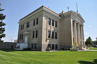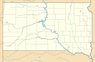
Platte County is a county located in the U.S. state of Wyoming. As of the 2010 United States Census, the population was 8,667. Its county seat is Wheatland.

Aspen Park is an unincorporated community and a census-designated place (CDP) located in Jefferson County, Colorado, United States. The CDP is a part of the Denver–Aurora–Lakewood, CO Metropolitan Statistical Area. The population of the Aspen Park CDP was 810 at the United States Census 2020. The Aspen Park Metropolitan District provides services. The Conifer post office serves the area.

El Rancho is a census-designated place (CDP) in Santa Fe County, New Mexico, United States. It is part of the Santa Fe, New Mexico Metropolitan Statistical Area. The population was 1,199 at the 2010 census.

Chugcreek is a census-designated place (CDP) in Platte County, Wyoming, United States. The population was 156 at the 2010 census.

Lakeview North is a census-designated place (CDP) in Platte County, Wyoming, United States. The population was 84 at the 2010 census.

Slater is a census-designated place (CDP) in Platte County, Wyoming, United States. The population was 80 at the 2010 census.

Westview Circle is a census-designated place (CDP) in Platte County, Wyoming, United States. The population was 52 at the 2010 census.

Hinesburg is the primary village and a census-designated place (CDP) in the town of Hinesburg, Chittenden County, Vermont, United States. As of the 2020 census, it had a population of 872, out of 4,698 in the entire town of Hinesburg.

Greensboro is the central village and a census-designated place (CDP) in the town of Greensboro, Orleans County, Vermont, United States. As of the 2020 census, it had a population of 156, out of 811 in the entire town of Greensboro.

Northfield is the central village and a census-designated place (CDP) in the town of Northfield, Washington County, Vermont, United States. As of the 2020 census, it had a population of 3,757, out of 5,918 in the entire town. The former village of Northfield merged with the surrounding town of Northfield in 2014; the current CDP includes the former village as well as the unincorporated villages of Northfield Center and South Northfield.

Rio Rancho Estates is an unincorporated community and census-designated place (CDP) in Sandoval County, New Mexico, United States. It was first listed as a CDP prior to the 2020 census.

Cedar Grove Colony is a Hutterite colony and census-designated place (CDP) in Brule County, South Dakota, United States. It was first listed as a CDP prior to the 2020 census.

Platte Colony is a Hutterite colony and census-designated place (CDP) in Charles Mix County, South Dakota, United States. It was first listed as a CDP prior to the 2020 census.

Palmer is a colonia and census-designated place (CDP) in Cameron County, Texas, United States. It was first listed as a CDP prior to the 2020 census.

Rice Tracts is an unincorporated area and census-designated place (CDP) in Cameron County, Texas, United States. It was first listed as a CDP prior to the 2020 census.

Garten is an unincorporated community and census-designated place (CDP) in Fayette County, West Virginia, United States. As of the 2020 census, it had a population of 204.

Jolmaville is a rural community and census-designated place (CDP) in Ashland County, Wisconsin, United States. As of the 2020 census, it had a population of 126.

Paac Ciinak is a census-designated place (CDP) in Shawano County, Wisconsin, United States. As of the 2020 census, it had a population of 83. On older federal topographic maps, the community is shown as Potch-Chee-Nunk or Potch Che Nunk.

Ceex Haci is a census-designated place (CDP) in Wood County, Wisconsin, United States. As of the 2020 census, it had a population of 89.

Powder Horn is a golf course community and census-designated place (CDP) in Sheridan County, Wyoming, United States. As of the 2020 census, it had a population of 682.


